Лонжшеналь (Longechenal, Longechenal)

- коммуна во Франции
 Hiking in Лонжшеналь
Longechenal is a beautiful destination for hiking enthusiasts, located in the picturesque region of Auvergne-Rhône-Alpes in France. Known for its stunning landscapes, diverse terrain, and charming rural atmosphere, this area offers a variety of hiking trails that cater to different levels of experience.
Key Features of Hiking in Longechenal:
-
Scenic Trails: The hiking paths in Longechenal often wind through lush forests, rolling hills, and alongside rivers, providing breathtaking views of the surrounding natural beauty. The area is rich in biodiversity, making it a great spot for nature lovers.
-
Accessibility: Many trails are well-marked and accessible for families and beginners, while others may challenge more experienced hikers with steeper inclines and rugged terrain.
-
Cultural Exploration: Besides the natural beauty, you can also discover the local culture. Small villages and historical sites along the trails give hikers a glimpse into the region’s traditional lifestyle and heritage.
-
Wildlife and Flora: Hiking in Longechenal offers excellent opportunities for spotting local wildlife and unique plant species. The varying elevations and habitats support a wide range of flora and fauna.
-
Seasonal Variability: Each season presents a different hiking experience. Spring and summer bring vibrant greenery and wildflowers, autumn showcases stunning foliage, and winter can offer snowy landscapes for those who enjoy winter hiking (though be cautious of icy conditions and snow levels).
-
Safety and Preparedness: As with any hike, it's essential to prepare adequately. Make sure to check the weather, wear appropriate footwear, and carry enough water and snacks. Familiarize yourself with the trail maps and stay on marked paths.
Before heading out, it’s a good idea to consult local hiking guides, information centers, or websites for updated trail information, difficulty levels, and any relevant regulations or safety tips. Enjoy your hiking adventure in Longechenal!
- Страна:

- Почтовый код: 38690
- Координаты: 45° 25' 8" N, 5° 20' 52" E


- GPS треки (wikiloc): [Ссылка]
- Площадь: 8.12 кв.км
- Население: 565
- Википедия русская: wiki(ru)
- Википедия английская: wiki(en)
- Википедия национальная: wiki(fr)
- Хранилище Wikidata: Wikidata: Q1069844
- Катеория в википедии: [Ссылка]
- код Freebase: [/m/03nvk64]
- код GeoNames: Альт: [6433228]
- номер SIREN: [213802135]
- код BNF: [15258028j]
- код муниципалитета INSEE: 38213
Граничит с регионами:


Эдош
- коммуна во Франции
Hiking in Эдош
It seems like there may be a typographical error in your question, as there is no well-known location called "Eydoche." However, if you meant "Eidoche," "Eidolons," or another similar-sounding name, it's possible it refers to a specific area or national park that's less commonly known....
- Страна:
- Почтовый код: 38690
- Координаты: 45° 26' 29" N, 5° 19' 51" E
- GPS треки (wikiloc): [Ссылка]
- Высота над уровнем моря: 629 м m
- Площадь: 5.58 кв.км
- Население: 524
- Веб сайт: [Ссылка]


Шабон
- коммуна во Франции
Hiking in Шабон
Châbons is a charming town located in the Isère department of the Auvergne-Rhône-Alpes region in southeastern France. It's surrounded by beautiful landscapes and offers various hiking opportunities suitable for different levels of experience. Here are some highlights regarding hiking in and around Châbons:...
- Страна:
- Почтовый код: 38690
- Координаты: 45° 26' 38" N, 5° 25' 51" E
- GPS треки (wikiloc): [Ссылка]
- Площадь: 18.14 кв.км
- Население: 2098
- Веб сайт: [Ссылка]


Бизон
- коммуна во Франции
Hiking in Бизон
Bizonnes is a small commune located in the Auvergne-Rhône-Alpes region of southeastern France, near the city of Grenoble. While it might not be the most prominent destination for hiking, it offers access to picturesque landscapes typical of the region, which is characterized by rolling hills, forests, and stunning views of the surrounding Alps....
- Страна:
- Почтовый код: 38690
- Координаты: 45° 27' 18" N, 5° 22' 49" E
- GPS треки (wikiloc): [Ссылка]
- Площадь: 11.04 кв.км
- Население: 926
- Веб сайт: [Ссылка]


Бевене
- коммуна во Франции
Hiking in Бевене
Bévenais is a charming commune located in the Rhône department of France. It is situated near the foothills of the Massif Central, offering a picturesque landscape that is ideal for hiking enthusiasts. Here are some highlights about hiking in Bévenais:...
- Страна:
- Почтовый код: 38690
- Координаты: 45° 23' 53" N, 5° 23' 22" E
- GPS треки (wikiloc): [Ссылка]
- Площадь: 14.08 кв.км
- Население: 987
- Веб сайт: [Ссылка]
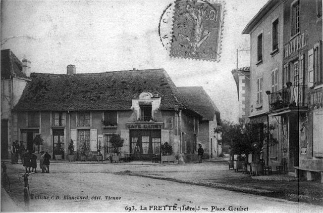

Ла-Фрет
- коммуна во Франции
Hiking in Ла-Фрет
La Frette, located in the Isère department of southeastern France, offers a variety of hiking opportunities that cater to different skill levels and preferences. Nestled in the picturesque landscape of the French Alps, La Frette is surrounded by stunning scenery, including mountains, forests, and rivers....
- Страна:
- Почтовый код: 38260
- Координаты: 45° 23' 26" N, 5° 21' 38" E
- GPS треки (wikiloc): [Ссылка]
- Площадь: 11.8 кв.км
- Население: 1108
- Веб сайт: [Ссылка]

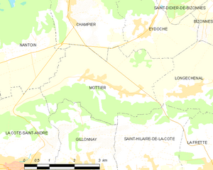
Мотье
- коммуна во Франции
Hiking in Мотье
Mottier, located in the beautiful area of Isère in the French Alps, offers a variety of hiking opportunities that cater to different skill levels and preferences. The surrounding landscape is characterized by stunning mountain views, diverse flora and fauna, and picturesque trails that are perfect for both day hikes and longer excursions....
- Страна:
- Почтовый код: 38260
- Координаты: 45° 25' 8" N, 5° 19' 2" E
- GPS треки (wikiloc): [Ссылка]
- Площадь: 10.72 кв.км
- Население: 690
- Веб сайт: [Ссылка]


Сент-Илер-де-ла-Кот
- коммуна во Франции
Hiking in Сент-Илер-де-ла-Кот
Saint-Hilaire-de-la-Côte is a picturesque mountain village located in the Isère department of the Auvergne-Rhône-Alpes region in southeastern France. It offers a variety of hiking opportunities, attracting both casual walkers and avid trekkers....
- Страна:
- Почтовый код: 38260
- Координаты: 45° 23' 26" N, 5° 19' 38" E
- GPS треки (wikiloc): [Ссылка]
- Площадь: 13.75 кв.км
- Население: 1431
- Веб сайт: [Ссылка]


Ле-Гран-Лан
- коммуна во Франции
Hiking in Ле-Гран-Лан
Le Grand-Lemps is a charming town located in the Isère department in southeastern France. It's an excellent base for hiking enthusiasts who want to explore the beautiful landscapes of the surrounding Vercors and Chartreuse mountain ranges. Here are some key points to consider when planning a hiking trip in Le Grand-Lemps:...
- Страна:
- Почтовый код: 38690
- Координаты: 45° 23' 54" N, 5° 25' 11" E
- GPS треки (wikiloc): [Ссылка]
- Площадь: 12.9 кв.км
- Население: 3082
- Веб сайт: [Ссылка]