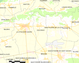
Сент-Илер-де-ла-Кот (Saint-Hilaire-de-la-Côte, Saint-Hilaire-de-la-Côte)

- коммуна во Франции
 Hiking in Сент-Илер-де-ла-Кот
Saint-Hilaire-de-la-Côte is a picturesque mountain village located in the Isère department of the Auvergne-Rhône-Alpes region in southeastern France. It offers a variety of hiking opportunities, attracting both casual walkers and avid trekkers.
Key Hiking Attractions:
-
Scenic Trails:
- The area features a network of well-marked hiking trails that showcase the stunning natural beauty of the surrounding mountains and valleys. These trails range in difficulty, catering to hikers of all levels.
-
Domaine de la Cote:
- This nearby natural area offers beautiful landscapes, including forests, meadows, and views of the Chartreuse mountains. It's perfect for leisurely hikes and nature walks.
-
Le Chartreuse Regional Natural Park:
- Although not directly in Saint-Hilaire-de-la-Côte, this nearby park provides numerous trails and is known for its dramatic limestone cliffs, deep gorges, and rich flora and fauna. A short drive can lead you to some exceptional hikes.
-
Cultural and Historical Sites:
- Hikers can explore historical landmarks such as chapels, ancient ruins, and traditional architecture along the way, enriching the hiking experience with a touch of local culture.
Tips for Hiking in Saint-Hilaire-de-la-Côte:
-
Preparation:
- Always check the weather conditions before heading out and ensure you have the proper gear, such as sturdy hiking shoes, proper clothing, and plenty of water.
-
Navigation:
- Make use of local maps and guides. Some trails may not have signal, so a physical map can be helpful.
-
Local Guidance:
- Consider joining a guided hike, especially if you're unfamiliar with the area. This can enhance your experience and provide insight into the region's ecology and history.
-
Respect Nature:
- Follow the Leave No Trace principles to maintain the natural beauty of the area.
-
Safety:
- Inform someone of your hiking plans if you’re hiking alone, and always be aware of your surroundings.
Whether you’re looking for a serene nature walk or a challenging hike, Saint-Hilaire-de-la-Côte has much to offer in terms of breathtaking scenery and outdoor adventure. Happy hiking!
- Страна:

- Почтовый код: 38260
- Координаты: 45° 23' 26" N, 5° 19' 38" E


- GPS треки (wikiloc): [Ссылка]
- Площадь: 13.75 кв.км
- Население: 1431
- Веб сайт: http://saint-hilaire-de-la-cote.fr
- Википедия русская: wiki(ru)
- Википедия английская: wiki(en)
- Википедия национальная: wiki(fr)
- Хранилище Wikidata: Wikidata: Q431325
- Катеория в википедии: [Ссылка]
- код Freebase: [/m/03nvhff]
- номер SIREN: [213803935]
- код BNF: [15258203r]
- код муниципалитета INSEE: 38393
Граничит с регионами:


Брезен
- коммуна во Франции
Hiking in Брезен
Brézins is a small commune located in the Isère department in the Auvergne-Rhône-Alpes region of southeastern France. While it may not be one of the most popular hiking destinations, it serves as a great starting point for exploring the surrounding natural beauty of the region, including the stunning landscapes of the Chartreuse and Vercors mountains....
- Страна:
- Почтовый код: 38590
- Координаты: 45° 20' 57" N, 5° 18' 24" E
- GPS треки (wikiloc): [Ссылка]
- Площадь: 8.26 кв.км
- Население: 2042
- Веб сайт: [Ссылка]
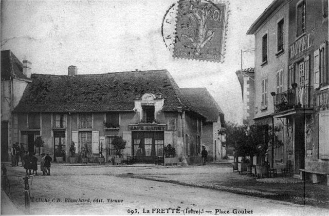

Ла-Фрет
- коммуна во Франции
Hiking in Ла-Фрет
La Frette, located in the Isère department of southeastern France, offers a variety of hiking opportunities that cater to different skill levels and preferences. Nestled in the picturesque landscape of the French Alps, La Frette is surrounded by stunning scenery, including mountains, forests, and rivers....
- Страна:
- Почтовый код: 38260
- Координаты: 45° 23' 26" N, 5° 21' 38" E
- GPS треки (wikiloc): [Ссылка]
- Площадь: 11.8 кв.км
- Население: 1108
- Веб сайт: [Ссылка]

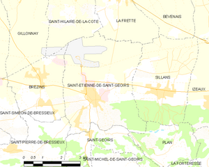
Сент-Этьенн-де-Сен-Жуар
- коммуна во Франции
Hiking in Сент-Этьенн-де-Сен-Жуар
Saint-Étienne-de-Saint-Geoirs, located in the Auvergne-Rhône-Alpes region of France, is surrounded by beautiful natural landscapes that are ideal for hiking enthusiasts. Here are some highlights and recommendations for hiking in this area:...
- Страна:
- Почтовый код: 38590
- Координаты: 45° 20' 20" N, 5° 20' 43" E
- GPS треки (wikiloc): [Ссылка]
- Площадь: 18.62 кв.км
- Население: 3259
- Веб сайт: [Ссылка]

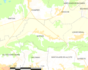
Мотье
- коммуна во Франции
Hiking in Мотье
Mottier, located in the beautiful area of Isère in the French Alps, offers a variety of hiking opportunities that cater to different skill levels and preferences. The surrounding landscape is characterized by stunning mountain views, diverse flora and fauna, and picturesque trails that are perfect for both day hikes and longer excursions....
- Страна:
- Почтовый код: 38260
- Координаты: 45° 25' 8" N, 5° 19' 2" E
- GPS треки (wikiloc): [Ссылка]
- Площадь: 10.72 кв.км
- Население: 690
- Веб сайт: [Ссылка]

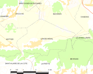
Лонжшеналь
- коммуна во Франции
Hiking in Лонжшеналь
Longechenal is a beautiful destination for hiking enthusiasts, located in the picturesque region of Auvergne-Rhône-Alpes in France. Known for its stunning landscapes, diverse terrain, and charming rural atmosphere, this area offers a variety of hiking trails that cater to different levels of experience....
- Страна:
- Почтовый код: 38690
- Координаты: 45° 25' 8" N, 5° 20' 52" E
- GPS треки (wikiloc): [Ссылка]
- Площадь: 8.12 кв.км
- Население: 565

Жийонне
- коммуна во Франции
Hiking in Жийонне
Gillonnay is a charming village located in the Isère department of the Auvergne-Rhône-Alpes region in southeastern France. The area offers a variety of hiking opportunities, ranging from easy walks to more challenging trails, all set against a backdrop of picturesque landscapes and natural beauty....
- Страна:
- Почтовый код: 38260
- Координаты: 45° 23' 34" N, 5° 17' 50" E
- GPS треки (wikiloc): [Ссылка]
- Площадь: 14.29 кв.км
- Население: 1014