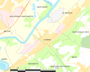
Мелан (Meylan, Meylan)

 Hiking in Мелан
Meylan is a charming suburb located near Grenoble in the Auvergne-Rhône-Alpes region of France. It is surrounded by beautiful natural landscapes, making it a great starting point for hiking enthusiasts. Here are some things to know about hiking in and around Meylan:
Hiking Trails
-
Belledonne Range: This mountain range is close to Meylan and offers numerous trails with varying difficulty levels. Trails range from leisurely walks to more challenging hikes, providing breathtaking views of the Alps.
-
Parc Naturel Régional de Chartreuse: A bit further out from Meylan, this regional park offers stunning trails in diverse terrains, from lush forests to rocky ridges. Popular trails include those leading to the Mont Granier, which provides a panoramic view of the surrounding areas.
-
Local Trails: Within Meylan itself, there are several local trails that are well-marked and suitable for all ages. These trails often offer views of both the natural landscape and urban surroundings.
Best Times to Hike
The best times for hiking in Meylan are generally from late spring to early autumn (May to October) when the weather is mild and trails are typically well-maintained. Summer months can be warm, so early mornings or late afternoons are ideal for hikes to avoid heat.
Preparations
-
Gear: Depending on the trail length and difficulty, make sure to wear appropriate hiking shoes and weather-appropriate clothing. A good map or GPS is also advisable since some trails may not be well-marked.
-
Hydration and Snacks: Always carry enough water and snacks, especially on longer hikes. There are limited facilities on many trails.
-
Local Regulations: Be mindful of local guidelines and regulations regarding trail usage, wildlife protection, and safety measures.
Safety Tips
- Always let someone know your hiking plan.
- Check the weather forecast before heading out.
- Be prepared for changes in weather conditions, especially in mountainous areas.
- Keep an eye on the time, especially if you plan on hiking to remote locations to ensure you return before dark.
Conclusion
Meylan serves as an excellent base for accessing the stunning hiking opportunities of the surrounding areas. Whether you are a beginner or an experienced hiker, you will find trails that suit your skill level and allow you to enjoy the natural beauty of the region.
- Страна:

- Почтовый код: 38240
- Координаты: 45° 12' 31" N, 5° 46' 46" E


- GPS треки (wikiloc): [Ссылка]
- Площадь: 12.32 кв.км
- Население: 17289
- Веб сайт: http://www.meylan.fr
- Википедия русская: wiki(ru)
- Википедия английская: wiki(en)
- Википедия национальная: wiki(fr)
- Хранилище Wikidata: Wikidata: Q632175
- Катеория в википедии: [Ссылка]
- код Freebase: [/m/03g_57g]
- код GeoNames: Альт: [2994087]
- номер SIREN: [213802291]
- код BNF: [15258043f]
- код VIAF: Альт: [133729915]
- код GND: Альт: [4377963-3]
- код LCNAF: Альт: [n83142893]
- место в MusicBrainz: [8e9fa09a-7cf0-4b2b-b104-896139830bba]
- код муниципалитета INSEE: 38229
Граничит с регионами:

Домен
- коммуна во Франции
Hiking in Домен
Domène, located in the Isère department in the Auvergne-Rhône-Alpes region of southeastern France, offers picturesque hiking opportunities with stunning views of the surrounding mountains and valleys. Nestled near the Chartreuse and Belledonne mountain ranges, the area boasts a variety of trails suitable for different skill levels, from leisurely walks to more challenging hikes....
- Страна:
- Почтовый код: 38420
- Координаты: 45° 12' 9" N, 5° 50' 20" E
- GPS треки (wikiloc): [Ссылка]
- Площадь: 5.29 кв.км
- Население: 6739
- Веб сайт: [Ссылка]


Ла-Тронш
- коммуна во Франции
Hiking in Ла-Тронш
La Tronche is a charming commune located in the Isère department of the Auvergne-Rhône-Alpes region in southeastern France, just a stone's throw from Grenoble. It is surrounded by beautiful landscapes and offers several opportunities for hiking enthusiasts. Here are some highlights and tips for hiking in and around La Tronche:...
- Страна:
- Почтовый код: 38700
- Координаты: 45° 12' 23" N, 5° 44' 25" E
- GPS треки (wikiloc): [Ссылка]
- Площадь: 6.42 кв.км
- Население: 6692
- Веб сайт: [Ссылка]


Монбонно-Сен-Мартен
- коммуна во Франции
Hiking in Монбонно-Сен-Мартен
Montbonnot-Saint-Martin is a charming commune located near Grenoble in the Auvergne-Rhône-Alpes region of France. It's situated at the foothills of the Chartreuse Mountains, making it an ideal starting point for hiking enthusiasts. Here’s what you can expect when hiking in and around Montbonnot-Saint-Martin:...
- Страна:
- Почтовый код: 38330
- Координаты: 45° 13' 37" N, 5° 48' 9" E
- GPS треки (wikiloc): [Ссылка]
- Площадь: 6.38 кв.км
- Население: 5010
- Веб сайт: [Ссылка]


Коренк
- коммуна во Франции
Hiking in Коренк
Corenc is a charming village located near the Grenoble area in the French Alps, offering beautiful hiking opportunities with stunning views of the surrounding mountains and nature. Here are some highlights and tips for hiking in Corenc:...
- Страна:
- Почтовый код: 38700
- Координаты: 45° 12' 41" N, 5° 45' 2" E
- GPS треки (wikiloc): [Ссылка]
- Площадь: 6.5 кв.км
- Население: 3980
- Веб сайт: [Ссылка]


Сен-Мартен-д'Эр
- коммуна во Франции
Hiking in Сен-Мартен-д'Эр
Saint-Martin-d'Hères is a charming commune located near Grenoble in the Auvergne-Rhône-Alpes region of southeastern France. It offers a variety of hiking opportunities, typically set against the stunning backdrop of the surrounding mountains, particularly the Chambéranger and Chartreuse ranges....
- Страна:
- Почтовый код: 38400
- Координаты: 45° 11' 1" N, 5° 45' 19" E
- GPS треки (wikiloc): [Ссылка]
- Высота над уровнем моря: 234 м m
- Площадь: 9.26 кв.км
- Население: 38479
- Веб сайт: [Ссылка]


Ле-Саппе-ан-Шартрёз
- коммуна во Франции
Hiking in Ле-Саппе-ан-Шартрёз
Le Sappey-en-Chartreuse is a charming village located in the Chartreuse mountain range of the French Alps. This region is known for its stunning natural landscapes, rich biodiversity, and a variety of outdoor activities, making it an excellent destination for hiking enthusiasts. Here are some highlights for hiking in Le Sappey-en-Chartreuse:...
- Страна:
- Почтовый код: 38700
- Координаты: 45° 15' 45" N, 5° 46' 41" E
- GPS треки (wikiloc): [Ссылка]
- Площадь: 15.13 кв.км
- Население: 1119

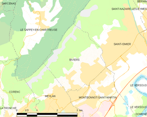
Бивье
- коммуна во Франции
Hiking in Бивье
Biviers is a small town located near Grenoble in the Auvergne-Rhône-Alpes region of France, and it serves as a great gateway for exploring the beautiful surrounding landscapes. Hiking in and around Biviers offers various opportunities for outdoor enthusiasts, ranging from easy walks to more challenging trails....
- Страна:
- Почтовый код: 38330
- Координаты: 45° 14' 24" N, 5° 48' 12" E
- GPS треки (wikiloc): [Ссылка]
- Площадь: 6.17 кв.км
- Население: 2324

Жьер
- коммуна во Франции
Hiking in Жьер
Gières is a charming village located in the Auvergne-Rhône-Alpes region of France, near the city of Grenoble. It boasts a scenic backdrop of the surrounding mountains, making it a wonderful place for hiking enthusiasts. Here are some key points to consider if you're planning to hike in or around Gières:...
- Страна:
- Почтовый код: 38610
- Координаты: 45° 10' 55" N, 5° 47' 31" E
- GPS треки (wikiloc): [Ссылка]
- Площадь: 6.93 кв.км
- Население: 6483
- Веб сайт: [Ссылка]


Мюрьянетт
- коммуна во Франции
Hiking in Мюрьянетт
Murianette is a beautiful area located in the region of Piedmont, Italy, near the city of Turin. It offers a variety of hiking trails that showcase stunning landscapes, lush greenery, and a rich diversity of flora and fauna. Here are a few key points about hiking in the Murianette area:...
- Страна:
- Почтовый код: 38420
- Координаты: 45° 11' 30" N, 5° 49' 13" E
- GPS треки (wikiloc): [Ссылка]
- Площадь: 6.07 кв.км
- Население: 886
- Веб сайт: [Ссылка]