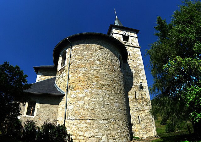
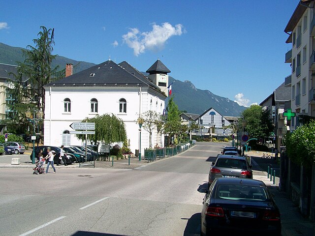
Nances (Nances)

- коммуна во Франции
 Hiking in Nances
Nances, often associated with scenic trails and beautiful landscapes, offers a variety of hiking opportunities for outdoor enthusiasts. Here’s a general guide to hiking in the Nances area, which you can adapt based on your specific location or preferences:
Hiking Trails
-
Trail Types: Nances may feature a mix of trails, including easy, moderate, and challenging routes. Be sure to check local maps for trail difficulty and length.
-
Scenic Views: Many trails in this region can boast breathtaking views—be sure to take breaks at lookout points to enjoy the scenery.
-
Wildlife Spotting: The area may be home to diverse wildlife. Make sure to bring binoculars if you’re interested in birdwatching or wildlife photography.
Preparation Tips
- Gear: Wear appropriate hiking boots and clothing suitable for the weather. A backpack with necessities like water, snacks, a first-aid kit, and navigation tools is crucial.
- Weather: Check the weather forecast before heading out. Mountain weather can change rapidly, so prepare for all conditions.
Safety
- Tell Someone: Always inform someone about your hiking plans and expected return time.
- Stay on Trails: To protect local flora and fauna, always stick to marked trails.
- Know Your Limits: Choose a route that matches your fitness level, and don’t hesitate to turn back if conditions become unsafe.
Local Regulations
- Permits: Some areas might require permits for hiking or camping. Check local regulations beforehand.
- Leave No Trace: Abide by Leave No Trace principles to preserve the natural beauty of Nances.
After Your Hike
- Explore the Area: Nances might also offer other outdoor activities like fishing, kayaking, or cycling. Local eateries can provide a nice treat after a long day on the trails.
Conclusion
Hiking in Nances can be a great way to connect with nature. Whether you're a seasoned hiker or just starting, the area likely has something to offer everyone. Just remember to prepare properly, respect the environment, and enjoy your adventure!
- Страна:

- Почтовый код: 73470
- Координаты: 45° 35' 25" N, 5° 47' 48" E


- GPS треки (wikiloc): [Ссылка]
- Площадь: 9.9 кв.км
- Население: 451
- Веб сайт: http://www.nancesensavoie.fr
- Википедия английская: wiki(en)
- Википедия национальная: wiki(fr)
- Хранилище Wikidata: Wikidata: Q430205
- Катеория в википедии: [Ссылка]
- код Freebase: [/m/03qlmt7]
- код Freebase: [/m/03qlmt7]
- код GeoNames: Альт: [6442838]
- код GeoNames: Альт: [6442838]
- номер SIREN: [217301845]
- номер SIREN: [217301845]
- код BNF: [152741168]
- код BNF: [152741168]
- WOEID: [12667457]
- WOEID: [12667457]
- код муниципалитета INSEE: 73184
- код муниципалитета INSEE: 73184
Граничит с регионами:


Novalaise
- коммуна во Франции
Hiking in Novalaise
Novalaise is a charming commune located in the Savoie department of the Auvergne-Rhône-Alpes region in southeastern France. Nestled between the picturesque shores of Lake Aiguebelette and the surrounding mountains, it presents excellent opportunities for hiking enthusiasts....
- Страна:
- Почтовый код: 73470
- Координаты: 45° 35' 40" N, 5° 46' 18" E
- GPS треки (wikiloc): [Ссылка]
- Площадь: 16.26 кв.км
- Население: 2067


Marcieux
- коммуна во Франции
Hiking in Marcieux
Marcieux is a charming village located in the Savoie region of France, nestled near the beautiful lakes and mountains of the Rhône-Alpes. While it may not be as well-known as some larger hiking destinations, it offers various trails that cater to different skill levels and provide stunning views of the surrounding landscapes....
- Страна:
- Почтовый код: 73470
- Координаты: 45° 36' 47" N, 5° 45' 45" E
- GPS треки (wikiloc): [Ссылка]
- Площадь: 4.4 кв.км
- Население: 163


Эгбелет-ле-Лак
- коммуна во Франции
Hiking in Эгбелет-ле-Лак
Aiguebelette-le-Lac is a beautiful destination located in the Savoie region of France, known for its stunning lake—one of the cleanest in Europe—and surrounding natural landscapes, making it a fantastic spot for hiking enthusiasts....
- Страна:
- Почтовый код: 73610
- Координаты: 45° 32' 16" N, 5° 48' 54" E
- GPS треки (wikiloc): [Ссылка]
- Площадь: 7.91 кв.км
- Население: 243

Сен-Сюльпис
- коммуна в департаменте Савойя, Франция
Hiking in Сен-Сюльпис
Saint-Sulpice in Savoie is a charming village located in the French Alps, offering beautiful hiking opportunities in a stunning natural setting. Here are some key points to consider when hiking in this area:...
- Страна:
- Почтовый код: 73160
- Координаты: 45° 34' 4" N, 5° 50' 42" E
- GPS треки (wikiloc): [Ссылка]
- Площадь: 8.82 кв.км
- Население: 777
- Веб сайт: [Ссылка]

Ла Мот-Серволе
- коммуна во Франции
Hiking in Ла Мот-Серволе
La Motte-Servolex is a charming commune located in the Savoie department in the Auvergne-Rhône-Alpes region of southeastern France. Nestled near the foothills of the Chartreuse Mountains and close to the city of Chambéry, it offers a variety of hiking opportunities for all skill levels....
- Страна:
- Почтовый код: 73290
- Координаты: 45° 35' 48" N, 5° 52' 39" E
- GPS треки (wikiloc): [Ссылка]
- Площадь: 29.85 кв.км
- Население: 11731
- Веб сайт: [Ссылка]