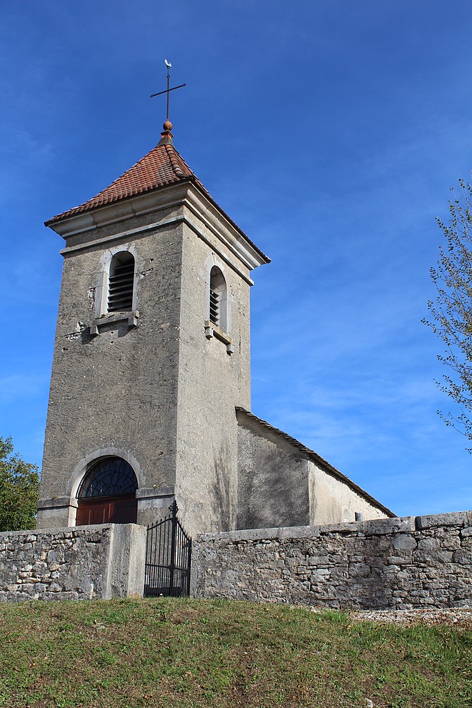
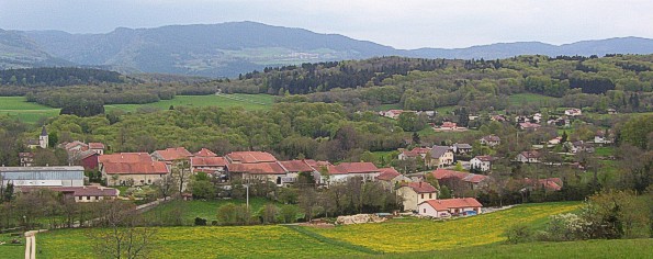
Нюрьё-Волонья (Nurieux-Volognat, Nurieux-Volognat)
- коммуна во Франции
 Hiking in Нюрьё-Волонья
Nurieux-Volognat is a charming commune located in the Ain department in the Auvergne-Rhône-Alpes region of France. Nestled in the foothills of the Jura Mountains, it offers a variety of hiking opportunities with stunning natural landscapes, diverse flora, and fauna.
Hiking Opportunities:
-
Scenic Trails: There are numerous marked trails in and around Nurieux-Volognat. You can explore different terrains that include forests, meadows, and panoramic viewpoints.
-
Jura Mountains: As part of the Jura range, you can hike trails that lead you to scenic overlooks where you can enjoy breathtaking views of the surrounding valleys and mountains.
-
Lac de Cuisance: A short distance from Nurieux-Volognat, this lake provides an ideal spot for hiking trails that loop around the water, as well as areas for picnicking and relaxation.
-
Hiking Levels: Trails in the area cater to a range of hiking levels, from easy family-friendly walks to more challenging routes for experienced hikers. Make sure to check the trail level before embarking on your adventure.
-
Local Flora and Fauna: The region is rich in biodiversity, and if you're lucky, you may spot local wildlife, such as deer, various bird species, and unique plant life.
Preparation for Hiking:
- Weather: Always check the weather forecast before you go, as conditions can change quickly in mountainous areas.
- Gear: Wear sturdy hiking boots, bring plenty of water, snacks, and dress in layers to accommodate temperature changes.
- Navigation: It’s a good idea to have a map or GPS device to help you navigate the trails, though many are well-marked.
- Safety: Inform someone about your hiking plans, and consider going with a buddy for safety.
Nearby Attractions:
- The Jura Regional Natural Park: A short drive away, this park offers more extensive trails, unique geological formations, and opportunities for other outdoor activities such as mountain biking and cross-country skiing in the winter.
- Local Culture: Take time to explore Nurieux-Volognat's local culture and cuisine, including traditional dishes that highlight regional specialties.
Whether you're looking for a relaxing stroll or a strenuous hike, Nurieux-Volognat has something to offer every outdoor enthusiast. Enjoy your hiking adventure!
- Страна:

- Почтовый код: 01460
- Координаты: 46° 10' 49" N, 5° 31' 19" E


- GPS треки (wikiloc): [Ссылка]
- Площадь: 19.34 кв.км
- Население: 1028
- Веб сайт: http://www.nurieux-volognat.fr
- Википедия русская: wiki(ru)
- Википедия английская: wiki(en)
- Википедия национальная: wiki(fr)
- Хранилище Wikidata: Wikidata: Q271322
- Катеория в википедии: [Ссылка]
- Карты в википедии: [Ссылка]
- код Freebase: [/m/03czg4w]
- код Freebase: [/m/03czg4w]
- код GeoNames: Альт: [2967723]
- код GeoNames: Альт: [2967723]
- номер SIREN: [210102679]
- номер SIREN: [210102679]
- код муниципалитета INSEE: 01267
- код муниципалитета INSEE: 01267
Граничит с регионами:

Брион
- коммуна во Франции, департамент Эн
Hiking in Брион
Brion, located in the Ain department in the Auvergne-Rhône-Alpes region of France, offers a picturesque setting for hiking enthusiasts. The region is characterized by its beautiful natural landscapes, rolling hills, oak forests, and charming rural scenery. Here are some key points to consider when hiking in Brion:...
- Страна:
- Почтовый код: 01460
- Координаты: 46° 10' 22" N, 5° 33' 9" E
- GPS треки (wikiloc): [Ссылка]
- Площадь: 4.48 кв.км
- Население: 515

Изернор
- коммуна во Франции
Hiking in Изернор
Izernore, located in the Ain department of the Auvergne-Rhône-Alpes region in eastern France, offers a beautiful environment for hiking enthusiasts. The area is characterized by its stunning natural landscapes, including rolling hills, forests, and views of the surrounding mountains. Here are some key points for hiking in Izernore:...
- Страна:
- Почтовый код: 01580
- Координаты: 46° 13' 14" N, 5° 33' 14" E
- GPS треки (wikiloc): [Ссылка]
- Площадь: 20.86 кв.км
- Население: 2275
- Веб сайт: [Ссылка]

Сен-Мартен-дю-Френ
- коммуна во Франции
Hiking in Сен-Мартен-дю-Френ
Saint-Martin-du-Frêne, located in the Ain department of the Auvergne-Rhône-Alpes region in France, offers a variety of beautiful hiking opportunities set against the backdrop of the stunning Jura Mountains. The area is recognized for its picturesque landscapes, lush forests, and diverse wildlife, making it an excellent destination for outdoor enthusiasts....
- Страна:
- Почтовый код: 01430
- Координаты: 46° 8' 20" N, 5° 33' 9" E
- GPS треки (wikiloc): [Ссылка]
- Площадь: 19.14 кв.км
- Население: 1076
- Веб сайт: [Ссылка]

Беар-Жеовресья
- коммуна во Франции
Hiking in Беар-Жеовресья
Béard-Géovreissiat is a charming commune located in the Ain department in the Auvergne-Rhône-Alpes region of France. This area is known for its beautiful natural landscapes, making it a great spot for hiking enthusiasts....
- Страна:
- Почтовый код: 01460
- Координаты: 46° 11' 23" N, 5° 33' 25" E
- GPS треки (wikiloc): [Ссылка]
- Площадь: 4.69 кв.км
- Население: 1026
- Веб сайт: [Ссылка]
Сонтонна-ла-Монтань
- коммуна во Франции
Hiking in Сонтонна-ла-Монтань
Sonthonnax-la-Montagne is a charming commune in the Ain department of the Auvergne-Rhône-Alpes region in France. Nestled in the countryside, it offers a variety of scenic hiking opportunities that showcase the natural beauty of the area....
- Страна:
- Почтовый код: 01580
- Координаты: 46° 13' 59" N, 5° 31' 27" E
- GPS треки (wikiloc): [Ссылка]
- Площадь: 14.14 кв.км
- Население: 321
- Веб сайт: [Ссылка]
Пейрья
- коммуна во Франции
Hiking in Пейрья
Peyriat is a lesser-known hiking destination, so details may vary depending on the specific area you’re referring to, as there might be various trails, landscapes, and attractions. However, if you are looking for a hiking experience in the region around Peyriat, here are some general tips and information:...
- Страна:
- Почтовый код: 01430
- Координаты: 46° 9' 15" N, 5° 30' 37" E
- GPS треки (wikiloc): [Ссылка]
- Площадь: 5.96 кв.км
- Население: 171

Лейсар
- коммуна во Франции
Hiking in Лейсар
Leyssard may not be a widely recognized hiking destination, so it might be useful to clarify if you're referring to a specific area or if there's a local name you're using for a location....
- Страна:
- Почтовый код: 01450
- Координаты: 46° 9' 21" N, 5° 28' 33" E
- GPS треки (wikiloc): [Ссылка]
- Площадь: 9.13 кв.км
- Население: 154