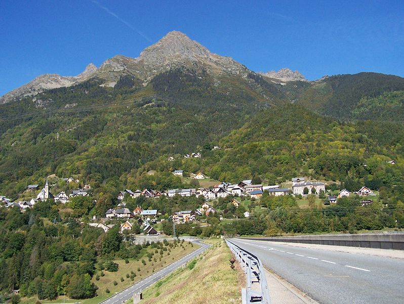
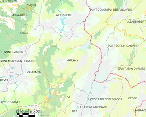
Оз (Изер) (Oz, Oz)

- коммуна во Франции
 Hiking in Оз (Изер)
Hiking in Oz, a charming alpine village located in the Isère department of France, offers exhilarating experiences amidst breathtaking scenery. Situated within the Grandes Rousses mountains in the French Alps, Oz is part of the Alpe d'Huez ski area, which transforms into a hiker's paradise during the summer months.
Hiking Trails
-
Alpe d'Huez Circuit: An extensive network of trails lies around Alpe d'Huez. You can enjoy stunning panoramic views while hiking various routes, from easier walks to more challenging treks.
-
Lac des Grenouilles: A beautiful hike that leads to a serene mountain lake, perfect for a picnic and relaxation surrounded by nature.
-
Outbound ascents: The nearby peaks such as Pic Blanc and La Fare offer more strenuous hikes for those looking for a challenge, featuring rewarding alpine vistas at the summits.
Difficulty Levels
The trails in and around Oz cater to various skill levels, from easy family hikes to more technical mountain excursions. It’s advisable to check the trail conditions and difficulty ratings before setting off.
Hiking Recommendations
- Best Time to Hike: Late spring to early fall (June to September) typically offers the most favorable weather conditions, though be prepared for changeable weather in the mountains.
- Gear Up: Good hiking boots, weather-appropriate clothing, and trekking poles can enhance your hiking experience. Don’t forget sun protection, as the Alpine sun can be strong.
- Hydration & Snacks: Carry sufficient water and snacks to keep your energy levels up during hikes.
Wildlife and Flora
Hiking in this region allows you to experience rich biodiversity. You may encounter diverse wildlife like chamois and marmots, as well as beautiful wildflowers that bloom during the summer months.
Local Considerations
Remember to adhere to local regulations and guidelines to ensure the preservation of the environment and safety on your hikes. It’s always good to inform someone of your hiking plans and expected return time.
Accessibility
Oz is accessible by road, and public transport options are available from nearby towns. Make sure to check public transport schedules in advance.
Resources
Several local guides and hiking maps can be found at tourist information centers in the area, providing insight into lesser-known trails and local tips.
Hiking in Oz, Isère, presents an unforgettable opportunity to immerse yourself in the natural beauty of the French Alps while enjoying an active outdoor lifestyle. Make sure to plan ahead, respect nature, and, most importantly, enjoy the stunning scenery!
- Страна:

- Почтовый код: 38114
- Координаты: 45° 8' 27" N, 6° 3' 7" E


- GPS треки (wikiloc): [Ссылка]
- Площадь: 16.81 кв.км
- Население: 246
- Веб сайт: http://www.oz-en-oisans.com
- Википедия русская: wiki(ru)
- Википедия английская: wiki(en)
- Википедия национальная: wiki(fr)
- Хранилище Wikidata: Wikidata: Q1153221
- Катеория в википедии: [Ссылка]
- код Freebase: [/m/03g_62m]
- код GeoNames: Альт: [2988883]
- номер SIREN: [213802895]
- код BNF: [15258101s]
- код VIAF: Альт: [171037228]
- код муниципалитета INSEE: 38289
Граничит с регионами:

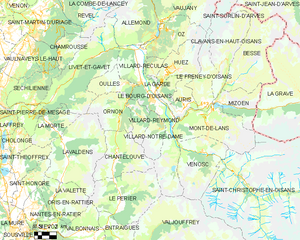
Аллемон
- коммуна во Франции
Hiking in Аллемон
Allemont is a picturesque village located in the French Alps, specifically in the Isère department. It serves as a gateway to the Vaujany valley and nearby hiking routes in the Oisans region, making it a great base for outdoor enthusiasts. Here are some highlights and considerations for hiking in and around Allemont:...
- Страна:
- Почтовый код: 38114
- Координаты: 45° 7' 49" N, 6° 2' 15" E
- GPS треки (wikiloc): [Ссылка]
- Площадь: 44.75 кв.км
- Население: 1006
- Веб сайт: [Ссылка]
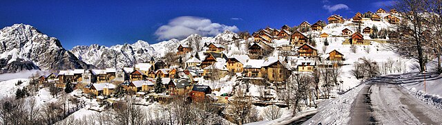
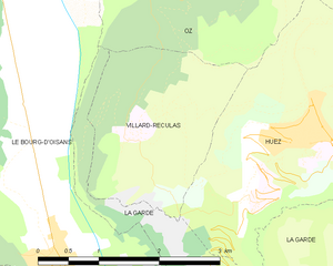
Виллар-Рекюла
- коммуна во Франции
Hiking in Виллар-Рекюла
Villard-Reculas is a charming alpine village located in the French Alps, part of the larger Alpe d'Huez ski area. It’s a fantastic destination for hiking enthusiasts, offering a variety of trails that cater to different levels of experience. Here are some key features and tips for hiking in Villard-Reculas:...
- Страна:
- Почтовый код: 38114
- Координаты: 45° 5' 32" N, 6° 1' 54" E
- GPS треки (wikiloc): [Ссылка]
- Площадь: 4.99 кв.км
- Население: 57
- Веб сайт: [Ссылка]


Ле-Френе-д'Уазан
- коммуна во Франции
Hiking in Ле-Френе-д'Уазан
Le Freney-d'Oisans is a charming village located in the Auvergne-Rhône-Alpes region of France, nestled in the French Alps. It's a fantastic location for hiking enthusiasts due to its stunning natural scenery, diverse trails, and proximity to other outdoor activities....
- Страна:
- Почтовый код: 38142
- Координаты: 45° 2' 41" N, 6° 7' 32" E
- GPS треки (wikiloc): [Ссылка]
- Площадь: 14.54 кв.км
- Население: 252
- Веб сайт: [Ссылка]

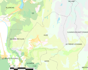
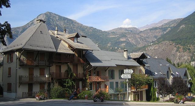
Юэ
- коммуна во Франции
Hiking in Юэ
Alpe d'Huez, situated in the French Alps, is well-known for its winter sports, but it offers excellent hiking opportunities during the summer months. Here are some highlights and tips for hiking in the Huez area:...
- Страна:
- Почтовый код: 38750
- Координаты: 45° 4' 57" N, 6° 3' 33" E
- GPS треки (wikiloc): [Ссылка]
- Площадь: 14.16 кв.км
- Население: 1335
- Веб сайт: [Ссылка]

Вожани
- коммуна во Франции
Hiking in Вожани
Vaujany is a charming alpine village located in the French Alps, within the Oisans region, and is part of the larger Alpe d'Huez Grand Domaine Ski area. It's not only a great skiing destination but also an excellent location for hiking, especially during the warmer months when the snow melts and the trails become accessible....
- Страна:
- Почтовый код: 38114
- Координаты: 45° 9' 27" N, 6° 4' 36" E
- GPS треки (wikiloc): [Ссылка]
- Площадь: 64.54 кв.км
- Население: 307
- Веб сайт: [Ссылка]
Ле-Бур-д'Уазан
- коммуна во Франции
Hiking in Ле-Бур-д'Уазан
Le Bourg-d'Oisans is a charming commune located in the French Alps, nestled between the Oisans mountain range and the breathtaking Ecrins National Park. It's an excellent base for those who enjoy hiking, as it offers a variety of trails suitable for all experience levels, from beginner to advanced....
- Страна:
- Почтовый код: 38520
- Координаты: 45° 3' 19" N, 6° 1' 46" E
- GPS треки (wikiloc): [Ссылка]
- Площадь: 35.75 кв.км
- Население: 3239
- Веб сайт: [Ссылка]


Ла-Гард
Hiking in Ла-Гард
La Garde is a charming commune located in the Isère department in southeastern France, nestled in the picturesque landscape of the French Alps. It's a great destination for hiking enthusiasts, offering a variety of trails that cater to different skill levels....
- Страна:
- Почтовый код: 38520
- Координаты: 45° 4' 8" N, 6° 2' 45" E
- GPS треки (wikiloc): [Ссылка]
- Высота над уровнем моря: 982 м m
- Площадь: 9.09 кв.км
- Население: 100
- Веб сайт: [Ссылка]