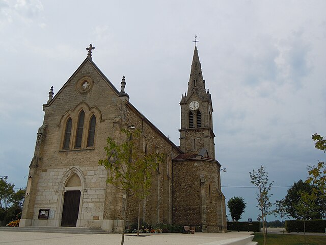
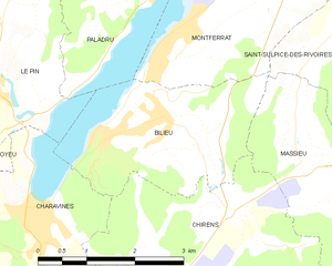
Паладрю (Paladru, Paladru)

- коммуна во Франции
 Hiking in Паладрю
Hiking in Paladru, located in the Auvergne-Rhône-Alpes region of France, offers a beautiful blend of natural landscapes, cultural heritage, and outdoor activities. The area is known for its stunning lake, Lac de Paladru, which is one of the cleanest lakes in the region and provides a picturesque backdrop for hiking.
Key Highlights for Hiking in Paladru:
-
Scenic Trails: There are various hiking trails around Lac de Paladru and the surrounding hills that cater to different skill levels. The trails offer varying levels of difficulty, making it enjoyable for both novice and experienced hikers.
-
Breathtaking Views: Many trails provide stunning views of the lake, lush forests, and the nearby mountains. The landscape is particularly beautiful during the spring and fall when the foliage is vibrant.
-
Historical Significance: While hiking, you may encounter archaeological sites and remnants of the region's history, including ancient farms and structures that date back to prehistoric times.
-
Flora and Fauna: The region is home to diverse flora and fauna. Hikers may encounter a variety of plant species, wildlife, and birdwatching opportunities, especially near the lake and in the surrounding woodlands.
-
Water Activities: In addition to hiking, Lac de Paladru is popular for swimming, kayaking, and paddleboarding during the warmer months. Combining water activities with hiking can make for a fun and varied outdoor experience.
-
Access and Amenities: The hiking trails are generally well marked, and there are several access points leading to the trails around the lake. Amenities such as parking, picnic areas, and local restaurants enhance the experience.
-
Seasons: The best times for hiking in Paladru are typically spring (April to June) and early fall (September to October) when temperatures are pleasant and the scenery is most appealing.
Recommendations:
- Preparation: Ensure you're well-prepared with appropriate footwear, plenty of water, snacks, and a map or GPS. Some trails can be more remote, so it's wise to be equipped.
- Local Guides: Consider hiring a local guide or joining organized hikes to get the most out of your experience and learn more about the area’s history and ecology.
- Respect Nature: Always follow the Leave No Trace principles to preserve the beauty of the landscape for future visitors.
Whether you're looking for a leisurely walk or a challenging hike, Paladru offers a wonderful destination for outdoor enthusiasts. Enjoy your adventure and the natural beauty!
- Страна:

- Почтовый код: 38137
- Координаты: 45° 28' 33" N, 5° 33' 12" E


- GPS треки (wikiloc): [Ссылка]
- Площадь: 11.64 кв.км
- Население: 1181
- Веб сайт: http://www.paladru.fr
- Википедия русская: wiki(ru)
- Википедия английская: wiki(en)
- Википедия национальная: wiki(fr)
- Хранилище Wikidata: Wikidata: Q1151362
- Катеория в википедии: [Ссылка]
- код Freebase: [/m/03g_628]
- код GeoNames: Альт: [6454080]
- код BNF: [15258104t]
- код тезауруса PACTOLS: [pcrtq3S0LIQw88]
- код муниципалитета INSEE: 38292
Граничит с регионами:


Ла-Бати-Дивизен
- коммуна во Франции
Hiking in Ла-Бати-Дивизен
La Bâtie-Divisin is a charming commune in the Isère department of the Auvergne-Rhône-Alpes region in southeastern France. Nestled near the foothills of the Alps, it offers a picturesque setting for hiking enthusiasts. Here are some key points about hiking in and around La Bâtie-Divisin:...
- Страна:
- Почтовый код: 38490
- Координаты: 45° 30' 36" N, 5° 35' 52" E
- GPS треки (wikiloc): [Ссылка]
- Площадь: 10.51 кв.км
- Население: 917
- Веб сайт: [Ссылка]


Валанконь
- коммуна во Франции
Hiking in Валанконь
Valencogne is a lesser-known but beautiful destination for hiking, located in the French Alps. Here are some highlights and tips for hiking in this area:...
- Страна:
- Почтовый код: 38730
- Координаты: 45° 29' 57" N, 5° 32' 24" E
- GPS треки (wikiloc): [Ссылка]
- Площадь: 7.55 кв.км
- Население: 662
- Веб сайт: [Ссылка]


Сент-Ондра
- коммуна во Франции
Hiking in Сент-Ондра
Saint-Ondras is a small commune located in the Isère department in the Auvergne-Rhône-Alpes region of France. While it may not be as well-known for hiking as some other areas in the region, it offers opportunities for outdoor enthusiasts seeking beautiful landscapes and tranquility....
- Страна:
- Почтовый код: 38490
- Координаты: 45° 31' 4" N, 5° 32' 49" E
- GPS треки (wikiloc): [Ссылка]
- Площадь: 8.15 кв.км
- Население: 621


Ле-Пен
Hiking in Ле-Пен
Le Pin, located in the Isère department of the Auvergne-Rhône-Alpes region in France, offers beautiful hiking opportunities with picturesque landscapes and a variety of trails suited for different skill levels. Here are some insights into hiking in the area:...
- Страна:
- Почтовый код: 38730
- Координаты: 45° 27' 24" N, 5° 30' 20" E
- GPS треки (wikiloc): [Ссылка]
- Площадь: 9.6 кв.км
- Население: 1255
- Веб сайт: [Ссылка]

Монферра
- коммуна во Франции
Hiking in Монферра
Montferrat, located in the Isère department of the Auvergne-Rhône-Alpes region in southeastern France, offers stunning hiking opportunities through its picturesque landscapes. Here are some key points to consider for hiking in Montferrat:...
- Страна:
- Почтовый код: 38620
- Координаты: 45° 29' 16" N, 5° 35' 27" E
- GPS треки (wikiloc): [Ссылка]
- Площадь: 12.26 кв.км
- Население: 1767
- Веб сайт: [Ссылка]

Бильё
- коммуна во Франции
Hiking in Бильё
Bilieu is a charming village located in the Auvergne-Rhône-Alpes region of France, near the shores of Lake Paladru. It offers a variety of hiking opportunities that cater to different skill levels, allowing both beginners and experienced hikers to explore the natural beauty of the area. Here are some highlights of hiking in Bilieu:...
- Страна:
- Почтовый код: 38850
- Координаты: 45° 26' 55" N, 5° 32' 59" E
- GPS треки (wikiloc): [Ссылка]
- Площадь: 6.71 кв.км
- Население: 1503
- Веб сайт: [Ссылка]


Шарансьё
- коммуна во Франции
Hiking in Шарансьё
Charancieu, located in the Isère department of the Auvergne-Rhône-Alpes region in France, offers beautiful scenery and a variety of hiking opportunities. The area is characterized by rolling hills, lush greenery, and stunning views of the surrounding mountains....
- Страна:
- Почтовый код: 38490
- Координаты: 45° 31' 30" N, 5° 34' 54" E
- GPS треки (wikiloc): [Ссылка]
- Площадь: 5.53 кв.км
- Население: 741