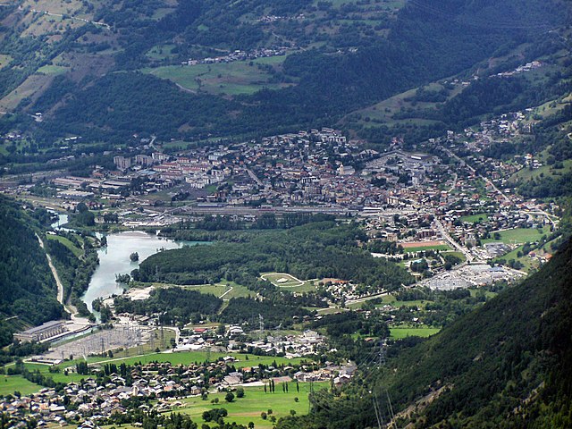
Séez (Séez)

- коммуна во Франции
 Hiking in Séez
Séez, located in the Auvergne-Rhône-Alpes region of France near the Italian border, is a gateway to some beautiful hiking experiences in the the French Alps. Here’s what you need to know about hiking in and around Séez:
Scenic Trails
-
Vanoise National Park: Just a short distance from Séez, this park offers stunning trails with various levels of difficulty. You'll find well-marked paths that lead through alpine meadows, past mountain lakes, and up to panoramic viewpoints.
-
Col de la Chal: A popular route starts from Séez to Col de la Chal, where hikers are rewarded with views of Mont Blanc on a clear day. This trail is ideal for those looking to enjoy a moderate hike.
-
Fortifications Trail: Explore the history of the area with a hike that includes visits to the historical forts built to protect the border. These trails offer both scenic views and a glimpse into the region’s military history.
Best Time to Hike
- Summer (June to September): This is the best time to hike as the trails are generally clear of snow, and wildflowers bloom in the valleys.
- Autumn (September to October): The fall foliage can be spectacular, and the weather is usually mild, making it pleasant for hiking.
Hiking Tips
- Equipment: Make sure to wear proper hiking boots and attire. Bring plenty of water, snacks, and a map or GPS device since some trails may not be well-marked.
- Weather: The weather in the Alps can change rapidly. Always check the forecast before heading out and be prepared for sudden changes.
- Local Guides: If you're not familiar with the area or prefer guided experiences, consider hiring a local guide who can provide insights into the geography and ecology of the region.
Additional Attractions
- Cultural Experiences: In addition to hiking, the region around Séez is rich in culture, with traditional Savoyard architecture and local cuisine worth exploring.
- Nearby Towns: Consider visiting the nearby town of Bourg-Saint-Maurice for more amenities, restaurants, and additional hiking trails.
Overall, Séez serves as a fantastic starting point for an unforgettable hiking experience in the French Alps!
- Страна:

- Почтовый код: 73700
- Координаты: 45° 37' 22" N, 6° 48' 3" E


- GPS треки (wikiloc): [Ссылка]
- Площадь: 42.55 кв.км
- Население: 2398
- Веб сайт: http://www.seez.fr
- Википедия английская: wiki(en)
- Википедия национальная: wiki(fr)
- Хранилище Wikidata: Wikidata: Q929303
- Катеория в википедии: [Ссылка]
- код Freebase: [/m/0f8pw0]
- код GeoNames: Альт: [6454656]
- номер SIREN: [217302850]
- код BNF: [152742156]
- код тезауруса PACTOLS: [pcrtc1t57sUOr4]
- код Trismegistos: [21925]
- код муниципалитета INSEE: 73285
Граничит с регионами:


Villaroger
- коммуна во Франции
Hiking in Villaroger
Villaroger is a charming village located in the French Alps, within the Tarentaise Valley in the Savoie region. It offers a range of hiking opportunities, making it an attractive destination for outdoor enthusiasts. Here are some key points to consider when hiking in Villaroger:...
- Страна:
- Почтовый код: 73640
- Координаты: 45° 35' 28" N, 6° 52' 28" E
- GPS треки (wikiloc): [Ссылка]
- Площадь: 28.15 кв.км
- Население: 387

Бур-Сен-Морис
- коммуна во Франции
Hiking in Бур-Сен-Морис
Bourg-Saint-Maurice, located in the Savoie region of the French Alps, is a fantastic destination for hikers. It offers stunning alpine scenery, a variety of trails suitable for different skill levels, and access to some of the most beautiful landscapes in the region, including the Vanoise National Park....
- Страна:
- Почтовый код: 73700
- Координаты: 45° 37' 0" N, 6° 46' 7" E
- GPS треки (wikiloc): [Ссылка]
- Высота над уровнем моря: 744 м m
- Площадь: 179.07 кв.км
- Население: 7228
- Веб сайт: [Ссылка]


Ла-Тюйль
- коммуна Италии
Hiking in Ла-Тюйль
La Thuile, located in the Aosta Valley region of Italy, is a fantastic destination for hiking enthusiasts. Nestled in the Alps, this area offers stunning landscapes, diverse wildlife, and a variety of hiking trails suitable for all skill levels, from beginners to experienced adventurers....
- Страна:

- Почтовый код: 11016
- Телефонный код: 0165
- Код автомобильного номера: AO
- Координаты: 45° 42' 58" N, 6° 57' 0" E
- GPS треки (wikiloc): [Ссылка]
- Высота над уровнем моря: 1450 м m
- Площадь: 125.67 кв.км
- Население: 783
- Веб сайт: [Ссылка]


Montvalezan
- коммуна во Франции
Hiking in Montvalezan
Montvalezan, nestled in the Savoie region of the French Alps, offers a stunning backdrop for hiking enthusiasts. This area is particularly known for its proximity to the vast Ski Paradiski area, which includes Les Arcs and La Plagne, but it also boasts fantastic summer hiking opportunities....
- Страна:
- Почтовый код: 73700
- Координаты: 45° 36' 43" N, 6° 50' 48" E
- GPS треки (wikiloc): [Ссылка]
- Площадь: 25.9 кв.км
- Население: 695