Saint-Jeoire (Saint-Jeoire)

- коммуна во Франции
 Hiking in Saint-Jeoire
Saint-Jeoire is a charming village located in the Rhône-Alpes region of France, nestled in the heart of the French Alps. It offers a variety of hiking opportunities, suitable for different skill levels and preferences. Here are some key points to consider about hiking in and around Saint-Jeoire:
Scenic Trails
- Diverse Landscapes: The area offers stunning views of the surrounding mountains, valleys, and lush forests. You can enjoy picturesque landscapes that change with the seasons.
- Trail Variety: There are numerous trails ranging from easy walks suitable for families to more challenging hikes for experienced trekkers. Many routes are well marked.
Notable Hiking Areas
- Mont Salève: Located nearby, Mont Salève offers breathtaking panoramic views of Geneva and the Alps. Various trails lead up to the summit, where hikers can find a small chapel and picturesque picnic spots.
- Les Voirons Mountains: This range provides several hiking options, with paths that offer a mix of forest and alpine terrain.
- Lake Geneva: The nearby lake offers scenic hiking opportunities along its shores and in the surrounding hills.
Best Times to Hike
- Summer (June to August): Ideal for most hiking activities, with mild temperatures and longer daylight hours. However, it’s also important to stay hydrated and protect against sun exposure.
- Autumn (September to October): Offers spectacular foliage as the leaves change colors, making for beautiful hiking conditions. The temperatures are cooler, which is comfortable for longer hikes.
- Winter: While some trails may be closed due to snow, certain areas can be explored through snowshoeing or winter hiking.
Safety Tips
- Check Weather Conditions: The weather can be unpredictable in the mountains. Always check the forecast before heading out, and be prepared for changing conditions.
- Wear Appropriate Gear: Good hiking boots, layered clothing, and a reliable backpack with water and snacks are essential.
- Navigation: Familiarize yourself with the trails, and consider having a map or GPS device handy. Some areas may have limited cell service.
Local Amenities
After hiking, you can relax in the local village, which has charming cafés and restaurants serving traditional Savoyard cuisine. It’s a great way to unwind and reflect on your hiking adventures.
With its stunning alpine scenery and a variety of trails, Saint-Jeoire is an excellent destination for nature lovers and hiking enthusiasts. Be sure to plan ahead to make the most of your experience!
- Страна:

- Почтовый код: 74490
- Координаты: 46° 8' 18" N, 6° 27' 34" E


- GPS треки (wikiloc): [Ссылка]
- Площадь: 22.75 кв.км
- Население: 3252
- Веб сайт: http://www.saint-jeoire.fr
- Википедия английская: wiki(en)
- Википедия национальная: wiki(fr)
- Хранилище Wikidata: Wikidata: Q769321
- Катеория в википедии: [Ссылка]
- код Freebase: [/m/03ntymx]
- код GeoNames: Альт: [2979185]
- номер SIREN: [217402411]
- код BNF: [15274496k]
- код муниципалитета INSEE: 74241
Граничит с регионами:


Marignier
- коммуна во Франции
Hiking in Marignier
Marignier is a charming town located in the Haute-Savoie region of southeastern France, nestled in the foothills of the French Alps. While it may not be as well-known as some of the larger towns in the area, it offers access to stunning natural landscapes and a variety of hiking opportunities....
- Страна:
- Почтовый код: 74970
- Координаты: 46° 5' 25" N, 6° 29' 59" E
- GPS треки (wikiloc): [Ссылка]
- Площадь: 19.97 кв.км
- Население: 6463
- Веб сайт: [Ссылка]
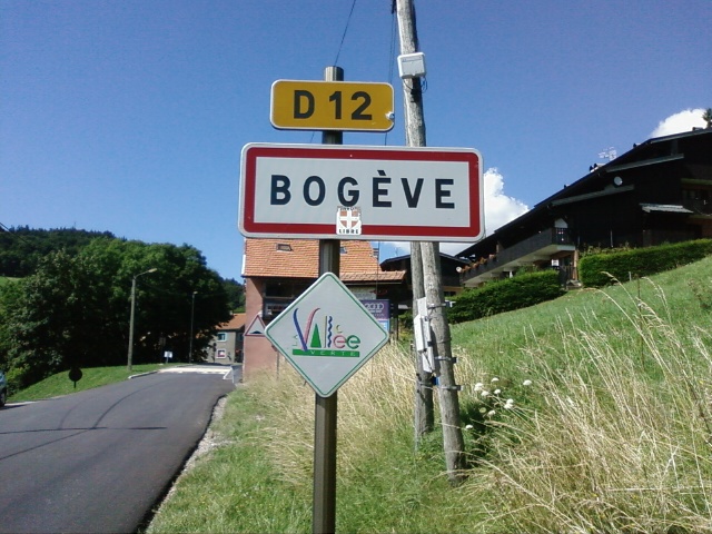

Bogève
- коммуна во Франции
Hiking in Bogève
Bogève, a picturesque village located in the Haute-Savoie region of France, offers stunning hiking opportunities amidst the French Alps. The area is known for its rich natural beauty, characterized by rolling hills, lush forests, and breathtaking mountain views....
- Страна:
- Почтовый код: 74250
- Координаты: 46° 11' 33" N, 6° 25' 47" E
- GPS треки (wikiloc): [Ссылка]
- Площадь: 7 кв.км
- Население: 1046


Mieussy
- коммуна во Франции
Hiking in Mieussy
Mieussy, located in the Haute-Savoie region of the French Alps, offers a variety of hiking opportunities that cater to different skill levels and preferences. Here are some highlights of hiking in Mieussy:...
- Страна:
- Почтовый код: 74440
- Координаты: 46° 8' 3" N, 6° 31' 22" E
- GPS треки (wikiloc): [Ссылка]
- Площадь: 44.45 кв.км
- Население: 2327
- Веб сайт: [Ссылка]


Onnion
- коммуна во Франции
Hiking in Onnion
Onnion is a picturesque commune located in the Auvergne-Rhône-Alpes region of France, near the French Alps. It's well-known for its beautiful landscapes, traditional alpine architecture, and a range of outdoor activities, particularly hiking. Here are some key points to consider for hiking in Onnion:...
- Страна:
- Почтовый код: 74490
- Координаты: 46° 10' 17" N, 6° 28' 44" E
- GPS треки (wikiloc): [Ссылка]
- Площадь: 18.97 кв.км
- Население: 1260
- Веб сайт: [Ссылка]


Ayze
- коммуна во Франции
Hiking in Ayze
Ayse, located in the Rize Province of Turkey, is known for its stunning natural landscapes, lush green mountains, and fascinating flora and fauna, making it an attractive destination for hiking enthusiasts. Here are some key points to consider if you're planning a hiking trip in Ayse:...
- Страна:
- Почтовый код: 74130
- Координаты: 46° 4' 57" N, 6° 26' 13" E
- GPS треки (wikiloc): [Ссылка]
- Площадь: 10.48 кв.км
- Население: 2119


Viuz-en-Sallaz
- коммуна во Франции
Hiking in Viuz-en-Sallaz
Viuz-en-Sallaz, located in the Haute-Savoie region of France, is an ideal destination for hiking enthusiasts. Nestled in the foothills of the Alps, it offers a mix of scenic landscapes, including lush forests, rolling hills, and panoramic mountain views....
- Страна:
- Почтовый код: 74250
- Координаты: 46° 8' 51" N, 6° 24' 37" E
- GPS треки (wikiloc): [Ссылка]
- Площадь: 20.99 кв.км
- Население: 4206


La Tour
Hiking in La Tour
La Tour, located in the Haute-Savoie region of the French Alps, offers some beautiful hiking opportunities, catering to a range of skill levels from beginners to experienced hikers. Here’s an overview of what you can expect when hiking in this picturesque area:...
- Страна:
- Почтовый код: 74250
- Координаты: 46° 7' 58" N, 6° 25' 50" E
- GPS треки (wikiloc): [Ссылка]
- Площадь: 7.73 кв.км
- Население: 1248


Saint-Jean-de-Tholome
- коммуна во Франции
Hiking in Saint-Jean-de-Tholome
Saint-Jean-de-Tholome is a charming village located in the Haute-Savoie region of France, which is part of the Auvergne-Rhône-Alpes. This area is blessed with stunning natural landscapes that are perfect for hiking enthusiasts....
- Страна:
- Почтовый код: 74250
- Координаты: 46° 6' 42" N, 6° 23' 52" E
- GPS треки (wikiloc): [Ссылка]
- Площадь: 12.37 кв.км
- Население: 947