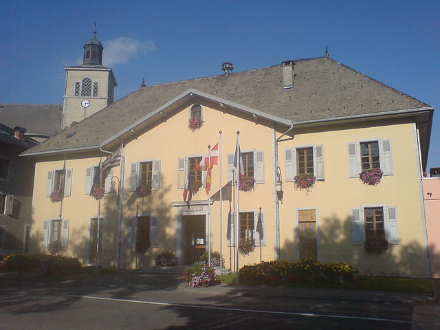
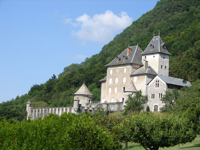
Mieussy (Mieussy)

- коммуна во Франции
 Hiking in Mieussy
Mieussy, located in the Haute-Savoie region of the French Alps, offers a variety of hiking opportunities that cater to different skill levels and preferences. Here are some highlights of hiking in Mieussy:
Scenic Trails
-
Mount G_Mont: This is a popular hiking area that provides stunning panoramic views of the surrounding mountains and valleys. The trails range from moderate to challenging and are ideal for those looking to experience the beauty of the Alps.
-
Lacs de la Vogealle: A relatively easy hike that leads to a series of picturesque mountain lakes. This trail is family-friendly and perfect for those who want a leisurely day out in nature.
-
Le Plateau de glières: This area is an excellent spot for hiking, with trails that offer insight into both the natural landscape and historical significance from World War II.
Difficulty Levels
Trails around Mieussy vary in difficulty:
- Beginner: Many trails are suitable for beginners, with gentle slopes and well-marked paths.
- Intermediate: Moderate trails will challenge hikers with steeper ascents but still remain manageable with a reasonable fitness level.
- Advanced: For experienced hikers, there are more rugged terrains and higher elevations that require good navigation skills and physical fitness.
Best Seasons
- Summer (June to September): Most trails are accessible, and the weather is typically pleasant, making it the best time for hiking.
- Autumn: Fall colors provide a stunning backdrop, though weather can be more unpredictable.
- Winter: While not ideal for traditional hiking, snowshoeing and winter hiking trails are available for those who want to explore the snowy landscape.
Essential Tips
- Gear up: Wear appropriate hiking boots and dress in layers to accommodate changing weather conditions.
- Stay hydrated: Carry plenty of water, as some trails may not have easy access to drinking water sources.
- Navigation: A good map or GPS device is essential, especially on less-marked trails.
- Respect nature: Follow Leave No Trace principles to help preserve the area's natural beauty.
Local Amenities
Mieussy has several accommodations, restaurants, and tourism offices that can provide additional resources, including maps and local guides for more in-depth exploration.
Overall, Mieussy is a wonderful destination for hikers looking to immerse themselves in the natural beauty and serene environment of the French Alps. Whether you're a beginner or an advanced hiker, there’s something for everyone in this picturesque part of the world.
- Страна:

- Почтовый код: 74440
- Координаты: 46° 8' 3" N, 6° 31' 22" E


- GPS треки (wikiloc): [Ссылка]
- Площадь: 44.45 кв.км
- Население: 2327
- Веб сайт: http://www.mieussy.eu
- Википедия английская: wiki(en)
- Википедия национальная: wiki(fr)
- Хранилище Wikidata: Wikidata: Q672956
- Катеория в википедии: [Ссылка]
- код Freebase: [/m/03ntylj]
- код GeoNames: Альт: [6442997]
- номер SIREN: [217401835]
- код BNF: [152744419]
- WOEID: [611477]
- код муниципалитета INSEE: 74183
Граничит с регионами:


Marignier
- коммуна во Франции
Hiking in Marignier
Marignier is a charming town located in the Haute-Savoie region of southeastern France, nestled in the foothills of the French Alps. While it may not be as well-known as some of the larger towns in the area, it offers access to stunning natural landscapes and a variety of hiking opportunities....
- Страна:
- Почтовый код: 74970
- Координаты: 46° 5' 25" N, 6° 29' 59" E
- GPS треки (wikiloc): [Ссылка]
- Площадь: 19.97 кв.км
- Население: 6463
- Веб сайт: [Ссылка]

Taninges
- коммуна во Франции
Hiking in Taninges
Taninges, located in the Haute-Savoie region of the French Alps, is an excellent destination for hiking enthusiasts. The area is known for its breathtaking landscapes, including majestic mountains, lush valleys, and beautiful alpine meadows. Here are some highlights and tips for hiking in and around Taninges:...
- Страна:
- Почтовый код: 74440
- Координаты: 46° 6' 27" N, 6° 35' 29" E
- GPS треки (wikiloc): [Ссылка]
- Площадь: 42.66 кв.км
- Население: 3410


Bellevaux
- коммуна во Франции
Hiking in Bellevaux
Bellevaux is a charming village located in the French Alps, known for its stunning mountainous landscapes, lush forests, and beautiful trails, making it a fantastic destination for hiking enthusiasts. Here are some highlights and tips for hiking in the Bellevaux area:...
- Страна:
- Почтовый код: 74470
- Координаты: 46° 15' 25" N, 6° 31' 52" E
- GPS треки (wikiloc): [Ссылка]
- Площадь: 48.97 кв.км
- Население: 1282
- Веб сайт: [Ссылка]

Saint-Jeoire
- коммуна во Франции
Hiking in Saint-Jeoire
Saint-Jeoire is a charming village located in the Rhône-Alpes region of France, nestled in the heart of the French Alps. It offers a variety of hiking opportunities, suitable for different skill levels and preferences. Here are some key points to consider about hiking in and around Saint-Jeoire:...
- Страна:
- Почтовый код: 74490
- Координаты: 46° 8' 18" N, 6° 27' 34" E
- GPS треки (wikiloc): [Ссылка]
- Площадь: 22.75 кв.км
- Население: 3252
- Веб сайт: [Ссылка]


Onnion
- коммуна во Франции
Hiking in Onnion
Onnion is a picturesque commune located in the Auvergne-Rhône-Alpes region of France, near the French Alps. It's well-known for its beautiful landscapes, traditional alpine architecture, and a range of outdoor activities, particularly hiking. Here are some key points to consider for hiking in Onnion:...
- Страна:
- Почтовый код: 74490
- Координаты: 46° 10' 17" N, 6° 28' 44" E
- GPS треки (wikiloc): [Ссылка]
- Площадь: 18.97 кв.км
- Население: 1260
- Веб сайт: [Ссылка]


La Côte-d'Arbroz
- коммуна во Франции
Hiking in La Côte-d'Arbroz
La Côte-d'Arbroz is a charming commune located in the Haute-Savoie region of the French Alps. Known for its stunning landscapes and proximity to the Portes du Soleil ski area, it also offers fantastic hiking opportunities, particularly in the summer months when the snow melts and the meadows bloom....
- Страна:
- Почтовый код: 74110
- Координаты: 46° 11' 16" N, 6° 40' 5" E
- GPS треки (wikiloc): [Ссылка]
- Площадь: 12.24 кв.км
- Население: 323
- Веб сайт: [Ссылка]
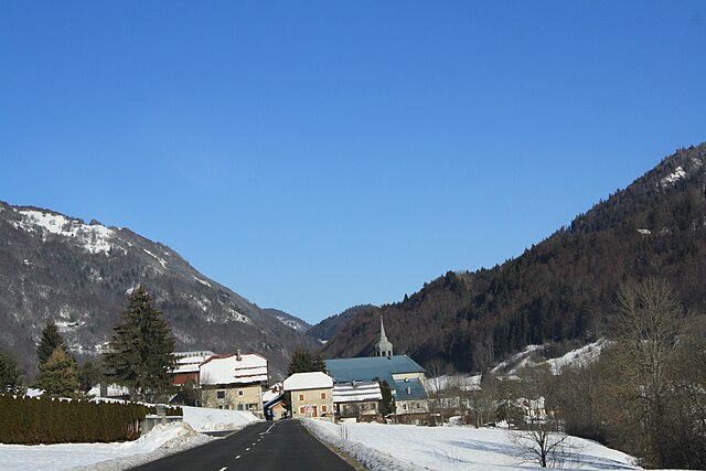
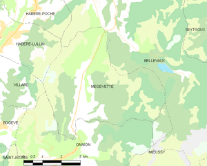
Mégevette
- коммуна во Франции
Hiking in Mégevette
Mégevette is a charming village located in the Haute-Savoie region of the French Alps, offering stunning natural landscapes and a range of hiking opportunities. Here are some highlights and tips for hiking in and around Mégevette:...
- Страна:
- Почтовый код: 74490
- Координаты: 46° 11' 58" N, 6° 29' 52" E
- GPS треки (wikiloc): [Ссылка]
- Площадь: 21.66 кв.км
- Население: 560


Châtillon-sur-Cluses
- коммуна во Франции
Hiking in Châtillon-sur-Cluses
Châtillon-sur-Cluses is a picturesque village in the Haute-Savoie region of France, nestled in the Alps. It provides a beautiful backdrop for hiking enthusiasts, offering a variety of trails that cater to different levels of experience. Here are some details about hiking in and around Châtillon-sur-Cluses:...
- Страна:
- Почтовый код: 74300
- Координаты: 46° 5' 14" N, 6° 34' 57" E
- GPS треки (wikiloc): [Ссылка]
- Площадь: 9.18 кв.км
- Население: 1258


Thyez
- коммуна во Франции
Hiking in Thyez
Thyez is a small commune located in the Haute-Savoie department in the Auvergne-Rhône-Alpes region of France. While it may not be as widely known for hiking as some of its neighboring areas, it is still surrounded by beautiful landscapes and offers opportunities for outdoor enthusiasts....
- Страна:
- Почтовый код: 74300
- Координаты: 46° 5' 1" N, 6° 32' 28" E
- GPS треки (wikiloc): [Ссылка]
- Площадь: 9.81 кв.км
- Население: 6011
- Веб сайт: [Ссылка]