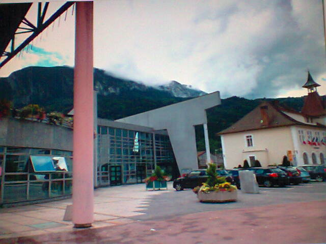
Бонвиль (arrondissement of Bonneville, arrondissement de Bonneville)

- округ Франции
 Hiking in Бонвиль
The Arrondissement of Bonneville, located in the Haute-Savoie department of the Auvergne-Rhône-Alpes region in southeastern France, offers some stunning hiking opportunities for outdoor enthusiasts. Nestled in the heart of the French Alps, this area is known for its breathtaking landscapes, diverse terrain, and beautiful alpine scenery. Here are a few highlights of hiking in the region:
Notable Hiking Areas
-
Chamonix-Mont-Blanc: While technically outside Bonneville, Chamonix is a renowned climbing area that can serve as a great starting point for those willing to explore the higher alpine trails, including the famous Tour du Mont Blanc.
-
Les Glières Plateau: This area is popular for its scenic views and historical significance. Trails here traverse lush pastures, wildflower fields, and offer panoramic views of the surrounding mountains.
-
Sixt-Fer-à-Cheval Nature Reserve: Known for its dramatic cliffs, waterfalls, and diverse flora and fauna, this area features several marked trails, ranging from easy walks to more challenging hikes.
-
Col des Montets: This mountain pass offers various trails that provide stunning views of the Mont Blanc range and the surrounding valleys. Hiking here is especially rewarding in spring and summer when wildflowers bloom.
-
Aravis Mountains: To the south of Bonneville, these mountains are crisscrossed with trails that vary from gentle walks to more strenuous hikes, accommodating all levels of hikers.
Trail Types and Skill Levels
-
Easy Trails: Suitable for families and beginners, these trails can often be found near lakes and demonstrate the natural beauty with less challenging elevation changes.
-
Moderate Trails: These may involve more substantial elevation gain and are well-marked. They are great for intermediate hikers looking to explore the area more deeply.
-
Difficult Trails: For experienced hikers, routes might offer steep ascents or require basic scrambling skills. Always check the trail conditions and be prepared for changing weather.
Best Hiking Seasons
-
Spring (April - June): Marvel at wildflowers and vibrant greenery, but be cautious as some trails may still have snow in higher altitudes.
-
Summer (July - August): The warmest and most popular time for hiking, with fully accessible trails and the possibility of mountain huts being open for refreshments.
-
Autumn (September - October): Offers stunning fall colors, less crowded trails, and still relatively mild weather.
Practical Tips
-
Preparation: Always check the weather before heading out, carry enough water, snacks, appropriate clothing, and a map or GPS device.
-
Respect Nature: Stick to marked trails, take all trash with you, and follow local guidelines to preserve the beautiful alpine ecosystems.
-
Wildlife Awareness: Be aware of local wildlife, including potential encounters with larger animals. Keep a safe distance and do not feed them.
Overall, the Arrondissement of Bonneville is a fantastic destination for both novice hikers and seasoned adventurers, offering a diverse range of trails that highlight the stunning natural beauty of the French Alps.
- Страна:

- Столица: Бонвиль
- Координаты: 46° 0' 0" N, 6° 40' 0" E


- GPS треки (wikiloc): [Ссылка]
- Площадь: 1656.11 кв.км
- Население: 186134
- Википедия русская: wiki(ru)
- Википедия английская: wiki(en)
- Википедия национальная: wiki(fr)
- Хранилище Wikidata: Wikidata: Q588823
- код Freebase: [/m/095hr7]
- код GeoNames: Альт: [3031676]
- код округа INSEE: [742]
- код GNS: -1413657
Включает регионы:
canton of Scionzier
Hiking in canton of Scionzier
Canton de Scionzier, located in the Haute-Savoie region of France, offers a beautiful array of hiking opportunities amidst the stunning landscapes of the French Alps. Whether you're an experienced hiker or a beginner, there are trails suitable for all levels....
Canton of Taninges
Hiking in Canton of Taninges
Canton de Taninges, located in the Haute-Savoie region of the French Alps, is a fantastic destination for hiking enthusiasts. Nestled near the Mont Blanc massif and close to several ski resorts, the area offers a variety of trails that cater to different skill levels, making it suitable for both beginners and experienced hikers....

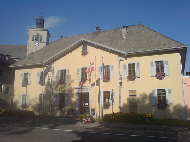
Бонвиль
- кантон Франции
Hiking in Бонвиль
The Canton of Bonneville, located in the Haute-Savoie region of the French Alps, is a beautiful area known for its stunning landscapes, diverse flora and fauna, and a range of hiking opportunities. Here are some key highlights and information about hiking in this region:...
- Страна:
- Столица: Бонвиль
- Координаты: 46° 4' 33" N, 6° 24' 23" E
- GPS треки (wikiloc): [Ссылка]
- Население: 52725
Шамони-Мон-Блан
- кантон Франции
Hiking in Шамони-Мон-Блан
Canton de Chamonix-Mont-Blanc is an incredible destination for hiking, located in the French Alps. It offers a stunning landscape characterized by towering peaks, glaciers, and lush valleys, making it one of the most picturesque hiking areas in the world. Here are some key points to consider when hiking in this region:...
- Страна:
- Столица: Шамони-Мон-Блан
- Координаты: 45° 56' 37" N, 6° 50' 25" E
- GPS треки (wikiloc): [Ссылка]


Клюз
- кантон Франции
Hiking in Клюз
The Canton of Cluses, located in the Haute-Savoie region of the French Alps, is a fantastic area for hiking enthusiasts. With its stunning alpine scenery, diverse landscapes, and numerous trails, it offers something for hikers of all skill levels....
- Страна:
- Столица: Клюз
- Координаты: 46° 3' 35" N, 6° 36' 22" E
- GPS треки (wikiloc): [Ссылка]
- Население: 52517

Ла-Рош-сюр-Форон
- кантон Франции
Hiking in Ла-Рош-сюр-Форон
The Canton of La Roche-sur-Foron, located in the Haute-Savoie department of the Auvergne-Rhône-Alpes region of France, offers a variety of hiking opportunities that cater to different skill levels and preferences. Here are some highlights:...
- Страна:
- Столица: Ла-Рош-сюр-Форон
- Координаты: 46° 4' 15" N, 6° 19' 6" E
- GPS треки (wikiloc): [Ссылка]
- Площадь: 277.75 кв.км
- Население: 52143

Сен-Жерве-ле-Бен
- кантон Франции
Hiking in Сен-Жерве-ле-Бен
Canton de Saint-Gervais-les-Bains is a stunning region located in the Alps of France, known for its breathtaking scenery and a variety of hiking options suitable for all levels. Here are some key points to consider while hiking in this area:...
- Страна:
- Столица: Сен-Жерве-ле-Бен
- Координаты: 45° 52' 48" N, 6° 42' 37" E
- GPS треки (wikiloc): [Ссылка]
Canton of Saint-Jeoire
Hiking in Canton of Saint-Jeoire
Canton de Saint-Jeoire is located in the Haute-Savoie region of the French Alps. It offers beautiful landscapes, picturesque villages, and a variety of hiking trails suitable for different skill levels. Here are some key features and tips for hiking in this area:...
- Страна:
- Столица: Saint-Jeoire
- Координаты: 46° 8' 59" N, 6° 26' 35" E
- GPS треки (wikiloc): [Ссылка]

Саллянш
Hiking in Саллянш
The Canton of Sallanches, located in the Haute-Savoie region of the French Alps, offers a stunning array of hiking opportunities for both beginners and experienced hikers. This area is known for its breathtaking scenery, diverse landscapes, and rich alpine culture....
- Страна:
- Столица: Салланш
- Координаты: 45° 53' 20" N, 6° 37' 13" E
- GPS треки (wikiloc): [Ссылка]
- Население: 31707

кантон Самоэнс
Hiking in кантон Самоэнс
Canton de Samoëns, located in the French Alps within the Haute-Savoie region, is a picturesque area known for its stunning landscapes and extensive hiking opportunities. The region offers a variety of trails suitable for all skill levels, from easy walks to challenging hikes, making it an attractive destination for outdoor enthusiasts....

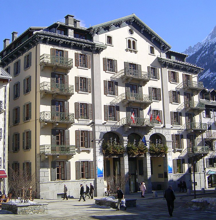
Шамони-Мон-Блан
- коммуна во Франции
Hiking in Шамони-Мон-Блан
Chamonix, located in the French Alps, is a renowned destination for hiking enthusiasts of all levels. Nestled at the foot of Mont Blanc, the highest mountain in Western Europe, Chamonix offers stunning landscapes, diverse terrain, and a variety of trails to explore. Here are some key points to consider when hiking in Chamonix:...
- Страна:
- Почтовый код: 74400
- Координаты: 45° 55' 20" N, 6° 52' 8" E
- GPS треки (wikiloc): [Ссылка]
- Высота над уровнем моря: 1030 м m
- Площадь: 116.53 кв.км
- Население: 8906
- Веб сайт: [Ссылка]