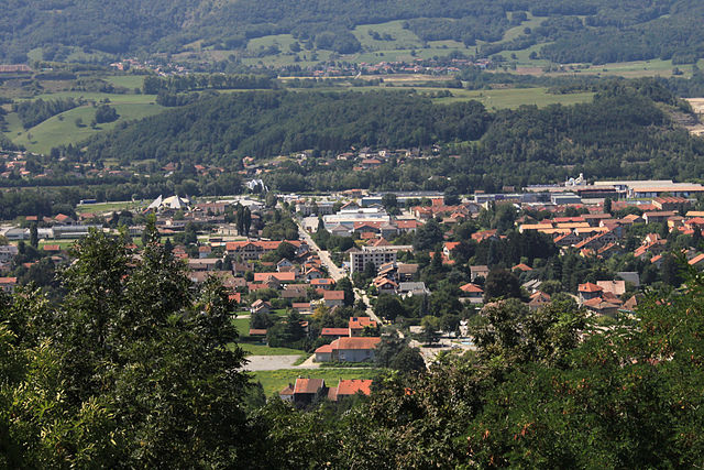
Сен-Максимен (Saint-Maximin, Saint-Maximin)

 Hiking in Сен-Максимен
Saint-Maximin, located in the Isère department in the Auvergne-Rhône-Alpes region of France, offers a range of beautiful hiking opportunities. Surrounded by the picturesque landscape of the Vercors and Chartreuse mountain ranges, it provides hikers with stunning views, diverse terrain, and a variety of trails suitable for different skill levels.
Hiking Trails:
-
Les sentiers des plateaux: This trail takes you through the lush plateaus of the region, where you can enjoy lush meadows and panoramic views. It's a moderate hike that’s great for families.
-
La Grande Molière: A popular route, this hike leads you through the forests and offers breathtaking views. It can be challenging in parts, making it more suitable for intermediate to experienced hikers.
-
Col de la Cochette: This trail provides a scenic route to the col (pass) and is known for its rewarding vistas over the surrounding mountains and valleys. It's a great option for those looking to spend a full day hiking.
Tips for Hiking in Saint-Maximin:
- Weather: Before heading out, check the weather conditions as they can change quickly in mountainous areas.
- Maps and Guides: Bring a map or download a hiking app, as some trails may not be well-marked. Local tourist offices can also provide valuable information.
- Gear: Wear appropriate hiking shoes with good grip, and dress in layers. The temperature can vary greatly depending on the altitude and time of year.
- Hydration and Snacks: Always carry enough water and some snacks to keep your energy up during the hike.
- Respect the Environment: Follow Leave No Trace principles, respecting the local flora and fauna.
Local Attractions:
After a hike, consider exploring the charming village of Saint-Maximin itself or visiting other nearby attractions, such as historical sites or local farms that offer opportunities to taste regional products.
Whether you’re looking for a relaxing stroll or a vigorous hike, Saint-Maximin and its surroundings provide an excellent playground for outdoor enthusiasts.
- Страна:

- Почтовый код: 38530
- Координаты: 45° 25' 35" N, 6° 2' 16" E


- GPS треки (wikiloc): [Ссылка]
- Площадь: 10.35 кв.км
- Население: 643
- Веб сайт: http://www.stmaximin38.fr
- Википедия русская: wiki(ru)
- Википедия английская: wiki(en)
- Википедия национальная: wiki(fr)
- Хранилище Wikidata: Wikidata: Q126991
- Катеория в википедии: [Ссылка]
- код Freebase: [/m/03nw7s8]
- номер SIREN: [213804263]
- код BNF: [15258235c]
- код VIAF: Альт: [236144783002898600112]
- код муниципалитета INSEE: 38426
Граничит с регионами:


La Chapelle-Blanche
Hiking in La Chapelle-Blanche
La Chapelle-Blanche is a charming commune located in the Savoie department in southeastern France. Nestled in the French Alps, it offers a unique hiking experience with stunning mountain views, lush landscapes, and a rich natural environment....
- Страна:
- Почтовый код: 73110
- Координаты: 45° 26' 52" N, 6° 4' 20" E
- GPS треки (wikiloc): [Ссылка]
- Площадь: 4.13 кв.км
- Население: 556


Аллевар
- коммуна во Франции
Hiking in Аллевар
Allevard is a charming town located in the Auvergne-Rhône-Alpes region of France, nestled in the Belledonne mountain range. It's an excellent destination for hikers due to its diverse landscapes, ranging from forests and rivers to rocky peaks....
- Страна:
- Почтовый код: 38580
- Координаты: 45° 23' 37" N, 6° 4' 27" E
- GPS треки (wikiloc): [Ссылка]
- Площадь: 25.63 кв.км
- Население: 4124
- Веб сайт: [Ссылка]

Поншарра
- коммуна во Франции
Hiking in Поншарра
Pontcharra is a charming town located in the Auvergne-Rhône-Alpes region of France, nestled in the Isère department. It offers great opportunities for hiking, surrounded by beautiful natural landscapes, including the Chartreuse and Belledonne mountain ranges. Here’s an overview of what you can expect when hiking in and around Pontcharra:...
- Страна:
- Почтовый код: 38530
- Координаты: 45° 25' 59" N, 6° 0' 55" E
- GPS треки (wikiloc): [Ссылка]
- Площадь: 15.58 кв.км
- Население: 7258
- Веб сайт: [Ссылка]


Ле-Мутаре
- коммуна во Франции
Hiking in Ле-Мутаре
Le Moutaret is located in the French Alps, within the vicinity of the Écrins National Park. This region is known for its stunning landscapes, diverse flora and fauna, and a network of hiking trails that cater to various skill levels. Here are some key points about hiking in Le Moutaret:...
- Страна:
- Почтовый код: 38580
- Координаты: 45° 25' 55" N, 6° 5' 19" E
- GPS треки (wikiloc): [Ссылка]
- Площадь: 5.29 кв.км
- Население: 253
- Веб сайт: [Ссылка]


Laissaud
- коммуна во Франции
Hiking in Laissaud
Laissaud is a beautiful area located in the French Alps, known for its stunning scenery and diverse hiking opportunities. The region offers a variety of trails suitable for different skill levels, from gentle walks to more challenging treks. Here's some information to help you plan your hiking experience in Laissaud:...
- Страна:
- Почтовый код: 73800
- Координаты: 45° 26' 49" N, 6° 2' 13" E
- GPS треки (wikiloc): [Ссылка]
- Площадь: 6.57 кв.км
- Население: 660