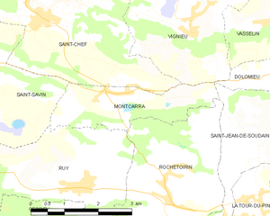
Виньё (Vignieu, Vignieu)

- коммуна во Франции
 Hiking in Виньё
Vignieu is a charming commune located in the Isère department in the Auvergne-Rhône-Alpes region of southeastern France. While it might not be as well-known as some other hiking destinations in France, it offers picturesque landscapes and a range of outdoor activities that can cater to hikers of various skill levels.
Hiking Opportunities:
-
Nearby Trails:
- Vignieu provides access to several local trails that wind through beautiful countryside, forests, and along rivers. These trails often feature scenic views of the surrounding landscape, including the Chartreuse Mountains to the east.
-
Natural Parks:
- The nearby Parc Naturel Régional de la Chartreuse is a fantastic place for hiking enthusiasts. It offers numerous trails that vary in difficulty, from easy walks to challenging hikes that reward you with stunning vistas.
-
Guided Hikes:
- Consider joining guided hikes if you are unfamiliar with the area. Local guides can provide valuable insights into the flora, fauna, and geology of the region.
-
Other Outdoor Activities:
- Aside from hiking, Vignieu also offers opportunities for cycling, horseback riding, and even some rock climbing in the nearby areas.
Preparation and Tips:
- Ensure you have appropriate footwear and clothing for hiking, considering the weather conditions.
- Carry plenty of water, snacks, and a map of the area if you are venturing out on your own.
- Be mindful of local wildlife and the natural environment; follow Leave No Trace principles.
- Check for any local regulations or trail conditions before heading out, especially if you are hiking in remote areas.
Access:
- Vignieu is easily accessible by car, and public transportation options may also be available depending on where you're coming from. It’s best to check local schedules.
When planning your hiking trip to Vignieu, be sure to enjoy the serene views and unique landscapes that this hidden gem of the French countryside has to offer!
- Страна:

- Почтовый код: 38890
- Координаты: 45° 37' 41" N, 5° 25' 29" E


- GPS треки (wikiloc): [Ссылка]
- Площадь: 9.4 кв.км
- Население: 1033
- Веб сайт: http://vignieu.reseaudescommunes.fr
- Википедия русская: wiki(ru)
- Википедия английская: wiki(en)
- Википедия национальная: wiki(fr)
- Хранилище Wikidata: Wikidata: Q1067438
- Катеория в википедии: [Ссылка]
- код Freebase: [/m/03nvjgf]
- код GeoNames: Альт: [6433454]
- номер SIREN: [213805468]
- код BNF: [152583469]
- код VIAF: Альт: [150760231]
- код муниципалитета INSEE: 38546
Граничит с регионами:


Васслен
- коммуна во Франции
Hiking in Васслен
Vasselin, a picturesque region in France, offers a variety of hiking opportunities for outdoor enthusiasts. While it's relatively lesser-known compared to some popular hiking destinations, its serene landscapes make it a hidden gem for nature lovers....
- Страна:
- Почтовый код: 38890
- Координаты: 45° 37' 51" N, 5° 27' 15" E
- GPS треки (wikiloc): [Ссылка]
- Площадь: 3.85 кв.км
- Население: 468
- Веб сайт: [Ссылка]


Сермерьё
- коммуна во Франции
Hiking in Сермерьё
Sermérieu is a small commune located in the Isère department of southeastern France. Nestled in a picturesque part of the Rhône-Alpes region, it offers several opportunities for hiking and enjoying the outdoors. Here are some things to know about hiking in and around Sermérieu:...
- Страна:
- Почтовый код: 38510
- Координаты: 45° 40' 17" N, 5° 24' 35" E
- GPS треки (wikiloc): [Ссылка]
- Площадь: 17.14 кв.км
- Население: 1640
- Веб сайт: [Ссылка]

Монкарра
- коммуна во Франции
Hiking in Монкарра
Montcarra, located in the Isère department of southeastern France, is a beautiful area known for its scenic landscapes and outdoor activities. While it may not be as widely recognized as some of the larger national parks in the Alps, it offers a variety of hiking opportunities that can cater to different skill levels and preferences....
- Страна:
- Почтовый код: 38890
- Координаты: 45° 36' 47" N, 5° 23' 29" E
- GPS треки (wikiloc): [Ссылка]
- Площадь: 4.9 кв.км
- Население: 519
- Веб сайт: [Ссылка]

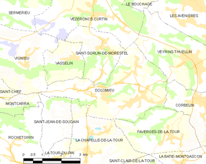
Доломьё
- коммуна во Франции
Hiking in Доломьё
Hiking in Dolomieu, Isère can be a wonderful experience, offering stunning landscapes and diverse trails. While Dolomieu is a small town, it is surrounded by natural beauty and is close to the Vercors and Chartreuse mountain ranges, which provide a variety of hiking opportunities....
- Страна:
- Почтовый код: 38110
- Координаты: 45° 36' 39" N, 5° 29' 57" E
- GPS треки (wikiloc): [Ссылка]
- Площадь: 13.32 кв.км
- Население: 3079
- Веб сайт: [Ссылка]

Везеронс-Кюртен
- коммуна во Франции
Hiking in Везеронс-Кюртен
Vézeronce-Curtin is a charming village located in the Auvergne-Rhône-Alpes region of France, known for its scenic landscapes and proximity to the beautiful natural areas surrounding it, including the Isère river valley. Here are some details about hiking in and around Vézeronce-Curtin:...
- Страна:
- Почтовый код: 38510
- Координаты: 45° 39' 2" N, 5° 28' 14" E
- GPS треки (wikiloc): [Ссылка]
- Высота над уровнем моря: 220 м m
- Площадь: 14.37 кв.км
- Население: 2065
- Веб сайт: [Ссылка]


Сен-Шеф
- коммуна во Франции
Hiking in Сен-Шеф
Saint-Chef is a charming commune located in the Isère department of the Auvergne-Rhône-Alpes region in southeastern France. The area is known for its beautiful landscapes, rolling hills, and rich natural surroundings, making it an attractive destination for hikers of all levels....
- Страна:
- Почтовый код: 38890
- Координаты: 45° 38' 2" N, 5° 21' 57" E
- GPS треки (wikiloc): [Ссылка]
- Площадь: 27.16 кв.км
- Население: 3620
- Веб сайт: [Ссылка]