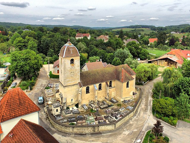
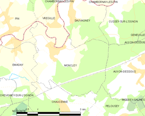
Émagny (Émagny)
- commune in Doubs, France
Émagny is a small commune in the Doubs department in the Bourgogne-Franche-Comté region of eastern France. While it may not be as widely known as some larger hiking destinations, its natural surroundings and rural charm can offer a pleasant experience for hikers looking to explore the region.
Hiking Opportunities in Émagny:
-
Scenic Trails: The area around Émagny features a mix of gentle hills, forests, and agricultural landscapes. You can find local trails that are suitable for various skill levels. These trails often offer picturesque views of the countryside and opportunities to observe local flora and fauna.
-
Regional Parks: Émagny is located not too far from some larger protected areas and regional parks like the Doubs Valley, where you can find designated hiking paths. These parks often provide a range of difficulty levels and well-marked trails.
-
Nearby Attractions: If you’re looking to expand your hiking trip, consider exploring further into the Doubs department, which is home to beautiful natural sites like the Gouffre de Poudrey and the Doubs River itself. The region also offers several lakes and panoramic viewpoints that can enhance your hiking experience.
-
Cultural Hikes: Some trails may lead you through charming villages, offering a glimpse into the local architecture and culture. Stop by traditional farms or small local wineries, which can add a unique flavor to your hiking journey.
Tips for Hiking in Émagny:
-
Preparation: Always check local maps and trail markers, as some trails may not be well-maintained. Bring a physical map or download offline maps in case of limited cell service.
-
Weather: The weather can change rapidly, so dress in layers and always check the forecast before heading out.
-
Safety: Carry enough water and snacks, and let someone know your planned route and return time if hiking alone.
-
Respect Nature: Follow Leave No Trace principles and respect local wildlife. Stick to marked trails to help protect the natural environment.
Whether you're a beginner or an experienced hiker, exploring Émagny and its surrounding areas can provide you with a refreshing outdoor experience!
- Country:

- Postal Code: 25170
- Coordinates: 47° 18' 41" N, 5° 52' 10" E


- GPS tracks (wikiloc): [Link]
- Area: 5.15 sq km
- Population: 589
- Web site: http://emagny.fr
- Wikipedia en: wiki(en)
- Wikipedia: wiki(fr)
- Wikidata storage: Wikidata: Q274831
- Wikipedia Commons Category: [Link]
- Freebase ID: [/m/03mh7v1]
- Freebase ID: [/m/03mh7v1]
- GeoNames ID: Alt: [6612385]
- GeoNames ID: Alt: [6612385]
- SIREN number: [212502173]
- SIREN number: [212502173]
- BnF ID: [152524433]
- BnF ID: [152524433]
- INSEE municipality code: 25217
- INSEE municipality code: 25217
Shares border with regions:


Beaumotte-lès-Pin
- commune in Haute-Saône, France
- Country:

- Postal Code: 70150
- Coordinates: 47° 19' 1" N, 5° 49' 51" E


- GPS tracks (wikiloc): [Link]
- Area: 8.43 sq km
- Population: 301
- Web site: [Link]


Pin
- commune in Haute-Saône, France
- Country:

- Postal Code: 70150
- Coordinates: 47° 19' 22" N, 5° 51' 52" E


- GPS tracks (wikiloc): [Link]
- AboveSeaLevel: 228 м m
- Area: 14.04 sq km
- Population: 687


Moncley
- commune in Doubs, France
Moncley isn't a widely recognized hiking destination, so it's important to clarify if you are referring to a specific region or a local area that may have hiking opportunities. However, I can provide general guidance on what to look for when exploring hiking locations:...
- Country:

- Postal Code: 25170
- Coordinates: 47° 18' 30" N, 5° 53' 30" E


- GPS tracks (wikiloc): [Link]
- Area: 7.92 sq km
- Population: 293


Noironte
- commune in Doubs, France
Noironte is a lesser-known destination for hiking, and getting specific information might be challenging if you haven’t found particular trails or parks in mind. However, if it's located in a region known for outdoor activities, you can generally expect a few common features:...
- Country:

- Postal Code: 25170
- Coordinates: 47° 16' 19" N, 5° 52' 28" E


- GPS tracks (wikiloc): [Link]
- Area: 6.73 sq km
- Population: 380
- Web site: [Link]

