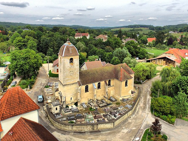
Pin (Pin)

- commune in Haute-Saône, France
- Country:

- Postal Code: 70150
- Coordinates: 47° 19' 22" N, 5° 51' 52" E


- GPS tracks (wikiloc): [Link]
- AboveSeaLevel: 228 м m
- Area: 14.04 sq km
- Population: 687
- Wikipedia en: wiki(en)
- Wikipedia: wiki(fr)
- Wikidata storage: Wikidata: Q902545
- Wikipedia Commons Category: [Link]
- Freebase ID: [/m/03nv1yf]
- GeoNames ID: Alt: [6617497]
- SIREN number: [217004100]
- BnF ID: [152728021]
- INSEE municipality code: 70410
Shares border with regions:


Émagny
- commune in Doubs, France
 Hiking in Émagny
Émagny is a small commune in the Doubs department in the Bourgogne-Franche-Comté region of eastern France. While it may not be as widely known as some larger hiking destinations, its natural surroundings and rural charm can offer a pleasant experience for hikers looking to explore the region....
- Country:
- Postal Code: 25170
- Coordinates: 47° 18' 41" N, 5° 52' 10" E
- GPS tracks (wikiloc): [Link]
- Area: 5.15 sq km
- Population: 589
- Web site: [Link]


Autoreille
- commune in Haute-Saône, France
- Country:
- Postal Code: 70700
- Coordinates: 47° 22' 11" N, 5° 48' 40" E
- GPS tracks (wikiloc): [Link]
- Area: 9.98 sq km
- Population: 320

Beaumotte-lès-Pin
- commune in Haute-Saône, France
- Country:
- Postal Code: 70150
- Coordinates: 47° 19' 1" N, 5° 49' 51" E
- GPS tracks (wikiloc): [Link]
- Area: 8.43 sq km
- Population: 301
- Web site: [Link]


Courcuire
- commune in Haute-Saône, France
- Country:
- Postal Code: 70150
- Coordinates: 47° 20' 31" N, 5° 49' 26" E
- GPS tracks (wikiloc): [Link]
- Area: 7.06 sq km
- Population: 136


Gézier-et-Fontenelay
- commune in Haute-Saône, France
- Country:
- Postal Code: 70700
- Coordinates: 47° 21' 26" N, 5° 53' 50" E
- GPS tracks (wikiloc): [Link]
- Area: 12.1 sq km
- Population: 201

Vregille
- commune in Haute-Saône, France
Hiking in Vregille
It seems that there may be a misunderstanding, as "Vregille" does not appear to be a widely recognized hiking destination or location. It's possible that you may be referring to a specific area or a less-known region. If you can provide more details or clarify the name, I would be happy to assist you with hiking information regarding that location....
- Country:
- Postal Code: 70150
- Coordinates: 47° 19' 11" N, 5° 53' 30" E
- GPS tracks (wikiloc): [Link]
- Area: 4.28 sq km
- Population: 171