Aigné (Aigné)

- commune in Sarthe, France
- Country:

- Postal Code: 72650
- Coordinates: 48° 4' 1" N, 0° 7' 8" E


- GPS tracks (wikiloc): [Link]
- Area: 12.59 sq km
- Population: 1627
- Web site: http://www.aigne.fr/
- Wikipedia en: wiki(en)
- Wikipedia: wiki(fr)
- Wikidata storage: Wikidata: Q1228213
- Wikipedia Commons Category: [Link]
- Freebase ID: [/m/03qj2pw]
- GeoNames ID: Alt: [6452498]
- SIREN number: [217200013]
- BnF ID: [15273561z]
- INSEE municipality code: 72001
Shares border with regions:


Degré
- commune in Sarthe, France
- Country:
- Postal Code: 72550
- Coordinates: 48° 3' 1" N, 0° 4' 5" E
- GPS tracks (wikiloc): [Link]
- Area: 9.83 sq km
- Population: 797
- Web site: [Link]


Trangé
- commune in Sarthe, France
- Country:
- Postal Code: 72650
- Coordinates: 48° 1' 36" N, 0° 6' 40" E
- GPS tracks (wikiloc): [Link]
- Area: 11.11 sq km
- Population: 1356


Domfront-en-Champagne
- commune in Sarthe, France
- Country:
- Postal Code: 72240
- Coordinates: 48° 6' 17" N, 0° 1' 41" E
- GPS tracks (wikiloc): [Link]
- Area: 20.97 sq km
- Population: 1020


La Milesse
- commune in Sarthe, France
- Country:
- Postal Code: 72650
- Coordinates: 48° 3' 53" N, 0° 8' 8" E
- GPS tracks (wikiloc): [Link]
- Area: 10.41 sq km
- Population: 2617
- Web site: [Link]

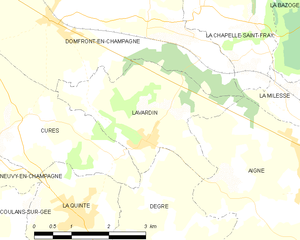
Lavardin
- commune in Sarthe, France
- Country:
- Postal Code: 72240
- Coordinates: 48° 4' 40" N, 0° 3' 43" E
- GPS tracks (wikiloc): [Link]
- Area: 7.63 sq km
- Population: 741
- Web site: [Link]


Chaufour-Notre-Dame
- commune in Sarthe, France
- Country:
- Postal Code: 72550
- Coordinates: 48° 1' 31" N, 0° 4' 30" E
- GPS tracks (wikiloc): [Link]
- Area: 11.19 sq km
- Population: 1059