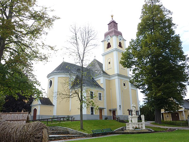
Albrechtsberg an der Großen Krems (Albrechtsberg an der Großen Krems)
- municipality in Austria
 Hiking in Albrechtsberg an der Großen Krems
Albrechtsberg an der Großen Krems is a charming village located in the picturesque Wachau Valley of Austria, known for its rich cultural heritage, beautiful landscapes, and excellent hiking opportunities. Here’s a guide to hiking in the area:
Scenic Trails
-
Wachau World Heritage Trail: This trail offers stunning views of the Danube River, terraced vineyards, and historical sites. Parts of the trail pass through Albrechtsberg, showcasing the region's natural beauty and cultural landmarks.
-
Vineyard Trails: The area around Albrechtsberg is surrounded by vineyards, and there are numerous walking paths through these wine-growing regions. These trails often lead to quaint wineries where you can stop for a tasting.
-
Forest Trails: Beyond the vineyards, you can find forested areas with well-marked hiking paths. These trails vary in difficulty and often lead to scenic viewpoints.
Points of Interest
-
Historic Castle: The nearby Albrechtsberg Castle offers not only historical charm but also lovely locale for a hike. Exploring the surrounding areas can reward you with views of the castle and the surrounding landscapes.
-
Danube River: Hiking along the banks of the Danube provides opportunities for relaxation and picturesque scenery. You can access several trails that run parallel to the river.
Tips for Hiking in Albrechtsberg
-
Preparation: Check the weather forecast before your hike; conditions can change quickly in the region. Wear appropriate footwear and bring water, snacks, and a map.
-
Trail Information: Make use of local maps or hiking apps to find trails suited to your skill level. Many trails are well-marked, but it's always good to take a map or download a hiking app.
-
Respect Nature: Whether you’re hiking through vineyards or forests, be sure to stay on marked paths and respect private property.
Best Time to Hike
The best times for hiking around Albrechtsberg are during spring and fall, when the temperatures are moderate and the landscapes are vibrant. Summer can be hot, while winter might present challenges with snow and ice.
Overall, hiking in Albrechtsberg an der Großen Krems is an enriching experience, blending outdoor activity with stunning natural scenery and cultural exploration. Enjoy your adventure!
- Country:

- Postal Code: 3613
- Local Dialing Code: 02876
- Licence Plate Code: KR
- Coordinates: 48° 27' 50" N, 15° 22' 8" E


- GPS tracks (wikiloc): [Link]
- AboveSeaLevel: 686 м m
- Area: 28.72 sq km
- Population: 1036
- Web site: http://www.albrechtsberg.at/
- Wikipedia en: wiki(en)
- Wikipedia: wiki(de)
- Wikidata storage: Wikidata: Q666173
- Wikipedia Commons Category: [Link]
- Freebase ID: [/m/02qxbk6]
- GeoNames ID: Alt: [7871796]
- VIAF ID: Alt: [241200556]
- archINFORM location ID: [14608]
- Austrian municipality key: [31302]
Shares border with regions:

Weinzierl am Walde
- municipality in Austria
Weinzierl am Walde, nestled in the picturesque region of Austria, offers a variety of hiking opportunities that cater to both beginners and experienced hikers. Here’s what you can expect when hiking in this area:...
- Country:

- Postal Code: 3521
- Local Dialing Code: 02717
- Licence Plate Code: KR
- Coordinates: 48° 25' 0" N, 15° 26' 0" E


- GPS tracks (wikiloc): [Link]
- AboveSeaLevel: 647 м m
- Area: 44.55 sq km
- Population: 1240
- Web site: [Link]

Lichtenau im Waldviertel
- municipality in Austria
 Hiking in Lichtenau im Waldviertel
Lichtenau im Waldviertel is a charming area in Austria's Waldviertel region, known for its beautiful landscapes, rolling hills, and dense forests, making it a great destination for hiking enthusiasts. Here are some key points to consider:...
- Country:

- Postal Code: 3522
- Local Dialing Code: 02718
- Licence Plate Code: KR
- Coordinates: 48° 30' 0" N, 15° 23' 0" E


- GPS tracks (wikiloc): [Link]
- AboveSeaLevel: 639 м m
- Area: 58.36 sq km
- Population: 2049
- Web site: [Link]

Kottes-Purk
- municipality in Austria
Kottes-Purk is a small municipality located in the province of Lower Austria, Austria. While it may not be as famous as some larger hiking destinations, it offers a quaint environment for nature lovers and hikers....
- Country:

- Local Dialing Code: 02873
- Licence Plate Code: ZT
- Coordinates: 48° 25' 0" N, 15° 18' 0" E


- GPS tracks (wikiloc): [Link]
- AboveSeaLevel: 706 м m
- Area: 58.61 sq km
- Population: 1485
- Web site: [Link]

Gföhl
- municipality in Austria
Gföhl, located in the beautiful state of Lower Austria, is a charming area that offers various hiking opportunities, especially for those who appreciate picturesque landscapes and serene nature. Here are some key points to consider if you're planning a hiking trip in Gföhl:...
- Country:

- Postal Code: 3542
- Local Dialing Code: 02716
- Licence Plate Code: KR
- Coordinates: 48° 31' 0" N, 15° 29' 0" E


- GPS tracks (wikiloc): [Link]
- AboveSeaLevel: 579 м m
- Area: 80.75 sq km
- Population: 3783
- Web site: [Link]