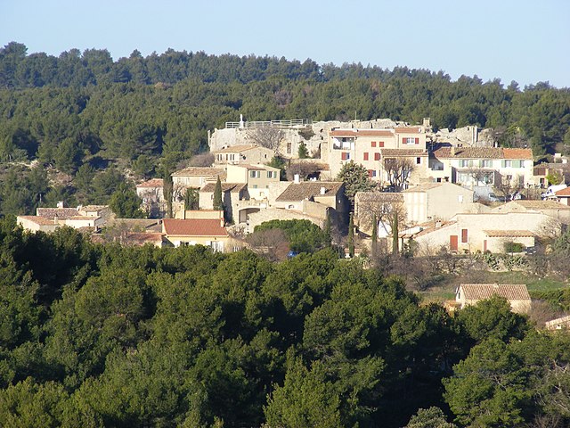
Alleins (Alleins)

- commune in Bouches-du-Rhône, France
 Hiking in Alleins
Hiking in Alleins, a charming village located in the Provence region of France, offers a unique blend of natural beauty, scenic landscapes, and cultural experiences. Here are some aspects to consider if you’re planning a hike in and around Alleins:
Scenic Trails
-
Natural Landscapes: The area surrounding Alleins features vineyards, olive groves, and rolling hills, providing a picturesque backdrop for hikers. The trails may vary in difficulty, catering to both casual walkers and more experienced hikers.
-
GR Trails: The Grande Randonnée (GR) trails that crisscross Provence may pass near or through Alleins, offering longer trekking options that connect to larger hiking routes in the region.
-
Vieux village: Explore the old village of Alleins, where you can find charming streets, rustic houses, and local architecture that adds to the cultural experience of your hike.
Tips for Hiking in Alleins
-
Best Time to Hike: The ideal times to hike in this region are during spring (April to June) and early autumn (September to October) when temperatures are milder and the landscapes are lush.
-
Local Guides: Consider hiring a local guide or joining a hiking group to enrich your experience with insights about the surrounding flora, fauna, and history of the area.
-
Hydration & Supplies: Carry enough water and snacks, especially during warmer months. There may be limited facilities along certain trails.
-
Navigation: Familiarize yourself with maps and trail markers, or use a GPS app to ensure you stay on the right path.
-
Respect Nature: Practice Leave No Trace principles to preserve the natural beauty of the area. Stay on marked paths to protect the local ecosystems.
Cultural Experiences
- Local Cuisine: After your hike, enjoy some traditional Provençal cuisine in nearby restaurants or cafes. Look for dishes featuring regional ingredients like herbs de Provence, olives, and fresh produce.
- Wine Tasting: Since you’re in wine country, consider visiting local vineyards for wine tastings, which can be a relaxing end to your hiking day.
Nearby Attractions
- Luberon Regional Park: Just a short drive from Alleins, this park offers a range of hiking options with stunning views, picturesque villages, and plenty of nature to explore.
- Cultural Sites: Explore historical sites, including churches and ruins, that reflect the rich history of the region.
Overall, hiking in Alleins can be a delightful experience, combining physical activity with opportunities to enjoy the beautiful scenery and rich culture of Provence. Happy hiking!
- Country:

- Postal Code: 13980
- Coordinates: 43° 42' 14" N, 5° 9' 42" E


- GPS tracks (wikiloc): [Link]
- Area: 16.78 sq km
- Population: 2494
- Web site: http://www.alleins.com
- Wikipedia en: wiki(en)
- Wikipedia: wiki(fr)
- Wikidata storage: Wikidata: Q330451
- Wikipedia Commons Category: [Link]
- Freebase ID: [/m/02rp922]
- GeoNames ID: Alt: [3038156]
- SIREN number: [211300033]
- BnF ID: [15247285g]
- VIAF ID: Alt: [236627047]
- GND ID: Alt: [7717327-2]
- PACTOLS thesaurus ID: [pcrt7FQg6mhTnJ]
- Quora topic ID: [Alleins]
- INSEE municipality code: 13003
Shares border with regions:
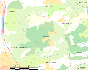
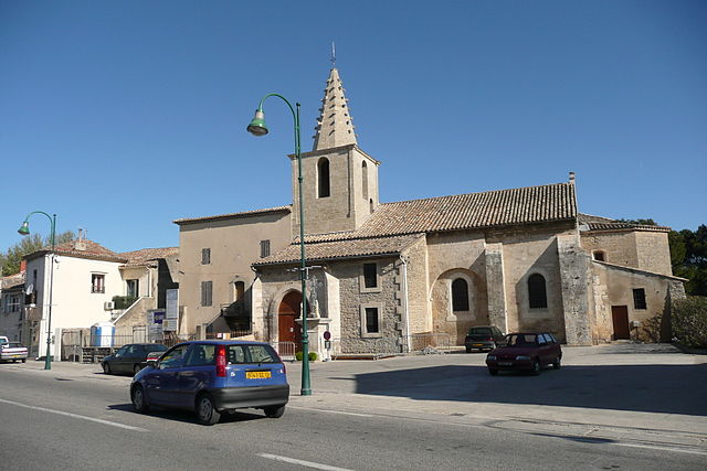
Aurons
- commune in Bouches-du-Rhône, France
- Country:
- Postal Code: 13121
- Coordinates: 43° 39' 54" N, 5° 9' 28" E
- GPS tracks (wikiloc): [Link]
- Area: 12.82 sq km
- Population: 533
- Web site: [Link]

Sénas
- commune in Bouches-du-Rhône, France
- Country:
- Postal Code: 13560
- Coordinates: 43° 44' 40" N, 5° 4' 43" E
- GPS tracks (wikiloc): [Link]
- Area: 30.61 sq km
- Population: 7022
- Web site: [Link]


Mallemort
- commune in Bouches-du-Rhône, France
Hiking in Mallemort
Mallemort, located in the Provence-Alpes-Côte d'Azur region of France, offers a variety of beautiful landscapes for hiking enthusiasts. The region is characterized by its rolling hills, vineyards, and picturesque views, making it an attractive destination for outdoor activities....
- Country:
- Postal Code: 13370
- Coordinates: 43° 43' 51" N, 5° 10' 46" E
- GPS tracks (wikiloc): [Link]
- Area: 28.16 sq km
- Population: 5880
- Web site: [Link]


Lamanon
- commune in Bouches-du-Rhône, France
- Country:
- Postal Code: 13113
- Coordinates: 43° 42' 7" N, 5° 5' 11" E
- GPS tracks (wikiloc): [Link]
- Area: 19.19 sq km
- Population: 2031
- Web site: [Link]
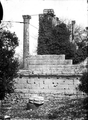

Vernègues
- commune in Bouches-du-Rhône, France
Hiking in Vernègues
Vernègues is a charming village located in the Provence region of southern France. Hiking in and around Vernègues offers a wonderful mix of beautiful landscapes, rich history, and cultural experiences. Here are some key points about hiking in Vernègues:...
- Country:
- Postal Code: 13116
- Coordinates: 43° 41' 9" N, 5° 10' 17" E
- GPS tracks (wikiloc): [Link]
- Area: 15.89 sq km
- Population: 1701
- Web site: [Link]