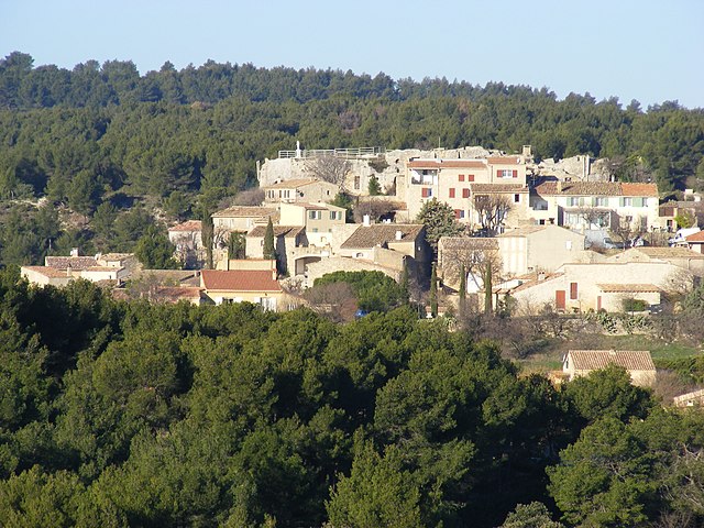
Vernègues (Vernègues)

- commune in Bouches-du-Rhône, France
 Hiking in Vernègues
Vernègues is a charming village located in the Provence region of southern France. Hiking in and around Vernègues offers a wonderful mix of beautiful landscapes, rich history, and cultural experiences. Here are some key points about hiking in Vernègues:
Scenic Trails
- Diverse Terrain: The area around Vernègues features diverse terrains, including vineyards, olive groves, and rocky hills that provide varied walking experiences.
- Stunning Views: Many trails offer panoramic views of the surrounding countryside, including the Luberon mountains and the Alpilles.
- Nature and Wildlife: The region is home to a variety of flora and fauna, making it a great opportunity for nature lovers and bird watchers.
Popular Hiking Routes
- Les Gorges de la Nesque: While a bit further afield, this area features beautiful gorges and stunning views, and is a popular destination for hiking enthusiasts.
- Local Pathways: There are several local pathways and trails that begin or end in Vernègues, leading to neighboring villages and natural sites.
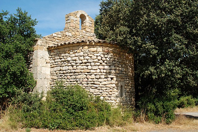
- Historic Routes: Some paths may lead to historical sites, such as the ruins of ancient structures or traditional Provencal architecture.
Tips for Hiking in Vernègues
- Best Time to Go: The ideal times for hiking are in the spring (April to June) or fall (September to October) when the weather is mild and pleasant.
- Hiking Gear: Wear sturdy hiking shoes, carry plenty of water, and bring sun protection, especially during the warmer months.
- Local Regulations: Always check for specific local hiking regulations, and stay on marked trails to protect the environment.
Amenities
- Accommodation: There are various options for accommodations in and around Vernègues, including hotels, guesthouses, and campsites.
- Local Cuisine: Don't forget to taste local delicacies in the village after a hike, as the region is known for its excellent cuisine and wines.
Conclusion
Hiking in Vernègues offers a unique blend of natural beauty, cultural richness, and outdoor adventure. Whether you're an experienced hiker or a casual walker, the trails in and around this picturesque village won't disappoint. Enjoy exploring the stunning landscapes and charming surroundings of Provence!
- Country:

- Postal Code: 13116
- Coordinates: 43° 41' 9" N, 5° 10' 17" E


- GPS tracks (wikiloc): [Link]
- Area: 15.89 sq km
- Population: 1701
- Web site: http://www.vernegues.com
- Wikipedia en: wiki(en)
- Wikipedia: wiki(fr)
- Wikidata storage: Wikidata: Q676398
- Wikipedia Commons Category: [Link]
- Freebase ID: [/m/02rpc53]
- GeoNames ID: Alt: [2969832]
- SIREN number: [211301155]
- BnF ID: [15247397r]
- PACTOLS thesaurus ID: [pcrtS46zeX4OS0]
- WOEID: [630775]
- INSEE municipality code: 13115
Shares border with regions:
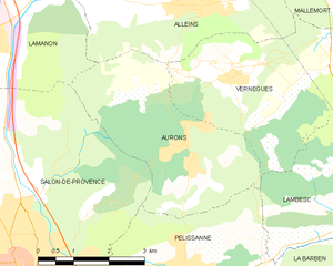
Aurons
- commune in Bouches-du-Rhône, France
- Country:
- Postal Code: 13121
- Coordinates: 43° 39' 54" N, 5° 9' 28" E
- GPS tracks (wikiloc): [Link]
- Area: 12.82 sq km
- Population: 533
- Web site: [Link]

Alleins
- commune in Bouches-du-Rhône, France
Hiking in Alleins
Hiking in Alleins, a charming village located in the Provence region of France, offers a unique blend of natural beauty, scenic landscapes, and cultural experiences. Here are some aspects to consider if you’re planning a hike in and around Alleins:...
- Country:
- Postal Code: 13980
- Coordinates: 43° 42' 14" N, 5° 9' 42" E
- GPS tracks (wikiloc): [Link]
- Area: 16.78 sq km
- Population: 2494
- Web site: [Link]


Charleval
- commune in Bouches-du-Rhône, France
Hiking in Charleval
Charleval, located in the Bouches-du-Rhône department in the south of France, offers beautiful hiking opportunities amidst stunning natural landscapes. Here are some key points about hiking in Charleval:...
- Country:
- Postal Code: 13350
- Coordinates: 43° 43' 7" N, 5° 14' 44" E
- GPS tracks (wikiloc): [Link]
- Area: 14.41 sq km
- Population: 2731
- Web site: [Link]


Lambesc
- commune in Bouches-du-Rhône, France
Hiking in Lambesc
Lambesc, a charming commune in the Bouches-du-Rhône department of southern France, offers a variety of hiking opportunities that showcase the stunning landscapes and rich cultural heritage of the region. Here are some highlights of hiking in and around Lambesc:...
- Country:
- Postal Code: 13410
- Coordinates: 43° 39' 14" N, 5° 15' 43" E
- GPS tracks (wikiloc): [Link]
- Area: 65.34 sq km
- Population: 9584
- Web site: [Link]


Mallemort
- commune in Bouches-du-Rhône, France
Hiking in Mallemort
Mallemort, located in the Provence-Alpes-Côte d'Azur region of France, offers a variety of beautiful landscapes for hiking enthusiasts. The region is characterized by its rolling hills, vineyards, and picturesque views, making it an attractive destination for outdoor activities....
- Country:
- Postal Code: 13370
- Coordinates: 43° 43' 51" N, 5° 10' 46" E
- GPS tracks (wikiloc): [Link]
- Area: 28.16 sq km
- Population: 5880
- Web site: [Link]