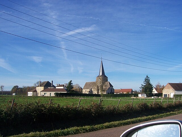
Allerey-sur-Saône (Allerey-sur-Saône)

- commune in Saône-et-Loire, France
- Country:

- Postal Code: 71350
- Coordinates: 46° 54' 21" N, 4° 58' 58" E


- GPS tracks (wikiloc): [Link]
- AboveSeaLevel: 190 м m
- Area: 16.42 sq km
- Population: 810
- Wikipedia en: wiki(en)
- Wikipedia: wiki(fr)
- Wikidata storage: Wikidata: Q1151174
- Wikipedia Commons Category: [Link]
- Wikipedia Commons Maps Category: [Link]
- Freebase ID: [/m/03qfx17]
- Freebase ID: [/m/03qfx17]
- GeoNames ID: Alt: [6617512]
- GeoNames ID: Alt: [6617512]
- SIREN number: [217100031]
- SIREN number: [217100031]
- BnF ID: [152729776]
- BnF ID: [152729776]
- VIAF ID: Alt: [241227324]
- VIAF ID: Alt: [241227324]
- GND ID: Alt: [4712741-7]
- GND ID: Alt: [4712741-7]
- INSEE municipality code: 71003
- INSEE municipality code: 71003
Shares border with regions:


Bragny-sur-Saône
- commune in Saône-et-Loire, France
- Country:
- Postal Code: 71350
- Coordinates: 46° 54' 39" N, 5° 1' 51" E
- GPS tracks (wikiloc): [Link]
- Area: 14.79 sq km
- Population: 600


Verjux
- commune in Saône-et-Loire, France
- Country:
- Postal Code: 71590
- Coordinates: 46° 52' 46" N, 4° 57' 48" E
- GPS tracks (wikiloc): [Link]
- Area: 12.09 sq km
- Population: 529

Saint-Gervais-en-Vallière
- commune in Saône-et-Loire, France
- Country:
- Postal Code: 71350
- Coordinates: 46° 56' 24" N, 4° 57' 4" E
- GPS tracks (wikiloc): [Link]
- Area: 16.27 sq km
- Population: 438


Gergy
- commune in Saône-et-Loire, France
- Country:
- Postal Code: 71590
- Coordinates: 46° 52' 37" N, 4° 56' 48" E
- GPS tracks (wikiloc): [Link]
- Area: 38.84 sq km
- Population: 2544
- Web site: [Link]


Saint-Martin-en-Gâtinois
- commune in Saône-et-Loire, France
- Country:
- Postal Code: 71350
- Coordinates: 46° 56' 34" N, 5° 0' 55" E
- GPS tracks (wikiloc): [Link]
- Area: 7.29 sq km
- Population: 122


Saint-Loup-Géanges
- commune in Saône-et-Loire, France
- Country:
- Postal Code: 71350
- Coordinates: 46° 56' 48" N, 4° 54' 29" E
- GPS tracks (wikiloc): [Link]
- Area: 25.72 sq km
- Population: 1622
- Web site: [Link]


Verdun-sur-le-Doubs
- commune in Saône-et-Loire, France
- Country:
- Postal Code: 71350
- Coordinates: 46° 53' 46" N, 5° 1' 24" E
- GPS tracks (wikiloc): [Link]
- AboveSeaLevel: 180 м m
- Area: 7.27 sq km
- Population: 1147
- Web site: [Link]