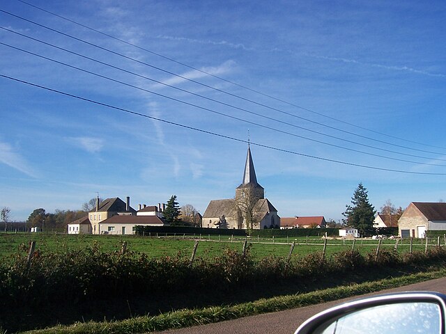
Saint-Loup-Géanges (Saint-Loup-Géanges)

- commune in Saône-et-Loire, France
- Country:

- Postal Code: 71350
- Coordinates: 46° 56' 48" N, 4° 54' 29" E


- GPS tracks (wikiloc): [Link]
- Area: 25.72 sq km
- Population: 1622
- Web site: http://www.saint-loup-geanges.fr
- Wikipedia en: wiki(en)
- Wikipedia: wiki(fr)
- Wikidata storage: Wikidata: Q590616
- Wikipedia Commons Category: [Link]
- Wikipedia Commons Maps Category: [Link]
- Freebase ID: [/m/03qh3ky]
- SIREN number: [217104439]
- INSEE municipality code: 71443
Shares border with regions:


Demigny
- commune in Saône-et-Loire, France
- Country:
- Postal Code: 71150
- Coordinates: 46° 55' 38" N, 4° 50' 2" E
- GPS tracks (wikiloc): [Link]
- Area: 29.63 sq km
- Population: 1781
- Web site: [Link]


Allerey-sur-Saône
- commune in Saône-et-Loire, France
- Country:
- Postal Code: 71350
- Coordinates: 46° 54' 21" N, 4° 58' 58" E
- GPS tracks (wikiloc): [Link]
- AboveSeaLevel: 190 м m
- Area: 16.42 sq km
- Population: 810

Saint-Gervais-en-Vallière
- commune in Saône-et-Loire, France
- Country:
- Postal Code: 71350
- Coordinates: 46° 56' 24" N, 4° 57' 4" E
- GPS tracks (wikiloc): [Link]
- Area: 16.27 sq km
- Population: 438


Gergy
- commune in Saône-et-Loire, France
- Country:
- Postal Code: 71590
- Coordinates: 46° 52' 37" N, 4° 56' 48" E
- GPS tracks (wikiloc): [Link]
- Area: 38.84 sq km
- Population: 2544
- Web site: [Link]


Chevigny-en-Valière
- commune in Côte-d'Or, France
- Country:
- Postal Code: 21200
- Coordinates: 46° 58' 1" N, 4° 58' 31" E
- GPS tracks (wikiloc): [Link]
- Area: 5.5 sq km
- Population: 329


Merceuil
- commune in Côte-d'Or, France
- Country:
- Postal Code: 21190
- Coordinates: 46° 56' 57" N, 4° 50' 30" E
- GPS tracks (wikiloc): [Link]
- Area: 13.8 sq km
- Population: 818

Meursanges
- commune in Côte-d'Or, France
- Country:
- Postal Code: 21200
- Coordinates: 46° 59' 28" N, 4° 56' 43" E
- GPS tracks (wikiloc): [Link]
- Area: 14.26 sq km
- Population: 547


Sainte-Marie-la-Blanche
- commune in Côte-d'Or, France
- Country:
- Postal Code: 21200
- Coordinates: 46° 58' 40" N, 4° 53' 28" E
- GPS tracks (wikiloc): [Link]
- Area: 6.79 sq km
- Population: 864
- Web site: [Link]