Allevard (Allevard)
- commune in Isère, France
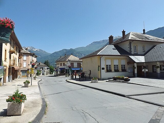
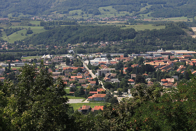
Allevard is a charming town located in the Auvergne-Rhône-Alpes region of France, nestled in the Belledonne mountain range. It's an excellent destination for hikers due to its diverse landscapes, ranging from forests and rivers to rocky peaks.
Hiking Trails
-
Belledonne Massif: The trails in this area offer stunning views and a variety of difficulty levels. Popular hikes include:
- La Croix du Merle: A moderate trail offering breathtaking panoramic views.
- Lac de Brignac: A beautiful hike leading to an alpine lake, perfect for a family outing.
- Le Grand Pic de Belledonne: For experienced hikers, this challenging ascent offers incredible vistas.
-
Forests and Valleys:
- Explore the lush valleys and forests surrounding Allevard. Trails in and around the Gorges du Haut-Bréda offer milder hikes through beautiful scenery and are great for wildlife spotting.
Best Time to Hike
- Spring (April to June): This is a lovely time when wildflowers bloom and the trails are less crowded.
- Summer (July to August): Ideal for hiking, but be prepared for potential thunderstorms in the afternoon.
- Autumn (September to October): The fall colors make for stunning landscapes.
- Winter (November to March): Snowshoeing and winter hiking are popular activities, but proper gear is essential.
Tips for Hiking in Allevard
- Equipment: Ensure you have the proper gear, including sturdy hiking boots, weather-appropriate clothing, and a good backpack.
- Navigation: Familiarize yourself with trail maps or GPS devices, as some trails may not be well-marked.
- Water and Snacks: Always carry enough water and snacks, especially for longer hikes.
- Respect Nature: Follow the principles of Leave No Trace to help maintain the natural beauty of the area.
Local Amenities
Allevard has facilities for hikers, including tourist information centers, accommodation, and restaurants where you can refuel after a day on the trails.
Whether you're a novice or an experienced hiker, Allevard offers the perfect setting for an amazing hiking experience amidst the stunning natural beauty of the French Alps!
- Country:

- Postal Code: 38580
- Coordinates: 45° 23' 37" N, 6° 4' 27" E


- GPS tracks (wikiloc): [Link]
- Area: 25.63 sq km
- Population: 4124
- Web site: http://www.allevard-les-bains.com
- Wikipedia en: wiki(en)
- Wikipedia: wiki(fr)
- Wikidata storage: Wikidata: Q463310
- Wikipedia Commons Category: [Link]
- Freebase ID: [/m/03g_7n3]
- GeoNames ID: Alt: [3038132]
- SIREN number: [213800063]
- BnF ID: [152578364]
- VIAF ID: Alt: [147280021]
- GND ID: Alt: [4495185-1]
- Library of Congress authority ID: Alt: [n84095101]
- PACTOLS thesaurus ID: [pcrtgHwvdagKX3]
- MusicBrainz area ID: [f57981cd-b5a9-4dfd-8b49-8a384522ccb4]
- WOEID: [575769]
- SUDOC authorities ID: [032682719]
- INSEE municipality code: 38006
Shares border with regions:


Pinsot
- commune in Isère, France
Pinsot is a charming village located in the Isère department in the Auvergne-Rhône-Alpes region of France. This area offers stunning natural landscapes, making it a delightful destination for hiking enthusiasts. Here are some key points to consider if you’re thinking about hiking in Pinsot:...
- Country:

- Postal Code: 38580
- Coordinates: 45° 21' 25" N, 6° 6' 0" E


- GPS tracks (wikiloc): [Link]
- Area: 24.27 sq km
- Population: 178
- Web site: [Link]


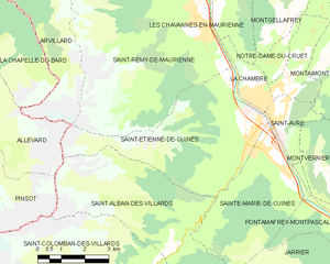
Saint-Étienne-de-Cuines
- commune in Savoie, France
 Hiking in Saint-Étienne-de-Cuines
Saint-Étienne-de-Cuines, located in the Savoie region of the French Alps, offers beautiful hiking opportunities amidst stunning mountain scenery. The area is characterized by picturesque landscapes, including forests, alpine meadows, and views of the surrounding peaks....
- Country:

- Postal Code: 73130
- Coordinates: 45° 20' 32" N, 6° 17' 30" E


- GPS tracks (wikiloc): [Link]
- Area: 20.5 sq km
- Population: 1190


Saint-Alban-des-Villards
- commune in Savoie, France
 Hiking in Saint-Alban-des-Villards
Saint-Alban-des-Villards is a charming village located in the French Alps, specifically in the Savoie department of the Auvergne-Rhône-Alpes region. Hiking in this area offers stunning views, diverse landscapes, and a variety of trails suitable for different skill levels. Here are some highlights and tips for hiking in and around Saint-Alban-des-Villards:...
- Country:

- Postal Code: 73130
- Coordinates: 45° 18' 33" N, 6° 14' 57" E


- GPS tracks (wikiloc): [Link]
- Area: 24.02 sq km
- Population: 103


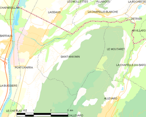
Saint-Maximin
- commune in Isère, France
Saint-Maximin, located in the Isère department in the Auvergne-Rhône-Alpes region of France, offers a range of beautiful hiking opportunities. Surrounded by the picturesque landscape of the Vercors and Chartreuse mountain ranges, it provides hikers with stunning views, diverse terrain, and a variety of trails suitable for different skill levels....
- Country:

- Postal Code: 38530
- Coordinates: 45° 25' 35" N, 6° 2' 16" E


- GPS tracks (wikiloc): [Link]
- Area: 10.35 sq km
- Population: 643
- Web site: [Link]


Pontcharra
- commune in Isère, France
Pontcharra is a charming town located in the Auvergne-Rhône-Alpes region of France, nestled in the Isère department. It offers great opportunities for hiking, surrounded by beautiful natural landscapes, including the Chartreuse and Belledonne mountain ranges. Here’s an overview of what you can expect when hiking in and around Pontcharra:...
- Country:

- Postal Code: 38530
- Coordinates: 45° 25' 59" N, 6° 0' 55" E


- GPS tracks (wikiloc): [Link]
- Area: 15.58 sq km
- Population: 7258
- Web site: [Link]


Le Moutaret
- commune in Isère, France
Le Moutaret is located in the French Alps, within the vicinity of the Écrins National Park. This region is known for its stunning landscapes, diverse flora and fauna, and a network of hiking trails that cater to various skill levels. Here are some key points about hiking in Le Moutaret:...
- Country:

- Postal Code: 38580
- Coordinates: 45° 25' 55" N, 6° 5' 19" E


- GPS tracks (wikiloc): [Link]
- Area: 5.29 sq km
- Population: 253
- Web site: [Link]


La Chapelle-du-Bard
- commune in Isère, France
La Chapelle-du-Bard is a delightful village located in the French Alps, offering stunning landscapes, rich wildlife, and a variety of hiking trails suitable for different skill levels. Nestled within the Rhône-Alpes region, it serves as an excellent base for exploring the natural beauty of the surrounding area....
- Country:

- Postal Code: 38580
- Coordinates: 45° 25' 22" N, 6° 5' 44" E


- GPS tracks (wikiloc): [Link]
- Area: 27.71 sq km
- Population: 554
- Web site: [Link]


Arvillard
- commune in Savoie, France
Arvillard is a charming commune located in the Savoie department of the Auvergne-Rhône-Alpes region in southeastern France. It is well-known for its stunning natural scenery and offers a variety of hikes that cater to different skill levels....
- Country:

- Postal Code: 73110
- Coordinates: 45° 26' 29" N, 6° 7' 12" E


- GPS tracks (wikiloc): [Link]
- Area: 29.28 sq km
- Population: 846
- Web site: [Link]
