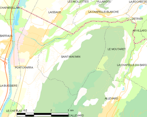
Le Moutaret (Le Moutaret)
- commune in Isère, France
Le Moutaret is located in the French Alps, within the vicinity of the Écrins National Park. This region is known for its stunning landscapes, diverse flora and fauna, and a network of hiking trails that cater to various skill levels. Here are some key points about hiking in Le Moutaret:
Trail Options
- Difficulty Levels: There are trails suitable for beginners, intermediate hikers, and advanced trekkers. The trails vary in length, elevation gain, and terrain.
- Scenic Views: Hiking in this area often provides breathtaking views of mountains, valleys, and alpine meadows. Photogenic spots abound, especially during wildflower seasons.
- Wildlife Watching: The region is home to various wildlife species, including ibex, chamois, and a variety of birds, making it a great spot for nature enthusiasts.
Best Time to Hike
- Summer Months: June to September is the best time for hiking, as the weather is generally warm, and trails are typically free of snow.
- Fall Colors: Late September to early October offers stunning autumn foliage, perfect for photography and enjoying the change of seasons.
Preparation
- Gear: Wear sturdy hiking boots, bring moisture-wicking clothing, and pack layers to adjust to changing weather. Don't forget a hat, sunscreen, and plenty of water.
- Maps and Navigation: Always carry a detailed map or GPS device, as some trails can be less marked. Familiarize yourself with the route before setting out.
Local Guides
If you're unfamiliar with the area or hiking in general, consider hiring a local guide. They can enhance your experience by providing insights about the terrain, flora, and fauna, and ensuring your safety.
Environmental Considerations
- Leave No Trace: Practice eco-friendly hiking by leaving no litter behind, sticking to marked trails, and respecting wildlife.
- Local Regulations: Always check for any specific regulations related to hiking in the area, as some zones may have restrictions to protect the environment.
Conclusion
Hiking in Le Moutaret offers a wonderful opportunity to experience the natural beauty of the French Alps, whether you're looking for a challenging trek or a leisurely stroll through picturesque landscapes. Always prepare adequately and enjoy your adventure!
- Country:

- Postal Code: 38580
- Coordinates: 45° 25' 55" N, 6° 5' 19" E


- GPS tracks (wikiloc): [Link]
- Area: 5.29 sq km
- Population: 253
- Web site: http://www.lemoutaret.fr
- Wikipedia en: wiki(en)
- Wikipedia: wiki(fr)
- Wikidata storage: Wikidata: Q570690
- Wikipedia Commons Category: [Link]
- Freebase ID: [/m/03nvkdb]
- GeoNames ID: Alt: [3003172]
- SIREN number: [213802689]
- BnF ID: [15258080n]
- INSEE municipality code: 38268
Shares border with regions:


Détrier
- commune in Savoie, France
Détrier is a lesser-known area but offers beautiful landscapes and a variety of hiking options for outdoor enthusiasts. Here are some key points to consider if you're thinking about hiking in the Détrier area:...
- Country:

- Postal Code: 73110
- Coordinates: 45° 26' 43" N, 6° 5' 55" E


- GPS tracks (wikiloc): [Link]
- Area: 2.25 sq km
- Population: 422


La Chapelle-Blanche
- commune in Savoie, France
La Chapelle-Blanche is a charming commune located in the Savoie department in southeastern France. Nestled in the French Alps, it offers a unique hiking experience with stunning mountain views, lush landscapes, and a rich natural environment....
- Country:

- Postal Code: 73110
- Coordinates: 45° 26' 52" N, 6° 4' 20" E


- GPS tracks (wikiloc): [Link]
- Area: 4.13 sq km
- Population: 556


Saint-Maximin
- commune in Isère, France
Saint-Maximin, located in the Isère department in the Auvergne-Rhône-Alpes region of France, offers a range of beautiful hiking opportunities. Surrounded by the picturesque landscape of the Vercors and Chartreuse mountain ranges, it provides hikers with stunning views, diverse terrain, and a variety of trails suitable for different skill levels....
- Country:

- Postal Code: 38530
- Coordinates: 45° 25' 35" N, 6° 2' 16" E


- GPS tracks (wikiloc): [Link]
- Area: 10.35 sq km
- Population: 643
- Web site: [Link]


Allevard
- commune in Isère, France
Allevard is a charming town located in the Auvergne-Rhône-Alpes region of France, nestled in the Belledonne mountain range. It's an excellent destination for hikers due to its diverse landscapes, ranging from forests and rivers to rocky peaks....
- Country:

- Postal Code: 38580
- Coordinates: 45° 23' 37" N, 6° 4' 27" E


- GPS tracks (wikiloc): [Link]
- Area: 25.63 sq km
- Population: 4124
- Web site: [Link]


La Chapelle-du-Bard
- commune in Isère, France
La Chapelle-du-Bard is a delightful village located in the French Alps, offering stunning landscapes, rich wildlife, and a variety of hiking trails suitable for different skill levels. Nestled within the Rhône-Alpes region, it serves as an excellent base for exploring the natural beauty of the surrounding area....
- Country:

- Postal Code: 38580
- Coordinates: 45° 25' 22" N, 6° 5' 44" E


- GPS tracks (wikiloc): [Link]
- Area: 27.71 sq km
- Population: 554
- Web site: [Link]

