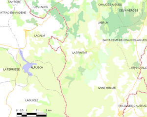
Alpuech (Alpuech)

- former commune in Aveyron, France
- Country:

- Postal Code: 12210
- Coordinates: 44° 45' 44" N, 2° 50' 54" E


- GPS tracks (wikiloc): [Link]
- Area: 14.88 sq km
- Population: 61
- Wikipedia en: wiki(en)
- Wikipedia: wiki(fr)
- Wikidata storage: Wikidata: Q931649
- Wikipedia Commons Category: [Link]
- Freebase ID: [/m/03m92kc]
- GeoNames ID: Alt: [6452130]
- BnF ID: [15246981s]
- INSEE municipality code: 12005
Shares border with regions:


Vitrac-en-Viadène
- former commune in Aveyron, France
- Country:
- Postal Code: 12420
- Coordinates: 44° 47' 42" N, 2° 50' 3" E
- GPS tracks (wikiloc): [Link]
- Area: 16.99 sq km
- Population: 116


La Terrisse
- former commune in Aveyron, France
- Country:
- Postal Code: 12210
- Coordinates: 44° 45' 19" N, 2° 49' 7" E
- GPS tracks (wikiloc): [Link]
- Area: 27.6 sq km
- Population: 148


Lacalm
- former commune in Aveyron, France
- Country:
- Postal Code: 12210
- Coordinates: 44° 46' 19" N, 2° 52' 57" E
- GPS tracks (wikiloc): [Link]
- Area: 26.49 sq km
- Population: 172

La Trinitat
- commune in Cantal, France
- Country:
- Postal Code: 15110
- Coordinates: 44° 44' 55" N, 2° 56' 28" E
- GPS tracks (wikiloc): [Link]
- Area: 17.57 sq km
- Population: 50
Laguiole
- commune in Aveyron, France
- Country:
- Postal Code: 12210
- Coordinates: 44° 41' 3" N, 2° 50' 50" E
- GPS tracks (wikiloc): [Link]
- Area: 63.06 sq km
- Population: 1236
- Web site: [Link]