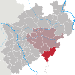
Altenkirchen district (Landkreis Altenkirchen (Westerwald))

- district of Rhineland-Palatinate, Germany
 Hiking in Altenkirchen district
Altenkirchen, located in the Rhineland-Palatinate region of Germany, offers a variety of hiking opportunities in a picturesque rural setting. The district is characterized by rolling hills, forests, and scenic landscapes, making it an excellent destination for both casual walkers and more experienced hikers.
Hiking Trails
-
Der Westerwaldsteig: Part of the larger Westerwaldsteig trail network, this long-distance hiking trail runs through Altenkirchen and showcases the beautiful scenery of the Westerwald region. It offers various stages that range from moderate to challenging, along with opportunities to enjoy local flora and fauna.
-
Nature Trails: There are numerous marked nature trails that wind through forests and along streams. These trails often include informational signs about the natural environment, making them ideal for hikers interested in learning more about the local ecology.
-
Circular Routes: Many shorter circular routes are available, allowing for flexible hiking options. These can be perfect for families or those looking for a more relaxed experience.
Scenic Spots
-
Hiking through Nature Reserves: Altenkirchen is close to several nature reserves where hikers can enjoy protected habitats and perhaps spot some wildlife.
-
Panoramic Views: Many trails lead to high vantage points that provide stunning views over the rolling hills and valleys of the region.
Hiking Tips
- Weather Considerations: Always check the weather before heading out, as conditions can change quickly in the outdoors.
- Footwear: Invest in good hiking boots to ensure comfort and safety on varying terrain.
- Maps and Navigation: Bring a map or a GPS device, as well-marked trails can sometimes be sparse in more remote areas.
- Local Regulations: Be mindful of local guidelines regarding protected areas, staying on designated trails, and respecting wildlife.
Accessibility
Public transport options, including buses, often allow access to various trailheads. It’s advisable to check local transportation schedules for the best routes.
Conclusion
Hiking in Altenkirchen district offers a delightful escape into nature, with options for every skill level. The combination of varied landscapes, local culture, and historic sites along the routes makes it a rewarding outdoor experience. Enjoy your hiking adventures!
- Country:

- Licence Plate Code: AK
- Coordinates: 50° 45' 0" N, 7° 45' 0" E


- GPS tracks (wikiloc): [Link]
- AboveSeaLevel: 157 м m
- Area: 642.00 sq km
- Population: 129166
- Web site: http://www.kreis-altenkirchen.de/
- Wikipedia en: wiki(en)
- Wikipedia: wiki(de)
- Wikidata storage: Wikidata: Q8608
- Wikipedia Commons Category: [Link]
- Freebase ID: [/m/01b51j]
- GeoNames ID: Alt: [3247456]
- VIAF ID: Alt: [145516131]
- OSM relation ID: [62357]
- GND ID: Alt: [4001416-2]
- archINFORM location ID: [4425]
- Library of Congress authority ID: Alt: [n87909437]
- MusicBrainz area ID: [512814dc-83c0-4889-8e0b-b7facccd0ba1]
- TGN ID: [7077164]
- NUTS code: [DEB13]
- German district key: 07132
Includes regions:
Rettersen
- municipality of Germany
Hiking in Rettersen
Rettersen is a picturesque area known for its stunning natural landscapes, making it an ideal destination for hiking enthusiasts. Nestled in a region characterized by rolling hills, dense forests, and tranquil waterways, it offers a variety of trails catering to all skill levels....
- Country:
- Postal Code: 57635
- Local Dialing Code: 02686
- Licence Plate Code: AK
- Coordinates: 50° 44' 16" N, 7° 41' 40" E
- GPS tracks (wikiloc): [Link]
- AboveSeaLevel: 285 м m
- Area: 3.21 sq km
- Population: 357
- Web site: [Link]
Shares border with regions:

Siegen-Wittgenstein
- district in North Rhine-Westphalia, Germany
Hiking in Siegen-Wittgenstein
Siegen-Wittgenstein is a beautiful region located in North Rhine-Westphalia, Germany, characterized by its lush landscapes, rolling hills, and dense forests. This area is perfect for hiking enthusiasts, offering a variety of trails suitable for all skill levels....
- Country:
- Licence Plate Code: BLB; SI
- Coordinates: 50° 55' 12" N, 8° 10' 12" E
- GPS tracks (wikiloc): [Link]
- AboveSeaLevel: 616 м m
- Area: 1132.89 sq km
- Population: 275909
- Web site: [Link]