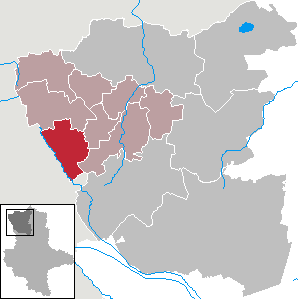
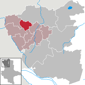
Altmarkkreis Salzwedel (Altmarkkreis Salzwedel)

- German district in Saxony-Anhalt
 Hiking in Altmarkkreis Salzwedel
Altmarkkreis Salzwedel, located in Saxony-Anhalt, Germany, offers a unique hiking experience characterized by its diverse landscapes, historical sites, and tranquil rural environment. Here’s a guide to help you explore the area safely and enjoyably.
Hiking Trails and Routes
-
Mühlenwanderweg (Mill Hiking Trail):
- This trail is well-marked and leads you past several traditional wind and water mills. It offers a glimpse into the region's agricultural past and features charming scenery.
-
Haven’t you heard about Arendsee?
- The area around Lake Arendsee provides beautiful waterfront trails. The lake is good for swim breaks, and the surrounding forest trails allow for a mix of hiking and water activities.
-
Altmark Round Trail:
- A longer hike that takes you through various landscapes, including forests, fields, and small villages. This route offers insights into local flora and fauna and is perfect for experienced hikers looking for a longer challenge.
-
Nature Reserves:
- Explore local nature reserves like the "Rundlingsdorf" nearby, which offer well-marked trails. These are great for observing wildlife and enjoying the serene landscapes.
Points of Interest
-
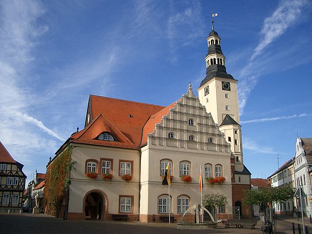
Historical Towns: The region is dotted with quaint towns such as Salzwedel, known for its half-timbered houses and the famous Salzwedeler Baumkuchen cake. Plan for some urban exploration during your hiking.
-
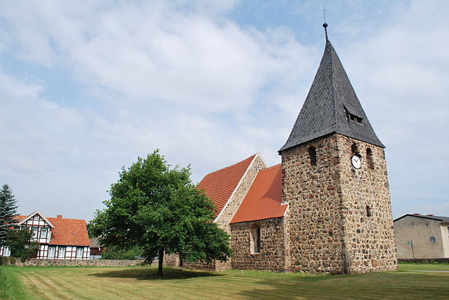
Cultural Heritage: The area is rich in history, with numerous castles and churches along the hiking trails, providing cultural enrichment alongside your outdoor adventure.
Preparation and Tips
-
Maps and Navigation: It's essential to have a good map of the trails. Many routes are marked, but it's helpful to have a GPS device or smartphone app.
-
Weather: Check the weather forecast before heading out, as conditions can change rapidly. Dress in layers and pack waterproof clothing if necessary.
-
Water and Snacks: Bring enough water and light snacks to keep your energy up during hikes. There may not be many facilities along the trails.
-
Footwear and Gear: Wear sturdy hiking shoes and consider trekking poles for better stability, especially on uneven terrain.
-
Wildlife Awareness: Respect local wildlife and plants. During certain seasons, you might encounter deer, wild boar, and various bird species.
Conclusion
Hiking in Altmarkkreis Salzwedel allows you to immerse yourself in nature while exploring the rich cultural heritage of the region. Whether you’re a novice or an experienced hiker, there are trails suited for all levels. Make sure to plan ahead, stay safe, and enjoy the beautiful landscapes that this unique part of Germany has to offer!
- Country:

- Capital: Salzwedel
- Licence Plate Code: SAW
- Coordinates: 52° 41' 0" N, 11° 13' 0" E


- GPS tracks (wikiloc): [Link]
- AboveSeaLevel: 41 м m
- Area: 2293.05 sq km
- Population: 86878
- Web site: http://www.altmarkkreis-salzwedel.de/
- Wikipedia en: wiki(en)
- Wikipedia: wiki(de)
- Wikidata storage: Wikidata: Q6061
- Wikipedia Commons Category: [Link]
- Wikipedia Commons Maps Category: [Link]
- Freebase ID: [/m/015jr3]
- GeoNames ID: Alt: [2842111]
- VIAF ID: Alt: [132593422]
- OSM relation ID: [62602]
- GND ID: Alt: [4379993-0]
- archINFORM location ID: [5914]
- Library of Congress authority ID: Alt: [n85207997]
- Historical Gazetteer (GOV) ID: [object_279160]
- National Library of Israel ID: [001011202]
- NUTS code: [DEE04]
- German district key: 15081
Includes regions:

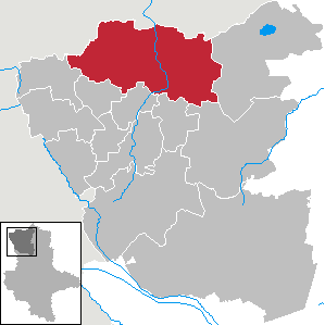
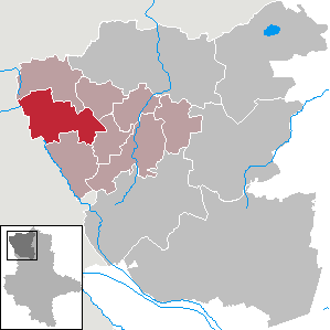
Salzwedel
- municipality of Germany
Hiking in Salzwedel
Salzwedel, a charming town located in the Altmark region of Germany, offers a variety of hiking opportunities that showcase its natural beauty and historical significance. While not as well-known as some other hiking destinations in Germany, Salzwedel is surrounded by scenic landscapes, woods, and fields that provide excellent routes for hikers of various skill levels....
- Country:
- Postal Code: 29416; 29413; 29410
- Local Dialing Code: 039038; 039037; 039033; 039032; 03901
- Licence Plate Code: SAW
- Coordinates: 52° 51' 0" N, 11° 9' 0" E
- GPS tracks (wikiloc): [Link]
- AboveSeaLevel: 19 м m
- Area: 304.53 sq km
- Population: 24002
- Web site: [Link]

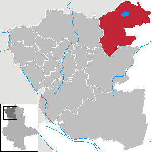
Arendsee (Altmark)
- town in Saxony-Anhalt, Germany
Hiking in Arendsee (Altmark)
Arendsee is a beautiful destination in Germany, located in the state of Brandenburg, known for its scenic landscapes, nature reserves, and the picturesque Arendsee lake. Hiking around Arendsee can offer a variety of experiences, from leisurely walks along the lakeshore to more challenging trails through the surrounding forests and countryside....
- Country:
- Postal Code: 39619
- Local Dialing Code: 039384; 039036; 039034; 039003
- Licence Plate Code: SAW
- Coordinates: 52° 52' 36" N, 11° 29' 12" E
- GPS tracks (wikiloc): [Link]
- AboveSeaLevel: 25 м m
- Area: 269.68 sq km
- Population: 6722
- Web site: [Link]
Gardelegen
- municipality of Germany
Hiking in Gardelegen
Gardelegen, located in the Saxony-Anhalt region of Germany, is not widely known as a hiking hotspot compared to some of the larger national parks and mountain areas in the country. However, it does offer some lovely hiking opportunities that showcase the natural beauty of the surrounding countryside....
- Country:
- Postal Code: 39649; 39638
- Local Dialing Code: 039088; 039087; 039085; 039056; 039006; 039004; 03907
- Coordinates: 52° 31' 31" N, 11° 23' 43" E
- GPS tracks (wikiloc): [Link]
- AboveSeaLevel: 49 м m
- Area: 632.43 sq km
- Population: 22614
- Web site: [Link]


Klötze
- municipality of Germany
Hiking in Klötze
Klötze is a small town located in the state of Saxony-Anhalt, Germany. While it may not be as widely known as some larger hiking destinations, there are opportunities for outdoor activities and hiking in the surrounding areas....
- Country:
- Postal Code: 38486
- Local Dialing Code: 03909; 039085; 039008; 039005
- Coordinates: 52° 37' 34" N, 11° 9' 41" E
- GPS tracks (wikiloc): [Link]
- AboveSeaLevel: 60 м m
- Area: 278.29 sq km
- Population: 10115
- Web site: [Link]

Jübar
- municipality of Germany
Hiking in Jübar
Jübar is a small town in the Altmark region of Germany, known for its tranquil rural landscape and scenic beauty. While it may not be as well-known for hiking as some larger national parks or mountainous regions, there are still opportunities for pleasant walks and hikes in and around the area....
- Country:
- Postal Code: 38489
- Local Dialing Code: 039003
- Licence Plate Code: SAW
- Coordinates: 52° 41' 23" N, 10° 54' 47" E
- GPS tracks (wikiloc): [Link]
- AboveSeaLevel: 75 м m
- Area: 70.89 sq km
- Population: 1631
- Web site: [Link]


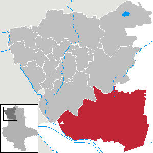
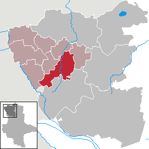
Kalbe (Milde)
- municipality in Saxony-Anhalt, Germany
Hiking in Kalbe (Milde)
Kalbe, located in Saxony-Anhalt, Germany, is a charming town surrounded by picturesque landscapes that offer excellent hiking opportunities. The region is characterized by its rolling hills, forests, and agricultural fields, making it suitable for various levels of hiking enthusiasts....
- Country:
- Postal Code: 39624
- Local Dialing Code: 039085; 039081; 039080; 039030; 039009
- Licence Plate Code: SAW
- Coordinates: 52° 39' 0" N, 11° 24' 0" E
- GPS tracks (wikiloc): [Link]
- AboveSeaLevel: 31 м m
- Area: 30.44 sq km
- Population: 7616
- Web site: [Link]


Dähre
- municipality of Germany
Hiking in Dähre
Dähre, a small town in Saxony-Anhalt, Germany, is not particularly renowned as a hiking destination compared to larger national parks or mountain regions, but it does offer some scenic routes and charming landscapes for outdoor enthusiasts....
- Country:
- Postal Code: 29413
- Local Dialing Code: 039031
- Licence Plate Code: SAW
- Coordinates: 52° 48' 2" N, 10° 54' 32" E
- GPS tracks (wikiloc): [Link]
- AboveSeaLevel: 44 м m
- Area: 78.73 sq km
- Population: 1469
- Web site: [Link]

Diesdorf
- municipality of Germany
Hiking in Diesdorf
Diesdorf is a small village located in the Altmark region of Germany. While it may not be widely recognized as a hiking destination, the surrounding natural landscape offers a number of opportunities for outdoor enthusiasts....
- Country:
- Postal Code: 29413
- Local Dialing Code: 03902
- Licence Plate Code: SAW
- Coordinates: 52° 45' 5" N, 10° 52' 31" E
- GPS tracks (wikiloc): [Link]
- AboveSeaLevel: 56 м m
- Area: 100.52 sq km
- Population: 2340
- Web site: [Link]

Beetzendorf
- municipality of Germany
Hiking in Beetzendorf
Beetzendorf, located in Lower Saxony, Germany, might not be the first destination that comes to mind for hiking, but it offers a peaceful and scenic environment for walking enthusiasts. Here’s a brief overview of what you can expect when hiking in and around Beetzendorf:...
- Country:
- Postal Code: 38486; 38489
- Local Dialing Code: 039000
- Licence Plate Code: SAW
- Coordinates: 52° 42' 0" N, 11° 5' 30" E
- GPS tracks (wikiloc): [Link]
- AboveSeaLevel: 35 м m
- Area: 25.46 sq km
- Population: 3190
- Web site: [Link]


Kuhfelde
- municipality of Germany
Hiking in Kuhfelde
Kuhfelde is a small village located in the Altmark region of Germany, and while it may not be the most well-known hiking destination, it offers access to beautiful natural areas and trails. Hiking in and around Kuhfelde can provide a peaceful experience, featuring scenic landscapes, forests, and rural surroundings....
- Country:
- Postal Code: 29416
- Local Dialing Code: 039035
- Licence Plate Code: SAW
- Coordinates: 52° 47' 0" N, 11° 7' 0" E
- GPS tracks (wikiloc): [Link]
- AboveSeaLevel: 44 м m
- Area: 45.6 sq km
- Population: 1107
- Web site: [Link]
Wallstawe
- municipality of Germany
Hiking in Wallstawe
Wallstawe, located in the Lower Saxony region of Germany, is known for its picturesque landscapes and tranquil natural environments, making it a great spot for hiking enthusiasts. Here are some highlights and tips for hiking in and around Wallstawe:...
- Country:
- Postal Code: 29413
- Local Dialing Code: 039033
- Licence Plate Code: SAW
- Coordinates: 52° 47' 48" N, 11° 1' 11" E
- GPS tracks (wikiloc): [Link]
- AboveSeaLevel: 32 м m
- Area: 44.09 sq km
- Population: 867
- Web site: [Link]


Apenburg-Winterfeld
- municipality of Germany
Hiking in Apenburg-Winterfeld
Apenburg-Winterfeld is a charming region located in the Altmark district of Saxony-Anhalt, Germany. It's less known compared to other hiking destinations but offers a unique experience with its beautiful landscapes, historical sites, and serene surroundings. Here are some highlights for someone considering hiking in this area:...
- Country:
- Postal Code: 38486
- Local Dialing Code: 039035; 039009; 039001
- Licence Plate Code: SAW
- Coordinates: 52° 44' 18" N, 11° 12' 14" E
- GPS tracks (wikiloc): [Link]
- AboveSeaLevel: 82 м m
- Area: 59.31 sq km
- Population: 1703
- Web site: [Link]


Rohrberg
- human settlement in Germany
Hiking in Rohrberg
Rohrberg, located in Saxony-Anhalt, Germany, is a charming village surrounded by beautiful landscapes, making it an excellent destination for hiking enthusiasts. The area is characterized by its picturesque countryside, forests, and rolling hills, providing a variety of trails for hikers of all skill levels....
- Country:
- Postal Code: 38489
- Local Dialing Code: 039000
- Licence Plate Code: SAW
- Coordinates: 52° 42' 24" N, 11° 2' 12" E
- GPS tracks (wikiloc): [Link]
- AboveSeaLevel: 37 м m
- Area: 38.27 sq km
- Population: 1081
- Web site: [Link]
Shares border with regions:

Lüchow-Dannenberg District
- German district in Lower Saxony
Hiking in Lüchow-Dannenberg District
Lüchow-Dannenberg, located in lower Saxony, Germany, offers a distinctive blend of natural beauty, cultural heritage, and a variety of outdoor activities, making it an excellent region for hiking enthusiasts....
- Country:
- Capital: Lüchow
- Licence Plate Code: DAN
- Coordinates: 53° 0' 0" N, 11° 10' 12" E
- GPS tracks (wikiloc): [Link]
- AboveSeaLevel: 13 м m
- Area: 1220.00 sq km
- Population: 48825
- Web site: [Link]
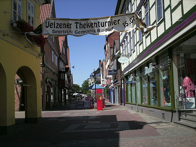

Uelzen District
- German district in Lower Saxony
Hiking in Uelzen District
Uelzen District in Lower Saxony, Germany, offers a variety of hiking opportunities for outdoor enthusiasts. While it might not be as widely known for hiking as some other regions, it provides beautiful natural scenery, charming villages, and historical sites to explore. Here are some aspects to consider for hiking in Uelzen:...
- Country:
- Licence Plate Code: UE
- Coordinates: 53° 0' 0" N, 10° 34' 48" E
- GPS tracks (wikiloc): [Link]
- AboveSeaLevel: 32 м m
- Area: 1454.00 sq km
- Population: 92961
- Web site: [Link]


Gifhorn
- district of Lower Saxony, Germany
Hiking in Gifhorn
Gifhorn, located in Lower Saxony, Germany, is surrounded by beautiful landscapes that offer a variety of hiking opportunities. The district is characterized by its picturesque lakes, forests, and gentle hills, making it an attractive destination for hikers of all skill levels....
- Country:
- Capital: Gifhorn
- Licence Plate Code: GF
- Coordinates: 52° 29' 0" N, 10° 33' 0" E
- GPS tracks (wikiloc): [Link]
- AboveSeaLevel: 63 м m
- Area: 1563.00 sq km
- Population: 174749
- Web site: [Link]