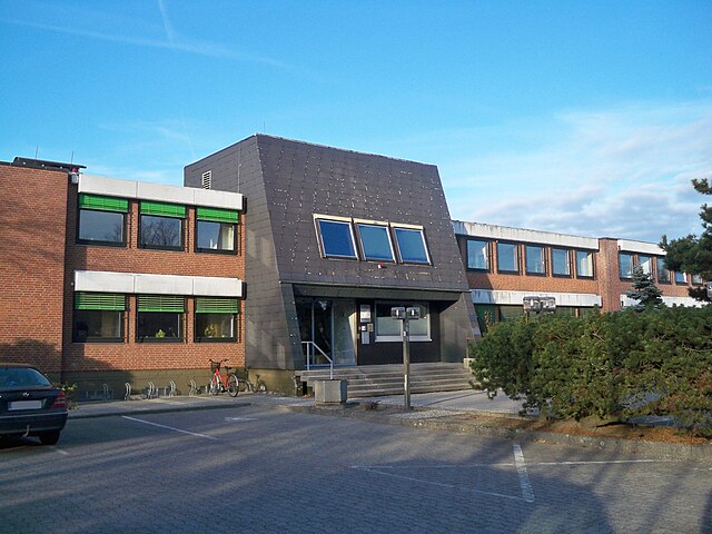
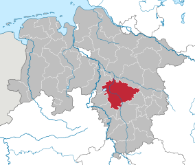
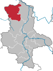
Gifhorn (Landkreis Gifhorn)

- district of Lower Saxony, Germany
 Hiking in Gifhorn
Gifhorn, located in Lower Saxony, Germany, is surrounded by beautiful landscapes that offer a variety of hiking opportunities. The district is characterized by its picturesque lakes, forests, and gentle hills, making it an attractive destination for hikers of all skill levels.
Popular Hiking Areas:
-
Ise Valley:
- The Ise River runs through Gifhorn, providing scenic trails along its banks. The Ise Valley is perfect for leisurely hikes and walking paths, with opportunities to enjoy the river views and local wildlife.
-
Lakes and Wetlands:
- The area features several lakes, such as the Gifhorn Lake (Gifhorner See) and the Großes Moor nature reserve. Hiking in these areas offers a chance to explore wetlands and observe various bird species.
-
Regional Park “Naturpark Elm-Lappwald”:
- Located nearby, this park offers extensive trails through diverse landscapes, including forests and hills. Hikers can enjoy well-maintained paths, beautiful views, and abundant flora and fauna.
-
Heidschnuckenweg:
- This long-distance hiking trail passes through Gifhorn and is part of the larger "Lüneburg Heath." It showcases the unique heath landscape and traditional sheep farming. Hiking along this path offers a more rural experience with charming villages along the way.
Hiking Tips:
- Trail Markings: Most trails are well-marked, but it’s always a good idea to have a map or a hiking app on your phone.
- Weather: Check the weather forecast before heading out, as conditions can change rapidly, especially in the autumn and winter months.
- Gear: Wear sturdy hiking shoes and dress in layers since temperatures can vary throughout the day.
- Local Regulations: Respect local wildlife and regulations, especially in protected nature areas.
Conclusion:
Overall, Gifhorn district provides a variety of hiking experiences, from tranquil lakeside strolls to more challenging wilderness treks. Whether you're an experienced hiker or just looking for a peaceful walk in nature, Gifhorn has something to offer. Make sure to enjoy the local scenery, history, and possibly even a stop at local eateries along your route!
- Country:

- Capital: Gifhorn
- Licence Plate Code: GF
- Coordinates: 52° 29' 0" N, 10° 33' 0" E


- GPS tracks (wikiloc): [Link]
- AboveSeaLevel: 63 м m
- Area: 1563.00 sq km
- Population: 174749
- Web site: http://www.gifhorn.de/
- Wikipedia en: wiki(en)
- Wikipedia: wiki(de)
- Wikidata storage: Wikidata: Q6053
- Wikipedia Commons Category: [Link]
- Wikipedia Commons Maps Category: [Link]
- Freebase ID: [/m/013bfs]
- Freebase ID: [/m/013bfs]
- GeoNames ID: Alt: [2920479]
- GeoNames ID: Alt: [2920479]
- VIAF ID: Alt: [151326824]
- VIAF ID: Alt: [151326824]
- OSM relation ID: [62647]
- OSM relation ID: [62647]
- GND ID: Alt: [4021005-4]
- GND ID: Alt: [4021005-4]
- archINFORM location ID: [11053]
- archINFORM location ID: [11053]
- Library of Congress authority ID: Alt: [n84239362]
- Library of Congress authority ID: Alt: [n84239362]
- TGN ID: [7183905]
- TGN ID: [7183905]
- National Library of Israel ID: [001006690]
- National Library of Israel ID: [001006690]
- NUTS code: [DE914]
- NUTS code: [DE914]
- BabelNet ID: [00717324n]
- BabelNet ID: [00717324n]
- German district key: 03151
- German district key: 03151
Includes regions:

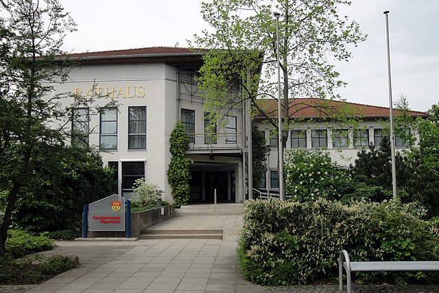
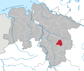
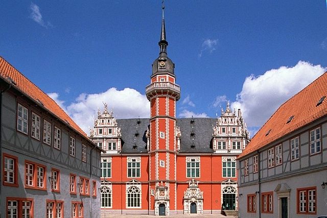
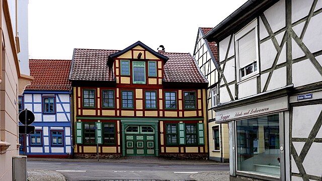
Gifhorn
- town in Lower Saxony, Germany
Hiking in Gifhorn
Gifhorn is a charming town in Lower Saxony, Germany, surrounded by natural beauty and offers a range of hiking opportunities. Here are some highlights about hiking in and around Gifhorn:...
- Country:
- Postal Code: 38518
- Local Dialing Code: 05371
- Licence Plate Code: GF
- Coordinates: 52° 29' 19" N, 10° 32' 47" E
- GPS tracks (wikiloc): [Link]
- AboveSeaLevel: 53 м m
- Area: 104.86 sq km
- Population: 42019
- Web site: [Link]
Brome
- Joint municipality in Lower Saxony, Germany
Hiking in Brome
Brome, located in the Samtgemeinde of Brome in Lower Saxony, Germany, offers a blend of natural beauty and quite a few well-maintained hiking routes. The area is characterized by picturesque landscapes, forests, and agricultural fields, making it a great destination for outdoor enthusiasts....
- Country:
- Licence Plate Code: GF
- Coordinates: 52° 35' 56" N, 10° 55' 59" E
- GPS tracks (wikiloc): [Link]
- Area: 203.87 sq km
- Population: 17018
- Web site: [Link]

Hankensbüttel
- Joint municipality in Lower Saxony
Hiking in Hankensbüttel
Hankensbüttel, located in the Samtgemeinde of Lower Saxony, Germany, is surrounded by picturesque nature that offers various hiking opportunities. Here are some highlights for hiking in this area:...
- Country:
- Licence Plate Code: GF
- Coordinates: 52° 43' 0" N, 10° 35' 0" E
- GPS tracks (wikiloc): [Link]
- Area: 290.27 sq km
- Population: 9096
- Web site: [Link]

Isenbüttel
- Joint municipality in Lower Saxony
Hiking in Isenbüttel
Isenbüttel, located in the Samtgemeinde of Isenbüttel in Lower Saxony, Germany, offers a variety of hiking experiences that are suitable for different skill levels. The area is characterized by picturesque landscapes, combining agricultural fields, forests, and water bodies, making it a great spot for nature enthusiasts....
- Country:
- Licence Plate Code: GF
- Coordinates: 52° 26' 0" N, 10° 35' 0" E
- GPS tracks (wikiloc): [Link]
- Area: 77.39 sq km
- Population: 15358
- Web site: [Link]

Meinersen
- Joint municipality in Lower Saxony
Hiking in Meinersen
Meinersen, located in Lower Saxony, Germany, is a charming area that offers a variety of hiking opportunities, especially for those who appreciate serene landscapes and the outdoors. Here’s what you can expect when hiking in this region:...
- Country:
- Licence Plate Code: GF
- Coordinates: 52° 28' 0" N, 10° 22' 0" E
- GPS tracks (wikiloc): [Link]
- Area: 173.09 sq km
- Population: 20515
- Web site: [Link]

Sassenburg
- municipality of Germany
Hiking in Sassenburg
Sassenburg, located in Lower Saxony, Germany, is surrounded by natural beauty and offers various opportunities for hiking enthusiasts. While not as widely known as some other hiking regions, it has its own charm and scenic landscapes....
- Country:
- Postal Code: 38524
- Local Dialing Code: 05379; 05378; 05371
- Licence Plate Code: GF
- Coordinates: 52° 31' 0" N, 10° 38' 0" E
- GPS tracks (wikiloc): [Link]
- AboveSeaLevel: 68 м m
- Area: 88.4 sq km
- Population: 12460
- Web site: [Link]
Papenteich
- Joint municipality in Lower Saxony, Germany
Hiking in Papenteich
Papenteich is a beautiful area located in Germany, known for its scenic landscapes and hiking opportunities. While it may not be as widely recognized as some other hiking destinations, it offers a variety of trails suitable for different skill levels, from casual walks to more challenging hikes....
- Country:
- Licence Plate Code: GF
- Coordinates: 52° 23' 0" N, 10° 32' 0" E
- GPS tracks (wikiloc): [Link]
- Area: 100.85 sq km
- Population: 24628
- Web site: [Link]

Boldecker Land
- Joint municipality in Lower Saxony, Germany
Hiking in Boldecker Land
Boldecker Land is a scenic region in Germany, renowned for its beautiful landscapes and variety of hiking trails. Located in the federal state of Lower Saxony, near the towns of Gifhorn and Wolsburg, this area offers a mix of natural beauty, charming villages, and cultural heritage, making it an appealing destination for hikers of all levels....
- Country:
- Licence Plate Code: GF
- Coordinates: 52° 28' 0" N, 10° 43' 0" E
- GPS tracks (wikiloc): [Link]
- Area: 69.56 sq km
- Population: 9994
- Web site: [Link]

Wesendorf
- Joint municipality in Lower Saxony
Hiking in Wesendorf
Wesendorf, located in the Samtgemeinde of Wesendorf in Lower Saxony, Germany, offers a serene environment for hiking enthusiasts. The area is characterized by its picturesque landscapes, featuring a mix of forests, open fields, and small lakes, making it ideal for both leisurely walks and more vigorous hikes....
- Country:
- Licence Plate Code: GF
- Coordinates: 52° 35' 36" N, 10° 32' 6" E
- GPS tracks (wikiloc): [Link]
- Area: 209.04 sq km
- Population: 14422
- Web site: [Link]

Wittingen
- City in Lower Saxony, Germany
Hiking in Wittingen
Wittingen is located in the Lower Saxony region of Germany and offers several opportunities for hiking enthusiasts to explore the natural beauty of the area. Here are some key points about hiking in Wittingen:...
- Country:
- Postal Code: 29379; 29378
- Local Dialing Code: 05839; 05836; 05834; 05831
- Licence Plate Code: GF
- Coordinates: 52° 43' 0" N, 10° 44' 0" E
- GPS tracks (wikiloc): [Link]
- AboveSeaLevel: 79 м m
- Area: 225.08 sq km
- Population: 11589
- Web site: [Link]
Giebel
- unincorporated area in Germany
Hiking in Giebel
Giebel, located in the district of Ortenaukreis in Baden-Württemberg, Germany, is part of a larger natural area that offers a variety of hiking opportunities. As a gemeindefreies Gebiet (unincorporated area), Giebel is characterized by its beautiful landscapes, forests, hills, and natural sights. Here are some key points to consider when hiking in and around Giebel:...
- Country:
- Coordinates: 52° 31' 6" N, 10° 56' 36" E
- GPS tracks (wikiloc): [Link]
- Area: 10.38 sq km
- Population: 0
Shares border with regions:

Brunswick
- city in Lower Saxony, Germany
Hiking in Brunswick
Braunschweig, located in Lower Saxony, Germany, offers a variety of hiking options that allow you to explore its natural beauty, historical sites, and charming landscapes. Here's an overview of what you can expect when hiking in and around Braunschweig:...
- Country:
- Postal Code: 38114; 38126; 38100; 38100–38126
- Local Dialing Code: 05341; 0531; 05309; 05307; 05300
- Licence Plate Code: BS
- Coordinates: 52° 16' 9" N, 10° 31' 16" E
- GPS tracks (wikiloc): [Link]
- AboveSeaLevel: 75 м m
- Area: 192.70 sq km
- Population: 248667
- Web site: [Link]


Wolfsburg
- German city
Hiking in Wolfsburg
Wolfsburg, located in Lower Saxony, Germany, is primarily known for its automobile industry, particularly as the headquarters of Volkswagen. However, it also offers some opportunities for hiking and enjoying nature, especially in nearby natural parks and areas....
- Country:
- Postal Code: 38448; 38446; 38444; 38442; 38440
- Local Dialing Code: 05308; 05367; 05366; 05365; 05363; 05362; 05361
- Licence Plate Code: WOB
- Coordinates: 52° 25' 23" N, 10° 47' 14" E
- GPS tracks (wikiloc): [Link]
- AboveSeaLevel: 63 м m
- Area: 204.61 sq km
- Population: 123909
- Web site: [Link]
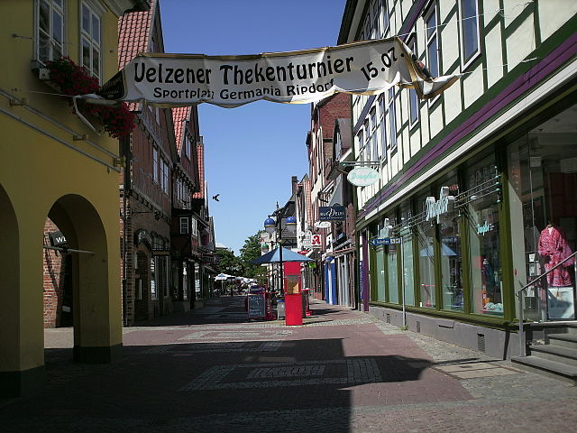

Uelzen District
- German district in Lower Saxony
Hiking in Uelzen District
Uelzen District in Lower Saxony, Germany, offers a variety of hiking opportunities for outdoor enthusiasts. While it might not be as widely known for hiking as some other regions, it provides beautiful natural scenery, charming villages, and historical sites to explore. Here are some aspects to consider for hiking in Uelzen:...
- Country:
- Licence Plate Code: UE
- Coordinates: 53° 0' 0" N, 10° 34' 48" E
- GPS tracks (wikiloc): [Link]
- AboveSeaLevel: 32 м m
- Area: 1454.00 sq km
- Population: 92961
- Web site: [Link]
Celle
- German district of Lower Saxony
Hiking in Celle
Celle district, located in Lower Saxony, Germany, offers a variety of hiking opportunities surrounded by beautiful landscapes, historic towns, and natural parks. Here are some highlights for hiking enthusiasts in the area:...
- Country:
- Licence Plate Code: CE
- Coordinates: 52° 34' 48" N, 10° 4' 48" E
- GPS tracks (wikiloc): [Link]
- AboveSeaLevel: 59 м m
- Area: 1554.00 sq km
- Population: 178370
- Web site: [Link]

Hanover region
- district in Lower Saxony, Germany
Hiking in Hanover region
The Hanover Region, located in Lower Saxony, Germany, offers a variety of hiking opportunities for both beginners and experienced hikers alike. With its mix of natural landscapes, historical sites, and well-maintained trails, the region is a great destination for outdoor enthusiasts....
- Country:
- Capital: Hanover
- Licence Plate Code: H
- Coordinates: 52° 25' 12" N, 9° 43' 12" E
- GPS tracks (wikiloc): [Link]
- AboveSeaLevel: 55 м m
- Area: 2291 sq km
- Population: 1149594
- Web site: [Link]

Peine
- district of Lower Saxony, Germany
Hiking in Peine
Peine is a district located in Lower Saxony, Germany, and it offers various outdoor activities, including hiking. The region is known for its beautiful landscapes, with a mix of forests, meadows, and picturesque villages. Here are some key points about hiking in the Peine district:...
- Country:
- Capital: Peine
- Licence Plate Code: PE
- Coordinates: 52° 19' 48" N, 10° 15' 0" E
- GPS tracks (wikiloc): [Link]
- AboveSeaLevel: 66 м m
- Area: 535.00 sq km
- Population: 132979
- Web site: [Link]

Helmstedt
- district of Lower Saxony, Germany
Hiking in Helmstedt
Helmstedt is a district located in Lower Saxony, Germany, and is known for its beautiful natural landscapes and varied hiking opportunities. The region combines cultural heritage with outdoor activities, making it an appealing destination for hikers of all skill levels. Here are some highlights and features of hiking in Helmstedt:...
- Country:
- Licence Plate Code: HE
- Coordinates: 52° 15' 0" N, 10° 55' 12" E
- GPS tracks (wikiloc): [Link]
- AboveSeaLevel: 142 м m
- Area: 674.00 sq km
- Population: 92079
- Web site: [Link]
Altmarkkreis Salzwedel
- German district in Saxony-Anhalt
Hiking in Altmarkkreis Salzwedel
Altmarkkreis Salzwedel, located in Saxony-Anhalt, Germany, offers a unique hiking experience characterized by its diverse landscapes, historical sites, and tranquil rural environment. Here’s a guide to help you explore the area safely and enjoyably....
- Country:
- Capital: Salzwedel
- Licence Plate Code: SAW
- Coordinates: 52° 41' 0" N, 11° 13' 0" E
- GPS tracks (wikiloc): [Link]
- AboveSeaLevel: 41 м m
- Area: 2293.05 sq km
- Population: 86878
- Web site: [Link]
Börde
- German district of Saxony-Anhalt
Hiking in Börde
Börde is a district in the state of Saxony-Anhalt, Germany, known for its picturesque landscapes, agricultural land, and historic towns. While it may not be as widely recognized as some other hiking destinations in Germany, it offers a variety of natural features and trails that can appeal to hikers looking for a more tranquil experience....
- Country:
- Licence Plate Code: WZL; WMS; OK; OC; HDL; BÖ; BK
- Coordinates: 52° 10' 0" N, 11° 20' 0" E
- GPS tracks (wikiloc): [Link]
- AboveSeaLevel: 172 м m
- Area: 2366.00 sq km
- Population: 174001
- Web site: [Link]