
Saxony-Anhalt (Sachsen-Anhalt)


- state of Germany
 Hiking in Saxony-Anhalt
Saxony-Anhalt, located in central Germany, offers a diverse range of hiking trails and natural landscapes that cater to outdoor enthusiasts. Here are some key highlights for hiking in this region:
Landscapes and Nature
-
Harz Mountains: This range features dense forests, rocky peaks, and picturesque valleys. The Brocken, the highest peak, offers stunning panoramic views. The Harz National Park is home to a variety of flora and fauna and is ideal for both short and long hikes.
-
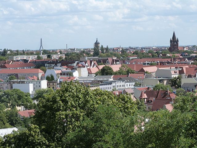
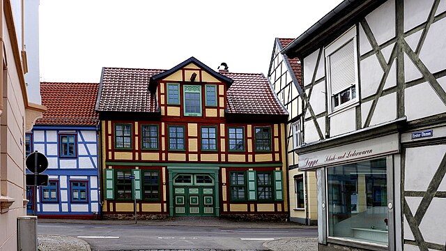
Mansfeld-Südharz: This area is great for exploring historic mining trails and natural sites. The trails here often connect small villages with historical significance, providing a cultural dimension to your hikes.
-
Saxony-Anhalt’s Vineyards: The Saale-Unstrut region is Germany's northernmost wine-growing area. Trails along the rivers offer beautiful views of vineyards mixed with charming towns.
-
The Elbe River: The Elbe Trail follows the river and passes through various scenic locations, including cliffs and historical towns such as Dessau and Wittenberg.
-
Anhalt Wittenberg: Known for its cultural and historical significance, this area includes numerous paths that connect to UNESCO World Heritage sites like the Dessau-Wörlitz Garden Realm.
Popular Hiking Trails
-
The Harzer-Hexen-Stieg: A long-distance trail of around 97 km that runs from Osterode to Thale, crossing the Harz National Park. It showcases folklore and nature.
-
The Saale Valley Trail: This trail takes you along the Saale River, providing excellent views of landscapes and vineyards.
-
Wanderweg im Saale-Unstrut-Tal: This is a network of well-marked paths through the Saale-Unstrut valley, offering scenic views and opportunities for wine tasting.
Tips for Hiking in Saxony-Anhalt
-
Trail Markings: Most trails are well-marked with signs and symbols, making navigation easier.
-
Weather: The weather can vary, especially in the Harz Mountains. Always check forecasts and prepare for changes.
-
Safety and Equipment: Ensure you are equipped with suitable hiking gear, including durable footwear, a map, and plenty of water.
-
Local Regulations: Be aware of any local regulations regarding wildlife protection and preservation of natural sites to minimize your impact on the environment.
In summary, Saxony-Anhalt offers a rich blend of natural beauty, history, and culture, making it a great hiking destination for both beginners and experienced hikers. Enjoy exploring the beautiful landscapes, charming towns, and the rich heritage of this vibrant region!
- Country:

- Capital: Magdeburg
- Coordinates: 51° 58' 16" N, 11° 28' 12" E


- GPS tracks (wikiloc): [Link]
- AboveSeaLevel: 51 м m
- Area: 20451.58 sq km
- Population: 2245470
- Web site: http://www.sachsen-anhalt.de/
- Wikipedia en: wiki(en)
- Wikipedia: wiki(de)
- Wikidata storage: Wikidata: Q1206
- Wikipedia Commons Gallery: [Link]
- Wikipedia Commons Category: [Link]
- Wikipedia Commons Maps Category: [Link]
- Freebase ID: [/m/09hrc]
- GeoNames ID: Alt: [2842565]
- BnF ID: [121688914]
- VIAF ID: Alt: [122573067]
- OSM relation ID: [62607]
- GND ID: Alt: [4051181-9]
- archINFORM location ID: [2904]
- Library of Congress authority ID: Alt: [n82166972]
- PACTOLS thesaurus ID: [pcrtecmrfNtnAu]
- MusicBrainz area ID: [f58905b4-f974-4292-a259-befaf8a4e957]
- TGN ID: [7003687]
- Encyclopædia Britannica Online ID: [place/Saxony-Anhalt]
- EMLO location ID: [146e1d06-3f5b-4f41-88b5-9157caf81e4a]
- NKCR AUT ID: [ge130747]
- DMOZ ID: Alt: [Regional/Europe/Germany/States/Saxony-Anhalt/]
- National Library of Israel ID: [000996512]
- NUTS code: [DEE0]
- Klexikon article ID: [Sachsen-Anhalt]
- BabelNet ID: [03097643n]
- STW Thesaurus for Economics ID: [18135-1]
- SELIBR ID: [274440]
- ISO 3166-2 code: DE-ST
- German regional key: 15
- FIPS 10-4 (countries and regions): GM14
- GACS ID: 19630
- Consolidated code of the electronic catalog of libraries of Belarus: 2249653
Includes regions:


Magdeburg
- federated state capital city of Saxony-Anhalt, Germany
Hiking in Magdeburg
Magdeburg, located in central Germany, offers various opportunities for hiking and enjoying nature, especially with its proximity to different parks and natural reserves. While the city itself is urban, there are several nearby areas where you can enjoy hiking trails and beautiful landscapes. Here are some key points about hiking around Magdeburg:...
- Country:
- Postal Code: 39104–39130
- Local Dialing Code: 0391
- Licence Plate Code: MD
- Coordinates: 52° 8' 0" N, 11° 37' 0" E
- GPS tracks (wikiloc): [Link]
- AboveSeaLevel: 55 м m
- Area: 201.01 sq km
- Population: 238136
- Web site: [Link]

Halle (Saale)
- city in the German state of Saxony-Anhalt
Hiking in Halle (Saale)
Hiking in Halle (Saale), a city in the state of Saxony-Anhalt, Germany, offers a blend of urban experiences and access to beautiful natural landscapes. The surrounding region features diverse hiking trails, picturesque parks, and historic sites....
- Country:
- Postal Code: 06108–06132
- Local Dialing Code: 0345
- Licence Plate Code: HAL
- Coordinates: 51° 28' 59" N, 11° 58' 19" E
- GPS tracks (wikiloc): [Link]
- AboveSeaLevel: 87 м m
- Area: 135.03 sq km
- Population: 239173
- Web site: [Link]

Dessau-Roßlau
- city in Saxony-Anhalt, Germany
Hiking in Dessau-Roßlau
Dessau-Roßlau, located in Saxony-Anhalt, Germany, is known for its rich cultural heritage and beautiful natural landscapes, making it an enjoyable destination for hiking enthusiasts. Here are some highlights for hiking in the region:...
- Country:
- Postal Code: 06842–06862
- Local Dialing Code: 034901; 0340
- Licence Plate Code: RSL; DE
- Coordinates: 51° 50' 0" N, 12° 14' 0" E
- GPS tracks (wikiloc): [Link]
- AboveSeaLevel: 59 м m
- Area: 244.74 sq km
- Population: 83616
- Web site: [Link]
Stendal District
- German district in Saxony-Anhalt
Hiking in Stendal District
Stendal is a district located in the state of Saxony-Anhalt in Germany. While it may not be as well-known for hiking as some other regions, it does provide some opportunities for outdoor activities in a scenic, largely rural setting. Here are some highlights about hiking in the Stendal district:...
- Country:
- Licence Plate Code: SDL; OBG; HV
- Coordinates: 52° 41' 0" N, 11° 51' 0" E
- GPS tracks (wikiloc): [Link]
- AboveSeaLevel: 39 м m
- Area: 2423.04 sq km
- Population: 116666
- Web site: [Link]
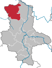
Altmarkkreis Salzwedel
- German district in Saxony-Anhalt
Hiking in Altmarkkreis Salzwedel
Altmarkkreis Salzwedel, located in Saxony-Anhalt, Germany, offers a unique hiking experience characterized by its diverse landscapes, historical sites, and tranquil rural environment. Here’s a guide to help you explore the area safely and enjoyably....
- Country:
- Capital: Salzwedel
- Licence Plate Code: SAW
- Coordinates: 52° 41' 0" N, 11° 13' 0" E
- GPS tracks (wikiloc): [Link]
- AboveSeaLevel: 41 м m
- Area: 2293.05 sq km
- Population: 86878
- Web site: [Link]
Börde
- German district of Saxony-Anhalt
Hiking in Börde
Börde is a district in the state of Saxony-Anhalt, Germany, known for its picturesque landscapes, agricultural land, and historic towns. While it may not be as widely recognized as some other hiking destinations in Germany, it offers a variety of natural features and trails that can appeal to hikers looking for a more tranquil experience....
- Country:
- Licence Plate Code: WZL; WMS; OK; OC; HDL; BÖ; BK
- Coordinates: 52° 10' 0" N, 11° 20' 0" E
- GPS tracks (wikiloc): [Link]
- AboveSeaLevel: 172 м m
- Area: 2366.00 sq km
- Population: 174001
- Web site: [Link]
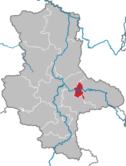
Jerichower Land
- German district of Saxony-Anhalt
Hiking in Jerichower Land
Jerichower Land is a picturesque area in the eastern part of Germany, situated in the state of Saxony-Anhalt. It’s known for its varied landscapes, historical sites, and a network of hiking trails that offer opportunities for both casual walkers and more seasoned hikers....
- Country:
- Licence Plate Code: JL; GNT; BRG
- Coordinates: 52° 20' 0" N, 12° 4' 0" E
- GPS tracks (wikiloc): [Link]
- AboveSeaLevel: 57 м m
- Web site: [Link]
Anhalt-Bitterfeld
- German district in Saxony-Anhalt
Hiking in Anhalt-Bitterfeld
Anhalt-Bitterfeld is a district in the state of Saxony-Anhalt in Germany, which offers a variety of hiking opportunities amidst a blend of natural landscapes and historical sites. Here are some highlights for hiking in the region:...
- Country:
- Licence Plate Code: ZE; KÖT; BTF; AZE; ABI
- Coordinates: 51° 43' 0" N, 12° 4' 0" E
- GPS tracks (wikiloc): [Link]
- AboveSeaLevel: 87 м m
- Area: 1452.80 sq km
- Population: 168475
- Web site: [Link]
Wittenberg
- German district in Saxony-Anhalt
Hiking in Wittenberg
Wittenberg, located in the state of Saxony-Anhalt, Germany, is not just known for its historical significance but also for its beautiful landscapes and opportunities for hiking. The region is rich in natural beauty, with a mix of woodlands, rivers, and rolling hills, making it an excellent destination for outdoor enthusiasts....
- Country:
- Licence Plate Code: WB; JE; GHC
- Coordinates: 51° 48' 0" N, 12° 41' 0" E
- GPS tracks (wikiloc): [Link]
- AboveSeaLevel: 66 м m
- Area: 1929.96 sq km
- Population: 130699
- Web site: [Link]
Salzlandkreis
- German district of Saxony-Anhalt
Hiking in Salzlandkreis
Salzlandkreis, located in the state of Saxony-Anhalt in Germany, offers a variety of hiking opportunities for outdoor enthusiasts. The area is characterized by its diverse landscapes, including forests, hills, and rivers, making it a great destination for hiking. Here are some highlights and recommendations for hiking in Salzlandkreis:...
- Country:
- Licence Plate Code: SLK
- Coordinates: 51° 50' 0" N, 11° 35' 0" E
- GPS tracks (wikiloc): [Link]
- AboveSeaLevel: 67 м m
- Area: 1425.9 sq km
- Web site: [Link]
Harz District
- German district in Saxony-Anhalt
Hiking in Harz District
The Harz district, located in central Germany, is a popular destination for hiking enthusiasts due to its stunning landscapes, rich history, and diverse range of trails. Here are some key points about hiking in the Harz region:...
- Country:
- Licence Plate Code: WR; QLB; HZ; HBS
- Coordinates: 51° 49' 12" N, 10° 57' 36" E
- GPS tracks (wikiloc): [Link]
- AboveSeaLevel: 243 м m
- Area: 2.10 sq km
- Population: 223094
- Web site: [Link]
Mansfeld-Südharz
- German district in Saxony-Anhalt
Hiking in Mansfeld-Südharz
Mansfeld-Südharz is a picturesque region in Germany, located in the state of Saxony-Anhalt. It offers a rich blend of natural beauty, historical sites, and diverse hiking opportunities that cater to different skill levels. Here are some highlights for hiking in this area:...
- Country:
- Licence Plate Code: MSH
- Coordinates: 51° 32' 0" N, 11° 22' 0" E
- GPS tracks (wikiloc): [Link]
- AboveSeaLevel: 169 м m
- Area: 1448.82 sq km
- Population: 144735
- Web site: [Link]


Saalekreis
- German district in Saxony-Anhalt
Hiking in Saalekreis
Saalekreis, located in Saxony-Anhalt, Germany, offers a variety of hiking opportunities thanks to its beautiful landscapes, forests, and historical sites. Here are some highlights for anyone looking to hike in this region:...
- Country:
- Licence Plate Code: QFT; MQ; MER; SK
- Coordinates: 51° 24' 0" N, 11° 50' 0" E
- GPS tracks (wikiloc): [Link]
- AboveSeaLevel: 76 м m
- Area: 1433.67 sq km
- Population: 186431
- Web site: [Link]


Burgenlandkreis
- rural district of Saxony-Anhalt, Germany
Hiking in Burgenlandkreis
Burgenlandkreis, located in Saxony-Anhalt, Germany, is a great destination for hikers due to its diverse landscapes and rich cultural heritage. The region features a mix of rolling hills, vineyards, river valleys, and historical sites, making it an attractive area for outdoor enthusiasts....
- Country:
- Licence Plate Code: BLK
- Coordinates: 51° 9' 0" N, 11° 52' 0" E
- GPS tracks (wikiloc): [Link]
- AboveSeaLevel: 124 м m
- Area: 1413.47 sq km
Shares border with regions:


Lower Saxony
- state of Germany
Hiking in Lower Saxony
Lower Saxony, located in northwestern Germany, offers a diverse range of hiking opportunities appealing to both novice and experienced hikers. Here are some of the highlights of hiking in Lower Saxony:...
- Country:
- Capital: Hanover
- Coordinates: 52° 45' 22" N, 9° 23' 35" E
- GPS tracks (wikiloc): [Link]
- AboveSeaLevel: 13 м m
- Area: 47614.07 sq km
- Population: 7945685
- Web site: [Link]


Saxony
- state in Germany
Hiking in Saxony
Saxony, located in the eastern part of Germany, is a fantastic destination for hiking enthusiasts due to its diverse landscapes, rich natural beauty, and well-maintained trails. Here are some highlights and tips for hiking in Saxony:...
- Country:
- Capital: Dresden
- Coordinates: 51° 1' 37" N, 13° 21' 32" E
- GPS tracks (wikiloc): [Link]
- AboveSeaLevel: 342 м m
- Area: 18415.66 sq km
- Population: 4055274
- Web site: [Link]


Thuringia
- state of Germany
Hiking in Thuringia
Thuringia, located in central Germany, is an excellent destination for hiking enthusiasts. Known for its diverse landscapes, lush forests, historical sites, and picturesque villages, Thuringia offers numerous trails that cater to different skill levels and interests. Here are some highlights and tips for hiking in the region:...
- Country:
- Capital: Erfurt
- Coordinates: 50° 51' 40" N, 11° 3' 7" E
- GPS tracks (wikiloc): [Link]
- AboveSeaLevel: 266 м m
- Area: 16171.0 sq km
- Population: 2161000
- Web site: [Link]


Brandenburg
- state of Germany
Hiking in Brandenburg
Brandenburg, a state in northeastern Germany, is an excellent destination for hiking enthusiasts. It's known for its diverse landscapes, which include vast forests, serene lakes, and rolling hills. Here are some key highlights and tips for hiking in Brandenburg:...
- Country:
- Capital: Potsdam
- Coordinates: 52° 21' 43" N, 13° 0' 29" E
- GPS tracks (wikiloc): [Link]
- AboveSeaLevel: 0 м m
- Area: 29478.63 sq km
- Population: 2449193
- Web site: [Link]