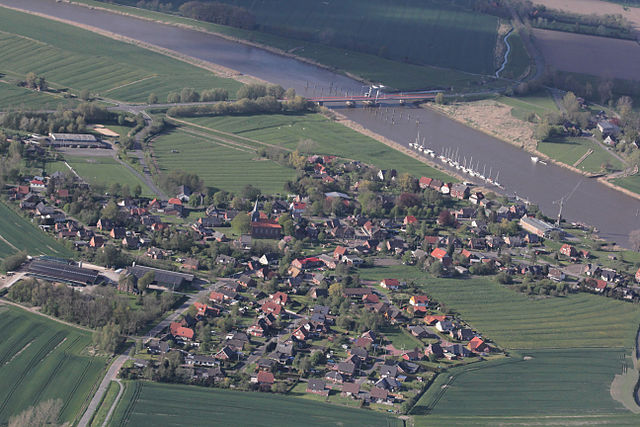
Am Dobrock (Samtgemeinde Am Dobrock)

- former Samtgemeinde in Lower Saxony
 Hiking in Am Dobrock
Am Dobrock is a picturesque area located in Germany, particularly known for its natural beauty and outdoor activities. The region is characterized by rolling hills, lush forests, and scenic views, making it a great destination for hiking.
Hiking Trails:
-
Varied Difficulty Levels: The trails around Am Dobrock range from easy to moderate, suitable for hikers of all skill levels. Beginners can enjoy leisurely walks, while experienced hikers can find more challenging routes.
-
Scenic Routes: Many trails offer stunning views of the surrounding landscapes, including valleys, forests, and sometimes rivers. Look for paths that lead to elevated viewpoints for panoramic vistas.
-
Wildlife Observation: The area is rich in biodiversity, allowing for opportunities to spot various wildlife and plant species. Bring binoculars if you're interested in bird watching.
Tips for Hiking in Am Dobrock:
-
Weather Conditions: Always check the weather forecast before heading out. Weather can change quickly in the mountains, so be prepared with appropriate clothing and footwear.
-
Navigation: Utilize maps or GPS apps to navigate the trails, especially if you're venturing into less marked areas. Familiarize yourself with the trail markers or signage.
-
Safety: Always inform someone about your hiking plans, especially if you're trekking alone. Carry a first-aid kit, plenty of water, and snacks.
-
Respect Nature: Follow Leave No Trace principles, including sticking to designated trails, disposing of waste properly, and respecting wildlife.
-
Local Regulations: Be aware of any local regulations regarding hiking, such as fire restrictions or seasonal trail closures, particularly in protected areas.
Additional Activities:
In addition to hiking, Am Dobrock may offer opportunities for cycling, bird watching, and photography. Exploring the nearby towns and enjoying local cuisine can enhance your overall experience.
Whether you're looking for a peaceful nature walk or a more challenging hike, Am Dobrock provides a beautiful backdrop for outdoor adventures. Happy hiking!
- Country:

- Coordinates: 53° 46' 15" N, 9° 3' 30" E


- GPS tracks (wikiloc): [Link]
- Area: 178.11 sq km
- Web site: http://www.am-dobrock.de/
- Wikipedia en: wiki(en)
- Wikipedia: wiki(de)
- Wikidata storage: Wikidata: Q489400
- Wikipedia Commons Gallery: [Link]
- Wikipedia Commons Category: [Link]
- Freebase ID: [/m/0c4qwv]
- Freebase ID: [/m/0c4qwv]
- Freebase ID: [/m/0c4qwv]
- Freebase ID: [/m/0c4qwv]
- GeoNames ID: Alt: [2956622]
- GeoNames ID: Alt: [2956622]
- GeoNames ID: Alt: [2956622]
- GeoNames ID: Alt: [2956622]
- VIAF ID: Alt: [142562815]
- VIAF ID: Alt: [142562815]
- VIAF ID: Alt: [142562815]
- VIAF ID: Alt: [142562815]
- GND ID: Alt: [2067291-3]
- GND ID: Alt: [2067291-3]
- GND ID: Alt: [2067291-3]
- GND ID: Alt: [2067291-3]
- German regional key: 033525401
- German regional key: 033525401
- German regional key: 033525401
- German regional key: 033525401
Includes regions:

Wingst Oppeln
- human settlement in Germany
Hiking in Wingst Oppeln
Hiking in the Oppeln area, specifically in Wingst, can offer a wonderful experience for outdoor enthusiasts. Wingst is a district in the Lower Saxony region of Germany, known for its beautiful landscapes, picturesque forests, and proximity to the North Sea. Here are some highlights and tips for hiking in this area:...
- Country:
- Postal Code: 21789
- Local Dialing Code: 04754
- Coordinates: 53° 43' 29" N, 8° 59' 42" E
- GPS tracks (wikiloc): [Link]
- AboveSeaLevel: 1 м m
- Area: 8.18 sq km

Geversdorf
- district of Cadenberge, Germany
Hiking in Geversdorf
Geversdorf is a small village located in Lower Saxony, Germany, not far from the port city of Cuxhaven. The area around Geversdorf offers some beautiful landscapes and opportunities for outdoor activities, including hiking....
- Country:
- Postal Code: 21784
- Local Dialing Code: 04752
- Licence Plate Code: CUX
- Coordinates: 53° 48' 0" N, 9° 5' 0" E
- GPS tracks (wikiloc): [Link]
- AboveSeaLevel: 2 м m
- Area: 21.62 sq km
- Web site: [Link]