Ambert (Ambert)

- commune in Puy-de-Dôme, France
- Country:

- Postal Code: 63600
- Coordinates: 45° 32' 58" N, 3° 44' 30" E


- GPS tracks (wikiloc): [Link]
- Area: 60.48 sq km
- Population: 6743
- Web site: http://www.ville-ambert.fr
- Wikipedia en: wiki(en)
- Wikipedia: wiki(fr)
- Wikidata storage: Wikidata: Q213317
- Wikipedia Commons Category: [Link]
- Freebase ID: [/m/03zsyd]
- GeoNames ID: Alt: [3037937]
- SIREN number: [216300038]
- BnF ID: [152693531]
- Library of Congress authority ID: Alt: [n87127936]
- MusicBrainz area ID: [44a5396f-36ec-44c4-a736-65f1e2f03bdb]
- Quora topic ID: [Ambert]
- INSEE municipality code: 63003
Shares border with regions:


Grandrif
- commune in Puy-de-Dôme, France
- Country:
- Postal Code: 63600
- Coordinates: 45° 30' 18" N, 3° 49' 2" E
- GPS tracks (wikiloc): [Link]
- Area: 22.15 sq km
- Population: 178


La Forie
- commune in Puy-de-Dôme, France
- Country:
- Postal Code: 63600
- Coordinates: 45° 35' 27" N, 3° 45' 42" E
- GPS tracks (wikiloc): [Link]
- Area: 2.81 sq km
- Population: 318
Saint-Ferréol-des-Côtes
- commune in Puy-de-Dôme, France
- Country:
- Postal Code: 63600
- Coordinates: 45° 31' 43" N, 3° 42' 27" E
- GPS tracks (wikiloc): [Link]
- Area: 15.03 sq km
- Population: 544


Le Monestier
- commune in Puy-de-Dôme, France
- Country:
- Postal Code: 63890
- Coordinates: 45° 33' 47" N, 3° 39' 43" E
- GPS tracks (wikiloc): [Link]
- Area: 17.31 sq km
- Population: 206


Bertignat
- commune in Puy-de-Dôme, France
- Country:
- Postal Code: 63480
- Coordinates: 45° 37' 3" N, 3° 40' 51" E
- GPS tracks (wikiloc): [Link]
- Area: 24.31 sq km
- Population: 456


Saint-Martin-des-Olmes
- commune in Puy-de-Dôme, France
- Country:
- Postal Code: 63600
- Coordinates: 45° 31' 49" N, 3° 47' 52" E
- GPS tracks (wikiloc): [Link]
- Area: 17.15 sq km
- Population: 283

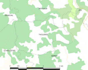
Thiolières
- commune in Puy-de-Dôme, France
- Country:
- Postal Code: 63600
- Coordinates: 45° 35' 3" N, 3° 41' 30" E
- GPS tracks (wikiloc): [Link]
- Area: 5.3 sq km
- Population: 166
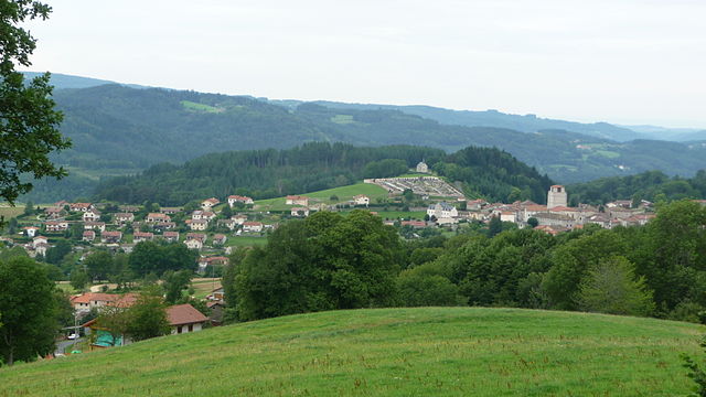
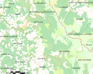
Job
- commune in Puy-de-Dôme, France
- Country:
- Postal Code: 63990
- Coordinates: 45° 36' 58" N, 3° 44' 44" E
- GPS tracks (wikiloc): [Link]
- Area: 42.68 sq km
- Population: 1021


Marsac-en-Livradois
- commune in Puy-de-Dôme, France
- Country:
- Postal Code: 63940
- Coordinates: 45° 28' 44" N, 3° 43' 40" E
- GPS tracks (wikiloc): [Link]
- Area: 48.46 sq km
- Population: 1459
- Web site: [Link]


Valcivières
- commune in Puy-de-Dôme, France
- Country:
- Postal Code: 63600
- Coordinates: 45° 35' 32" N, 3° 47' 44" E
- GPS tracks (wikiloc): [Link]
- Area: 32.96 sq km
- Population: 209