Saint-Ferréol-des-Côtes (Saint-Ferréol-des-Côtes)

- commune in Puy-de-Dôme, France
- Country:

- Postal Code: 63600
- Coordinates: 45° 31' 43" N, 3° 42' 27" E


- GPS tracks (wikiloc): [Link]
- Area: 15.03 sq km
- Population: 544
- Wikipedia en: wiki(en)
- Wikipedia: wiki(fr)
- Wikidata storage: Wikidata: Q1048797
- Wikipedia Commons Category: [Link]
- Freebase ID: [/m/03ql28l]
- SIREN number: [216303412]
- BnF ID: [15269691d]
- INSEE municipality code: 63341
Shares border with regions:


Le Monestier
- commune in Puy-de-Dôme, France
- Country:
- Postal Code: 63890
- Coordinates: 45° 33' 47" N, 3° 39' 43" E
- GPS tracks (wikiloc): [Link]
- Area: 17.31 sq km
- Population: 206
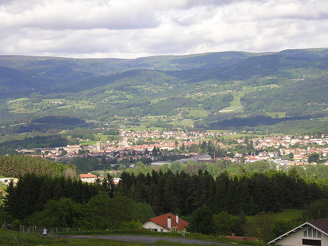
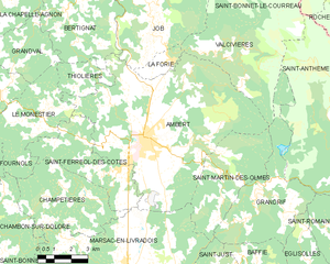
Ambert
- commune in Puy-de-Dôme, France
- Country:
- Postal Code: 63600
- Coordinates: 45° 32' 58" N, 3° 44' 30" E
- GPS tracks (wikiloc): [Link]
- Area: 60.48 sq km
- Population: 6743
- Web site: [Link]


Champétières
- commune in Puy-de-Dôme, France
- Country:
- Postal Code: 63600
- Coordinates: 45° 31' 10" N, 3° 41' 39" E
- GPS tracks (wikiloc): [Link]
- Area: 18.54 sq km
- Population: 261


Marsac-en-Livradois
- commune in Puy-de-Dôme, France
- Country:
- Postal Code: 63940
- Coordinates: 45° 28' 44" N, 3° 43' 40" E
- GPS tracks (wikiloc): [Link]
- Area: 48.46 sq km
- Population: 1459
- Web site: [Link]