Amenucourt (Amenucourt)

- commune in Val-d'Oise, France
- Country:

- Postal Code: 95510
- Coordinates: 49° 6' 22" N, 1° 38' 31" E


- GPS tracks (wikiloc): [Link]
- Area: 8.7 sq km
- Population: 211
- Web site: http://www.amenucourt.fr
- Wikipedia en: wiki(en)
- Wikipedia: wiki(fr)
- Wikidata storage: Wikidata: Q462934
- Wikipedia Commons Category: [Link]
- Freebase ID: [/m/03qljtc]
- Freebase ID: [/m/03qljtc]
- GeoNames ID: Alt: [3037870]
- GeoNames ID: Alt: [3037870]
- SIREN number: [219500121]
- SIREN number: [219500121]
- BnF ID: [152803716]
- BnF ID: [152803716]
- INSEE municipality code: 95012
- INSEE municipality code: 95012
Shares border with regions:

Fourges
- former commune in Eure, France
- Country:
- Postal Code: 27630
- Coordinates: 49° 7' 16" N, 1° 38' 25" E
- GPS tracks (wikiloc): [Link]
- Area: 7.72 sq km
- Population: 799

Gasny
- commune in Eure, France
- Country:
- Postal Code: 27620
- Coordinates: 49° 5' 32" N, 1° 36' 15" E
- GPS tracks (wikiloc): [Link]
- Area: 12.89 sq km
- Population: 3090
- Web site: [Link]

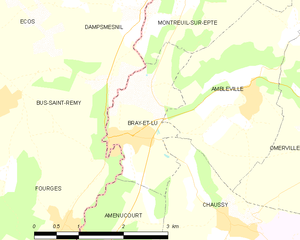
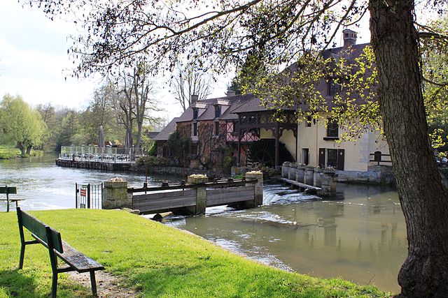
Bray-et-Lû
- commune in Val-d'Oise, France
- Country:
- Postal Code: 95710
- Coordinates: 49° 8' 22" N, 1° 39' 40" E
- GPS tracks (wikiloc): [Link]
- Area: 3.71 sq km
- Population: 950
- Web site: [Link]


Chérence
- commune in Val-d'Oise, France
- Country:
- Postal Code: 95510
- Coordinates: 49° 5' 21" N, 1° 40' 35" E
- GPS tracks (wikiloc): [Link]
- Area: 8.47 sq km
- Population: 161


Chaussy
- commune in Val-d'Oise, France
- Country:
- Postal Code: 95710
- Coordinates: 49° 7' 18" N, 1° 41' 30" E
- GPS tracks (wikiloc): [Link]
- Area: 14.56 sq km
- Population: 599
- Web site: [Link]


La Roche-Guyon
- commune in Val-d'Oise, France
- Country:
- Postal Code: 95780
- Coordinates: 49° 4' 54" N, 1° 37' 46" E
- GPS tracks (wikiloc): [Link]
- Area: 4.61 sq km
- Population: 464
- Web site: [Link]