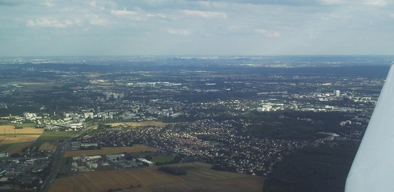
arrondissement of Pontoise (arrondissement de Pontoise)

- arrondissement of France
- Country:

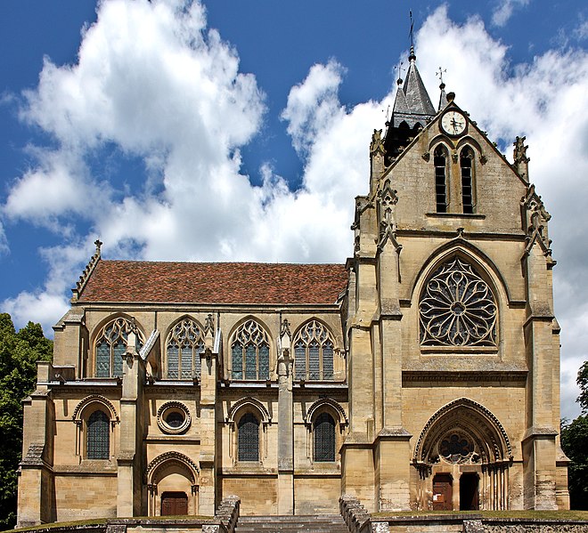
- Capital: Pontoise
- Coordinates: 49° 3' 3" N, 2° 5' 47" E


- GPS tracks (wikiloc): [Link]
- Area: 765.98 sq km
- Population: 337178
- Wikipedia en: wiki(en)
- Wikipedia: wiki(fr)
- Wikidata storage: Wikidata: Q702112
- Wikipedia Commons Category: [Link]
- Freebase ID: [/m/0953_s]
- GeoNames ID: Alt: [2986139]
- INSEE arrondissement code: [953]
Includes regions:

canton of Pontoise
- canton of France
- Country:
- Capital: Pontoise
- Coordinates: 49° 3' 0" N, 2° 6' 0" E
- GPS tracks (wikiloc): [Link]
- Population: 53771

canton of Beaumont-sur-Oise
- canton of France (until March 2015)
- Country:
- Capital: Beaumont-sur-Oise
- Coordinates: 49° 8' 0" N, 2° 17' 0" E
- GPS tracks (wikiloc): [Link]


canton of Franconville
- canton of France
- Country:
- Capital: Franconville
- Coordinates: 48° 59' 0" N, 2° 14' 0" E
- GPS tracks (wikiloc): [Link]
- Population: 58581


canton of l'Hautil
- canton of France (until March 2015)
- Country:
- Capital: Jouy-le-Moutier
- Coordinates: 49° 1' 0" N, 2° 2' 0" E
- GPS tracks (wikiloc): [Link]

canton of Saint-Ouen-l'Aumône
- canton of France
- Country:
- Capital: Saint-Ouen-l'Aumône
- Coordinates: 49° 3' 0" N, 2° 7' 0" E
- GPS tracks (wikiloc): [Link]
- Population: 56487


canton of L'Isle-Adam
- canton of France
- Country:
- Capital: L'Isle-Adam
- Coordinates: 49° 7' 0" N, 2° 14' 0" E
- GPS tracks (wikiloc): [Link]
- Population: 63790

canton of Magny-en-Vexin
- canton of France
- Country:
- Capital: Magny-en-Vexin
- Coordinates: 49° 9' 0" N, 1° 47' 0" E
- GPS tracks (wikiloc): [Link]


canton of Vallée-du-Sausseron
- canton of France (until March 2015)
- Country:
- Capital: Auvers-sur-Oise
- Coordinates: 49° 6' 34" N, 2° 8' 31" E
- GPS tracks (wikiloc): [Link]

canton of Saint-Leu-la-Forêt
- canton of France (until March 2015)
- Country:
- Capital: Saint-Leu-la-Forêt
- Coordinates: 49° 1' 0" N, 2° 15' 0" E
- GPS tracks (wikiloc): [Link]


canton of Ermont
- canton of France
- Country:
- Capital: Ermont
- Coordinates: 48° 59' 0" N, 2° 16' 0" E
- GPS tracks (wikiloc): [Link]
- Population: 53441


canton of Taverny
- canton of France
- Country:
- Capital: Taverny
- Coordinates: 49° 2' 0" N, 2° 13' 0" E
- GPS tracks (wikiloc): [Link]
- Population: 49751
Shares border with regions:


arrondissement of Saint-Germain-en-Laye
- arrondissement of France
- Country:
- Capital: Saint-Germain-en-Laye
- Coordinates: 48° 54' 7" N, 2° 5' 0" E
- GPS tracks (wikiloc): [Link]
- Area: 341 sq km
- Population: 517641


arrondissement of Argenteuil
- arrondissement of France
- Country:
- Capital: Argenteuil
- Coordinates: 48° 56' 51" N, 2° 14' 56" E
- GPS tracks (wikiloc): [Link]
- Area: 108.62 sq km
- Population: 408510


arrondissement of Beauvais
- arrondissement of France
- Country:
- Capital: Beauvais
- Coordinates: 49° 26' 0" N, 2° 4' 0" E
- GPS tracks (wikiloc): [Link]
- Area: 2100 sq km
- Population: 227650

arrondissement of Mantes-la-Jolie
- arrondissement of France
- Country:
- Capital: Mantes-la-Jolie
- Coordinates: 48° 59' 57" N, 1° 41' 41" E
- GPS tracks (wikiloc): [Link]
- Area: 825 sq km
- Population: 270275


arrondissement of Senlis
- arrondissement of France
- Country:
- Capital: Senlis
- Coordinates: 49° 12' 0" N, 2° 35' 0" E
- GPS tracks (wikiloc): [Link]
- Area: 1344 sq km
- Population: 281400


arrondissement of Les Andelys
- arrondissement of France in the Eure department of Haute-Normandie
- Country:
- Capital: Les Andelys
- Coordinates: 49° 15' 0" N, 1° 25' 0" E
- GPS tracks (wikiloc): [Link]
- Population: 235334

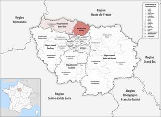
arrondissement of Sarcelles
- French arrondissement in Val-d'Oise
- Country:
- Capital: Sarcelles
- Coordinates: 48° 59' 50" N, 2° 22' 43" E
- GPS tracks (wikiloc): [Link]
- Area: 364 sq km
- Population: 469702