Amirat (Amirat)

- commune in Alpes-Maritimes, France
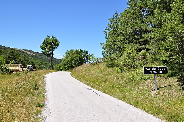
 Hiking in Amirat
Amirat, located near Muscat in Oman, is a great destination for hiking enthusiasts. The region is characterized by its stunning mountainous landscapes, traditional Omani villages, and a rich culture. Here are some highlights and tips for hiking in Amirat:
Hiking Trails
-
Wadi Bani Awf: A short drive from Amirat, this wadi offers breathtaking views, lush date palms, and a chance to explore ancient villages. The trail can be rugged, so it's best suited for those with some hiking experience.
-
Jebel Shams: Known as Oman’s highest peak, Jebel Shams offers various trails ranging from moderate to challenging. You can hike to the summit for panoramic views of the surrounding mountains and the "Grand Canyon of Oman."
-
Wadi Al Arbeieen: This wadi features a beautiful river and is lined with stunning cliffs and steep gorges, making it an excellent destination for a half-day hike.
Best Time to Hike
The best time for hiking in Amirat and the surrounding areas is during the cooler months from October to April. Temperatures can soar in the summer, making it challenging to hike during the day.
Safety Tips
- Stay Hydrated: Carry ample water as the climate can be dry and hot.
- Wear Appropriate Gear: Sturdy hiking shoes and clothing that can protect you from sun exposure are essential.
- Follow Trails: Stick to marked trails to avoid getting lost and to protect the natural environment.
- Check Local Conditions: Always verify current trail conditions and any potential hazards, such as flash floods in wadis.
Cultural Considerations
When hiking in and around villages, be respectful of local customs and traditions. Modest dress is recommended, and it's polite to greet local residents you may encounter.
Conclusion
Hiking in Amirat provides an excellent opportunity to connect with nature and experience the natural beauty of Oman. With proper preparation and respect for the environment, it's an adventure that invites exploration and discovery.
- Country:

- Postal Code: 06910
- Coordinates: 43° 53' 26" N, 6° 49' 27" E


- GPS tracks (wikiloc): [Link]
- Area: 12.95 sq km
- Population: 74
- Web site: http://www.ville-amirat.com
- Wikipedia en: wiki(en)
- Wikipedia: wiki(fr)
- Wikidata storage: Wikidata: Q1060272
- Wikipedia Commons Category: [Link]
- Freebase ID: [/m/03m4z0s]
- Freebase ID: [/m/03m4z0s]
- GeoNames ID: Alt: [3037843]
- GeoNames ID: Alt: [3037843]
- SIREN number: [210600029]
- SIREN number: [210600029]
- INSEE municipality code: 06002
- INSEE municipality code: 06002
Shares border with regions:

La Rochette
- commune in Alpes-de-Haute-Provence, France
Hiking in La Rochette
La Rochette is a quaint village located in the Alpes-de-Haute-Provence region of southeastern France. It is surrounded by stunning natural landscapes, making it a great destination for hiking enthusiasts....
- Country:
- Postal Code: 06260
- Coordinates: 43° 54' 54" N, 6° 53' 26" E
- GPS tracks (wikiloc): [Link]
- Area: 18.8 sq km
- Population: 66
Val-de-Chalvagne
- commune in Alpes-de-Haute-Provence, France
Hiking in Val-de-Chalvagne
Val-de-Chalvagne, located in the Alpes-de-Haute-Provence region of France, offers a variety of beautiful hiking opportunities. The area is characterized by stunning natural landscapes, including scenic valleys, mountains, and rivers, making it a great destination for outdoor enthusiasts....
- Country:
- Postal Code: 04320
- Coordinates: 43° 54' 51" N, 6° 48' 28" E
- GPS tracks (wikiloc): [Link]
- AboveSeaLevel: 900 м m
- Area: 32.57 sq km
- Population: 88
- Web site: [Link]


Briançonnet
- commune in Alpes-Maritimes, France
Hiking in Briançonnet
Briançonnet is a picturesque village located in the Alpes-Maritimes region of France, known for its stunning natural scenery and diverse hiking opportunities. Nestled in the foothills of the Alps, Briançonnet offers a range of trails that cater to different skill levels, making it an excellent destination for both beginner and experienced hikers....
- Country:
- Postal Code: 06850
- Coordinates: 43° 51' 55" N, 6° 45' 28" E
- GPS tracks (wikiloc): [Link]
- Area: 24.32 sq km
- Population: 226

Les Mujouls
- commune in Alpes-Maritimes, France
Hiking in Les Mujouls
Les Mujouls is a picturesque region located in the French Alps, specifically within the larger Vercors Massif area, which is known for its stunning landscapes, rich biodiversity, and outdoor recreational opportunities. Hiking in Les Mujouls offers a chance to explore the rugged terrain, ancient forests, and impressive rock formations, making it a favorite destination for both casual walkers and veteran hikers....
- Country:
- Postal Code: 06910
- Coordinates: 43° 53' 1" N, 6° 51' 37" E
- GPS tracks (wikiloc): [Link]
- Area: 14.55 sq km
- Population: 47

Gars
- commune in Alpes-Maritimes, France
Hiking in Gars
Gars is a picturesque village located in the Alpes-Maritimes region of southern France, nestled in the Pre-Alps near the Verdon Gorge. It offers numerous hiking opportunities that cater to various skill levels, making it a delightful destination for outdoor enthusiasts....
- Country:
- Postal Code: 06850
- Coordinates: 43° 51' 55" N, 6° 48' 13" E
- GPS tracks (wikiloc): [Link]
- Area: 15.57 sq km
- Population: 71


Collongues
- commune in Alpes-Maritimes, France
Hiking in Collongues
Collongues is a charming village located in the Alpes-Maritimes department in the southeastern region of France, nestled within the beautiful landscapes of the French Riviera. Hiking in this area offers a wonderful opportunity to explore the natural beauty and diverse terrain of the region....
- Country:
- Postal Code: 06910
- Coordinates: 43° 53' 17" N, 6° 51' 47" E
- GPS tracks (wikiloc): [Link]
- Area: 10.78 sq km
- Population: 97