Anais (Anais)

- commune in Charente, France
- Country:

- Postal Code: 16560
- Coordinates: 45° 46' 27" N, 0° 12' 32" E


- GPS tracks (wikiloc): [Link]
- AboveSeaLevel: 75 м m
- Area: 9.87 sq km
- Population: 590
- Wikipedia en: wiki(en)
- Wikipedia: wiki(fr)
- Wikidata storage: Wikidata: Q605929
- Wikipedia Commons Category: [Link]
- Freebase ID: [/m/03mbc48]
- GeoNames ID: Alt: [6615958]
- SIREN number: [211600119]
- BnF ID: [15248450m]
- INSEE municipality code: 16011
Shares border with regions:


Jauldes
- commune in Charente, France
- Country:
- Postal Code: 16560
- Coordinates: 45° 47' 8" N, 0° 15' 28" E
- GPS tracks (wikiloc): [Link]
- Area: 25.59 sq km
- Population: 779
- Web site: [Link]

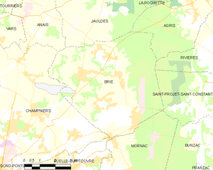
Brie
- commune in Charente, France
- Country:
- Postal Code: 16590
- Coordinates: 45° 44' 16" N, 0° 14' 27" E
- GPS tracks (wikiloc): [Link]
- AboveSeaLevel: 135 м m
- Area: 34.05 sq km
- Population: 4260


Vars
- commune in Charente, France
- Country:
- Postal Code: 16330
- Coordinates: 45° 45' 44" N, 0° 7' 26" E
- GPS tracks (wikiloc): [Link]
- Area: 27.46 sq km
- Population: 2048
- Web site: [Link]


Tourriers
- commune in Charente, France
- Country:
- Postal Code: 16560
- Coordinates: 45° 47' 52" N, 0° 11' 30" E
- GPS tracks (wikiloc): [Link]
- Area: 6.77 sq km
- Population: 759
- Web site: [Link]

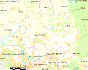
Champniers
- commune in Charente, France
- Country:
- Postal Code: 16430
- Coordinates: 45° 42' 54" N, 0° 12' 20" E
- GPS tracks (wikiloc): [Link]
- Area: 45.29 sq km
- Population: 5217
- Web site: [Link]