
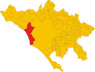
Anguillara Sabazia (Anguillara Sabazia)
.svg)
- Italian comune
 Hiking in Anguillara Sabazia
Anguillara Sabazia is a charming town located on the shores of Lake Bracciano, about 30 kilometers northwest of Rome, Italy. The area is known for its scenic beauty, historic sites, and pleasant walking trails, making it a great destination for hiking enthusiasts.
Hiking Trails and Areas:
-
Lake Bracciano Trails: The trails around Lake Bracciano offer stunning views of the lake and surrounding landscapes. You can enjoy paths that run along the water's edge, providing opportunities for both leisurely strolls and more challenging hikes.
-
Nature Reserves: The nearby Bracciano–Martignano Nature Reserve features various hiking trails through wooded areas, grasslands, and along the shores of the lakes. The reserve is home to diverse flora and fauna, making it a great spot for nature lovers.
-
Historic Trails: Anguillara Sabazia has a rich history, and there are trails that connect to ancient sites and historical landmarks in the area. Hiking through the town itself allows you to explore medieval architecture and local culture.
-
Countryside Paths: The landscape around Anguillara includes rolling hills and vineyards. Trails through the countryside can offer a peaceful hiking experience while allowing you to taste the local wine and cuisine in nearby agriturismi (farm stays).
Tips for Hiking in Anguillara Sabazia:
-
Best Time to Visit: Spring and early autumn are ideal for hiking, with mild temperatures and beautiful scenery. Avoid the hottest summer months to ensure a more comfortable experience.
-
Equipment: Wear sturdy hiking shoes and bring plenty of water. A light backpack with snacks and a map or GPS device can be helpful.
-
Respect Nature: Follow the principles of Leave No Trace to protect the natural environment while hiking.
-
Local Resources: Consider visiting the local tourism office for maps and additional information about trails, guided hikes, or organized events.
Conclusion:
Hiking in Anguillara Sabazia offers a delightful combination of natural beauty, history, and culture. Whether you're seeking a leisurely walk along the scenic lakeside or a more vigorous hike in the surrounding hills, there's something for everyone to enjoy in this picturesque part of Italy.
- Country:

- Postal Code: 00061
- Local Dialing Code: 06
- Licence Plate Code: RM
- Coordinates: 42° 5' 18" N, 12° 16' 39" E


- GPS tracks (wikiloc): [Link]
- AboveSeaLevel: 195 м m
- Area: 74.93 sq km
- Population: 19426
- Web site: http://www.comune.anguillara-sabazia.roma.it
- Wikipedia en: wiki(en)
- Wikipedia: wiki(it)
- Wikidata storage: Wikidata: Q241693
- Wikipedia Commons Gallery: [Link]
- Wikipedia Commons Category: [Link]
- Freebase ID: [/m/0gm6qh]
- GeoNames ID: Alt: [6538666]
- BnF ID: [11992214f]
- VIAF ID: Alt: [127105644]
- OSM relation ID: [41722]
- GND ID: Alt: [4357532-8]
- Library of Congress authority ID: Alt: [nr87000846]
- Quora topic ID: [Anguillara-Sabazia]
- TGN ID: [7007173]
- Trismegistos Geo ID: [31977]
- ISTAT ID: 058005
- Italian cadastre code: A297
Shares border with regions:

Fiumicino
- Italian comune
Hiking in Fiumicino
Fiumicino, known primarily for its airport, is located near the coast of the Tyrrhenian Sea in Italy, just southwest of Rome. While it may not be a traditional hiking destination, there are a few areas and opportunities for outdoor activities in and around the Fiumicino area that you might find interesting....
- Country:
- Postal Code: 00054
- Local Dialing Code: 06
- Licence Plate Code: ROMA
- Coordinates: 41° 46' 0" N, 12° 14' 0" E
- GPS tracks (wikiloc): [Link]
- AboveSeaLevel: 4 м m
- Area: 213.89 sq km
- Population: 79630
- Web site: [Link]
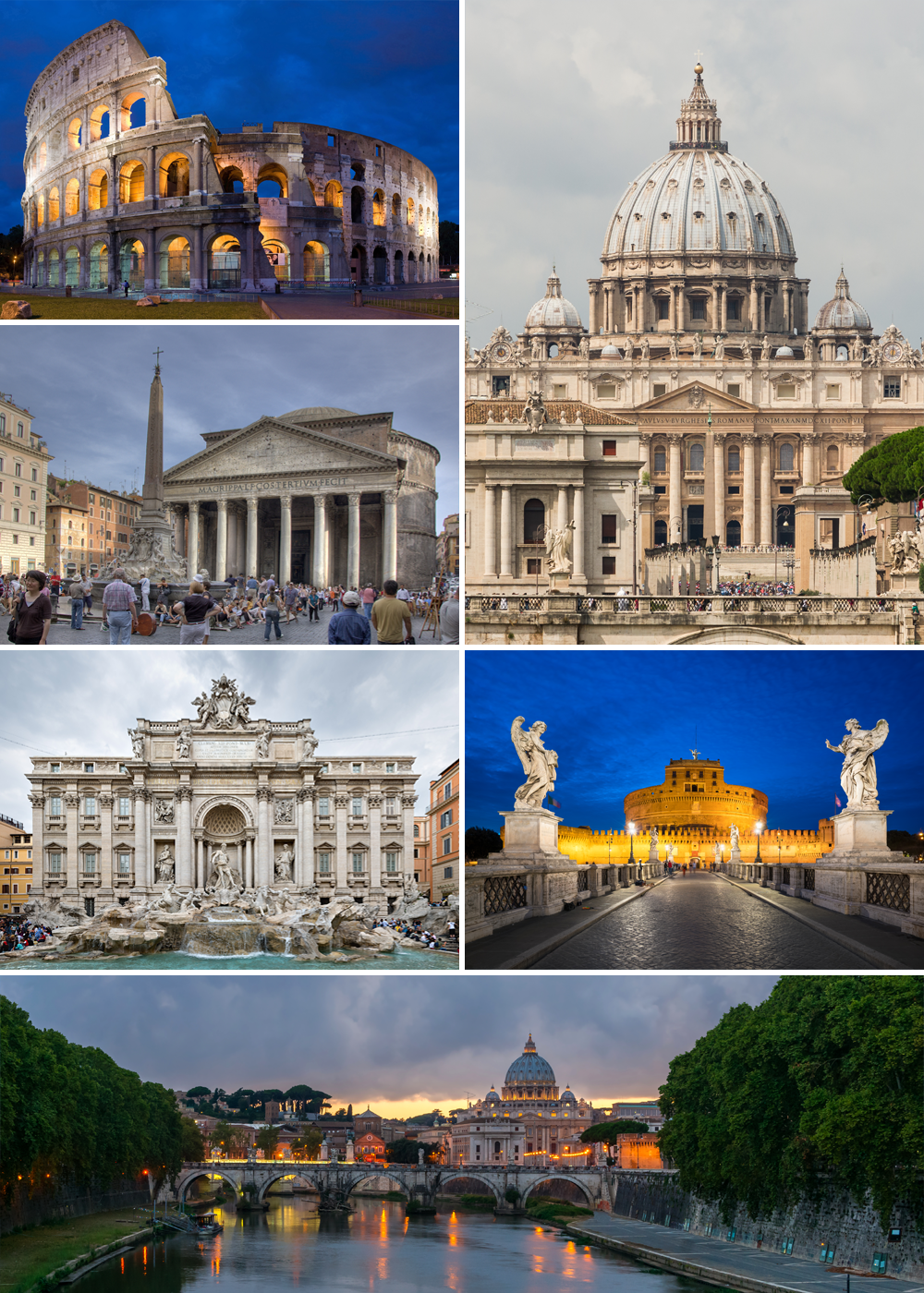

Rome
- capital and largest city of Italy
Hiking in Rome
Hiking in and around Rome offers a unique way to explore not just the historic city itself but also the beautiful landscapes and trails in the surrounding areas. While most visitors focus on the city’s famous landmarks, hiking provides a different perspective and a chance to escape the hustle and bustle. Here are some great options for hiking in Rome and its surroundings:...
- Country:
- Postal Code: 00118–00199
- Local Dialing Code: 06
- Licence Plate Code: RM
- Coordinates: 41° 53' 35" N, 12° 28' 58" E
- GPS tracks (wikiloc): [Link]
- AboveSeaLevel: 21 м m
- Area: 1287.36 sq km
- Population: 2873494
- Web site: [Link]
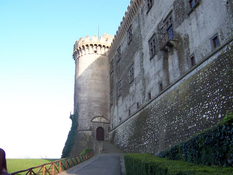

Bracciano
- Italian comune
Hiking in Bracciano
Bracciano, a charming town located in the Lazio region of Italy, is known for its beautiful landscapes, rich history, and proximity to Lake Bracciano. The area offers several excellent hiking opportunities, ranging from easy walks to more challenging trails, suitable for hikers of all levels....
- Country:
- Postal Code: 00062
- Local Dialing Code: 06
- Licence Plate Code: ROMA
- Coordinates: 42° 6' 0" N, 12° 11' 0" E
- GPS tracks (wikiloc): [Link]
- AboveSeaLevel: 280 м m
- Area: 143.06 sq km
- Population: 19219
- Web site: [Link]


Campagnano di Roma
- Italian comune
Hiking in Campagnano di Roma
Campagnano di Roma, a charming town located in the Province of Rome, offers a variety of hiking opportunities that showcase the natural beauty and historical richness of the region. Here are some insights on hiking in and around Campagnano di Roma:...
- Country:
- Postal Code: 00063
- Local Dialing Code: 06
- Licence Plate Code: RM
- Coordinates: 42° 8' 0" N, 12° 23' 0" E
- GPS tracks (wikiloc): [Link]
- AboveSeaLevel: 270 м m
- Area: 46.94 sq km
- Population: 11561
- Web site: [Link]


Cerveteri
- Italian comune
Hiking in Cerveteri
Cerveteri, located in the Lazio region of Italy, is well-known for its rich Etruscan history and archaeological sites, particularly the Banditaccia Necropolis, a UNESCO World Heritage site. While it's not primarily known as a hiking destination, there are several beautiful trails and areas in and around Cerveteri that offer pleasant hiking experiences, allowing you to explore its natural beauty and historical significance....
- Country:
- Postal Code: 00052
- Local Dialing Code: 0699
- Licence Plate Code: ROMA
- Coordinates: 42° 0' 0" N, 12° 6' 0" E
- GPS tracks (wikiloc): [Link]
- AboveSeaLevel: 81 м m
- Area: 134.32 sq km
- Population: 37977
- Web site: [Link]


Trevignano Romano
- Italian comune
Hiking in Trevignano Romano
Trevignano Romano, located in the Lazio region of Italy along the shores of Lake Bracciano, is a picturesque destination that offers beautiful hiking opportunities amidst stunning natural scenery. Here are some highlights about hiking in this area:...
- Country:
- Postal Code: 00069
- Local Dialing Code: 06
- Licence Plate Code: RM
- Coordinates: 42° 9' 0" N, 12° 15' 0" E
- GPS tracks (wikiloc): [Link]
- AboveSeaLevel: 173 м m
- Area: 38.99 sq km
- Population: 5711
- Web site: [Link]