
Province of Rome (provincia di Roma)
- former province in the Lazio region of Italy
Hiking in the Province of Rome offers diverse landscapes, historical significance, and a rich cultural backdrop. The region, established in 1870, features a mix of natural parks, ancient ruins, and beautiful countryside that attract hikers of all levels.
Natural Parks and Trails
-
Parco Regionale dei Castelli Romani: This park is located within the ancient volcanic area south of Rome. The trails here take you through charming villages, vineyards, and stunning lakes, such as Lake Albano and Lake Nemi. The area is known for its biodiversity and scenic views.
-
Parco Naturale dell'Appia Antica: This park contains the ancient Appian Way and allows hikers to journey through history while enjoying the surrounding nature. The trail is lined with historical sites, tombs, and ruins from the Roman Empire, making it a culturally rich hiking experience.
-
Parco Nazionale del Circeo: For those looking for a coastal experience, this national park showcases diverse ecosystems including coastal dunes, forests, and marshlands. You can hike along trails that offer views of the Tyrrhenian Sea.
Cultural and Historical Context
Hiking in this region also provides a glimpse into the historical evolution of the area from the unification of Italy in 1870 to modern times. Many trails follow ancient routes once used by Roman armies and traders. Historical landmarks abound, with numerous ruins, castles, and churches dotting the landscape.
Challenges and Considerations
The diverse trails range from easy walks to more challenging hikes, accommodating all fitness levels. Hikers should prepare adequately, considering weather conditions and trail lengths. It’s advisable to carry enough water, wear sturdy hiking shoes, and check local advice for trail conditions.
Modern Developments
In recent years, there has been an increased emphasis on sustainable tourism and conservation efforts in the region. Hikers are encouraged to follow the "Leave No Trace" principles, ensuring that the natural beauty of the Province of Rome is preserved for future generations.
Conclusion
Whether you’re interested in the natural beauty, the historical context, or the cultural richness of the area, hiking in the Province of Rome offers a unique experience driven by centuries of history and nature intertwined.
- Country:

- Capital: Rome
- Postal Code: 00118-00199 (Roma), 00010-00069 (provincia)
- Licence Plate Code: RM
- Coordinates: 41° 53' 35" N, 12° 28' 58" E


- GPS tracks (wikiloc): [Link]
- Area: 5363.28 sq km
- Web site: http://www.provincia.roma.it/
- Wikipedia en: wiki(en)
- Wikipedia: wiki(it)
- Wikidata storage: Wikidata: Q15119
- Wikipedia Commons Gallery: [Link]
- Wikipedia Commons Category: [Link]
- Freebase ID: [/m/098phg]
- GeoNames ID: Alt: [3169069]
- BnF ID: [11932804j]
- VIAF ID: Alt: [155365550]
- GND ID: Alt: [4473043-3]
- archINFORM location ID: [2588]
- Library of Congress authority ID: Alt: [n79086777]
- PACTOLS thesaurus ID: [pcrtxTU0Uwa0SZ]
- MusicBrainz area ID: [184969d8-461e-43be-8728-288358ebe487]
- TGN ID: [7003138]
- SUDOC authorities ID: [028059387]
- Gran Enciclopèdia Catalana ID: [0056583]
- NUTS code: [ITI43]
- ISTAT ID: 058
- ISO 3166-2 code: IT-RM
Includes regions:


Zagarolo
- Italian comune
Zagarolo, located in the Lazio region of Italy, is a charming town with beautiful landscapes ideal for hiking enthusiasts. The surrounding area is characterized by rolling hills, lush vegetation, and stunning views of the Roman countryside. Here are some highlights about hiking in Zagarolo:...
- Country:

- Postal Code: 00039
- Local Dialing Code: 06
- Licence Plate Code: RM
- Coordinates: 41° 50' 0" N, 12° 50' 0" E


- GPS tracks (wikiloc): [Link]
- AboveSeaLevel: 303 м m
- Area: 28.04 sq km
- Population: 17933
- Web site: [Link]
Monteflavio
- Italian comune
Monteflavio is a charming village located in the Province of Rome, Italy, nestled in the beautiful Sabine Hills. The area around Monteflavio offers several opportunities for hiking, characterized by its lush landscapes, historic sites, and panoramic views....
- Country:

- Postal Code: 00010
- Local Dialing Code: 0774
- Licence Plate Code: RM
- Coordinates: 42° 6' 30" N, 12° 49' 51" E


- GPS tracks (wikiloc): [Link]
- AboveSeaLevel: 800 м m
- Area: 16.84 sq km
- Population: 1285
- Web site: [Link]
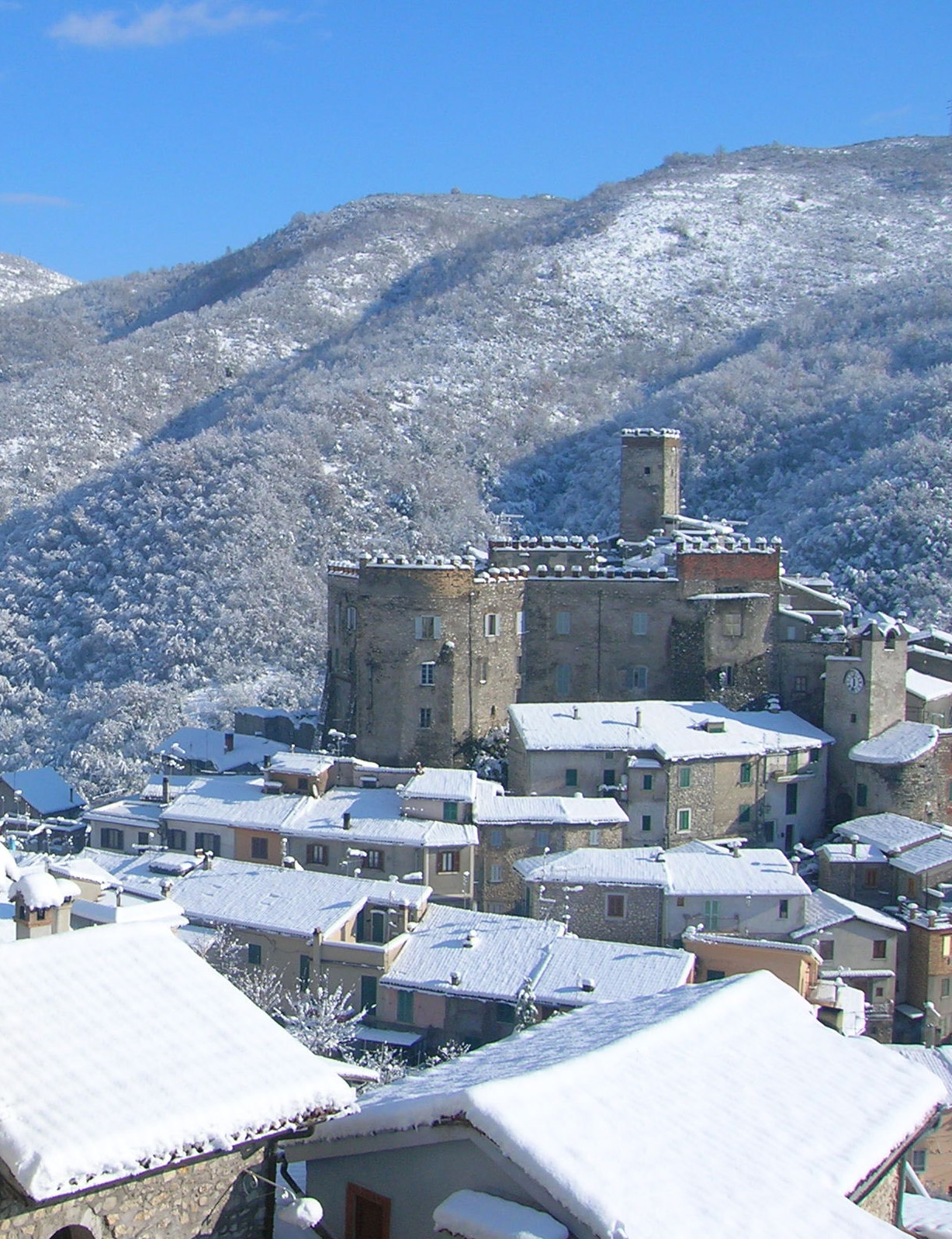

Cineto Romano
- Italian comune
Cineto Romano is a charming village located in the Lazio region of Italy, not far from Rome. Nestled in the Sabine Hills, it's an excellent destination for hiking enthusiasts, offering a blend of natural beauty, historical sites, and cultural experiences....
- Country:

- Postal Code: 00020
- Local Dialing Code: 0774
- Licence Plate Code: RM
- Coordinates: 42° 3' 1" N, 12° 57' 54" E


- GPS tracks (wikiloc): [Link]
- AboveSeaLevel: 519 м m
- Area: 10.37 sq km
- Population: 586
- Web site: [Link]
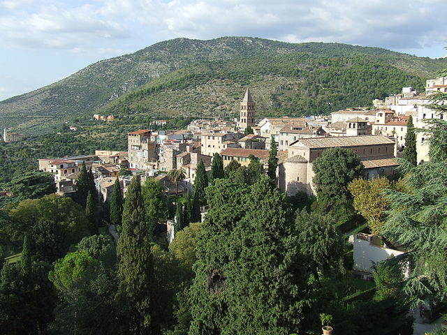

Tivoli
- Italian comune
Tivoli, located in the Lazio region of Italy, is renowned for its stunning landscapes, historical sites, and beautiful villas. Here are some key points for hikers looking to explore this picturesque area:...
- Country:

- Postal Code: 00019; 00011; 00010
- Local Dialing Code: 0774
- Licence Plate Code: ROMA
- Coordinates: 41° 58' 0" N, 12° 48' 0" E


- GPS tracks (wikiloc): [Link]
- AboveSeaLevel: 235 м m
- Area: 68.65 sq km
- Population: 56603
- Web site: [Link]
Cave
- comune in Italy
Cave, located in the province of Rome in the Lazio region of Italy, offers a charming escape for hikers and nature enthusiasts. The area is characterized by its picturesque landscapes, rich history, and diverse flora and fauna....
- Country:

- Postal Code: 00033
- Local Dialing Code: 06
- Licence Plate Code: RM
- Coordinates: 41° 49' 0" N, 12° 56' 0" E


- GPS tracks (wikiloc): [Link]
- AboveSeaLevel: 399 м m
- Area: 17.88 sq km
- Population: 11381
- Web site: [Link]


Velletri
- Italian comune
Velletri, a town located in the Castelli Romani region of Italy, offers a variety of hiking opportunities that showcase the natural beauty and historical significance of the area. Here are some key points about hiking in Velletri:...
- Country:

- Postal Code: 00049
- Local Dialing Code: 06
- Licence Plate Code: ROMA
- Coordinates: 41° 40' 0" N, 12° 47' 0" E


- GPS tracks (wikiloc): [Link]
- AboveSeaLevel: 332 м m
- Area: 113.23 sq km
- Population: 53188
- Web site: [Link]
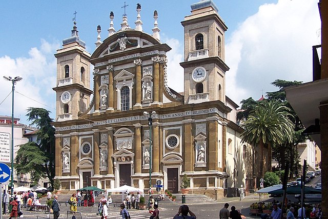

Frascati
- Italian comune
Frascati, located just a short distance from Rome, is a charming town in the Castelli Romani region of Italy, known for its beautiful landscapes, vineyards, and historical sites. Hiking in Frascati offers a unique blend of natural beauty, cultural attractions, and gastronomy....
- Country:

- Postal Code: 00044
- Local Dialing Code: 06
- Licence Plate Code: ROMA
- Coordinates: 41° 49' 0" N, 12° 41' 0" E


- GPS tracks (wikiloc): [Link]
- AboveSeaLevel: 320 м m
- Area: 22.48 sq km
- Population: 22450
- Web site: [Link]
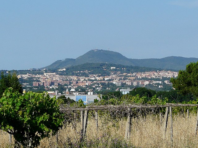

Albano Laziale
- Italian comune
Albano Laziale, located in the region of Lazio, Italy, is a picturesque town that offers a variety of hiking opportunities surrounded by natural beauty and historical significance. Here are some highlights for hiking in this area:...
- Country:

- Postal Code: 00041
- Local Dialing Code: 06
- Licence Plate Code: ROMA
- Coordinates: 41° 44' 0" N, 12° 40' 0" E


- GPS tracks (wikiloc): [Link]
- AboveSeaLevel: 400 м m
- Area: 24.37 sq km
- Population: 41314
- Web site: [Link]

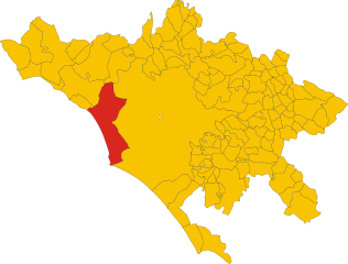
Fiumicino
- Italian comune
Fiumicino, known primarily for its airport, is located near the coast of the Tyrrhenian Sea in Italy, just southwest of Rome. While it may not be a traditional hiking destination, there are a few areas and opportunities for outdoor activities in and around the Fiumicino area that you might find interesting....
- Country:

- Postal Code: 00054
- Local Dialing Code: 06
- Licence Plate Code: ROMA
- Coordinates: 41° 46' 0" N, 12° 14' 0" E


- GPS tracks (wikiloc): [Link]
- AboveSeaLevel: 4 м m
- Area: 213.89 sq km
- Population: 79630
- Web site: [Link]


Rome
- capital and largest city of Italy
Hiking in and around Rome offers a unique way to explore not just the historic city itself but also the beautiful landscapes and trails in the surrounding areas. While most visitors focus on the city’s famous landmarks, hiking provides a different perspective and a chance to escape the hustle and bustle. Here are some great options for hiking in Rome and its surroundings:...
- Country:

- Postal Code: 00118–00199
- Local Dialing Code: 06
- Licence Plate Code: RM
- Coordinates: 41° 53' 35" N, 12° 28' 58" E


- GPS tracks (wikiloc): [Link]
- AboveSeaLevel: 21 м m
- Area: 1287.36 sq km
- Population: 2873494
- Web site: [Link]


Affile
- Italian comune
Affile is a charming village located in the province of Rome, Italy, nestled in the beautiful landscape of the Monti Simbruini Regional Park. This region offers diverse hiking opportunities due to its varied terrain, rich biodiversity, and stunning vistas....
- Country:

- Postal Code: 00021
- Local Dialing Code: 0774
- Licence Plate Code: RM
- Coordinates: 41° 53' 6" N, 13° 5' 46" E


- GPS tracks (wikiloc): [Link]
- AboveSeaLevel: 684 м m
- Area: 15.11 sq km
- Population: 1502
- Web site: [Link]


Agosta, Lazio
- Italian comune
Agosta, a charming town located in the Lazio region of Italy, is nestled in the Aniene Valley and offers beautiful landscapes and outdoor activities, making it a great destination for hiking enthusiasts. Here are some key points to consider when hiking in and around Agosta:...
- Country:

- Postal Code: 00020
- Local Dialing Code: 0774
- Licence Plate Code: ROMA
- Coordinates: 41° 58' 57" N, 13° 2' 1" E


- GPS tracks (wikiloc): [Link]
- AboveSeaLevel: 392 м m
- Area: 9.5 sq km
- Population: 1742
- Web site: [Link]

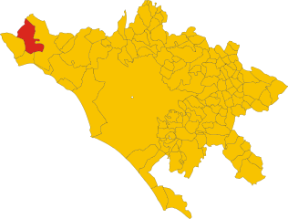
Allumiere
- Italian comune
Allumiere, a charming town located in the Lazio region of Italy, is surrounded by stunning natural landscapes, making it a great destination for hiking enthusiasts. The area is part of the larger Monti della Tolfa mountain range, characterized by rolling hills, lush forests, and scenic vistas....
- Country:

- Postal Code: 00051
- Local Dialing Code: 0766
- Licence Plate Code: RM
- Coordinates: 42° 9' 25" N, 11° 54' 17" E


- GPS tracks (wikiloc): [Link]
- AboveSeaLevel: 522 м m
- Area: 92.17 sq km
- Population: 4059
- Web site: [Link]


Anguillara Sabazia
- Italian comune
Anguillara Sabazia is a charming town located on the shores of Lake Bracciano, about 30 kilometers northwest of Rome, Italy. The area is known for its scenic beauty, historic sites, and pleasant walking trails, making it a great destination for hiking enthusiasts....
- Country:

- Postal Code: 00061
- Local Dialing Code: 06
- Licence Plate Code: RM
- Coordinates: 42° 5' 18" N, 12° 16' 39" E


- GPS tracks (wikiloc): [Link]
- AboveSeaLevel: 195 м m
- Area: 74.93 sq km
- Population: 19426
- Web site: [Link]
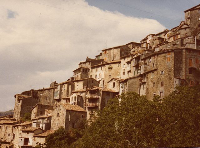

Anticoli Corrado
- Italian comune
Anticoli Corrado is a charming village located in the Lazio region of Italy, nestled in the Aniene Valley and surrounded by the stunning scenery of the Simbruini Mountains. Hiking in this area offers a range of experiences from leisurely walks to more challenging treks, suitable for various skill levels....
- Country:

- Postal Code: 00022
- Local Dialing Code: 0774
- Licence Plate Code: ROMA
- Coordinates: 42° 1' 0" N, 12° 59' 0" E


- GPS tracks (wikiloc): [Link]
- AboveSeaLevel: 508 м m
- Area: 16.22 sq km
- Population: 896
- Web site: [Link]


Anzio
- Italian comune
Hiking in Anzio, a coastal town located on the Tyrrhenian Sea in central Italy, offers a unique combination of beautiful landscapes, rich history, and cultural experiences. Here are some highlights to consider if you're planning to hike in this area:...
- Country:

- Postal Code: 00042
- Local Dialing Code: 06
- Licence Plate Code: ROMA
- Coordinates: 41° 26' 50" N, 12° 37' 42" E


- GPS tracks (wikiloc): [Link]
- AboveSeaLevel: 3 м m
- Area: 43.65 sq km
- Population: 54710
- Web site: [Link]
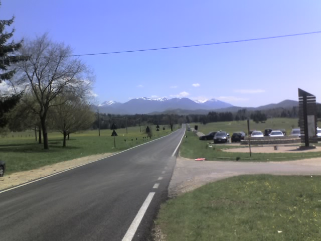

Arcinazzo Romano
- Italian comune
Arcinazzo Romano is a charming village located in the province of Frosinone, in the Lazio region of Italy. It’s surrounded by stunning natural landscapes, making it a great destination for hiking enthusiasts. Here’s a guide to hiking in this beautiful area:...
- Country:

- Postal Code: 00020
- Local Dialing Code: 0774
- Licence Plate Code: RM
- Coordinates: 41° 53' 0" N, 13° 7' 0" E


- GPS tracks (wikiloc): [Link]
- AboveSeaLevel: 831 м m
- Area: 28.31 sq km
- Population: 1344
- Web site: [Link]


Ardea
- Italian comune
Ardea, located in the Lazio region of Italy, is an area that offers unique opportunities for hiking, particularly due to its proximity to the coastline and the rich natural landscapes. Here are some highlights for hiking in and around Ardea:...
- Country:

- Postal Code: 00040
- Local Dialing Code: 06
- Licence Plate Code: ROMA
- Coordinates: 41° 37' 0" N, 12° 33' 0" E


- GPS tracks (wikiloc): [Link]
- AboveSeaLevel: 37 м m
- Area: 72.09 sq km
- Population: 49663
- Web site: [Link]


Ariccia
- Italian comune
Ariccia, located in the Lazio region of Italy, is known for its scenic landscapes and charming historical architecture. While it's primarily recognized for its beautiful palaces and famous porchetta, it also offers some lovely opportunities for hiking in the surrounding areas....
- Country:

- Postal Code: 00040
- Local Dialing Code: 06
- Licence Plate Code: ROMA
- Coordinates: 41° 43' 0" N, 12° 40' 0" E


- GPS tracks (wikiloc): [Link]
- AboveSeaLevel: 412 м m
- Area: 18.59 sq km
- Population: 18851
- Web site: [Link]


Arsoli
- Italian comune
Arsoli is a charming village located in the province of Rome, Italy, and is surrounded by beautiful natural landscapes that offer fantastic hiking opportunities. Nestled in the Simbruini Mountains, the area is characterized by its rugged terrain, lush forests, and stunning views, making it an excellent destination for outdoor enthusiasts....
- Country:

- Postal Code: 00023
- Local Dialing Code: 0774
- Licence Plate Code: RM
- Coordinates: 42° 2' 26" N, 13° 1' 4" E


- GPS tracks (wikiloc): [Link]
- AboveSeaLevel: 470 м m
- Area: 12.2 sq km
- Population: 1534
- Web site: [Link]

Artena
- Italian comune
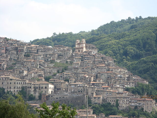
Artena is a charming hilltop town located in the province of Rome, Italy. It is set in the beautiful landscape of the Lazio region, surrounded by hills, forests, and panoramic views, making it a great destination for hiking enthusiasts. Here are a few highlights about hiking in and around Artena:...
- Country:

- Postal Code: 00031
- Local Dialing Code: 06
- Licence Plate Code: RM
- Coordinates: 41° 44' 0" N, 12° 55' 0" E


- GPS tracks (wikiloc): [Link]
- AboveSeaLevel: 420 м m
- Area: 54.8 sq km
- Population: 14107
- Web site: [Link]

Bellegra
- Italian comune
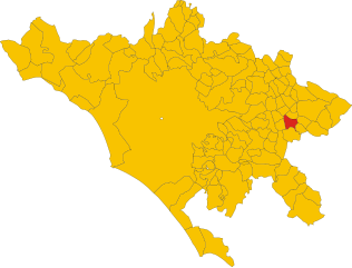
Bellegra, nestled in the beautiful Aniene Valley of Italy, offers a variety of hiking opportunities that showcase the region's stunning natural landscapes, rich history, and diverse flora and fauna. Here’s an overview of what you can expect when hiking in this scenic area:...
- Country:

- Postal Code: 00030
- Local Dialing Code: 06
- Licence Plate Code: ROMA
- Coordinates: 41° 53' 0" N, 13° 2' 0" E


- GPS tracks (wikiloc): [Link]
- AboveSeaLevel: 815 м m
- Area: 18.78 sq km
- Population: 2841
- Web site: [Link]

Bracciano
- Italian comune
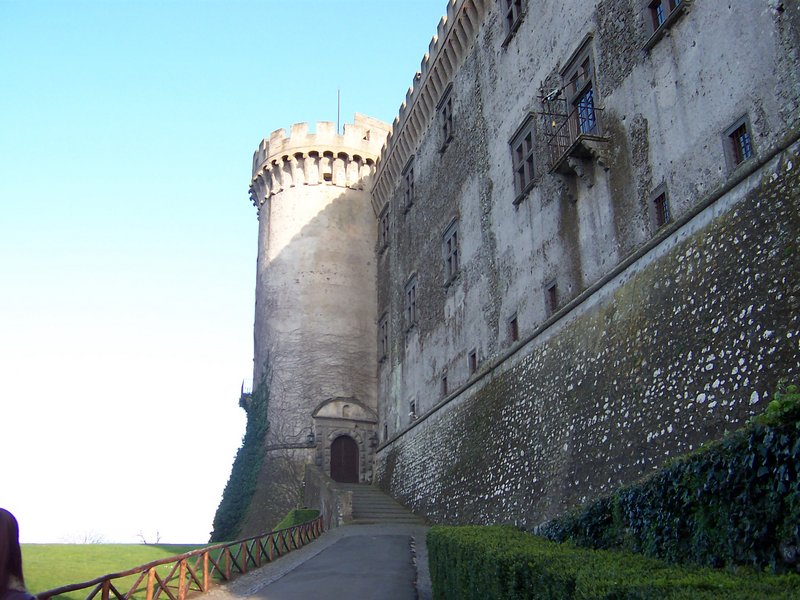
Bracciano, a charming town located in the Lazio region of Italy, is known for its beautiful landscapes, rich history, and proximity to Lake Bracciano. The area offers several excellent hiking opportunities, ranging from easy walks to more challenging trails, suitable for hikers of all levels....
- Country:

- Postal Code: 00062
- Local Dialing Code: 06
- Licence Plate Code: ROMA
- Coordinates: 42° 6' 0" N, 12° 11' 0" E


- GPS tracks (wikiloc): [Link]
- AboveSeaLevel: 280 м m
- Area: 143.06 sq km
- Population: 19219
- Web site: [Link]
Camerata Nuova
- Italian comune
Camerata Nuova is a charming village located in the province of Rome, Italy, nestled within the beautiful landscape of the Apennine Mountains. This area is known for its natural beauty, making it a fantastic destination for hiking enthusiasts....
- Country:

- Postal Code: 00020
- Local Dialing Code: 0774
- Licence Plate Code: RM
- Coordinates: 42° 1' 0" N, 13° 6' 0" E


- GPS tracks (wikiloc): [Link]
- AboveSeaLevel: 810 м m
- Area: 40.5 sq km
- Population: 445
- Web site: [Link]


Campagnano di Roma
- Italian comune
Campagnano di Roma, a charming town located in the Province of Rome, offers a variety of hiking opportunities that showcase the natural beauty and historical richness of the region. Here are some insights on hiking in and around Campagnano di Roma:...
- Country:

- Postal Code: 00063
- Local Dialing Code: 06
- Licence Plate Code: RM
- Coordinates: 42° 8' 0" N, 12° 23' 0" E


- GPS tracks (wikiloc): [Link]
- AboveSeaLevel: 270 м m
- Area: 46.94 sq km
- Population: 11561
- Web site: [Link]

Canale Monterano
- Italian comune
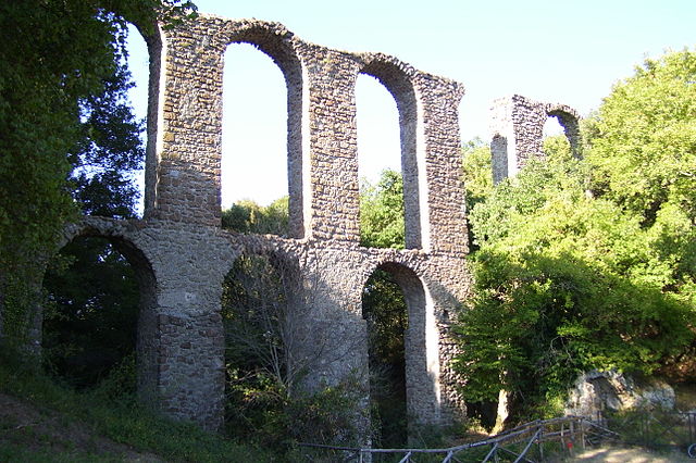
Canale Monterano, located in the Lazio region of Italy, is a beautiful and lesser-known hiking destination that offers a unique combination of natural beauty, historical ruins, and a rich biodiversity. The area is particularly famous for its stunning landscapes, including cliffs, valleys, and woodlands....
- Country:

- Postal Code: 00060
- Local Dialing Code: 06
- Licence Plate Code: ROMA
- Coordinates: 42° 8' 0" N, 12° 6' 0" E


- GPS tracks (wikiloc): [Link]
- AboveSeaLevel: 378 м m
- Area: 36.92 sq km
- Population: 4165
- Web site: [Link]


Canterano
- Italian comune
Canterano is a small town located in the Lazio region of Italy, surrounded by beautiful natural landscapes, making it an appealing destination for hiking enthusiasts. Situated in the Sabine Hills, Canterano offers a variety of trails that cater to different skill levels, from gentle walks to more challenging hikes....
- Country:

- Postal Code: 00020
- Local Dialing Code: 0774
- Licence Plate Code: ROMA
- Coordinates: 41° 57' 0" N, 13° 2' 0" E


- GPS tracks (wikiloc): [Link]
- AboveSeaLevel: 602 м m
- Area: 7.37 sq km
- Population: 325
- Web site: [Link]


Capena
- Italian comune
Capena is a charming town located in the Lazio region of Italy, close to Rome, and offers several hiking opportunities for both beginners and experienced hikers. The surrounding area features a mix of natural beauty and historical significance, making it an attractive destination for outdoor enthusiasts....
- Country:

- Postal Code: 00060
- Local Dialing Code: 06
- Licence Plate Code: ROMA
- Coordinates: 42° 8' 25" N, 12° 32' 25" E


- GPS tracks (wikiloc): [Link]
- AboveSeaLevel: 160 м m
- Area: 29.51 sq km
- Population: 10799
- Web site: [Link]
Capranica Prenestina
- Italian comune
 Hiking in Capranica Prenestina
Capranica Prenestina is a beautiful town nestled in the eastern part of the Lazio region in Italy, known for its scenic landscapes and rich historical heritage. Hiking in this area offers a delightful blend of nature, cultural exploration, and stunning views of the surrounding countryside....
- Country:

- Postal Code: 00030
- Local Dialing Code: 06
- Licence Plate Code: RM
- Coordinates: 41° 52' 0" N, 12° 57' 0" E


- GPS tracks (wikiloc): [Link]
- AboveSeaLevel: 915 м m
- Area: 20.36 sq km
- Population: 332
- Web site: [Link]


Carpineto Romano
- Italian comune
Carpineto Romano, located in the Lazio region of Italy, is a wonderful destination for hiking enthusiasts. Nestled in the Monti Lepini mountain range, this charming town is surrounded by stunning natural landscapes, making it an ideal spot for various outdoor activities....
- Country:

- Postal Code: 00032
- Local Dialing Code: 06
- Licence Plate Code: ROMA
- Coordinates: 41° 36' 0" N, 13° 5' 0" E


- GPS tracks (wikiloc): [Link]
- AboveSeaLevel: 550 м m
- Area: 86.29 sq km
- Population: 4425
- Web site: [Link]
Casape
- Italian comune
Casape, a picturesque town in the Lazio region of Italy, offers beautiful landscapes and a variety of hiking opportunities. Here are some key points to consider if you're planning a hiking trip in and around Casape:...
- Country:

- Postal Code: 00010
- Local Dialing Code: 0774
- Licence Plate Code: RM
- Coordinates: 41° 54' 25" N, 12° 53' 8" E


- GPS tracks (wikiloc): [Link]
- AboveSeaLevel: 475 м m
- Area: 5.38 sq km
- Population: 699
- Web site: [Link]


Castel Gandolfo
- Italian comune
Castel Gandolfo, located in the Alban Hills of Italy, is famous not only for its breathtaking views of Lake Albano but also for its rich history and natural beauty, making it an excellent destination for hikers. Here are some highlights for hiking in this picturesque area:...
- Country:

- Postal Code: 00040
- Local Dialing Code: 06
- Licence Plate Code: RM
- Coordinates: 41° 45' 0" N, 12° 39' 0" E


- GPS tracks (wikiloc): [Link]
- AboveSeaLevel: 426 м m
- Area: 14.19 sq km
- Population: 8922
- Web site: [Link]

Castel Madama
- Italian comune
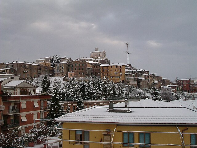
Castel Madama is a charming medieval town located in the province of Rome, Italy, surrounded by beautiful natural landscapes, making it an excellent destination for hiking enthusiasts. Here are some key points you might find interesting:...
- Country:

- Postal Code: 00024
- Local Dialing Code: 0774
- Licence Plate Code: ROMA
- Coordinates: 41° 58' 29" N, 12° 52' 2" E


- GPS tracks (wikiloc): [Link]
- AboveSeaLevel: 428 м m
- Area: 28.8 sq km
- Population: 7328
- Web site: [Link]
Castel San Pietro Romano
- Italian comune
 Hiking in Castel San Pietro Romano
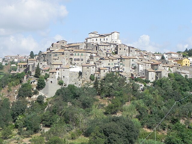
Castel San Pietro Romano is a picturesque village in the province of Rome, Italy, nestled in the hills of the Anzio and Latina regions. This area offers a variety of hiking trails that cater to different skill levels and provide stunning views and a chance to explore the natural beauty of central Italy....
- Country:

- Postal Code: 00030
- Local Dialing Code: 06
- Licence Plate Code: ROMA
- Coordinates: 41° 50' 45" N, 12° 53' 42" E


- GPS tracks (wikiloc): [Link]
- AboveSeaLevel: 752 м m
- Area: 15.29 sq km
- Population: 876
- Web site: [Link]

Castelnuovo di Porto
- Italian comune
 Hiking in Castelnuovo di Porto
Castelnuovo di Porto, located in the Lazio region of Italy, offers a variety of beautiful hiking opportunities that showcase the region's natural beauty and history. Nestled between the Tiber River and the hills of the Sabina region, the area is characterized by its picturesque landscapes, rolling hills, and charming medieval architecture....
- Country:

- Postal Code: 00060
- Local Dialing Code: 06
- Licence Plate Code: ROMA
- Coordinates: 42° 7' 40" N, 12° 30' 0" E


- GPS tracks (wikiloc): [Link]
- AboveSeaLevel: 250 м m
- Area: 30.57 sq km
- Population: 8564
- Web site: [Link]


Cervara di Roma
- Italian comune
Cervara di Roma is a charming mountain village located in the Apennines, known for its stunning landscapes, rich history, and excellent hiking opportunities. Here are some highlights about hiking in and around Cervara di Roma:...
- Country:

- Postal Code: 00020
- Local Dialing Code: 0774
- Licence Plate Code: RM
- Coordinates: 41° 59' 17" N, 13° 4' 2" E


- GPS tracks (wikiloc): [Link]
- AboveSeaLevel: 1053 м m
- Area: 31.75 sq km
- Population: 438
- Web site: [Link]
Cerreto Laziale
- Italian comune
Cerreto Laziale is a charming village located in the Lazio region of Italy, not far from Rome. It offers a variety of hiking opportunities, often characterized by beautiful landscapes, historic towns, and lush nature....
- Country:

- Postal Code: 00020
- Local Dialing Code: 0774
- Licence Plate Code: RM
- Coordinates: 41° 56' 42" N, 12° 58' 58" E


- GPS tracks (wikiloc): [Link]
- AboveSeaLevel: 520 м m
- Area: 12.08 sq km
- Population: 1104
- Web site: [Link]


Cerveteri
- Italian comune
Cerveteri, located in the Lazio region of Italy, is well-known for its rich Etruscan history and archaeological sites, particularly the Banditaccia Necropolis, a UNESCO World Heritage site. While it's not primarily known as a hiking destination, there are several beautiful trails and areas in and around Cerveteri that offer pleasant hiking experiences, allowing you to explore its natural beauty and historical significance....
- Country:

- Postal Code: 00052
- Local Dialing Code: 0699
- Licence Plate Code: ROMA
- Coordinates: 42° 0' 0" N, 12° 6' 0" E


- GPS tracks (wikiloc): [Link]
- AboveSeaLevel: 81 м m
- Area: 134.32 sq km
- Population: 37977
- Web site: [Link]


Ciampino
- Italian comune
Ciampino is a town located near Rome, Italy, and while it's not primarily known as a hiking destination, there are several beautiful hiking opportunities in the nearby areas. Here’s a breakdown of what you can expect when hiking in and around Ciampino:...
- Country:

- Postal Code: 00043
- Local Dialing Code: 06
- Licence Plate Code: ROMA
- Coordinates: 41° 48' 0" N, 12° 36' 0" E


- GPS tracks (wikiloc): [Link]
- AboveSeaLevel: 124 м m
- Area: 13.38 sq km
- Population: 38645
- Web site: [Link]
Ciciliano
- Italian comune
Ciciliano is a charming town in the Lazio region of Italy, located about 50 kilometers east of Rome. It is situated in a picturesque area characterized by rolling hills, dense forests, and scenic views, making it an excellent location for hiking enthusiasts. Here are some key points to consider when hiking in the Ciciliano area:...
- Country:

- Postal Code: 00020
- Local Dialing Code: 0774
- Licence Plate Code: ROMA
- Coordinates: 41° 57' 36" N, 12° 56' 30" E


- GPS tracks (wikiloc): [Link]
- AboveSeaLevel: 619 м m
- Area: 18.85 sq km
- Population: 1331
- Web site: [Link]

Civitavecchia
- Italian comune
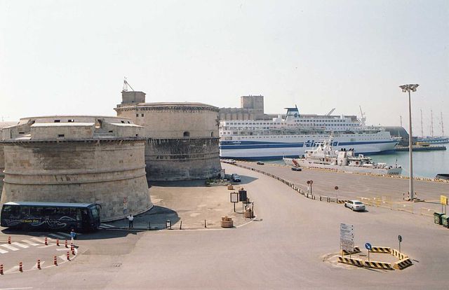
Civitavecchia, located along the western coast of Italy in the Lazio region, is known primarily as a port city serving as a gateway to Rome. While it may not be traditionally recognized as a hiking destination, there are several beautiful natural areas and trails nearby that can offer a pleasant experience for hikers....
- Country:

- Postal Code: 00053
- Local Dialing Code: 0766
- Licence Plate Code: ROMA
- Coordinates: 42° 6' 0" N, 11° 48' 0" E


- GPS tracks (wikiloc): [Link]
- AboveSeaLevel: 4 м m
- Area: 73.74 sq km
- Population: 52957
- Web site: [Link]
Civitella San Paolo
- Italian comune
Civitella San Paolo is a picturesque village located in the Lazio region of Italy, not far from Rome. It offers a charming blend of cultural heritage and natural beauty, making it an appealing destination for hikers and outdoor enthusiasts....
- Country:

- Postal Code: 00060
- Local Dialing Code: 0765
- Licence Plate Code: RM
- Coordinates: 42° 11' 45" N, 12° 34' 56" E


- GPS tracks (wikiloc): [Link]
- AboveSeaLevel: 195 м m
- Area: 20.75 sq km
- Population: 2049
- Web site: [Link]


Colleferro
- Italian comune
Colleferro, located in the Lazio region of Italy, offers a variety of hiking opportunities thanks to its picturesque landscapes and proximity to the beautiful Monti Lepini mountain range. Here’s a breakdown of what you can expect when hiking in and around Colleferro:...
- Country:

- Postal Code: 00034
- Local Dialing Code: 06
- Licence Plate Code: ROMA
- Coordinates: 41° 43' 43" N, 13° 0' 11" E


- GPS tracks (wikiloc): [Link]
- AboveSeaLevel: 218 м m
- Area: 27 sq km
- Population: 21394
- Web site: [Link]


Colonna, Lazio
- Italian comune
Hiking in Colonna, a town in the Lazio region of Italy, offers a blend of scenic trails and rich cultural history. Nestled in the hills near Rome, Colonna is surrounded by beautiful landscapes, vineyards, and olive groves, making it an appealing destination for outdoor enthusiasts....
- Country:

- Postal Code: 00030
- Local Dialing Code: 06
- Licence Plate Code: ROMA
- Coordinates: 41° 50' 0" N, 12° 45' 0" E


- GPS tracks (wikiloc): [Link]
- AboveSeaLevel: 393 м m
- Area: 3.55 sq km
- Population: 4312
- Web site: [Link]


Fiano Romano
- Italian comune
Fiano Romano is a charming town located in the Province of Rome, Italy. It's situated near the ancient Via Flaminia, making it not just historically significant but also a great starting point for outdoor activities, particularly hiking....
- Country:

- Postal Code: 00065
- Local Dialing Code: 0765
- Licence Plate Code: ROMA
- Coordinates: 42° 10' 0" N, 12° 36' 0" E


- GPS tracks (wikiloc): [Link]
- AboveSeaLevel: 97 м m
- Area: 41.19 sq km
- Population: 15688
- Web site: [Link]
Filacciano
- Italian comune
Filacciano, a charming village in the Lazio region of Italy, offers some beautiful opportunities for hiking enthusiasts looking for scenic trails and a taste of the Italian countryside. Here are some key points about hiking in and around Filacciano:...
- Country:

- Postal Code: 00060
- Local Dialing Code: 0765
- Licence Plate Code: RM
- Coordinates: 42° 15' 21" N, 12° 36' 3" E


- GPS tracks (wikiloc): [Link]
- AboveSeaLevel: 197 м m
- Area: 5.66 sq km
- Population: 461
- Web site: [Link]
Fonte Nuova
- Italian comune
Fonte Nuova is a charming area located just outside of Rome, Italy, known for its natural beauty and outdoor activities, including hiking. The region offers various trails that range from easy walks to more challenging hikes, making it suitable for hikers of all levels....
- Country:

- Postal Code: 00013
- Local Dialing Code: 06
- Licence Plate Code: RM
- Coordinates: 42° 0' 6" N, 12° 37' 19" E


- GPS tracks (wikiloc): [Link]
- AboveSeaLevel: 150 м m
- Area: 19.94 sq km
- Population: 33193
- Web site: [Link]


Formello
- Italian comune
Formello, located in the Lazio region of Italy, is a charming destination for hiking enthusiasts. Situated just a short distance from Rome, it offers scenic landscapes, historical sites, and a taste of the Italian countryside. Here’s what you can expect when hiking in Formello:...
- Country:

- Postal Code: 00060
- Local Dialing Code: 06
- Licence Plate Code: ROMA
- Coordinates: 42° 5' 0" N, 12° 24' 0" E


- GPS tracks (wikiloc): [Link]
- AboveSeaLevel: 243 м m
- Area: 31.15 sq km
- Population: 13070
- Web site: [Link]
Gallicano nel Lazio
- Italian comune
Gallicano nel Lazio is a charming town located in the province of Rome, Italy. Nestled in the foothills of the Apennine Mountains, it offers various hiking opportunities that allow you to immerse yourself in the natural beauty of the region while enjoying the rich history and culture of the area....
- Country:

- Postal Code: 00010
- Local Dialing Code: 06
- Licence Plate Code: RM
- Coordinates: 41° 52' 0" N, 12° 49' 0" E


- GPS tracks (wikiloc): [Link]
- AboveSeaLevel: 241 м m
- Area: 25.7 sq km
- Population: 6343
- Web site: [Link]


Gavignano
- Italian comune
Gavignano, a charming village in the province of Rome, Italy, offers some beautiful hiking opportunities thanks to its picturesque landscapes and proximity to the Monti Simbruini National Park. Here are some highlights for hiking in and around Gavignano:...
- Country:

- Postal Code: 00030
- Local Dialing Code: 06
- Licence Plate Code: RM
- Coordinates: 41° 42' 0" N, 13° 3' 0" E


- GPS tracks (wikiloc): [Link]
- AboveSeaLevel: 404 м m
- Area: 15.04 sq km
- Population: 1905
- Web site: [Link]
Genazzano
- Italian comune
Genazzano, a charming medieval town in the Lazio region of Italy, offers wonderful opportunities for hiking and exploring the surrounding landscapes. Nestled in the hills near the Aniene Valley, Genazzano is known for its picturesque views, historic architecture, and lush natural surroundings....
- Country:

- Postal Code: 00030
- Local Dialing Code: 06
- Licence Plate Code: ROMA
- Coordinates: 41° 50' 0" N, 12° 58' 0" E


- GPS tracks (wikiloc): [Link]
- AboveSeaLevel: 375 м m
- Area: 32.07 sq km
- Population: 5949
- Web site: [Link]


Genzano di Roma
- Italian comune
Genzano di Roma, located in the picturesque Castelli Romani region, is a charming town in the province of Rome, Italy. It's surrounded by beautiful landscapes, making it an excellent spot for hiking enthusiasts. Here are some highlights about hiking in and around Genzano di Roma:...
- Country:

- Postal Code: 00045
- Local Dialing Code: 06
- Licence Plate Code: RM; ROMA
- Coordinates: 41° 42' 8" N, 12° 41' 33" E


- GPS tracks (wikiloc): [Link]
- AboveSeaLevel: 435 м m
- Area: 17.9 sq km
- Population: 23892
- Web site: [Link]


Gerano
- Italian comune
Gerano is a small village located in the region of Lazio, Italy, known for its picturesque landscapes and charming hilltop setting. Hiking in and around Gerano offers a wonderful experience for nature enthusiasts and outdoor lovers....
- Country:

- Postal Code: 00025
- Local Dialing Code: 0774
- Licence Plate Code: RM
- Coordinates: 41° 56' 0" N, 12° 59' 37" E


- GPS tracks (wikiloc): [Link]
- AboveSeaLevel: 502 м m
- Area: 10.12 sq km
- Population: 1250
- Web site: [Link]
Gorga
- Italian comune
Gorga, a small town in the province of Rome, Lazio, is surrounded by beautiful natural landscapes, making it an excellent destination for hiking enthusiasts. The area offers a variety of trails that cater to different levels of experience, from leisurely walks to more challenging treks....
- Country:

- Postal Code: 00030
- Local Dialing Code: 06
- Licence Plate Code: RM
- Coordinates: 41° 39' 0" N, 13° 7' 0" E


- GPS tracks (wikiloc): [Link]
- AboveSeaLevel: 766 м m
- Area: 26.19 sq km
- Population: 712
- Web site: [Link]


Grottaferrata
- Italian comune
Grottaferrata is a charming town located in the Castelli Romani region of Italy, about 25 kilometers southeast of Rome. It is known for its stunning landscapes, historical sites, and proximity to the Alban Hills, which make it a great destination for hiking enthusiasts....
- Country:

- Postal Code: 00046
- Local Dialing Code: 06
- Licence Plate Code: ROMA
- Coordinates: 41° 48' 0" N, 12° 40' 0" E


- GPS tracks (wikiloc): [Link]
- AboveSeaLevel: 320 м m
- Area: 18.4 sq km
- Population: 20460
- Web site: [Link]

Guidonia Montecelio
- Italian comune
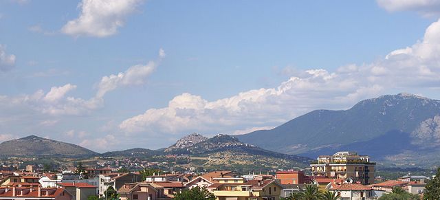
Guidonia Montecelio, located in the Lazio region of Italy, is a great destination for hiking enthusiasts. The area is characterized by a mix of natural landscapes, historical sites, and striking views, making it appealing for outdoor activities. Here are some key points about hiking in Guidonia Montecelio:...
- Country:

- Postal Code: 00012
- Local Dialing Code: 0774
- Licence Plate Code: ROMA
- Coordinates: 41° 59' 49" N, 12° 43' 34" E


- GPS tracks (wikiloc): [Link]
- AboveSeaLevel: 105 м m
- Area: 79.06 sq km
- Population: 89288
- Web site: [Link]


Jenne, Lazio
- Italian comune
Jenne, a charming town located in the Lazio region of Italy, is a hidden gem for hikers and outdoor enthusiasts. Nestled in the Simbruini Mountains, it offers a variety of trails that range from easy walks to more challenging hikes, allowing for exploration of the stunning landscapes, rich biodiversity, and historical sites....
- Country:

- Postal Code: 00020
- Local Dialing Code: 0774
- Licence Plate Code: RM
- Coordinates: 41° 53' 0" N, 13° 10' 0" E


- GPS tracks (wikiloc): [Link]
- AboveSeaLevel: 834 м m
- Area: 31.52 sq km
- Population: 347
- Web site: [Link]
Labico
- Italian comune
Labico is a charming town located in the province of Rome, Italy, and it offers several opportunities for outdoor enthusiasts, including hiking. The surrounding area boasts beautiful landscapes, including hills, forests, and vineyards, making it an attractive destination for nature lovers....
- Country:

- Postal Code: 00030
- Local Dialing Code: 06
- Licence Plate Code: ROMA
- Coordinates: 41° 47' 0" N, 12° 53' 0" E


- GPS tracks (wikiloc): [Link]
- AboveSeaLevel: 319 м m
- Area: 11.75 sq km
- Population: 6469
- Web site: [Link]


Ladispoli
- Italian comune
Ladispoli, located on the Tyrrhenian coast of Italy, is not only known for its beautiful beaches but also offers several opportunities for hiking and outdoor activities. Here are some key points about hiking in and around Ladispoli:...
- Country:

- Postal Code: 00055
- Local Dialing Code: 06
- Licence Plate Code: ROMA
- Coordinates: 41° 57' 16" N, 12° 4' 27" E


- GPS tracks (wikiloc): [Link]
- AboveSeaLevel: 2 м m
- Area: 25.95 sq km
- Population: 41604
- Web site: [Link]


Lanuvio
- Italian comune
Lanuvio, located in the province of Rome, Italy, offers a variety of hiking opportunities that showcase its beautiful landscapes, historical sites, and natural beauty. The area is characterized by rolling hills, vineyards, and scenic views, making it an excellent destination for hikers of all levels....
- Country:

- Postal Code: 00075; 00040
- Local Dialing Code: 06
- Licence Plate Code: ROMA
- Coordinates: 41° 41' 0" N, 12° 42' 0" E


- GPS tracks (wikiloc): [Link]
- AboveSeaLevel: 324 м m
- Area: 43.76 sq km
- Population: 13580
- Web site: [Link]
Lariano
- Italian comune
Lariano is a charming town located in the Lazio region of Italy, not far from Rome. It's surrounded by beautiful natural landscapes, making it an ideal destination for hiking enthusiasts. Here are some key points to consider if you're planning a hiking trip in Lariano:...
- Country:

- Postal Code: 00040
- Local Dialing Code: 06
- Licence Plate Code: ROMA
- Coordinates: 41° 44' 0" N, 12° 50' 0" E


- GPS tracks (wikiloc): [Link]
- AboveSeaLevel: 350 м m
- Area: 22.53 sq km
- Population: 13448
- Web site: [Link]

Licenza
- Italian comune
Licenza is a charming town located in the province of Rome, Italy, known for its stunning landscapes, historical sites, and relatively mild climate. Hiking in and around Licenza can be an enjoyable experience, offering a mix of natural beauty and cultural exploration....
- Country:

- Postal Code: 00026
- Local Dialing Code: 0774
- Licence Plate Code: RM
- Coordinates: 42° 4' 27" N, 12° 54' 6" E


- GPS tracks (wikiloc): [Link]
- AboveSeaLevel: 475 м m
- Area: 17.99 sq km
- Population: 950
- Web site: [Link]
Magliano Romano
- Italian comune
Magliano Romano, located in the Lazio region of Italy, is a charming medieval town that offers some wonderful hiking opportunities. Nestled in the Sabine Hills, it is surrounded by natural beauty, including rolling hills, forests, and picturesque landscapes. Here’s what you might consider when planning a hiking trip in the area:...
- Country:

- Postal Code: 00060
- Local Dialing Code: 06
- Licence Plate Code: RM
- Coordinates: 42° 9' 36" N, 12° 26' 9" E


- GPS tracks (wikiloc): [Link]
- AboveSeaLevel: 270 м m
- Area: 20.52 sq km
- Population: 1397
- Web site: [Link]
Mandela, Lazio
- Italian comune
Mandela is a charming village situated in the Lazio region of Italy, near the region's eastern edge. It is surrounded by stunning natural landscapes, making it an excellent destination for hiking enthusiasts. Here are some key points to consider when hiking in and around Mandela:...
- Country:

- Postal Code: 00020
- Local Dialing Code: 0774
- Licence Plate Code: RM
- Coordinates: 42° 1' 48" N, 12° 55' 23" E


- GPS tracks (wikiloc): [Link]
- AboveSeaLevel: 487 м m
- Area: 13.72 sq km
- Population: 912
- Web site: [Link]
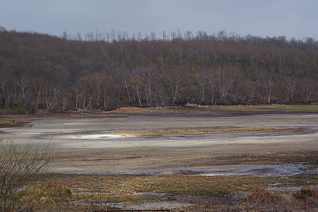

Manziana
- Italian comune
Manziana, located in the Lazio region of Italy, offers beautiful landscapes and a variety of hiking opportunities. Surrounded by the lush vegetation of the Tolfa mountains, it is a great destination for both experienced hikers and casual walkers....
- Country:

- Postal Code: 00066
- Local Dialing Code: 06
- Licence Plate Code: ROMA
- Coordinates: 42° 8' 0" N, 12° 8' 0" E


- GPS tracks (wikiloc): [Link]
- AboveSeaLevel: 369 м m
- Area: 23.8 sq km
- Population: 7737
- Web site: [Link]


Marano Equo
- Italian comune
Marano Equo is a charming village located in the Roman province of Lazio, Italy, nestled in the Aniene Valley and surrounded by the beautiful Sabine Mountains. Hiking around this area offers a mix of stunning natural landscapes, historical sites, and traditional Italian culture. Here are some highlights and tips for hiking in Marano Equo:...
- Country:

- Postal Code: 00020
- Local Dialing Code: 0774
- Licence Plate Code: RM
- Coordinates: 41° 59' 38" N, 13° 1' 0" E


- GPS tracks (wikiloc): [Link]
- AboveSeaLevel: 450 м m
- Area: 7.65 sq km
- Population: 783
- Web site: [Link]
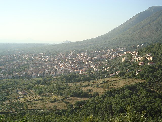

Marcellina
- Italian comune
Marcellina is a picturesque municipality located in the province of Rome, Italy. While it may not be as famous as some of the larger national parks and hiking destinations in the region, it offers beautiful landscapes and a chance to experience nature away from the crowds. Here are some key points to consider when hiking in Marcellina:...
- Country:

- Postal Code: 00010
- Local Dialing Code: 0774
- Licence Plate Code: ROMA
- Coordinates: 42° 1' 28" N, 12° 48' 16" E


- GPS tracks (wikiloc): [Link]
- AboveSeaLevel: 285 м m
- Area: 15.36 sq km
- Population: 7325
- Web site: [Link]
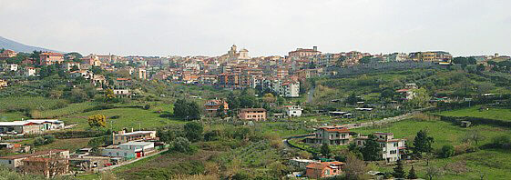

Marino, Lazio
- Italian comune
Marino, located in the Lazio region of Italy, is known for its picturesque scenery, charming historical architecture, and beautiful hiking trails. It sits on the Alban Hills, which offers opportunities for various outdoor activities, including hiking. Here are some key points to consider when planning a hiking trip in and around Marino:...
- Country:

- Postal Code: 00047
- Local Dialing Code: 06
- Licence Plate Code: ROMA
- Coordinates: 41° 46' 0" N, 12° 40' 0" E


- GPS tracks (wikiloc): [Link]
- AboveSeaLevel: 360 м m
- Area: 24.19 sq km
- Population: 44472
- Web site: [Link]


Mazzano Romano
- Italian comune
Mazzano Romano is a charming medieval village located in the province of Rome, Italy. It sits in the Lazio region, amidst beautiful landscapes that provide excellent opportunities for hiking and outdoor activities. Here are some highlights and recommendations for hiking in and around Mazzano Romano:...
- Country:

- Postal Code: 00060
- Local Dialing Code: 06
- Licence Plate Code: RM
- Coordinates: 42° 12' 20" N, 12° 23' 51" E


- GPS tracks (wikiloc): [Link]
- AboveSeaLevel: 200 м m
- Area: 29.07 sq km
- Population: 3119
- Web site: [Link]


Mentana
- Italian comune
Mentana is a charming town located in the Lazio region of Italy, not far from Rome. It offers various hiking opportunities, thanks to its picturesque landscapes and proximity to natural reserves and scenic hills....
- Country:

- Postal Code: 00013
- Local Dialing Code: 06
- Licence Plate Code: RM
- Coordinates: 42° 2' 1" N, 12° 38' 40" E


- GPS tracks (wikiloc): [Link]
- AboveSeaLevel: 150 м m
- Area: 24.27 sq km
- Population: 23126
- Web site: [Link]


Monte Compatri
- Italian comune
Monte Compatri, located near Rome, Italy, offers some fantastic hiking opportunities, particularly within the scenic area of the Castelli Romani regional park. Here are some highlights and tips for hiking in this charming region:...
- Country:

- Postal Code: 00077
- Local Dialing Code: 06
- Licence Plate Code: ROMA
- Coordinates: 41° 48' 29" N, 12° 44' 14" E


- GPS tracks (wikiloc): [Link]
- AboveSeaLevel: 576 м m
- Area: 24.57 sq km
- Population: 12134
- Web site: [Link]


Monte Porzio Catone
- Italian comune
Monte Porzio Catone is a charming town located in the province of Rome, Italy, and is known for its beautiful landscapes and proximity to the scenic natural reserve of Monte Catillo. The area offers a range of hiking trails that cater to different skill levels, providing a wonderful opportunity to experience the natural beauty of the region....
- Country:

- Postal Code: 00078
- Local Dialing Code: 06
- Licence Plate Code: ROMA
- Coordinates: 41° 49' 0" N, 12° 43' 0" E


- GPS tracks (wikiloc): [Link]
- AboveSeaLevel: 451 м m
- Area: 9.13 sq km
- Population: 8718
- Web site: [Link]
Montelanico
- Italian comune
Montelanico is a charming town located in the Lazio region of central Italy, known for its beautiful landscapes and proximity to the Apennine mountains. Hiking in and around Montelanico offers a unique opportunity to explore stunning natural scenery, charming villages, and a rich array of local flora and fauna. Here are some key points to consider when hiking in this area:...
- Country:

- Postal Code: 00030
- Local Dialing Code: 06
- Licence Plate Code: ROMA
- Coordinates: 41° 39' 0" N, 13° 2' 23" E


- GPS tracks (wikiloc): [Link]
- AboveSeaLevel: 297 м m
- Area: 35.14 sq km
- Population: 2125
- Web site: [Link]


Montelibretti
- Italian comune
Montelibretti is a charming area located in the province of Rome, Italy. Known for its scenic landscapes and historical sites, it offers a unique hiking experience for nature enthusiasts and history buffs alike. Here are some key points about hiking in Montelibretti:...
- Country:

- Postal Code: 00010
- Local Dialing Code: 0774
- Licence Plate Code: ROMA
- Coordinates: 42° 8' 0" N, 12° 44' 0" E


- GPS tracks (wikiloc): [Link]
- AboveSeaLevel: 232 м m
- Area: 45.43 sq km
- Population: 5326
- Web site: [Link]


Monterotondo
- Italian comune
Monterotondo, located near Rome, Italy, offers a blend of natural beauty and cultural heritage, making it a great location for hiking enthusiasts. The area is characterized by scenic landscapes, ancient ruins, and charming countryside....
- Country:

- Postal Code: 00015; 00015, 00016 (Scalo)
- Local Dialing Code: 06
- Licence Plate Code: ROMA
- Coordinates: 42° 3' 0" N, 12° 37' 0" E


- GPS tracks (wikiloc): [Link]
- AboveSeaLevel: 165 м m
- Area: 40.94 sq km
- Population: 41144
- Web site: [Link]
Montorio Romano
- Italian comune
Montorio Romano is a charming village located in the Lazio region of Italy, surrounded by the stunning natural landscapes of the Sabine Hills and the nearby Simbruini Mountains. Hiking in Montorio Romano offers a variety of trails that cater to different skill levels and preferences, making it an excellent destination for outdoor enthusiasts....
- Country:

- Postal Code: 00010
- Local Dialing Code: 0774
- Licence Plate Code: ROMA
- Coordinates: 42° 8' 16" N, 12° 48' 28" E


- GPS tracks (wikiloc): [Link]
- AboveSeaLevel: 575 м m
- Area: 23.39 sq km
- Population: 1913
- Web site: [Link]
Moricone
- Italian comune
Moricone, a picturesque village located in the Lazio region of Italy, is surrounded by beautiful landscapes and offers various hiking opportunities. The surrounding areas are characterized by lush woods, rolling hills, and scenic trails. Here are some key points to consider if you're planning a hiking trip to Moricone:...
- Country:

- Postal Code: 00010
- Local Dialing Code: 0774
- Licence Plate Code: RM
- Coordinates: 42° 7' 0" N, 12° 46' 20" E


- GPS tracks (wikiloc): [Link]
- AboveSeaLevel: 296 м m
- Area: 19.59 sq km
- Population: 2559
- Web site: [Link]


Morlupo
- Italian comune
Morlupo is a picturesque town located in the Lazio region of Italy, near Rome. It is surrounded by beautiful natural landscapes, making it a great spot for hiking enthusiasts. Here are some key points to consider when hiking in and around Morlupo:...
- Country:

- Postal Code: 00067
- Local Dialing Code: 06
- Licence Plate Code: RM
- Coordinates: 42° 8' 36" N, 12° 30' 17" E


- GPS tracks (wikiloc): [Link]
- AboveSeaLevel: 207 м m
- Area: 24.08 sq km
- Population: 8689
- Web site: [Link]


Nazzano
- Italian comune
Nazzano, located in the Lazio region of Italy, offers a beautiful setting for hiking enthusiasts, characterized by a combination of scenic landscapes, historical sites, and rich biodiversity. The area is particularly known for the Nazzano Tevere-Farfa Natural Reserve, where you can enjoy various trails amidst lush forests, riverbanks, and wetlands....
- Country:

- Postal Code: 00060
- Local Dialing Code: 0765
- Licence Plate Code: RM
- Coordinates: 42° 13' 49" N, 12° 35' 40" E


- GPS tracks (wikiloc): [Link]
- AboveSeaLevel: 202 м m
- Area: 12.4 sq km
- Population: 1395
- Web site: [Link]


Nemi
- Italian comune
Nemi, a charming town located in the Alban Hills near Rome, Italy, is known for its scenic beauty, historical significance, and delightful hiking opportunities. Here’s what you need to know about hiking in Nemi:...
- Country:

- Postal Code: 00040
- Local Dialing Code: 06
- Licence Plate Code: RM
- Coordinates: 41° 43' 19" N, 12° 43' 5" E


- GPS tracks (wikiloc): [Link]
- AboveSeaLevel: 521 м m
- Area: 7 sq km
- Population: 1910
- Web site: [Link]


Nerola
- Italian comune
Nerola is a charming town located in the Lazio region of Italy, known for its picturesque landscapes and historical significance. While it may not be as famous as some other hiking destinations in Italy, it offers several opportunities for outdoor enthusiasts to explore nature and enjoy scenic views....
- Country:

- Postal Code: 00017
- Local Dialing Code: 0774
- Licence Plate Code: RM
- Coordinates: 42° 10' 0" N, 12° 47' 0" E


- GPS tracks (wikiloc): [Link]
- AboveSeaLevel: 453 м m
- Area: 17.1 sq km
- Population: 1969
- Web site: [Link]
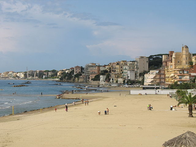

Nettuno
- Italian comune
Nettuno, located on the Tyrrhenian Sea coast in the Lazio region of Italy, is primarily known for its beaches and historical significance, particularly its connection to World War II. While it may not be a prominent hiking destination compared to the nearby Monti Lepini or the Parco Regionale dei Castelli Romani, there are still some pleasant trails and areas around Nettuno that offer opportunities for hiking....
- Country:

- Postal Code: 00048
- Local Dialing Code: 06
- Licence Plate Code: ROMA
- Coordinates: 41° 28' 0" N, 12° 40' 0" E


- GPS tracks (wikiloc): [Link]
- AboveSeaLevel: 11 м m
- Area: 71.64 sq km
- Population: 49852
- Web site: [Link]


Olevano Romano
- Italian comune
Olevano Romano, located in the Lazio region of Italy, is a beautiful destination for hiking enthusiasts. Nestled in the Aniene Valley, this charming town is surrounded by stunning landscapes, including rolling hills, dense woodlands, and picturesque views of the surrounding countryside....
- Country:

- Postal Code: 00035
- Local Dialing Code: 06
- Licence Plate Code: ROMA
- Coordinates: 41° 51' 38" N, 13° 1' 55" E


- GPS tracks (wikiloc): [Link]
- AboveSeaLevel: 571 м m
- Area: 26.16 sq km
- Population: 6664
- Web site: [Link]


Palestrina
- Italian comune
Palestrina, located just east of Rome, Italy, is not only rich in history but also offers various hiking opportunities that blend natural beauty with cultural exploration. Here are some aspects of hiking in Palestrina:...
- Country:

- Postal Code: 00036
- Local Dialing Code: 06
- Licence Plate Code: ROMA
- Coordinates: 41° 50' 0" N, 12° 54' 0" E


- GPS tracks (wikiloc): [Link]
- AboveSeaLevel: 450 м m
- Area: 47.02 sq km
- Population: 21872
- Web site: [Link]
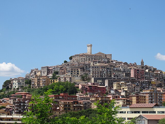

Palombara Sabina
- Italian comune
Palombara Sabina, located in the Lazio region of Italy, is a charming town known for its picturesque landscapes and a variety of hiking opportunities. Nestled in the Sabine Hills, it offers a mix of natural beauty, historical sites, and beautiful trails that are perfect for both beginner and experienced hikers....
- Country:

- Postal Code: 00018
- Local Dialing Code: 0774
- Licence Plate Code: ROMA
- Coordinates: 42° 4' 0" N, 12° 46' 0" E


- GPS tracks (wikiloc): [Link]
- AboveSeaLevel: 372 м m
- Area: 75.8 sq km
- Population: 13200
- Web site: [Link]


Percile
- Italian comune
Percile is a beautiful area located in the region of Lazio, Italy, known for its picturesque landscapes, rich history, and numerous hiking opportunities. Situated near the Aniene Valley and surrounded by the Simbruini Mountains, it offers a variety of trails suitable for different skill levels. Here are some key points about hiking in Percile:...
- Country:

- Postal Code: 00020
- Local Dialing Code: 0774
- Licence Plate Code: RM
- Coordinates: 42° 5' 41" N, 12° 54' 31" E


- GPS tracks (wikiloc): [Link]
- AboveSeaLevel: 575 м m
- Area: 17.76 sq km
- Population: 233
- Web site: [Link]
Pisoniano
- Italian comune
Pisoniano is a charming village located in the province of Rome, Italy, and surrounded by picturesque landscapes of the Lazio region. Hiking in and around Pisoniano offers a unique opportunity to explore beautiful valleys, ancient forests, and scenic viewpoints....
- Country:

- Postal Code: 00020
- Local Dialing Code: 06
- Licence Plate Code: RM
- Coordinates: 41° 54' 28" N, 12° 57' 30" E


- GPS tracks (wikiloc): [Link]
- AboveSeaLevel: 532 м m
- Area: 12.92 sq km
- Population: 739
- Web site: [Link]


Poli, Lazio
- Italian comune
Poli, a small municipality in the Lazio region of Italy, is located in the beautiful hills of the Aniene Valley, just east of Rome. It offers visitors a chance to experience picturesque landscapes, rich history, and a variety of hiking trails suitable for all skill levels....
- Country:

- Postal Code: 00010
- Local Dialing Code: 06
- Licence Plate Code: RM
- Coordinates: 41° 53' 0" N, 12° 53' 0" E


- GPS tracks (wikiloc): [Link]
- AboveSeaLevel: 435 м m
- Area: 21.75 sq km
- Population: 2399
- Web site: [Link]
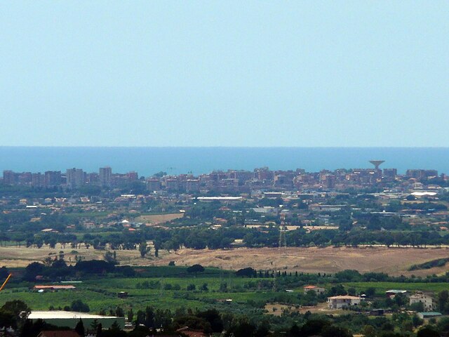

Pomezia
- Italian comune
Pomezia, located in the Lazio region of Italy, is an area rich in natural beauty and history, making it a great destination for hiking enthusiasts. While the town itself is primarily known for its industrial character, there are several nearby natural parks and areas that offer great hiking opportunities....
- Country:

- Postal Code: 00071
- Local Dialing Code: 06
- Licence Plate Code: ROMA
- Coordinates: 41° 40' 10" N, 12° 30' 7" E


- GPS tracks (wikiloc): [Link]
- AboveSeaLevel: 108 м m
- Area: 86.57 sq km
- Population: 63641
- Web site: [Link]


Ponzano Romano
- Italian comune
Ponzano Romano, located in the Lazio region of Italy, near Rome, offers hikers a variety of scenic trails and beautiful landscapes. The area is characterized by its rolling hills, lush vegetation, and picturesque views of the Tiber Valley. Here are some highlights and tips for hiking in Ponzano Romano:...
- Country:

- Postal Code: 00060
- Local Dialing Code: 0765
- Licence Plate Code: RM
- Coordinates: 42° 15' 29" N, 12° 34' 18" E


- GPS tracks (wikiloc): [Link]
- AboveSeaLevel: 205 м m
- Area: 19.52 sq km
- Population: 1140
- Web site: [Link]
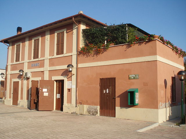

Riano, Lazio
- Italian comune
Riano, located in the Lazio region of Italy just north of Rome, offers a variety of hiking opportunities that combine stunning natural beauty with historical and cultural sites. Here are some key highlights for hikers considering this area:...
- Country:

- Postal Code: 00060
- Local Dialing Code: 06
- Licence Plate Code: ROMA
- Coordinates: 42° 5' 28" N, 12° 31' 22" E


- GPS tracks (wikiloc): [Link]
- AboveSeaLevel: 125 м m
- Area: 25.43 sq km
- Population: 10649
- Web site: [Link]


Rignano Flaminio
- Italian comune
Rignano Flaminio is a charming town located in the Lazio region of Italy, just north of Rome. This area is known for its beautiful landscapes, rich history, and proximity to the Tiber River, making it a great destination for hiking enthusiasts....
- Country:

- Postal Code: 00068
- Local Dialing Code: 0761
- Licence Plate Code: ROMA
- Coordinates: 42° 12' 0" N, 12° 29' 0" E


- GPS tracks (wikiloc): [Link]
- AboveSeaLevel: 250 м m
- Area: 38.56 sq km
- Population: 10328
- Web site: [Link]
Riofreddo
- Italian comune
Riofreddo is a picturesque village located in the province of Rome, Italy, surrounded by the stunning landscapes of the Apennine Mountains. It's a great destination for hiking enthusiasts, offering various trails that cater to different skill levels. Here are some highlights for hiking in the Riofreddo area:...
- Country:

- Postal Code: 00020
- Local Dialing Code: 0774
- Licence Plate Code: ROMA
- Coordinates: 42° 3' 32" N, 12° 59' 48" E


- GPS tracks (wikiloc): [Link]
- AboveSeaLevel: 705 м m
- Area: 12.38 sq km
- Population: 749
- Web site: [Link]
Rocca Canterano
- Italian comune
Rocca Canterano is a picturesque village located in the province of Rome, Italy, nestled in the Apennine mountains. The area surrounding Rocca Canterano offers diverse hiking opportunities thanks to its rich natural landscape and historical sites....
- Country:

- Postal Code: 00020
- Local Dialing Code: 0774
- Licence Plate Code: RM
- Coordinates: 41° 57' 0" N, 13° 1' 0" E


- GPS tracks (wikiloc): [Link]
- AboveSeaLevel: 745 м m
- Area: 15.84 sq km
- Population: 189
- Web site: [Link]


Rocca Priora
- Italian comune
Rocca Priora is a charming town located in the Alban Hills of Italy, approximately 30 kilometers southeast of Rome. It is part of the Regional Park of the Castelli Romani, which is known for its beautiful landscapes, rolling hills, and rich historical sites, making it a popular destination for hikers and nature enthusiasts....
- Country:

- Postal Code: 00040
- Local Dialing Code: 06
- Licence Plate Code: RM
- Coordinates: 41° 47' 0" N, 12° 46' 0" E


- GPS tracks (wikiloc): [Link]
- AboveSeaLevel: 768 м m
- Area: 28.27 sq km
- Population: 12060
- Web site: [Link]
Rocca Santo Stefano
- Italian comune
Rocca Santo Stefano is a picturesque destination located in the province of Rome, Italy, renowned for its natural beauty and rich history. The area is characterized by rugged terrain, rolling hills, and scenic vistas, making it a great spot for hiking enthusiasts....
- Country:

- Postal Code: 00030
- Local Dialing Code: 06
- Licence Plate Code: ROMA
- Coordinates: 41° 54' 38" N, 13° 1' 26" E


- GPS tracks (wikiloc): [Link]
- AboveSeaLevel: 664 м m
- Area: 9.57 sq km
- Population: 967
- Web site: [Link]
Rocca di Cave
- Italian comune
Rocca di Cave is a charming village located in the province of Rome, Italy, within the scenic region of the Monti Simbruini. The area is known for its natural beauty, lush forests, and panoramic views, making it an excellent destination for hiking enthusiasts....
- Country:

- Postal Code: 00030
- Local Dialing Code: 06
- Licence Plate Code: RM
- Coordinates: 41° 51' 0" N, 12° 57' 0" E


- GPS tracks (wikiloc): [Link]
- AboveSeaLevel: 933 м m
- Area: 11.09 sq km
- Population: 371
- Web site: [Link]

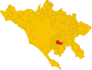
Rocca di Papa
- Italian comune
Rocca di Papa is a beautiful town located in the Castelli Romani area of Italy, renowned for its stunning landscapes, historical sites, and excellent hiking opportunities. The town is situated on the slopes of the Alban Hills and provides access to several scenic trails that showcase the natural beauty of the region....
- Country:

- Postal Code: 00040
- Local Dialing Code: 06
- Licence Plate Code: RM
- Coordinates: 41° 46' 0" N, 12° 43' 0" E


- GPS tracks (wikiloc): [Link]
- AboveSeaLevel: 680 м m
- Area: 39.72 sq km
- Population: 17201
- Web site: [Link]


Roccagiovine
- Italian comune
Roccagiovine is a small village located in the Lazio region of Italy, nestled in the Sabine Hills. It is an excellent destination for hiking enthusiasts looking to explore picturesque landscapes, rich history, and serene natural surroundings. Here are some key points to consider when planning a hiking trip to Roccagiovine:...
- Country:

- Postal Code: 00020
- Local Dialing Code: 0774
- Licence Plate Code: RM
- Coordinates: 42° 3' 0" N, 12° 54' 0" E


- GPS tracks (wikiloc): [Link]
- AboveSeaLevel: 520 м m
- Area: 8.41 sq km
- Population: 260
- Web site: [Link]

Roiate
- Italian comune
Roiate is a charming village located in the hills of the Province of Rome, Italy, and it's known for its stunning landscapes and scenic hiking trails. If you're planning to hike in Roiate, here are some things to consider:...
- Country:

- Postal Code: 00030
- Local Dialing Code: 06
- Licence Plate Code: ROMA
- Coordinates: 41° 52' 0" N, 13° 4' 0" E


- GPS tracks (wikiloc): [Link]
- AboveSeaLevel: 697 м m
- Area: 10.36 sq km
- Population: 710
- Web site: [Link]


Roviano
- Italian comune
Roviano, located in the province of Rome, Italy, is a picturesque town surrounded by the Monti Lucretili regional park. This area offers various hiking opportunities for outdoor enthusiasts, with trails that showcase the natural beauty of the region, including lush forests, stunning views, and charming rural landscapes....
- Country:

- Postal Code: 00027
- Local Dialing Code: 0774
- Licence Plate Code: ROMA
- Coordinates: 42° 1' 33" N, 12° 59' 40" E


- GPS tracks (wikiloc): [Link]
- AboveSeaLevel: 523 м m
- Area: 8.5 sq km
- Population: 1341
- Web site: [Link]


Sacrofano
- Italian comune
Sacrofano, located just north of Rome, Italy, is a charming area known for its natural beauty and picturesque landscapes, making it an excellent destination for hiking enthusiasts. The region features a mix of wooded areas, hills, and historical sites, providing a variety of hiking experiences. Here are a few key points to consider when hiking in Sacrofano:...
- Country:

- Postal Code: 00060
- Local Dialing Code: 06
- Licence Plate Code: RM
- Coordinates: 42° 6' 0" N, 12° 27' 0" E


- GPS tracks (wikiloc): [Link]
- AboveSeaLevel: 260 м m
- Area: 28.43 sq km
- Population: 7799
- Web site: [Link]
Sambuci
- Italian comune
Sambuci is a charming village located in the Lazio region of Italy, not far from Rome. Nestled in the foothills of the Monti Simbruini, it offers a variety of opportunities for hiking and exploring the natural beauty of the surrounding area....
- Country:

- Postal Code: 00020
- Local Dialing Code: 0774
- Licence Plate Code: RM
- Coordinates: 41° 59' 0" N, 12° 56' 0" E


- GPS tracks (wikiloc): [Link]
- AboveSeaLevel: 434 м m
- Area: 8.3 sq km
- Population: 901
- Web site: [Link]
San Cesareo
- Italian comune
San Cesareo, located in the Lazio region of Italy, offers scenic hiking opportunities amidst beautiful landscapes and historical sites. Here are some highlights and tips for hiking in this area:...
- Country:

- Postal Code: 00030
- Local Dialing Code: 06
- Licence Plate Code: ROMA
- Coordinates: 41° 49' 0" N, 12° 48' 0" E


- GPS tracks (wikiloc): [Link]
- AboveSeaLevel: 312 м m
- Area: 23.64 sq km
- Population: 15552
- Web site: [Link]


San Gregorio da Sassola
- Italian comune
 Hiking in San Gregorio da Sassola
San Gregorio da Sassola, a charming small town in the Lazio region of Italy, is surrounded by beautiful landscapes that offer a variety of hiking opportunities. Here are some key aspects of hiking in this area:...
- Country:

- Postal Code: 00010
- Local Dialing Code: 0774
- Licence Plate Code: RM
- Coordinates: 41° 55' 0" N, 12° 52' 0" E


- GPS tracks (wikiloc): [Link]
- AboveSeaLevel: 420 м m
- Area: 35.45 sq km
- Population: 1582
- Web site: [Link]


San Polo dei Cavalieri
- Italian comune
 Hiking in San Polo dei Cavalieri
San Polo dei Cavalieri, located in the Lazio region of Italy, offers a delightful hiking experience amidst beautiful landscapes and rich history. The area is characterized by its picturesque countryside, rolling hills, and lush forests, making it a great destination for hiking enthusiasts of all levels....
- Country:

- Postal Code: 00010
- Local Dialing Code: 0774
- Licence Plate Code: RM
- Coordinates: 42° 1' 0" N, 12° 50' 0" E


- GPS tracks (wikiloc): [Link]
- AboveSeaLevel: 651 м m
- Area: 42.53 sq km
- Population: 2919
- Web site: [Link]
San Vito Romano
- Italian comune
San Vito Romano is a charming town located in the province of Rome, Italy, and is surrounded by beautiful natural landscapes, making it an excellent destination for hiking enthusiasts. The area is characterized by its hills, forests, and the stunning Simbruini Mountains to the east, providing a variety of trails suitable for different skill levels....
- Country:

- Postal Code: 00030
- Local Dialing Code: 06
- Licence Plate Code: RM
- Coordinates: 41° 53' 0" N, 12° 59' 0" E


- GPS tracks (wikiloc): [Link]
- AboveSeaLevel: 655 м m
- Area: 12.66 sq km
- Population: 3313
- Web site: [Link]


Sant'Angelo Romano
- Italian comune
Sant'Angelo Romano is a charming village located in the Sabine Hills, about 40 kilometers northeast of Rome, Italy. It’s an excellent destination for hiking enthusiasts looking for scenic trails and a mix of natural beauty and cultural heritage....
- Country:

- Postal Code: 00010
- Local Dialing Code: 0774
- Licence Plate Code: RM
- Coordinates: 42° 2' 5" N, 12° 42' 48" E


- GPS tracks (wikiloc): [Link]
- AboveSeaLevel: 400 м m
- Area: 21.36 sq km
- Population: 4987
- Web site: [Link]
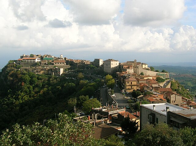

Sant'Oreste
- Italian comune
Sant'Oreste is a picturesque town in the Lazio region of Italy, surrounded by lush landscapes and rich history. It is located near the ancient Roman road called the Via Flaminia, making it a great starting point for various hiking trails....
- Country:

- Postal Code: 00060
- Local Dialing Code: 0761
- Licence Plate Code: ROMA
- Coordinates: 42° 14' 0" N, 12° 31' 0" E


- GPS tracks (wikiloc): [Link]
- AboveSeaLevel: 420 м m
- Area: 43.89 sq km
- Population: 3648
- Web site: [Link]
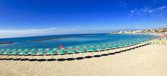

Santa Marinella
- Italian comune
Santa Marinella, located on the coast of Lazio, Italy, is a charming town known for its beautiful beaches and historic sites. While it might not be as famous for hiking as the nearby hills or the rugged terrain of other regions in Italy, there are still some great opportunities for outdoor enthusiasts to explore....
- Country:

- Postal Code: 00058
- Local Dialing Code: 0766
- Licence Plate Code: ROMA
- Coordinates: 42° 2' 0" N, 11° 51' 0" E


- GPS tracks (wikiloc): [Link]
- AboveSeaLevel: 7 м m
- Area: 48.91 sq km
- Population: 18921
- Web site: [Link]
Saracinesco
- Italian comune
Saracinesco is a picturesque small village nestled in the Apennine Mountains of Italy, in the province of Rome. It's an excellent destination for hiking enthusiasts, offering a blend of beautiful landscapes, charming historical sites, and a taste of authentic Italian culture. Here are some key points to consider when hiking in Saracinesco:...
- Country:

- Postal Code: 00020
- Local Dialing Code: 0774
- Licence Plate Code: ROMA
- Coordinates: 42° 0' 0" N, 12° 57' 0" E


- GPS tracks (wikiloc): [Link]
- AboveSeaLevel: 908 м m
- Area: 11.16 sq km
- Population: 175
- Web site: [Link]
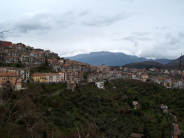

Segni
- Italian comune
Segni, located in the province of Rome, Italy, offers a range of hiking opportunities with its beautiful landscapes, historical sites, and varied terrain. Nestled in the foothills of the Lepini Mountains, this area is perfect for outdoor enthusiasts looking to explore nature while appreciating the rich cultural heritage of the region....
- Country:

- Postal Code: 00037
- Local Dialing Code: 06
- Licence Plate Code: RM
- Coordinates: 41° 41' 0" N, 13° 1' 0" E


- GPS tracks (wikiloc): [Link]
- AboveSeaLevel: 668 м m
- Area: 60.86 sq km
- Population: 9192
- Web site: [Link]


Subiaco
- Italian comune
Subiaco, located in the Lazio region of Italy, is known for its stunning natural landscapes, rich history, and numerous hiking opportunities. It is situated in the Aniene Valley, surrounded by the Simbruini Mountains, making it a great base for hiking enthusiasts. Here’s what you should know about hiking in Subiaco:...
- Country:

- Postal Code: 00028
- Local Dialing Code: 0774
- Licence Plate Code: RM
- Coordinates: 41° 56' 0" N, 13° 6' 0" E


- GPS tracks (wikiloc): [Link]
- AboveSeaLevel: 408 м m
- Area: 63.23 sq km
- Population: 8916
- Web site: [Link]


Tolfa
- Italian comune
Hiking in Tolfa, located in the Lazio region of Italy, offers an excellent opportunity to explore both natural beauty and historical sites. The area is characterized by its rolling hills, lush vegetation, and panoramic views overlooking the nearby coastline, particularly the Tyrrhenian Sea....
- Country:

- Postal Code: 00059
- Local Dialing Code: 0766
- Licence Plate Code: RM
- Coordinates: 42° 9' 0" N, 11° 56' 0" E


- GPS tracks (wikiloc): [Link]
- AboveSeaLevel: 484 м m
- Area: 168.27 sq km
- Population: 5006
- Web site: [Link]
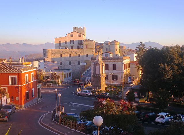

Torrita Tiberina
- Italian comune
Torrita Tiberina is a charming medieval village located in the Lazio region of Italy, overlooking the Tiber River. This area is not only rich in history and culture but also offers beautiful landscapes, making it a great location for hiking enthusiasts. Here’s what you should know about hiking in and around Torrita Tiberina:...
- Country:

- Postal Code: 00060
- Local Dialing Code: 0765
- Licence Plate Code: RM
- Coordinates: 42° 14' 0" N, 12° 37' 0" E


- GPS tracks (wikiloc): [Link]
- AboveSeaLevel: 174 м m
- Area: 10.78 sq km
- Population: 1056
- Web site: [Link]


Trevignano Romano
- Italian comune
Trevignano Romano, located in the Lazio region of Italy along the shores of Lake Bracciano, is a picturesque destination that offers beautiful hiking opportunities amidst stunning natural scenery. Here are some highlights about hiking in this area:...
- Country:

- Postal Code: 00069
- Local Dialing Code: 06
- Licence Plate Code: RM
- Coordinates: 42° 9' 0" N, 12° 15' 0" E


- GPS tracks (wikiloc): [Link]
- AboveSeaLevel: 173 м m
- Area: 38.99 sq km
- Population: 5711
- Web site: [Link]


Vallepietra
- Italian comune
Vallepietra, located in the Lazio region of Italy, is known for its beautiful landscapes and its setting within the Simbruini Mountains. The area is an excellent choice for hiking enthusiasts due to its varied terrain, rich wildlife, and historical sites....
- Country:

- Postal Code: 00020
- Local Dialing Code: 0774
- Licence Plate Code: RM
- Coordinates: 41° 56' 0" N, 13° 14' 0" E


- GPS tracks (wikiloc): [Link]
- AboveSeaLevel: 825 м m
- Area: 52.94 sq km
- Population: 268
- Web site: [Link]
Vallinfreda
- Italian comune
Vallinfreda is a picturesque village located in the Lazio region of Italy, nestled in the Monti Simbruini National Park. This area is known for its beautiful landscapes, rich biodiversity, and a variety of hiking trails suitable for different skill levels. Here are some key points about hiking in Vallinfreda:...
- Country:

- Postal Code: 00020
- Local Dialing Code: 0774
- Licence Plate Code: RM
- Coordinates: 42° 5' 0" N, 12° 58' 0" E


- GPS tracks (wikiloc): [Link]
- AboveSeaLevel: 870 м m
- Area: 16.72 sq km
- Population: 291
- Web site: [Link]

Valmontone
- Italian comune
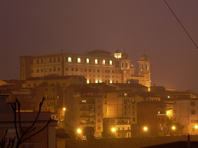
Valmontone, located in the Lazio region of Italy, is not only known for its historical sites and proximity to the Rainbow Magicland amusement park but also offers some inviting hiking opportunities. Here are some aspects to consider if you're planning to hike in and around Valmontone:...
- Country:

- Postal Code: 00038
- Local Dialing Code: 06
- Licence Plate Code: ROMA
- Coordinates: 41° 46' 24" N, 12° 55' 7" E


- GPS tracks (wikiloc): [Link]
- AboveSeaLevel: 303 м m
- Area: 40.91 sq km
- Population: 16073
- Web site: [Link]

Vicovaro
- Italian comune
Vicovaro is a charming town located in the province of Rome, Italy, nestled in the beautiful countryside of the Lazio region. It's a great destination for hiking enthusiasts due to its picturesque landscapes, rich history, and numerous trails that cater to various skill levels. Here are some highlights to consider if you're planning to hike in and around Vicovaro:...
- Country:

- Postal Code: 00029
- Local Dialing Code: 0774
- Licence Plate Code: RM
- Coordinates: 42° 1' 4" N, 12° 53' 49" E


- GPS tracks (wikiloc): [Link]
- AboveSeaLevel: 300 м m
- Area: 35.94 sq km
- Population: 3968
- Web site: [Link]


Vivaro Romano
- Italian comune
Vivaro Romano is a charming town located in the province of Rome, Italy, surrounded by stunning landscapes and natural beauty, making it a fantastic destination for hiking enthusiasts....
- Country:

- Postal Code: 00020
- Local Dialing Code: 0774
- Licence Plate Code: RM
- Coordinates: 42° 6' 2" N, 13° 0' 27" E


- GPS tracks (wikiloc): [Link]
- AboveSeaLevel: 756 м m
- Area: 12.54 sq km
- Population: 158
- Web site: [Link]
Shares border with regions:


Province of Frosinone
- province of Italy
 Hiking in Province of Frosinone
Hiking in the Province of Frosinone, located in the Lazio region of Italy, offers a wonderful blend of natural beauty, cultural heritage, and diverse landscapes. Here are some key highlights for hikers planning to explore this beautiful area:...
- Country:

- Capital: Frosinone
- Postal Code: 03100
- Local Dialing Code: 0775; 0776
- Licence Plate Code: FR
- Coordinates: 41° 38' 0" N, 13° 21' 0" E


- GPS tracks (wikiloc): [Link]
- Area: 3243.95 sq km
- Web site: [Link]
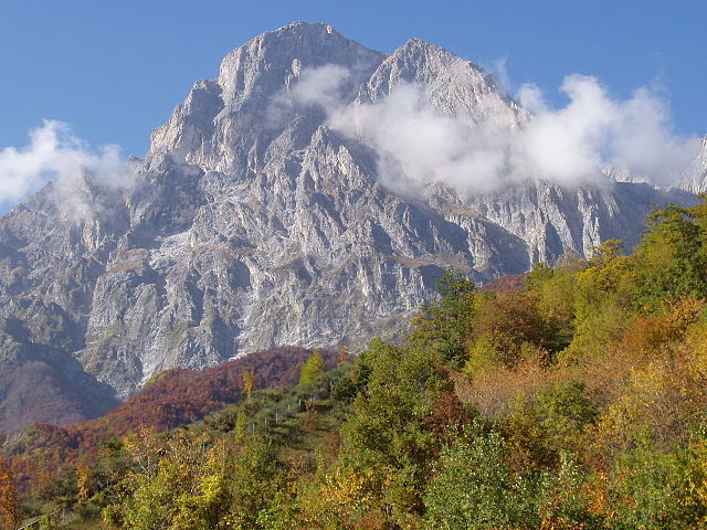

Province of L'Aquila
- province of Italy
 Hiking in Province of L'Aquila
The Province of L'Aquila, located in the Abruzzo region of Italy, is a fantastic destination for hiking enthusiasts. Known for its diverse landscapes, it offers a variety of trails that range from easy walks to challenging mountain treks, appealing to hikers of all levels. Here are some highlights:...
- Country:

- Capital: L'Aquila
- Postal Code: 67066–67069; 67019–67041; 67017; 67012–67015; 67010; 67100
- Local Dialing Code: 0863; 0864; 0862
- Licence Plate Code: AQ
- Coordinates: 42° 25' 22" N, 13° 23' 40" E


- GPS tracks (wikiloc): [Link]
- Area: 5034.46 sq km
- Web site: [Link]
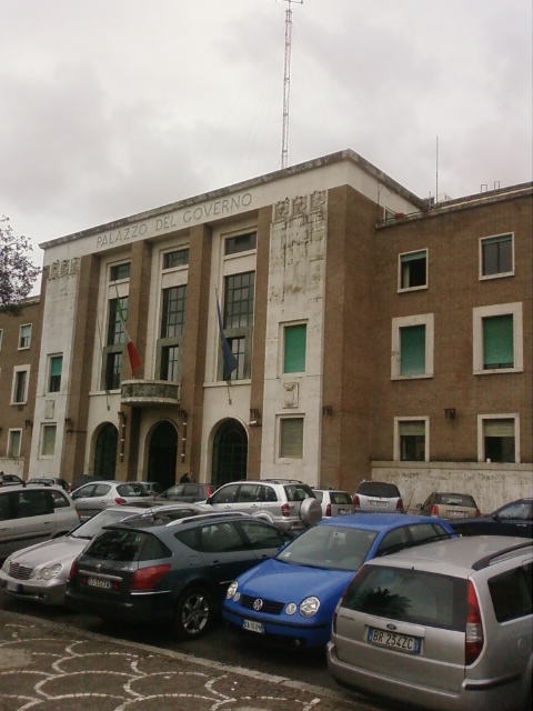

Province of Latina
- province of Italy
The Province of Latina, located in the Lazio region of Italy, offers a variety of hiking opportunities characterized by beautiful landscapes, rugged coastline, and historical sites. Here's what you need to know about hiking in this area:...
- Country:

- Capital: Latina
- Postal Code: 04010–04029; 04100
- Local Dialing Code: 06; 0773; 0771
- Licence Plate Code: LT
- Coordinates: 41° 28' 3" N, 12° 54' 13" E


- GPS tracks (wikiloc): [Link]
- Area: 2251 sq km
- Web site: [Link]

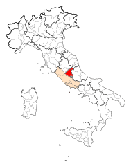
Province of Rieti
- province of Italy
The Province of Rieti, located in the Lazio region of Italy, is a fantastic destination for hikers, thanks to its breathtaking landscapes, rich history, and diverse trails. Here are some highlights and recommendations for hiking in this beautiful area:...
- Country:

- Capital: Rieti
- Postal Code: 02010–02048; 02100
- Local Dialing Code: 0765; 0746; 0744
- Licence Plate Code: RI
- Coordinates: 42° 23' 55" N, 12° 51' 42" E


- GPS tracks (wikiloc): [Link]
- AboveSeaLevel: 405 м m
- Area: 2749.16 sq km
- Web site: [Link]

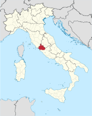
Province of Viterbo
- province of Italy
The Province of Viterbo, located in the Lazio region of Italy, offers a wealth of hiking opportunities amidst stunning landscapes, rich history, and diverse environments. Here are some highlights to explore while hiking in this province:...
- Country:

- Capital: Viterbo
- Postal Code: 01010–01039; 01100
- Local Dialing Code: 0763; 06; 0766; 0761
- Licence Plate Code: VT
- Coordinates: 42° 25' 7" N, 12° 6' 15" E


- GPS tracks (wikiloc): [Link]
- Area: 3612.24 sq km
- Web site: [Link]
