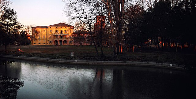
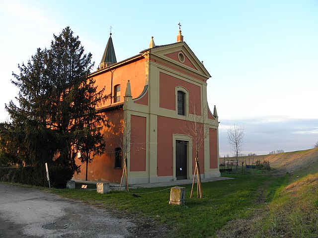
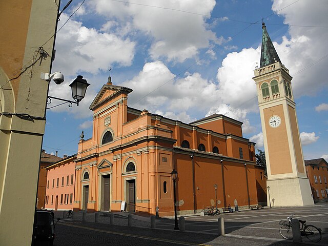
Argelato (Argelato)
.svg)
- Italian comune
 Hiking in Argelato
Argelato is a municipality located in the Emilia-Romagna region of Italy, near Bologna. While it's not primarily known as a hiking destination, there are some opportunities for outdoor activities in the surrounding areas. Here are some points to consider if you're thinking about hiking around Argelato:
-
Scenic Routes: The region around Argelato features flat countryside, meandering rivers, and agricultural landscapes. You can find trails that offer pleasant walks through the countryside, where you might see picturesque farms and local wildlife.
-
Proximity to Bologna: Argelato is very close to Bologna, which is a gateway for more extensive hiking trails in the Apennine Mountains to the south. If you're looking for more challenging hikes, consider venturing into the hills and mountains that are just a short drive away.
-
Local Parks: Check for local parks and nature reserves in the vicinity. These areas often have designated walking and hiking trails that can provide a nice escape into nature without requiring extensive travel.
-
Route Planning: If you decide to hike around Argelato, it's advisable to plan your route in advance. Because the area is more rural and agricultural, some paths may not be well-marked. A map or a GPS device can be very helpful.
-
Cultural Aspects: While hiking, you may encounter local culture and history, including small villages and traditional Italian architecture. Consider combining your hikes with visits to nearby towns, sampling local cuisines, or exploring historical sites.
-
Best Seasons: Spring and early autumn are the best times for hiking in this region, as the weather is generally mild and the landscapes are particularly beautiful during these seasons.
-
Safety and Preparation: Ensure you are prepared for your hike with appropriate footwear, sufficient water, and sun protection. Familiarize yourself with the area, and let someone know your plans if you're venturing out for a longer hike.
While Argelato itself may not be a hiking hotspot, exploring the surrounding areas can offer enjoyable outdoor experiences. Always check local resources for any specific trail maps or updated information about the area before you head out. Happy hiking!
- Country:

- Postal Code: 40050
- Local Dialing Code: 051
- Licence Plate Code: BO
- Coordinates: 44° 38' 33" N, 11° 20' 55" E


- GPS tracks (wikiloc): [Link]
- AboveSeaLevel: 25 м m
- Area: 35.1 sq km
- Population: 9865
- Web site: http://www.comune.argelato.bo.it
- Wikipedia en: wiki(en)
- Wikipedia: wiki(it)
- Wikidata storage: Wikidata: Q52218
- Wikipedia Commons Category: [Link]
- Freebase ID: [/m/0911vg]
- GeoNames ID: Alt: [6536737]
- VIAF ID: Alt: [140880945]
- OSM relation ID: [43372]
- WOEID: [710288]
- Quora topic ID: [Argelato]
- UN/LOCODE: [ITARL]
- ISTAT ID: 037002
- Italian cadastre code: A392
Shares border with regions:

Bentivoglio
- Italian comune
Hiking in Bentivoglio
Bentivoglio, located in the Emilia-Romagna region of Italy, is a small town known for its historical significance and agricultural surroundings. While it may not be a well-known hiking destination like some of the larger national parks or mountain areas in Italy, there are still opportunities for hiking and exploring the beautiful Emilian countryside....
- Country:
- Postal Code: 40010
- Local Dialing Code: 051
- Licence Plate Code: BO
- Coordinates: 44° 38' 7" N, 11° 25' 8" E
- GPS tracks (wikiloc): [Link]
- AboveSeaLevel: 19 м m
- Area: 51.14 sq km
- Population: 5513
- Web site: [Link]


Castel Maggiore
- Italian comune
Hiking in Castel Maggiore
Castel Maggiore is a charming area located just outside of Bologna, Italy. While it may not be as widely known for extensive hiking trails compared to some of Italy's larger national parks or mountainous regions, there are still opportunities for outdoor walking and exploration in the surrounding countryside....
- Country:
- Postal Code: 40013
- Local Dialing Code: 051
- Licence Plate Code: BO
- Coordinates: 44° 34' 40" N, 11° 21' 42" E
- GPS tracks (wikiloc): [Link]
- AboveSeaLevel: 29 м m
- Area: 30.9 sq km
- Population: 18349
- Web site: [Link]


Castello d'Argile
- Italian comune
Hiking in Castello d'Argile
Castello d'Argile, located in the Emilia-Romagna region of Italy, offers a picturesque setting for those interested in hiking, albeit it is not as famous for hiking trails as some other regions in Italy. This small town, situated in the province of Bologna, provides a blend of rural charm and historical sights....
- Country:
- Postal Code: 40050
- Local Dialing Code: 051
- Licence Plate Code: BO
- Coordinates: 44° 40' 52" N, 11° 17' 48" E
- GPS tracks (wikiloc): [Link]
- AboveSeaLevel: 23 м m
- Area: 29.07 sq km
- Population: 6583
- Web site: [Link]

Sala Bolognese
- Italian comune
Hiking in Sala Bolognese
Sala Bolognese, located in the Emilia-Romagna region of Italy, is not a widely recognized hiking destination compared to surrounding areas. However, the region's rich landscape and proximity to larger natural attractions provide opportunities for walkers and hikers to explore....
- Country:
- Postal Code: 40010
- Local Dialing Code: 051
- Licence Plate Code: BO
- Coordinates: 44° 37' 49" N, 11° 16' 34" E
- GPS tracks (wikiloc): [Link]
- AboveSeaLevel: 25 м m
- Area: 45.64 sq km
- Population: 8372
- Web site: [Link]

San Giorgio di Piano
- Italian comune
Hiking in San Giorgio di Piano
San Giorgio di Piano is a charming town located in the Emilia-Romagna region of Italy, known primarily for its agricultural landscape and historical significance. While it might not be a well-known hiking destination compared to more mountainous areas in Italy, there are definitely opportunities to enjoy nature and explore the surrounding countryside....
- Country:
- Postal Code: 40016
- Local Dialing Code: 051
- Licence Plate Code: BO
- Coordinates: 44° 39' 0" N, 11° 23' 0" E
- GPS tracks (wikiloc): [Link]
- AboveSeaLevel: 21 м m
- Area: 30.43 sq km
- Population: 8749
- Web site: [Link]