
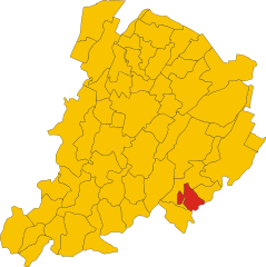
Province of Bologna (provincia di Bologna)

- province of Italy
 Hiking in Province of Bologna
Hiking in the Province of Bologna offers a delightful blend of natural beauty, rich history, and cultural heritage. This region, part of the Emilia-Romagna region in northern Italy, is characterized by its picturesque landscapes, including rolling hills, vineyards, and ancient towns.
Key Hiking Areas:
-
Bolognese Hills (Colli Bolognesi):
- The hills surrounding Bologna provide numerous trails with varying difficulty levels. Popular routes take you through vineyards, olive groves, and charming medieval villages such as Monte San Pietro and Vignola.
- Trail Suggestions: The Via degli Dei, a historical path connecting Bologna to Florence, is a great longer trek that showcases the stunning landscapes.
-
Parco Regionale dei Gessi Bolognesi e Calanchi dell'Abbadessa:
- This regional park offers unique geological formations and a network of trails. The park features impressive limestone cliffs and deep ravines, making it a great spot for both hiking and exploring.
- Trail Highlights: Paths lead through lush woodlands and offer panoramic views of the surrounding area.
-
Silla Nature Park:
- Located near the city, this park is perfect for a quick escape into nature without straying far from Bologna. It features various trails suitable for leisurely hikes and family outings.
-
Valli di Comacchio and the Delta del Po:
- While a bit further afield, the Delta del Po offers unique ecosystems and bird-watching opportunities. There are trails that allow you to explore the marshes and see traditional fishing techniques.
Hiking Considerations:
- Best Time to Hike: The ideal hiking seasons in Bologna are spring (April to June) and fall (September to October) when the weather is mild and the landscapes are particularly beautiful.
- Preparation: Make sure to carry adequate supplies such as water, snacks, and a first-aid kit. It's also wise to dress in layers, as the weather can change.
- Maps and Navigation: Sometimes, trail markers can be sparse; thus, having a physical map or a hiking app can be beneficial.
Local Culture and Cuisine:
- After a day of hiking, sample local delicacies such as tortellini, tagliatelle al ragù (Bolognese sauce), and local wines like Lambrusco.
- Take the time to visit historical sites in Bologna, such as the Two Towers, Piazza Maggiore, and the University of Bologna, which is one of the oldest universities in the world.
Overall, hiking in the Province of Bologna combines outdoor adventure with a rich cultural experience, making it an excellent destination for nature lovers and those seeking to explore the history and traditions of Italy.
- Country:

- Capital: Bologna
- Postal Code: 40010–40069; 40121–40141
- Local Dialing Code: 0542; 0534; 051
- Licence Plate Code: BO
- Coordinates: 44° 29' 38" N, 11° 20' 34" E


- GPS tracks (wikiloc): [Link]
- Area: 3702 sq km
- Web site: http://www.provincia.bologna.it/
- Wikipedia en: wiki(en)
- Wikipedia: wiki(it)
- Wikidata storage: Wikidata: Q16139
- Wikipedia Commons Gallery: [Link]
- Wikipedia Commons Category: [Link]
- Freebase ID: [/m/03wxhc]
- GeoNames ID: Alt: [3181927]
- BnF ID: [11933390t]
- VIAF ID: Alt: [312794095]
- GND ID: Alt: [4080457-4]
- archINFORM location ID: [2344]
- MusicBrainz area ID: [0f036b20-6e6b-4675-8533-42030e52e60d]
- Gran Enciclopèdia Catalana ID: [0010956]
- NUTS code: [ITH55]
- ISTAT ID: 037
- US National Archives Identifier: 10044831
- ISO 3166-2 code: IT-BO
Includes regions:


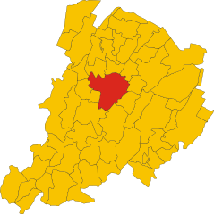
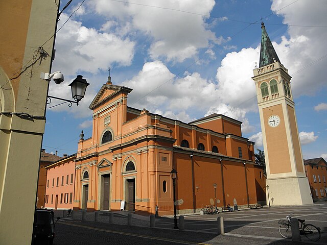
Valsamoggia
- italian municipality
Hiking in Valsamoggia
Valsamoggia is a picturesque area in the Emilia-Romagna region of Italy, located near the city of Bologna. It's known for its beautiful landscapes, rolling hills, vineyards, and charming villages, making it a great destination for hiking enthusiasts. Here are some key points to consider when hiking in Valsamoggia:...
- Country:
- Postal Code: 40053
- Licence Plate Code: BO
- Coordinates: 44° 30' 28" N, 11° 5' 54" E
- GPS tracks (wikiloc): [Link]
- AboveSeaLevel: 93 м m
- Area: 178.13 sq km
- Population: 30849
- Web site: [Link]
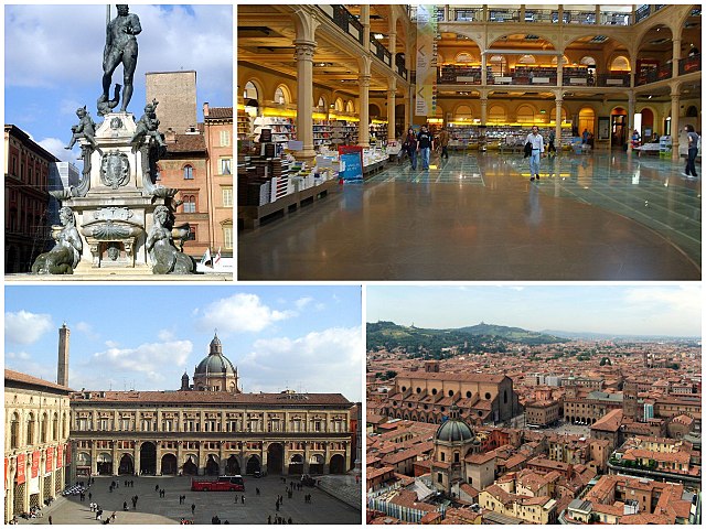
Bologna
- city in Emilia-Romagna, Italy
Hiking in Bologna
Bologna, known for its rich culture, gastronomy, and history, also offers some lovely opportunities for hiking and outdoor activities in its surrounding areas. Here's a guide to hiking in and around Bologna:...
- Country:
- Postal Code: 40121–40141
- Local Dialing Code: 051
- Licence Plate Code: BO
- Coordinates: 44° 29' 38" N, 11° 20' 34" E
- GPS tracks (wikiloc): [Link]
- AboveSeaLevel: 54 м m
- Area: 140.86 sq km
- Population: 388367
- Web site: [Link]
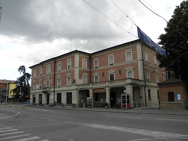
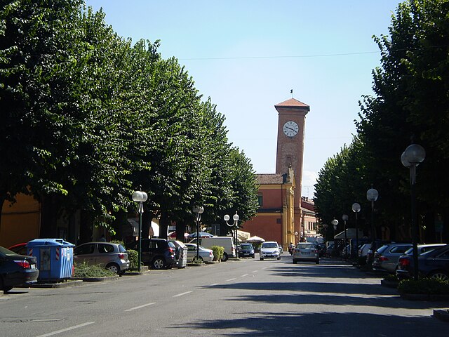
Ozzano dell'Emilia
- Italian comune
Hiking in Ozzano dell'Emilia
Ozzano dell'Emilia, located in the Emilia-Romagna region of Italy near Bologna, offers picturesque landscapes and a variety of hiking opportunities. The area is characterized by rolling hills, lush greenery, and a mix of agricultural and natural environments....
- Country:
- Postal Code: 40064
- Local Dialing Code: 051
- Licence Plate Code: BO
- Coordinates: 44° 27' 0" N, 11° 29' 0" E
- GPS tracks (wikiloc): [Link]
- AboveSeaLevel: 67 м m
- Area: 64.95 sq km
- Population: 13819
- Web site: [Link]


Imola
- town and comune in Italy
Hiking in Imola
Hiking in Imola can be a delightful experience, especially for those who appreciate the beautiful landscapes and rich history of the Emilia-Romagna region in Italy. While Imola is primarily known for its motorsport scene, including the famous Autodromo Enzo e Dino Ferrari, the surrounding areas offer various hiking opportunities....
- Country:
- Postal Code: 40026
- Local Dialing Code: 0542
- Licence Plate Code: BO
- Coordinates: 44° 21' 12" N, 11° 42' 52" E
- GPS tracks (wikiloc): [Link]
- AboveSeaLevel: 47 м m
- Area: 205.02 sq km
- Population: 69951
- Web site: [Link]


Argelato
- Italian comune
Hiking in Argelato
Argelato is a municipality located in the Emilia-Romagna region of Italy, near Bologna. While it's not primarily known as a hiking destination, there are some opportunities for outdoor activities in the surrounding areas. Here are some points to consider if you're thinking about hiking around Argelato:...
- Country:
- Postal Code: 40050
- Local Dialing Code: 051
- Licence Plate Code: BO
- Coordinates: 44° 38' 33" N, 11° 20' 55" E
- GPS tracks (wikiloc): [Link]
- AboveSeaLevel: 25 м m
- Area: 35.1 sq km
- Population: 9865
- Web site: [Link]
Vergato
- Italian comune
Hiking in Vergato
Vergato, located in the Emilia-Romagna region of Italy, offers a variety of hiking opportunities surrounded by beautiful landscapes and historical sites. Situated in the foothills of the Apennines, Vergato provides access to trails that cater to hikers of all levels, from leisurely walks to more challenging treks....
- Country:
- Postal Code: 40038
- Local Dialing Code: 051
- Licence Plate Code: BO
- Coordinates: 44° 17' 0" N, 11° 7' 0" E
- GPS tracks (wikiloc): [Link]
- AboveSeaLevel: 193 м m
- Area: 59 sq km
- Population: 7664
- Web site: [Link]
Anzola dell'Emilia
- Italian comune
Hiking in Anzola dell'Emilia
Anzola dell'Emilia is a charming town located in the Emilia-Romagna region of Italy, known for its rich cultural heritage and beautiful landscapes. While it may not be as famous for hiking as some of the more mountainous regions of Italy, there are certainly opportunities for outdoor activities in and around Anzola dell'Emilia....
- Country:
- Postal Code: 40011
- Local Dialing Code: 051
- Licence Plate Code: BO
- Coordinates: 44° 32' 50" N, 11° 11' 44" E
- GPS tracks (wikiloc): [Link]
- AboveSeaLevel: 38 м m
- Area: 36.6 sq km
- Population: 12310
- Web site: [Link]


Baricella
- Italian comune
Hiking in Baricella
Baricella is a small town located in the province of Bologna in the Emilia-Romagna region of Italy. While it may not be as widely recognized for hiking as some of the larger national parks or mountainous regions, it offers some charming paths and routes for those looking to enjoy nature....
- Country:
- Postal Code: 40052
- Local Dialing Code: 051
- Licence Plate Code: BO
- Coordinates: 44° 38' 51" N, 11° 32' 7" E
- GPS tracks (wikiloc): [Link]
- AboveSeaLevel: 11 м m
- Area: 45.48 sq km
- Population: 7030
- Web site: [Link]

Bentivoglio
- Italian comune
Hiking in Bentivoglio
Bentivoglio, located in the Emilia-Romagna region of Italy, is a small town known for its historical significance and agricultural surroundings. While it may not be a well-known hiking destination like some of the larger national parks or mountain areas in Italy, there are still opportunities for hiking and exploring the beautiful Emilian countryside....
- Country:
- Postal Code: 40010
- Local Dialing Code: 051
- Licence Plate Code: BO
- Coordinates: 44° 38' 7" N, 11° 25' 8" E
- GPS tracks (wikiloc): [Link]
- AboveSeaLevel: 19 м m
- Area: 51.14 sq km
- Population: 5513
- Web site: [Link]
Borgo Tossignano
- Italian comune
Hiking in Borgo Tossignano
Borgo Tossignano is a picturesque village located in the Emilia-Romagna region of Italy, nestled amid rolling hills and lush landscapes. It offers several hiking opportunities that allow nature enthusiasts to explore the stunning scenery, rich history, and vibrant local culture....
- Country:
- Postal Code: 40021
- Local Dialing Code: 0542
- Licence Plate Code: BO
- Coordinates: 44° 17' 0" N, 11° 35' 0" E
- GPS tracks (wikiloc): [Link]
- AboveSeaLevel: 102 м m
- Area: 29 sq km
- Population: 3010
- Web site: [Link]

Budrio
- Italian comune
Hiking in Budrio
Budrio, located in the Emilia-Romagna region of Italy, is a charming town known for its rich history and beautiful landscapes. While Budrio itself is not a major hiking destination like the nearby Apennines, there are still several opportunities for walking and exploring the natural scenery in and around the area....
- Country:
- Postal Code: 40054
- Local Dialing Code: 051
- Licence Plate Code: BO
- Coordinates: 44° 32' 15" N, 11° 32' 4" E
- GPS tracks (wikiloc): [Link]
- AboveSeaLevel: 26 м m
- Area: 120.18 sq km
- Population: 18440
- Web site: [Link]


Calderara di Reno
- Italian comune
Hiking in Calderara di Reno
Calderara di Reno is a municipality located in the province of Bologna, Italy. While the area itself may not be as widely recognized for hiking as some of the larger national parks or mountainous regions, it offers some opportunities for outdoor enthusiasts. Here’s what you can expect when hiking in and around Calderara di Reno:...
- Country:
- Postal Code: 40012
- Local Dialing Code: 051
- Licence Plate Code: BO
- Coordinates: 44° 33' 50" N, 11° 16' 19" E
- GPS tracks (wikiloc): [Link]
- AboveSeaLevel: 30 м m
- Area: 41.25 sq km
- Population: 13224
- Web site: [Link]
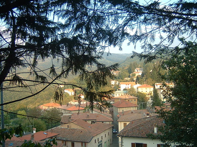
Camugnano
- Italian comune
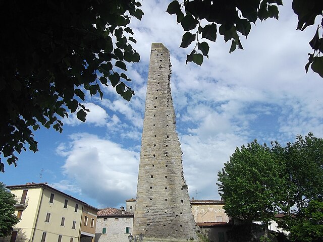
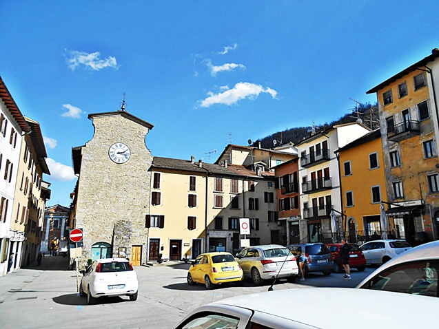
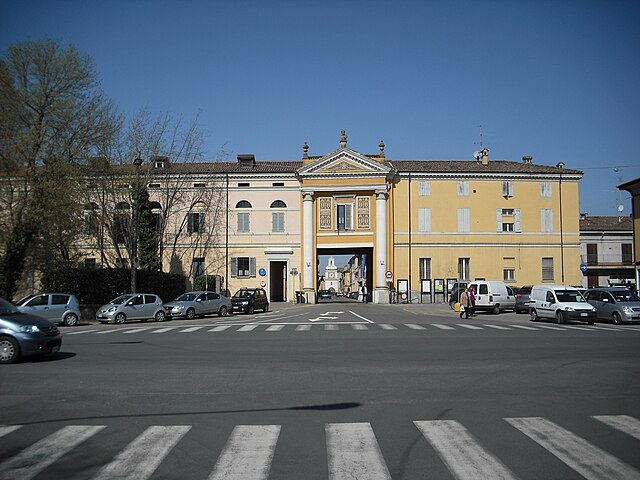
Hiking in Camugnano
Camugnano, located in the Apennine Mountains of Italy, is a fantastic destination for hiking enthusiasts. Situated in the province of Bologna, it offers beautiful landscapes, diverse flora and fauna, and a variety of trails suitable for different skill levels....
- Country:
- Postal Code: 40032
- Local Dialing Code: 0534
- Licence Plate Code: BO
- Coordinates: 44° 10' 0" N, 11° 6' 0" E
- GPS tracks (wikiloc): [Link]
- AboveSeaLevel: 692 м m
- Area: 96 sq km
- Population: 2132
- Web site: [Link]


Casalecchio di Reno
- Italian comune
Hiking in Casalecchio di Reno
Casalecchio di Reno is a town located in the Emilia-Romagna region of Italy, near Bologna. It offers a variety of hiking opportunities, particularly for those interested in combining nature with the charm of local culture....
- Country:
- Postal Code: 40033
- Local Dialing Code: 051
- Licence Plate Code: BO
- Coordinates: 44° 29' 0" N, 11° 17' 0" E
- GPS tracks (wikiloc): [Link]
- AboveSeaLevel: 61 м m
- Area: 17 sq km
- Population: 36456
- Web site: [Link]


Casalfiumanese
- Italian comune
Hiking in Casalfiumanese
Casalfiumanese, a small municipality located in the Emilia-Romagna region of Italy, is surrounded by beautiful hills and countryside, making it a delightful destination for hiking enthusiasts. The area's natural landscapes, rich in flora and fauna, provide numerous trails that cater to various skill levels, from easy walks to more challenging hikes....
- Country:
- Postal Code: 40020
- Local Dialing Code: 0542
- Licence Plate Code: BO
- Coordinates: 44° 18' 0" N, 11° 38' 0" E
- GPS tracks (wikiloc): [Link]
- AboveSeaLevel: 125 м m
- Area: 82 sq km
- Population: 3460
- Web site: [Link]
Castel d'Aiano
- Italian comune
Hiking in Castel d'Aiano
Castel d'Aiano is a charming town located in the Emilia-Romagna region of Italy, well known for its beautiful natural landscapes and rich historical background. It sits in the Apennine Mountains, making it a great destination for outdoor enthusiasts, particularly hikers....
- Country:
- Postal Code: 40034
- Local Dialing Code: 051
- Licence Plate Code: BO
- Coordinates: 44° 16' 36" N, 11° 0' 1" E
- GPS tracks (wikiloc): [Link]
- AboveSeaLevel: 805 м m
- Area: 45.26 sq km
- Population: 1865
- Web site: [Link]


Castel del Rio
- Italian comune
Hiking in Castel del Rio
Castel del Rio, located in the Emilia-Romagna region of Italy, is an excellent destination for hiking enthusiasts. Nestled in the Apennine mountains and surrounded by lush forests, this area offers a variety of trails that cater to different skill levels....
- Country:
- Postal Code: 40022
- Local Dialing Code: 0542
- Licence Plate Code: BO
- Coordinates: 44° 12' 50" N, 11° 30' 15" E
- GPS tracks (wikiloc): [Link]
- AboveSeaLevel: 215 м m
- Area: 52.58 sq km
- Population: 1209
- Web site: [Link]

Castel di Casio
- Italian comune
Hiking in Castel di Casio
Castel di Casio is a picturesque municipality located in the Emilia-Romagna region of Italy, nestled in the Apennine Mountains. It's known for its stunning landscapes, rich history, and outdoor recreational opportunities, making it an excellent destination for hiking enthusiasts....
- Country:
- Postal Code: 40030
- Local Dialing Code: 0534
- Licence Plate Code: BO
- Coordinates: 44° 10' 0" N, 11° 2' 0" E
- GPS tracks (wikiloc): [Link]
- AboveSeaLevel: 533 м m
- Area: 47.33 sq km
- Population: 3418
- Web site: [Link]
Castel Guelfo di Bologna
- Italian comune
Hiking in Castel Guelfo di Bologna
Castel Guelfo di Bologna, located in the Emilia-Romagna region of Italy, offers a beautiful setting for hiking and enjoying nature. This area is characterized by rolling hills, vineyards, and ancient woodlands, making it an ideal spot for both casual walkers and more experienced hikers....
- Country:
- Postal Code: 40023
- Local Dialing Code: 051; 0542
- Licence Plate Code: BO
- Coordinates: 44° 26' 0" N, 11° 41' 0" E
- GPS tracks (wikiloc): [Link]
- AboveSeaLevel: 32 м m
- Area: 28.61 sq km
- Population: 4506
- Web site: [Link]


Castel Maggiore
- Italian comune
Hiking in Castel Maggiore
Castel Maggiore is a charming area located just outside of Bologna, Italy. While it may not be as widely known for extensive hiking trails compared to some of Italy's larger national parks or mountainous regions, there are still opportunities for outdoor walking and exploration in the surrounding countryside....
- Country:
- Postal Code: 40013
- Local Dialing Code: 051
- Licence Plate Code: BO
- Coordinates: 44° 34' 40" N, 11° 21' 42" E
- GPS tracks (wikiloc): [Link]
- AboveSeaLevel: 29 м m
- Area: 30.9 sq km
- Population: 18349
- Web site: [Link]


Castel San Pietro Terme
- Italian comune
Hiking in Castel San Pietro Terme
Castel San Pietro Terme, located in the Emilia-Romagna region of Italy, offers a variety of hiking opportunities amidst beautiful landscapes and a rich cultural backdrop. The area is characterized by rolling hills, vineyards, and historical sites, making it an attractive destination for both nature lovers and outdoor enthusiasts....
- Country:
- Postal Code: 40024
- Local Dialing Code: 051
- Licence Plate Code: BO
- Coordinates: 44° 23' 52" N, 11° 35' 22" E
- GPS tracks (wikiloc): [Link]
- AboveSeaLevel: 75 м m
- Area: 148.42 sq km
- Population: 20862
- Web site: [Link]


Castello d'Argile
- Italian comune
Hiking in Castello d'Argile
Castello d'Argile, located in the Emilia-Romagna region of Italy, offers a picturesque setting for those interested in hiking, albeit it is not as famous for hiking trails as some other regions in Italy. This small town, situated in the province of Bologna, provides a blend of rural charm and historical sights....
- Country:
- Postal Code: 40050
- Local Dialing Code: 051
- Licence Plate Code: BO
- Coordinates: 44° 40' 52" N, 11° 17' 48" E
- GPS tracks (wikiloc): [Link]
- AboveSeaLevel: 23 м m
- Area: 29.07 sq km
- Population: 6583
- Web site: [Link]
Castenaso
- Italian comune
Hiking in Castenaso
Castenaso, located in the Emilia-Romagna region of Italy, is a charming town surrounded by scenic landscapes, making it a great area for hiking enthusiasts. While the town itself may not have extensive hiking routes, it serves as a gateway to explore the nearby hills and natural parks....
- Country:
- Postal Code: 40050; 40055
- Local Dialing Code: 051
- Licence Plate Code: BO
- Coordinates: 44° 30' 35" N, 11° 28' 14" E
- GPS tracks (wikiloc): [Link]
- AboveSeaLevel: 42 м m
- Area: 35.73 sq km
- Population: 15363
- Web site: [Link]

Castiglione dei Pepoli
- Italian comune
Hiking in Castiglione dei Pepoli
Castiglione dei Pepoli is a charming village located in the Emilia-Romagna region of Italy, surrounded by the stunning landscapes of the Apennine Mountains. Known for its picturesque scenery, it offers numerous opportunities for hiking enthusiasts to explore the natural beauty of the area....
- Country:
- Postal Code: 40035
- Local Dialing Code: 0534
- Licence Plate Code: BO
- Coordinates: 44° 9' 0" N, 11° 9' 0" E
- GPS tracks (wikiloc): [Link]
- AboveSeaLevel: 691 м m
- Area: 65.76 sq km
- Population: 5514
- Web site: [Link]

Crevalcore
- Italian comune
Hiking in Crevalcore
Crevalcore is a charming town located in the Emilia-Romagna region of Italy, known more for its agricultural landscape than for traditional hiking trails. However, there are opportunities for easy hiking and walking in the surrounding countryside....
- Country:
- Postal Code: 40014
- Local Dialing Code: 051
- Licence Plate Code: BO
- Coordinates: 44° 43' 0" N, 11° 9' 0" E
- GPS tracks (wikiloc): [Link]
- AboveSeaLevel: 20 м m
- Area: 102.75 sq km
- Population: 13501
- Web site: [Link]


Dozza
- Italian comune
Hiking in Dozza
Dozza is a charming village located in the Emilia-Romagna region of Italy, known for its rich history, picturesque landscapes, and vibrant art scene. While it may not be as famous for hiking as some of its surrounding areas, there are still some lovely trails and opportunities for outdoor enthusiasts to enjoy....
- Country:
- Postal Code: 40060
- Local Dialing Code: 0542
- Licence Plate Code: BO
- Coordinates: 44° 21' 32" N, 11° 37' 40" E
- GPS tracks (wikiloc): [Link]
- AboveSeaLevel: 190 м m
- Area: 24 sq km
- Population: 6588
- Web site: [Link]

Fontanelice
- Italian comune
Hiking in Fontanelice
Fontanelice is a small town located in the region of Emilia-Romagna, Italy, known for its beautiful landscapes and picturesque countryside. Hiking in and around Fontanelice offers a wonderful opportunity to explore the natural beauty of the area, which is characterized by rolling hills, lush forests, and charming villages....
- Country:
- Postal Code: 40025
- Local Dialing Code: 0542
- Licence Plate Code: BO
- Coordinates: 44° 16' 0" N, 11° 34' 0" E
- GPS tracks (wikiloc): [Link]
- AboveSeaLevel: 165 м m
- Area: 36.56 sq km
- Population: 1944
- Web site: [Link]
Gaggio Montano
- Italian comune
Hiking in Gaggio Montano
Gaggio Montano is a charming municipality nestled in the Apennine Mountains of northern Italy, in the province of Bologna. This area is known for its natural beauty, offering a variety of hiking trails that cater to different skill levels. Here’s what you can expect when hiking in Gaggio Montano:...
- Country:
- Postal Code: 40041
- Local Dialing Code: 0534
- Licence Plate Code: BO
- Coordinates: 44° 12' 0" N, 10° 56' 0" E
- GPS tracks (wikiloc): [Link]
- AboveSeaLevel: 682 м m
- Area: 58 sq km
- Population: 4760
- Web site: [Link]
Galliera
- Italian comune
Hiking in Galliera
Galliera is a municipality located in the Emilia-Romagna region of northern Italy, near Bologna. While it's not widely recognized as a major hiking destination, the surrounding areas offer beautiful landscapes, fields, and trails that can be appealing to hikers looking for a more regional experience....
- Country:
- Postal Code: 40015
- Local Dialing Code: 051
- Licence Plate Code: BO
- Coordinates: 44° 45' 0" N, 11° 24' 0" E
- GPS tracks (wikiloc): [Link]
- AboveSeaLevel: 14 м m
- Area: 37.16 sq km
- Population: 5451
- Web site: [Link]


Granaglione
- Italian comune
Hiking in Granaglione
Granaglione is a charming town located in the Apennine Mountains of Italy, specifically in the province of Bologna, Emilia-Romagna. The area surrounding Granaglione offers beautiful landscapes, rich flora and fauna, and numerous opportunities for hiking enthusiasts of all levels....
- Country:
- Postal Code: 40030; 40030–40045
- Local Dialing Code: 0534
- Licence Plate Code: BO
- Coordinates: 44° 7' 0" N, 10° 58' 0" E
- GPS tracks (wikiloc): [Link]
- AboveSeaLevel: 493 м m
- Area: 39 sq km
- Population: 2089
- Web site: [Link]

Granarolo dell'Emilia
- Italian comune
Hiking in Granarolo dell'Emilia
Granarolo dell'Emilia is a small town located in the Emilia-Romagna region of Italy, known for its picturesque landscapes and proximity to the Apennine mountains. While it may not be a well-known hiking hub, there are certainly opportunities for hiking and enjoying the natural beauty of the surrounding area....
- Country:
- Postal Code: 40057
- Local Dialing Code: 051
- Licence Plate Code: BO
- Coordinates: 44° 33' 12" N, 11° 26' 34" E
- GPS tracks (wikiloc): [Link]
- AboveSeaLevel: 28 м m
- Area: 34 sq km
- Population: 12032
- Web site: [Link]


Grizzana Morandi
- Italian comune
Hiking in Grizzana Morandi
Grizzana Morandi, located in the Apennine Mountains of northern Italy, offers a wonderful hiking experience surrounded by stunning landscapes, rich flora and fauna, and historical sites. Here are some highlights to consider when hiking in this beautiful area:...
- Country:
- Postal Code: 40030
- Local Dialing Code: 051
- Licence Plate Code: BO
- Coordinates: 44° 15' 0" N, 11° 9' 0" E
- GPS tracks (wikiloc): [Link]
- AboveSeaLevel: 547 м m
- Area: 77 sq km
- Population: 3694
- Web site: [Link]


Lizzano in Belvedere
- Italian comune
Hiking in Lizzano in Belvedere
Lizzano in Belvedere, located in the Apennine Mountains of Italy, is a fantastic hiking destination known for its stunning landscapes, rich biodiversity, and various trails that cater to different skill levels. Here’s a general overview of what to expect when hiking in this beautiful area:...
- Country:
- Postal Code: 40042
- Local Dialing Code: 0534
- Licence Plate Code: BO
- Coordinates: 44° 10' 0" N, 10° 54' 0" E
- GPS tracks (wikiloc): [Link]
- AboveSeaLevel: 640 м m
- Area: 85.45 sq km
- Population: 2191
- Web site: [Link]


Loiano
- Italian comune
Hiking in Loiano
Loiano is a picturesque town located in the Emilia-Romagna region of Italy, nestled in the Apennine Mountains. It serves as an excellent base for hiking enthusiasts, offering a variety of trails that cater to different skill levels and preferences. Here are some key points to consider when hiking in Loiano:...
- Country:
- Postal Code: 40050
- Local Dialing Code: 051
- Licence Plate Code: BO
- Coordinates: 44° 16' 0" N, 11° 19' 0" E
- GPS tracks (wikiloc): [Link]
- AboveSeaLevel: 714 м m
- Area: 52.41 sq km
- Population: 4288
- Web site: [Link]
Malalbergo
- Italian comune
Hiking in Malalbergo
Malalbergo, located in the Emilia-Romagna region of Italy, offers various hiking opportunities that showcase its beautiful landscapes, historic sites, and charming villages. While the area may not be as famous for hiking as some of Italy's larger national parks, it provides unique trails that appeal to outdoor enthusiasts....
- Country:
- Postal Code: 40051
- Local Dialing Code: 051
- Licence Plate Code: BO
- Coordinates: 44° 43' 10" N, 11° 31' 59" E
- GPS tracks (wikiloc): [Link]
- AboveSeaLevel: 12 м m
- Area: 53.82 sq km
- Population: 9087
- Web site: [Link]


Marzabotto
- Italian comune
Hiking in Marzabotto
Marzabotto, located in the Emilia-Romagna region of Italy, is not only known for its historical significance but also offers a variety of hiking opportunities that showcase the region's natural beauty and rich culture....
- Country:
- Postal Code: 40043
- Local Dialing Code: 051
- Licence Plate Code: BO
- Coordinates: 44° 20' 0" N, 11° 12' 0" E
- GPS tracks (wikiloc): [Link]
- AboveSeaLevel: 130 м m
- Area: 74.53 sq km
- Population: 6853
- Web site: [Link]
Medicina
- Italian comune
Hiking in Medicina
Medicina, located in the Emilia-Romagna region of Italy, is not primarily known as a hiking destination, but it is surrounded by beautiful landscapes that can provide a variety of hiking opportunities. The region's rich history, charming countryside, and proximity to the Apennine Mountains make it an appealing area for outdoor enthusiasts....
- Country:
- Postal Code: 40059
- Local Dialing Code: 051
- Licence Plate Code: BO
- Coordinates: 44° 29' 0" N, 11° 38' 0" E
- GPS tracks (wikiloc): [Link]
- AboveSeaLevel: 25 м m
- Area: 159.11 sq km
- Population: 16768
- Web site: [Link]


Minerbio
- Italian comune
Hiking in Minerbio
Minerbio is a small town located in the Emilia-Romagna region of Italy, situated just northeast of the city of Bologna. While Minerbio itself is not widely known for extensive hiking trails or major outdoor activities, the surrounding countryside offers some pleasant opportunities for walking and exploring the natural landscape....
- Country:
- Postal Code: 40061
- Local Dialing Code: 051
- Licence Plate Code: BO
- Coordinates: 44° 37' 3" N, 11° 28' 18" E
- GPS tracks (wikiloc): [Link]
- AboveSeaLevel: 16 м m
- Area: 43.07 sq km
- Population: 8760
- Web site: [Link]

Molinella
- Italian comune
Hiking in Molinella
Molinella is a charming town located in the Emilia-Romagna region of Italy. While it may not be as renowned for hiking as some other areas in Italy, it offers lovely landscapes and opportunities for walking and exploring the countryside....
- Country:
- Postal Code: 40062
- Local Dialing Code: 051
- Licence Plate Code: BO
- Coordinates: 44° 37' 3" N, 11° 40' 2" E
- GPS tracks (wikiloc): [Link]
- AboveSeaLevel: 8 м m
- Area: 127.84 sq km
- Population: 15642
- Web site: [Link]


Monghidoro
- Italian comune
Hiking in Monghidoro
Monghidoro, located in the region of Emilia-Romagna in Italy, offers a variety of hiking opportunities that allow you to explore its beautiful landscapes and rich biodiversity. Here’s what you need to know about hiking in this area:...
- Country:
- Postal Code: 40063
- Local Dialing Code: 051
- Licence Plate Code: BO
- Coordinates: 44° 13' 0" N, 11° 19' 0" E
- GPS tracks (wikiloc): [Link]
- AboveSeaLevel: 841 м m
- Area: 48.29 sq km
- Population: 3689
- Web site: [Link]
Monte San Pietro
- Italian comune
Hiking in Monte San Pietro
Monte San Pietro, located in the Emilia-Romagna region of Italy, offers a variety of hiking opportunities for outdoor enthusiasts. The area is characterized by its beautiful landscapes, rolling hills, and picturesque views, making it an ideal spot for both casual walkers and experienced hikers....
- Country:
- Postal Code: 40050
- Local Dialing Code: 051
- Licence Plate Code: BO
- Coordinates: 44° 26' 19" N, 11° 8' 3" E
- GPS tracks (wikiloc): [Link]
- AboveSeaLevel: 112 м m
- Area: 74.69 sq km
- Population: 10960
- Web site: [Link]


Monterenzio
- Italian comune
Hiking in Monterenzio
Monterenzio is a charming municipality located in the Emilia-Romagna region of Italy, surrounded by beautiful hills and natural landscapes, making it a fantastic location for hiking enthusiasts. Here are some highlights and things to consider if you're planning to hike in Monterenzio:...
- Country:
- Postal Code: 40050
- Local Dialing Code: 051
- Licence Plate Code: BO
- Coordinates: 44° 20' 0" N, 11° 24' 0" E
- GPS tracks (wikiloc): [Link]
- AboveSeaLevel: 207 м m
- Area: 105.26 sq km
- Population: 6110
- Web site: [Link]


Monzuno
- Italian comune
Hiking in Monzuno
Monzuno is located in the Emilia-Romagna region of Italy, nestled within the beautiful hills of the Apennine Mountains. It’s a wonderful destination for hikers and nature enthusiasts, offering a variety of trails that cater to different skill levels. Here are some highlights to consider when hiking in Monzuno:...
- Country:
- Postal Code: 40036
- Local Dialing Code: 051
- Licence Plate Code: BO
- Coordinates: 44° 17' 0" N, 11° 16' 0" E
- GPS tracks (wikiloc): [Link]
- AboveSeaLevel: 621 м m
- Area: 65.01 sq km
- Population: 6375
- Web site: [Link]
Mordano
- Italian comune
Hiking in Mordano
Mordano, located in the Emilia-Romagna region of Italy, is not typically known as a major hiking destination compared to more mountainous areas of Italy, but it does offer some pleasant trails and beautiful landscapes for outdoor enthusiasts....
- Country:
- Postal Code: 40027
- Local Dialing Code: 0542
- Licence Plate Code: BO
- Coordinates: 44° 24' 0" N, 11° 49' 0" E
- GPS tracks (wikiloc): [Link]
- AboveSeaLevel: 21 м m
- Area: 21.45 sq km
- Population: 4692
- Web site: [Link]


Pianoro
- Italian comune
Hiking in Pianoro
Pianoro, located in the Emilia-Romagna region of Italy, offers a variety of hiking opportunities, characterized by its beautiful landscapes, rolling hills, and charming countryside. The area is not far from the city of Bologna, making it easily accessible for both locals and visitors....
- Country:
- Postal Code: 40065; 40067; 40060
- Local Dialing Code: 051
- Licence Plate Code: BO
- Coordinates: 44° 23' 0" N, 11° 20' 0" E
- GPS tracks (wikiloc): [Link]
- AboveSeaLevel: 200 м m
- Area: 107.13 sq km
- Population: 17503
- Web site: [Link]


Pieve di Cento
- Italian comune
Hiking in Pieve di Cento
Pieve di Cento, located in the Emilia-Romagna region of Italy, may not be as well-known for hiking as some of the nearby mountainous areas, but it offers charming landscapes and opportunities for outdoor activities in the surrounding countryside. Here’s what you can expect when hiking in and around Pieve di Cento:...
- Country:
- Postal Code: 40066
- Local Dialing Code: 051
- Licence Plate Code: BO
- Coordinates: 44° 42' 47" N, 11° 18' 30" E
- GPS tracks (wikiloc): [Link]
- AboveSeaLevel: 18 м m
- Area: 15.94 sq km
- Population: 7068
- Web site: [Link]

Sala Bolognese
- Italian comune
Hiking in Sala Bolognese
Sala Bolognese, located in the Emilia-Romagna region of Italy, is not a widely recognized hiking destination compared to surrounding areas. However, the region's rich landscape and proximity to larger natural attractions provide opportunities for walkers and hikers to explore....
- Country:
- Postal Code: 40010
- Local Dialing Code: 051
- Licence Plate Code: BO
- Coordinates: 44° 37' 49" N, 11° 16' 34" E
- GPS tracks (wikiloc): [Link]
- AboveSeaLevel: 25 м m
- Area: 45.64 sq km
- Population: 8372
- Web site: [Link]

San Benedetto Val di Sambro
- Italian comune
Hiking in San Benedetto Val di Sambro
San Benedetto Val di Sambro, located in the Apennine Mountains of Italy, offers a picturesque setting for hiking enthusiasts. The area is characterized by its lush landscapes, rolling hills, and a diverse range of flora and fauna. Here are some highlights and tips for hiking in this region:...
- Country:
- Postal Code: 40048
- Local Dialing Code: 0534
- Licence Plate Code: BO
- Coordinates: 44° 13' 0" N, 11° 14' 0" E
- GPS tracks (wikiloc): [Link]
- AboveSeaLevel: 602 м m
- Area: 66.47 sq km
- Population: 4198
- Web site: [Link]

San Giorgio di Piano
- Italian comune
Hiking in San Giorgio di Piano
San Giorgio di Piano is a charming town located in the Emilia-Romagna region of Italy, known primarily for its agricultural landscape and historical significance. While it might not be a well-known hiking destination compared to more mountainous areas in Italy, there are definitely opportunities to enjoy nature and explore the surrounding countryside....
- Country:
- Postal Code: 40016
- Local Dialing Code: 051
- Licence Plate Code: BO
- Coordinates: 44° 39' 0" N, 11° 23' 0" E
- GPS tracks (wikiloc): [Link]
- AboveSeaLevel: 21 м m
- Area: 30.43 sq km
- Population: 8749
- Web site: [Link]

San Giovanni in Persiceto
- Italian comune
Hiking in San Giovanni in Persiceto
San Giovanni in Persiceto, located in the Emilia-Romagna region of Italy, offers beautiful landscapes and scenic routes that attract hikers looking to explore the rustic charm of the area. While the town itself is known for its historical architecture and cultural heritage, the surrounding countryside provides several opportunities for hiking and outdoor activities....
- Country:
- Postal Code: 40017
- Local Dialing Code: 051
- Licence Plate Code: BO
- Coordinates: 44° 38' 27" N, 11° 11' 6" E
- GPS tracks (wikiloc): [Link]
- AboveSeaLevel: 21 м m
- Area: 114.41 sq km
- Population: 28153
- Web site: [Link]


San Lazzaro di Savena
- Italian comune
Hiking in San Lazzaro di Savena
San Lazzaro di Savena is a charming town located near Bologna, Italy, and offers a variety of hiking opportunities in the surrounding areas. The region is characterized by its picturesque hills, lush forests, and scenic landscapes, making it an excellent destination for outdoor enthusiasts....
- Country:
- Postal Code: 40068
- Local Dialing Code: 051
- Licence Plate Code: BO
- Coordinates: 44° 28' 4" N, 11° 24' 50" E
- GPS tracks (wikiloc): [Link]
- AboveSeaLevel: 62 м m
- Area: 44.72 sq km
- Population: 32473
- Web site: [Link]


San Pietro in Casale
- Italian comune
Hiking in San Pietro in Casale
San Pietro in Casale is a charming town located in the Emilia-Romagna region of Italy, surrounded by beautiful landscapes that offer some great opportunities for hiking and outdoor activities. While the town itself may not be a well-known hiking destination, its proximity to the Po Valley and the surrounding countryside provides various trails and paths for nature lovers and hikers....
- Country:
- Postal Code: 40018
- Local Dialing Code: 051
- Licence Plate Code: BO
- Coordinates: 44° 42' 0" N, 11° 24' 0" E
- GPS tracks (wikiloc): [Link]
- AboveSeaLevel: 17 м m
- Area: 65.86 sq km
- Population: 12418
- Web site: [Link]
Sant'Agata Bolognese
- Italian comune
Hiking in Sant'Agata Bolognese
Sant'Agata Bolognese is a charming village located in the Emilia-Romagna region of Italy, and while it may not be widely known as a hiking destination, it offers a few opportunities to enjoy the beautiful Italian countryside....
- Country:
- Postal Code: 40019
- Local Dialing Code: 051
- Licence Plate Code: BO
- Coordinates: 44° 40' 0" N, 11° 8' 0" E
- GPS tracks (wikiloc): [Link]
- AboveSeaLevel: 21 м m
- Area: 34.79 sq km
- Population: 7344
- Web site: [Link]

Sasso Marconi
- Italian comune
Hiking in Sasso Marconi
Sasso Marconi, located in the Emilia-Romagna region of Italy, is a great area for hiking enthusiasts. Nestled in the Apennine Mountains, it offers a range of trails suited for different skill levels, with beautiful landscapes that include hills, forests, and panoramic views of the surrounding countryside....
- Country:
- Postal Code: 40037
- Local Dialing Code: 051
- Licence Plate Code: BO
- Coordinates: 44° 24' 0" N, 11° 15' 0" E
- GPS tracks (wikiloc): [Link]
- AboveSeaLevel: 128 м m
- Area: 96.45 sq km
- Population: 14903
- Web site: [Link]


Zola Predosa
- Italian comune
Hiking in Zola Predosa
Zola Predosa, located in the metropolitan area of Bologna in Italy, offers a variety of hiking opportunities amidst its picturesque landscapes. The area is characterized by rolling hills, vineyards, and olive groves, making it an appealing destination for outdoor enthusiasts. Here are some key points about hiking in Zola Predosa:...
- Country:
- Postal Code: 40069
- Local Dialing Code: 051
- Licence Plate Code: BO
- Coordinates: 44° 29' 18" N, 11° 13' 5" E
- GPS tracks (wikiloc): [Link]
- AboveSeaLevel: 74 м m
- Area: 37 sq km
- Population: 15105
- Web site: [Link]
Shares border with regions:

Province of Ferrara
- province of Italy
Hiking in Province of Ferrara
The Province of Ferrara, located in the Emilia-Romagna region of northern Italy, is not typically recognized for extensive hiking trails like some of its mountainous neighbors. However, it does offer some unique opportunities for those interested in exploring its natural beauty and historical landscapes....
- Country:
- Capital: Ferrara
- Postal Code: 44010–44049; 44121–44124
- Local Dialing Code: 0533; 0532
- Licence Plate Code: FE
- Coordinates: 44° 50' 42" N, 11° 37' 58" E
- GPS tracks (wikiloc): [Link]
- Area: 2630 sq km
- Web site: [Link]

Province of Florence
- one of the ten provinces of Tuscany
Hiking in Province of Florence
Hiking in the Province of Florence offers an exquisite blend of natural beauty, cultural heritage, and historical charm. The region is characterized by scenic landscapes, rolling hills, vineyards, olive groves, and ancient towns, making it a fantastic destination for hikers of all levels....
- Country:
- Capital: Florence
- Postal Code: 50100
- Local Dialing Code: 0571; 055
- Licence Plate Code: FI
- Coordinates: 43° 46' 17" N, 11° 15' 15" E
- GPS tracks (wikiloc): [Link]
- Area: 3514 sq km
- Web site: [Link]


Province of Modena
- province of Italy
Hiking in Province of Modena
The Province of Modena, located in the Emilia-Romagna region of Italy, offers a rich array of hiking opportunities, characterized by its diverse landscapes, rolling hills, vineyards, and historical sites. Here are some highlights for hiking in this picturesque area:...
- Country:
- Capital: Modena
- Postal Code: 41121–41126
- Local Dialing Code: 0536; 0535; 059
- Licence Plate Code: MO
- Coordinates: 44° 10' 49" N, 10° 38' 54" E
- GPS tracks (wikiloc): [Link]
- Area: 2688 sq km
- Web site: [Link]


Province of Pistoia
- province of Italy
Hiking in Province of Pistoia
The Province of Pistoia, located in Tuscany, Italy, is known for its stunning landscapes, rich history, and diverse hiking opportunities. Here are some highlights and tips for hiking in this beautiful region:...
- Country:
- Capital: Pistoia
- Postal Code: 51010–51039; 51100
- Local Dialing Code: 0574; 0572; 0573
- Licence Plate Code: PT
- Coordinates: 43° 56' 0" N, 10° 55' 0" E
- GPS tracks (wikiloc): [Link]
- Area: 964.98 sq km
- Web site: [Link]


Province of Prato
- province of Italy
Hiking in Province of Prato
The Province of Prato, located in Tuscany, Italy, offers a variety of hiking opportunities that cater to different skill levels and interests. Here's an overview of what you can expect when hiking in this beautiful region:...
- Country:
- Capital: Prato
- Postal Code: 59011–59026; 59100
- Local Dialing Code: 055; 0574
- Licence Plate Code: PO
- Coordinates: 43° 52' 51" N, 11° 5' 48" E
- GPS tracks (wikiloc): [Link]
- Area: 365.26 sq km
- Web site: [Link]


Province of Ravenna
- province of Italy
Hiking in Province of Ravenna
Hiking in the Province of Ravenna offers a delightful mix of natural beauty, historical sites, and diverse landscapes. Situated in the Emilia-Romagna region of Italy, Ravenna is known for its rich cultural heritage, including early Christian mosaics and beautiful Byzantine architecture, but it also has many outdoor activities to offer....
- Country:
- Capital: Ravenna
- Postal Code: 48010–48028; 48121–48125
- Local Dialing Code: 0546; 0545; 0544
- Licence Plate Code: RA
- Coordinates: 44° 25' 4" N, 12° 11' 58" E
- GPS tracks (wikiloc): [Link]
- Area: 1858.49 sq km
- Population: 391345
- Web site: [Link]