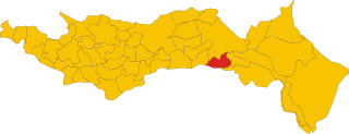
Ariano nel Polesine (Ariano nel Polesine)
.svg)
- Italian comune
 Hiking in Ariano nel Polesine
Ariano nel Polesine, located in the northeastern part of Italy's Veneto region, offers a unique experience for hiking enthusiasts. While the area is primarily known for its flat landscape and agricultural fields, it also provides opportunities to explore the surrounding natural beauty, particularly through its proximity to the Po Delta Park.
Hiking Opportunities:
-
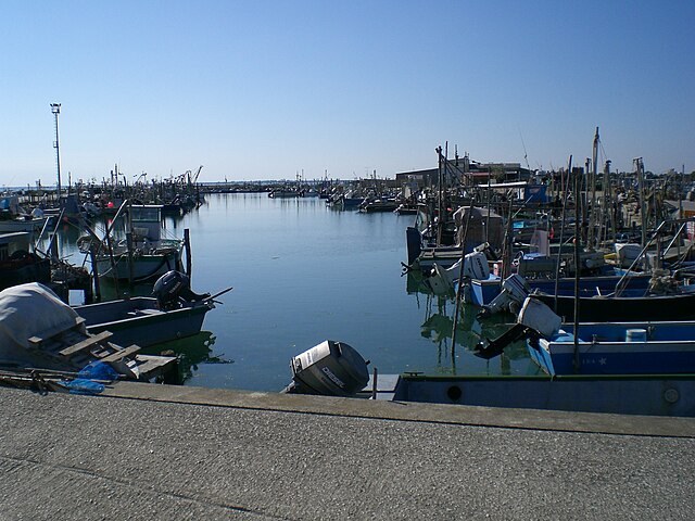
Po Delta Regional Park: Just a short distance from Ariano nel Polesine, this UNESCO Biosphere Reserve is characterized by its rich biodiversity, including wetlands, marshes, and lakes. There are several walking and cycling paths that allow you to immerse yourself in the stunning natural environment, where you can spot various bird species and enjoy the local flora.
-
Local Trails: The countryside around Ariano is dotted with rural roads and paths that connect small villages and farms. These trails allow for leisurely hikes through picturesque landscapes, giving you a chance to experience the local culture and perhaps sample some regional cuisine.
-
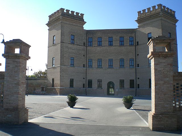
Cultural Walks: Consider incorporating visits to local historical sites. The area around Ariano has several churches, historical buildings, and lookout points that can enhance your hiking experience. Walking through the town itself can provide insight into local traditions and architecture.
Tips for Hiking in Ariano nel Polesine:
-
Prepare for Flat Terrain: Since the area is primarily flat, most hikes will be of moderate difficulty. Be prepared for long stretches of walking on flat surfaces.
-
Check Weather Conditions: The climate in this region can vary, so check the weather before you head out. Spring and autumn are optimal times for hiking due to milder temperatures.
-
Bring Binoculars: If you're visiting the Po Delta Park, bringing binoculars can enhance your ability to view the diverse wildlife, particularly birds.
-
Stay Hydrated and Pack Snacks: As with any hike, it's important to carry enough water and snacks to maintain your energy levels.
-
Respect Nature: Be mindful of local wildlife and plant life, and stick to marked trails to help preserve the delicate ecosystems.
Conclusion:
Hiking in Ariano nel Polesine may differ from mountainous treks, but it offers a serene escape into nature with opportunities to appreciate the unique landscape of the Veneto region. Whether you're enjoying a tranquil walk in the Po Delta Park or exploring nearby rural paths, you'll find beauty and charm in this relatively undiscovered part of Italy.
- Country:

- Postal Code: 45012
- Local Dialing Code: 0426
- Licence Plate Code: RO
- Coordinates: 44° 56' 46" N, 12° 7' 28" E


- GPS tracks (wikiloc): [Link]
- AboveSeaLevel: 2 м m
- Area: 80.63 sq km
- Population: 4241
- Web site: http://www.comune.arianonelpolesine.ro.it/
- Wikipedia en: wiki(en)
- Wikipedia: wiki(it)
- Wikidata storage: Wikidata: Q34719
- Wikipedia Commons Category: [Link]
- Freebase ID: [/m/0gk695]
- GeoNames ID: Alt: [6540229]
- VIAF ID: Alt: [125835066]
- OSM relation ID: [43646]
- Library of Congress authority ID: Alt: [no2003104111]
- Quora topic ID: [Ariano-Nel-Polesine]
- TGN ID: [1043281]
- UN/LOCODE: [ITAN9]
- ISTAT ID: 029002
- Italian cadastre code: A400
Shares border with regions:


Porto Tolle
- Italian comune
Hiking in Porto Tolle
Porto Tolle, located in the Veneto region of Italy, is a great destination for hiking enthusiasts, especially those who enjoy exploring natural reserves and unique landscapes. This area is part of the Po Delta, an expansive wetland known for its biodiversity and rich ecosystems. Here are some key points to consider when hiking in Porto Tolle:...
- Country:
- Postal Code: 45018
- Local Dialing Code: 0426
- Licence Plate Code: RO
- Coordinates: 44° 57' 0" N, 12° 19' 0" E
- GPS tracks (wikiloc): [Link]
- AboveSeaLevel: 1 м m
- Area: 256.88 sq km
- Population: 9663
- Web site: [Link]

Taglio di Po
- Italian comune
Hiking in Taglio di Po
Taglio di Po is a small town located in the Veneto region of Italy. While it may not be a widely recognized hiking destination, there are various outdoor activities and scenic landscapes nearby that can offer enjoyable hiking experiences....
- Country:
- Postal Code: 45019
- Local Dialing Code: 0426
- Licence Plate Code: RO
- Coordinates: 45° 0' 0" N, 12° 13' 0" E
- GPS tracks (wikiloc): [Link]
- AboveSeaLevel: 0 м m
- Area: 78.68 sq km
- Population: 8271
- Web site: [Link]

Papozze
- Italian comune
Hiking in Papozze
Papozze is a small town located near the Po River in the northern part of Italy, within the province of Rovigo in the Veneto region. While it may not be a widely recognized hiking destination, the surrounding area offers some charming landscapes and opportunities for outdoor activities, particularly for those interested in walking or cycling....
- Country:
- Postal Code: 45010
- Local Dialing Code: 0426
- Licence Plate Code: RO
- Coordinates: 44° 59' 0" N, 12° 2' 0" E
- GPS tracks (wikiloc): [Link]
- AboveSeaLevel: 5 м m
- Area: 21.49 sq km
- Population: 1455
- Web site: [Link]


Corbola
- Italian comune
Hiking in Corbola
Corbola is a small municipality located in the Veneto region of Italy, known for its picturesque landscapes and natural beauty. While it may not be as famous for hiking as other areas in Italy, it offers opportunities for outdoor enthusiasts to explore the serene countryside, wetlands, and nearby natural reserves....
- Country:
- Postal Code: 45015
- Local Dialing Code: 0426
- Licence Plate Code: RO
- Coordinates: 45° 0' 0" N, 12° 5' 0" E
- GPS tracks (wikiloc): [Link]
- AboveSeaLevel: 2 м m
- Area: 18.55 sq km
- Population: 2372
- Web site: [Link]

Goro
- Italian comune
Hiking in Goro
Goro, located in the Emilia-Romagna region of Italy, offers a unique hiking experience primarily due to its proximity to the Po Delta, a UNESCO Biosphere Reserve. This area is characterized by a mix of wetlands, lagoons, and rich biodiversity, making it an ideal spot for nature lovers and outdoor enthusiasts....
- Country:
- Postal Code: 44020
- Local Dialing Code: 0533
- Licence Plate Code: FE
- Coordinates: 44° 51' 6" N, 12° 17' 45" E
- GPS tracks (wikiloc): [Link]
- AboveSeaLevel: 1 м m
- Area: 33.18 sq km
- Population: 3742
- Web site: [Link]

Mesola
- Italian comune
Hiking in Mesola
Mesola, located in the Emilia-Romagna region of Italy, is known for its stunning natural landscapes, rich history, and proximity to the Po Delta. Here are some key aspects to consider when planning a hiking trip in the Mesola area:...
- Country:
- Postal Code: 44026
- Local Dialing Code: 0533
- Licence Plate Code: FE
- Coordinates: 44° 55' 14" N, 12° 13' 48" E
- GPS tracks (wikiloc): [Link]
- AboveSeaLevel: 1 м m
- Area: 84.31 sq km
- Population: 6778
- Web site: [Link]