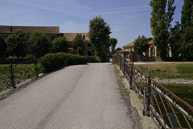
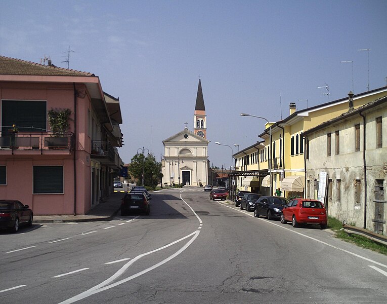
Taglio di Po (Taglio di Po)
- Italian comune
 Hiking in Taglio di Po
Taglio di Po is a small town located in the Veneto region of Italy. While it may not be a widely recognized hiking destination, there are various outdoor activities and scenic landscapes nearby that can offer enjoyable hiking experiences.
-
Surrounding Nature: The area around Taglio di Po features a mix of rural farmland, wetlands, and rivers. This diverse landscape provides opportunities for hiking in relatively flat terrains, making it accessible for hikers of all skill levels.
-
Po River Delta: The nearby Po River Delta is a UNESCO Biosphere Reserve offering unique ecosystems. There are several paths and trails in the delta that you can explore. Birdwatching is also a popular activity in this region, so don’t forget your binoculars!
-
Local Trails: While specific trails in Taglio di Po may not be well-known, nearby towns and natural parks often have marked hiking trails. It would be beneficial to check local guides or tourism websites for designated paths.
-
Cultural Exploration: Hiking in the area can also be complemented with cultural experiences. Exploring nearby towns can reveal rich histories and local traditions, making your hiking trip a cultural journey as well.
-
Weather Considerations: The best time for hiking in northern Italy is typically from late spring to early autumn, when the weather is mild and nature is in full bloom. Be sure to check the weather forecast before embarking on longer hikes.
Before setting out, make sure to carry enough water, snacks, and possibly a map or GPS device, as some trails may not be well-marked. Always be mindful of local regulations and preserve the natural environment as you explore. Enjoy your hiking adventure!
- Country:

- Postal Code: 45019
- Local Dialing Code: 0426
- Licence Plate Code: RO
- Coordinates: 45° 0' 0" N, 12° 13' 0" E


- GPS tracks (wikiloc): [Link]
- AboveSeaLevel: 0 м m
- Area: 78.68 sq km
- Population: 8271
- Web site: http://www.comune.tagliodipo.ro.it/
- Wikipedia en: wiki(en)
- Wikipedia: wiki(it)
- Wikidata storage: Wikidata: Q34341
- Wikipedia Commons Category: [Link]
- Freebase ID: [/m/0gk7dk]
- GeoNames ID: Alt: [6536685]
- VIAF ID: Alt: [246323640]
- OSM relation ID: [43878]
- WOEID: [724673]
- UN/LOCODE: [ITTLP]
- ISTAT ID: 029046
- Italian cadastre code: L026
Shares border with regions:


Porto Tolle
- Italian comune
Hiking in Porto Tolle
Porto Tolle, located in the Veneto region of Italy, is a great destination for hiking enthusiasts, especially those who enjoy exploring natural reserves and unique landscapes. This area is part of the Po Delta, an expansive wetland known for its biodiversity and rich ecosystems. Here are some key points to consider when hiking in Porto Tolle:...
- Country:
- Postal Code: 45018
- Local Dialing Code: 0426
- Licence Plate Code: RO
- Coordinates: 44° 57' 0" N, 12° 19' 0" E
- GPS tracks (wikiloc): [Link]
- AboveSeaLevel: 1 м m
- Area: 256.88 sq km
- Population: 9663
- Web site: [Link]

Loreo
- Italian comune
Hiking in Loreo
Loreo, located in the region of Veneto, Italy, is not as widely known for hiking as some other areas in the Veneto region, but it does offer some charming landscapes and trails for those looking to explore the area. The region is characterized by its flat lands and rivers, predominantly made up of agricultural fields, historical sites, and natural reserves....
- Country:
- Postal Code: 45017
- Local Dialing Code: 0426
- Licence Plate Code: RO
- Coordinates: 45° 4' 0" N, 12° 12' 0" E
- GPS tracks (wikiloc): [Link]
- AboveSeaLevel: 1 м m
- Area: 39.84 sq km
- Population: 3459
- Web site: [Link]

Porto Viro
- Italian comune
Hiking in Porto Viro
Porto Viro, located in the Veneto region of Italy, is a charming area that offers a unique blend of natural beauty and cultural experiences. While it may not be as famous as some other hiking destinations, it has several routes and trails that can satisfy outdoor enthusiasts looking for exploration within its picturesque landscapes....
- Country:
- Postal Code: 45014
- Local Dialing Code: 0426
- Licence Plate Code: RO
- Coordinates: 45° 1' 0" N, 12° 13' 0" E
- GPS tracks (wikiloc): [Link]
- AboveSeaLevel: 2 м m
- Area: 133.77 sq km
- Population: 14298
- Web site: [Link]


Adria
- Italian comune
Hiking in Adria
Adria, often referred to as the "Adriatic Coast," encompasses parts of several countries including Italy, Slovenia, and Croatia. This region is renowned for its picturesque landscapes, charming coastal towns, and diverse hiking opportunities. Here’s an overview of hiking in the area:...
- Country:
- Postal Code: 45011
- Local Dialing Code: 0426
- Licence Plate Code: RO
- Coordinates: 45° 3' 0" N, 12° 3' 0" E
- GPS tracks (wikiloc): [Link]
- AboveSeaLevel: 4 м m
- Area: 113.39 sq km
- Population: 19436
- Web site: [Link]


Corbola
- Italian comune
Hiking in Corbola
Corbola is a small municipality located in the Veneto region of Italy, known for its picturesque landscapes and natural beauty. While it may not be as famous for hiking as other areas in Italy, it offers opportunities for outdoor enthusiasts to explore the serene countryside, wetlands, and nearby natural reserves....
- Country:
- Postal Code: 45015
- Local Dialing Code: 0426
- Licence Plate Code: RO
- Coordinates: 45° 0' 0" N, 12° 5' 0" E
- GPS tracks (wikiloc): [Link]
- AboveSeaLevel: 2 м m
- Area: 18.55 sq km
- Population: 2372
- Web site: [Link]


Ariano nel Polesine
- Italian comune
Hiking in Ariano nel Polesine
Ariano nel Polesine, located in the northeastern part of Italy's Veneto region, offers a unique experience for hiking enthusiasts. While the area is primarily known for its flat landscape and agricultural fields, it also provides opportunities to explore the surrounding natural beauty, particularly through its proximity to the Po Delta Park....
- Country:
- Postal Code: 45012
- Local Dialing Code: 0426
- Licence Plate Code: RO
- Coordinates: 44° 56' 46" N, 12° 7' 28" E
- GPS tracks (wikiloc): [Link]
- AboveSeaLevel: 2 м m
- Area: 80.63 sq km
- Population: 4241
- Web site: [Link]