Arnstorf (Arnstorf)
- municipality of Germany
Arnstorf, located in Bavaria, Germany, is a charming village surrounded by beautiful landscapes that are perfect for hiking enthusiasts. The region offers a mix of gentle hills, meadows, and forests, making it suitable for various skill levels.
Hiking Trails
-
Nature Trails: There are several well-marked nature trails around Arnstorf that allow you to explore the local flora and fauna. These trails often include informative panels about the ecosystem and wildlife you may encounter.
-
Forest Paths: The surrounding forests provide shaded paths that are especially enjoyable during warmer months. These can vary in difficulty, from easy walks to more challenging hikes that involve steeper inclines.
-
Scenic Routes: Some trails lead you toward scenic viewpoints where you can take breaks and enjoy panoramic views of the Bavarian countryside.
Preparation Tips
- Weather: Always check the local weather before your hike, as conditions can change rapidly.
- Gear: Wear sturdy hiking shoes and consider layering your clothing. A small backpack with water, snacks, and a first-aid kit is recommended.
- Maps: Carry a local hiking map or download a digital map to help navigate the trails.
Local Attractions
- Historical Sites: Enjoying nature doesn't mean you can't also appreciate the history of the area. Look for local historical landmarks along your hiking route.
- Culinary Stops: After your hike, consider visiting local cafes or restaurants to sample Bavarian cuisine and refreshments.
Hiking Community
Joining a local hiking group or participating in guided hikes can enhance your experience, providing safety and companionship while exploring the beautiful landscapes around Arnstorf.
Overall, Arnstorf is a great destination for hiking, offering a mix of natural beauty and local culture. Whether you’re looking for a leisurely stroll or a more challenging hike, there's something for everyone!
- Country:

- Postal Code: 94424
- Local Dialing Code: 08723
- Licence Plate Code: PAN
- Coordinates: 48° 34' 0" N, 12° 49' 0" E


- GPS tracks (wikiloc): [Link]
- AboveSeaLevel: 397 м m
- Area: 80.37 sq km
- Population: 5579
- Web site: http://www.arnstorf.de/
- Wikipedia en: wiki(en)
- Wikipedia: wiki(de)
- Wikidata storage: Wikidata: Q582608
- Wikipedia Commons Category: [Link]
- Freebase ID: [/m/02rg8rj]
- GeoNames ID: Alt: [2955429]
- VIAF ID: Alt: [240307621]
- OSM relation ID: [957058]
- GND ID: Alt: [4003016-7]
- Bavarikon ID: [ODB_A00001610]
- German municipality key: 09277111
Shares border with regions:


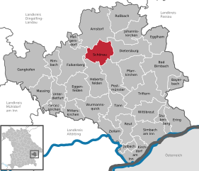
Schönau
- municipality of Germany
Schönau, located in Lower Bavaria, is a delightful destination for hiking enthusiasts. Nestled near the foothills of the Bavarian Forest and close to the picturesque Berchtesgaden National Park, it offers a variety of trails and stunning landscapes. Here are some highlights for hiking in Schönau:...
- Country:

- Postal Code: 84337
- Local Dialing Code: 08726
- Licence Plate Code: PAN
- Coordinates: 48° 29' 0" N, 12° 51' 0" E


- GPS tracks (wikiloc): [Link]
- AboveSeaLevel: 453 м m
- Area: 36.14 sq km
- Population: 1540
- Web site: [Link]


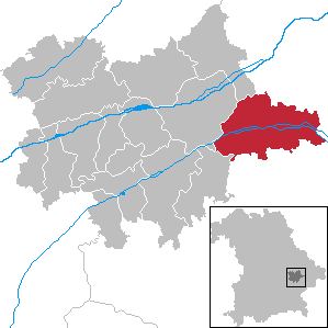
Eichendorf
- municipality of Germany
Eichendorf, located in Bavaria, Germany, is a charming area surrounded by picturesque landscapes, making it a great destination for hiking enthusiasts. Here are some highlights and information to consider if you're planning to hike in and around Eichendorf:...
- Country:

- Postal Code: 94428
- Local Dialing Code: 09956; 09952; 09937; 08547
- Licence Plate Code: DGF
- Coordinates: 48° 38' 0" N, 12° 51' 0" E


- GPS tracks (wikiloc): [Link]
- AboveSeaLevel: 355 м m
- Area: 98.19 sq km
- Population: 6236
- Web site: [Link]


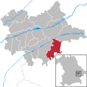
Simbach
- municipality of Germany
Simbach, located in the Dingolfing-Landau district of Bavaria, Germany, is a charming area surrounded by picturesque landscapes that are ideal for hiking. Here are some highlights and tips for hiking in this region:...
- Country:

- Postal Code: 94436
- Local Dialing Code: 09954
- Licence Plate Code: DGF
- Coordinates: 48° 34' 0" N, 12° 45' 0" E


- GPS tracks (wikiloc): [Link]
- AboveSeaLevel: 415 м m
- Area: 51.19 sq km
- Population: 3392
- Web site: [Link]


Johanniskirchen
- municipality of Germany
Johanniskirchen is a small community in Bavaria, Germany, known for its picturesque landscapes and scenic trails. Hiking in and around Johanniskirchen offers a great opportunity to experience the beauty of the Bavarian countryside. Here are some key points to consider if you're planning a hiking trip in this area:...
- Country:

- Postal Code: 84381
- Local Dialing Code: 08564
- Licence Plate Code: PAN
- Coordinates: 48° 32' 0" N, 12° 57' 0" E


- GPS tracks (wikiloc): [Link]
- AboveSeaLevel: 365 м m
- Area: 40.59 sq km
- Population: 2335
- Web site: [Link]


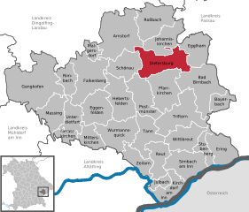
Dietersburg
- municipality in Bavaria, Germany
Dietersburg, located in Bavaria, Germany, offers a variety of hiking opportunities for outdoor enthusiasts. While it may not be as well-known as some of the larger hiking destinations in Bavaria, it is surrounded by beautiful landscapes typical of the region, including rolling hills, forests, and picturesque countryside....
- Country:

- Postal Code: 84385; 84378
- Local Dialing Code: 08726; 08565; 08564; 08561
- Licence Plate Code: PAN
- Coordinates: 48° 30' 0" N, 12° 55' 0" E


- GPS tracks (wikiloc): [Link]
- AboveSeaLevel: 427 м m
- Area: 55.03 sq km
- Population: 3110
- Web site: [Link]


Falkenberg
- human settlement in Germany
Falkenberg, located in Lower Bavaria, is a picturesque area that offers wonderful hiking opportunities amidst a blend of natural beauty and cultural heritage. The region is characterized by rolling hills, lush forests, and charming villages, providing a diverse landscape for hikers to explore....
- Country:

- Postal Code: 84326
- Local Dialing Code: 08727
- Licence Plate Code: PAN
- Coordinates: 48° 28' 0" N, 12° 43' 0" E


- GPS tracks (wikiloc): [Link]
- AboveSeaLevel: 487 м m
- Area: 66.51 sq km
- Population: 3480
- Web site: [Link]


Roßbach
- municipality of Germany
Roßbach, located in Bavaria, Germany, is a picturesque village that serves as a great starting point for a variety of hiking adventures. The surrounding landscape is characterized by lush forests, rolling hills, and stunning views of the Bavarian countryside....
- Country:

- Postal Code: 94439
- Local Dialing Code: 08547
- Licence Plate Code: PAN
- Coordinates: 48° 36' 0" N, 12° 56' 0" E


- GPS tracks (wikiloc): [Link]
- AboveSeaLevel: 344 м m
- Area: 48.15 sq km
- Population: 2730
- Web site: [Link]


Malgersdorf
- municipality in the district of Rottal-Inn in Bavaria
Malgersdorf is a quaint village located in Bavaria, Germany, surrounded by picturesque landscapes that are perfect for hiking enthusiasts. The area boasts a mixture of flat terrain and gentle hills, making it accessible for hikers of all skill levels....
- Country:

- Postal Code: 84333
- Local Dialing Code: 09954
- Licence Plate Code: PAN
- Coordinates: 48° 24' 0" N, 12° 45' 0" E


- GPS tracks (wikiloc): [Link]
- AboveSeaLevel: 398 м m
- Area: 11.48 sq km
- Population: 998
- Web site: [Link]

