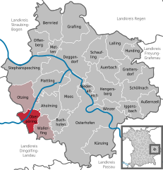
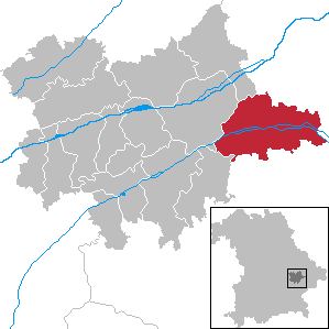
Eichendorf (Eichendorf)
- municipality of Germany
Eichendorf, located in Bavaria, Germany, is a charming area surrounded by picturesque landscapes, making it a great destination for hiking enthusiasts. Here are some highlights and information to consider if you're planning to hike in and around Eichendorf:
Trails and Scenic Routes
-
Local Trails: There are various well-marked hiking trails that weave through forests, fields, and hills. The terrain can vary, offering both easy walks suitable for families and more challenging hikes for seasoned trekkers.
-
Nature Experience: The region is rich in flora and fauna, providing opportunities to spot wildlife and enjoy the natural beauty of the countryside. Look out for local plants and perhaps some wildlife like deer or birds.
-
Bavarian Forest National Park: While Eichendorf is on the outskirts of the Bavarian Forest, this national park is worth a visit for longer trips. It offers extensive trails, including the famous Goldsteig trail, which showcases stunning views and diverse ecosystems.
Planning Your Hike
-
Maps and Guides: Before heading out, it is recommended to check local hiking maps or guides. These can be found at tourist information centers, or you can download apps with trail information.
-
Weather Conditions: Always check the weather forecast before your hike. Bavaria can experience sudden changes in weather, especially in higher elevations.
-
Equipment: Proper footwear is essential for hiking in this area. Sturdy hiking boots and appropriate clothing for the weather will enhance your comfort while hiking.
-
Safety Considerations: Inform someone about your hiking plan and estimated return time, especially if you're heading out on less-trafficked trails.
Amenities
-
Local Facilities: Eichendorf offers basic amenities such as accommodations, restaurants, and shops where you can stock up on supplies before heading out on the trail.
-
Guided Tours: Consider joining guided hiking tours if you're unfamiliar with the area. Local guides can provide insights and ensure safety on more challenging routes.
Attractions Nearby
-
Cultural Sites: In addition to hiking, Eichendorf is near other Bavarian attractions, including historic towns and castles. Exploring these after a day of hiking can be a rewarding experience.
-
Microbreweries: Bavaria is known for its beer. After a long hike, checking out a local brewery can be a delightful end to the day.
Conclusion
Hiking in Eichendorf offers a wonderful opportunity to immerse yourself in nature and experience the stunning Bavarian landscape. Whether you're looking for a peaceful day hike or a more strenuous adventure, you’ll find trails that suit your needs. Always remember to prepare adequately and enjoy the natural beauty that this charming area has to offer!
- Country:

- Postal Code: 94428
- Local Dialing Code: 09956; 09952; 09937; 08547
- Licence Plate Code: DGF
- Coordinates: 48° 38' 0" N, 12° 51' 0" E


- GPS tracks (wikiloc): [Link]
- AboveSeaLevel: 355 м m
- Area: 98.19 sq km
- Population: 6236
- Web site: http://www.markt-eichendorf.de/
- Wikipedia en: wiki(en)
- Wikipedia: wiki(de)
- Wikidata storage: Wikidata: Q509129
- Wikipedia Commons Category: [Link]
- Freebase ID: [/m/02p962x]
- GeoNames ID: Alt: [2932321]
- VIAF ID: Alt: [241848548]
- OSM relation ID: [959906]
- GND ID: Alt: [4412584-7]
- archINFORM location ID: [8279]
- MusicBrainz area ID: [cd523890-8b09-4ee5-ae4c-364486f6facf]
- Bavarikon ID: [ODB_A00001681]
- German municipality key: 09279113
Shares border with regions:


Osterhofen
- municipality of Germany
Osterhofen, located in Bavaria, Germany, is a charming area for hiking enthusiasts. Nestled in the picturesque landscape of Lower Bavaria, it offers various trails that can cater to both beginners and experienced hikers. Here are some key points to consider when hiking in and around Osterhofen:...
- Country:

- Postal Code: 94486
- Local Dialing Code: 09938; 08547; 09932
- Licence Plate Code: DEG
- Coordinates: 48° 42' 0" N, 13° 1' 0" E


- GPS tracks (wikiloc): [Link]
- AboveSeaLevel: 315 м m
- Area: 111.17 sq km
- Population: 11387
- Web site: [Link]


Oberpöring
- municipality of Germany
Oberpöring is located in Bavaria, Germany, and is surrounded by beautiful landscapes that make it an excellent location for hiking enthusiasts. The region features a mix of gentle hills, forests, and agricultural fields, offering a variety of trails suitable for different skill levels....
- Country:

- Postal Code: 94562
- Local Dialing Code: 09937
- Licence Plate Code: DEG
- Coordinates: 48° 42' 0" N, 12° 50' 0" E


- GPS tracks (wikiloc): [Link]
- AboveSeaLevel: 349 м m
- Area: 17.39 sq km
- Population: 1151
- Web site: [Link]


Roßbach
- municipality of Germany
Roßbach, located in Bavaria, Germany, is a picturesque village that serves as a great starting point for a variety of hiking adventures. The surrounding landscape is characterized by lush forests, rolling hills, and stunning views of the Bavarian countryside....
- Country:

- Postal Code: 94439
- Local Dialing Code: 08547
- Licence Plate Code: PAN
- Coordinates: 48° 36' 0" N, 12° 56' 0" E


- GPS tracks (wikiloc): [Link]
- AboveSeaLevel: 344 м m
- Area: 48.15 sq km
- Population: 2730
- Web site: [Link]


Arnstorf
- municipality of Germany
Arnstorf, located in Bavaria, Germany, is a charming village surrounded by beautiful landscapes that are perfect for hiking enthusiasts. The region offers a mix of gentle hills, meadows, and forests, making it suitable for various skill levels....
- Country:

- Postal Code: 94424
- Local Dialing Code: 08723
- Licence Plate Code: PAN
- Coordinates: 48° 34' 0" N, 12° 49' 0" E


- GPS tracks (wikiloc): [Link]
- AboveSeaLevel: 397 м m
- Area: 80.37 sq km
- Population: 5579
- Web site: [Link]


Wallerfing
- municipality of Germany
Wallerfing is a small village located in Bavaria, Germany, known for its scenic countryside and natural beauty, making it a great destination for hiking enthusiasts. While it may not be as popular as other destinations, the area around Wallerfing offers a variety of hiking trails that allow you to experience the picturesque landscape, local flora and fauna, and quaint villages....
- Country:

- Postal Code: 94574
- Local Dialing Code: 09936
- Licence Plate Code: DEG
- Coordinates: 48° 41' 0" N, 12° 53' 0" E


- GPS tracks (wikiloc): [Link]
- AboveSeaLevel: 357 м m
- Area: 20.76 sq km
- Population: 1350
- Web site: [Link]

