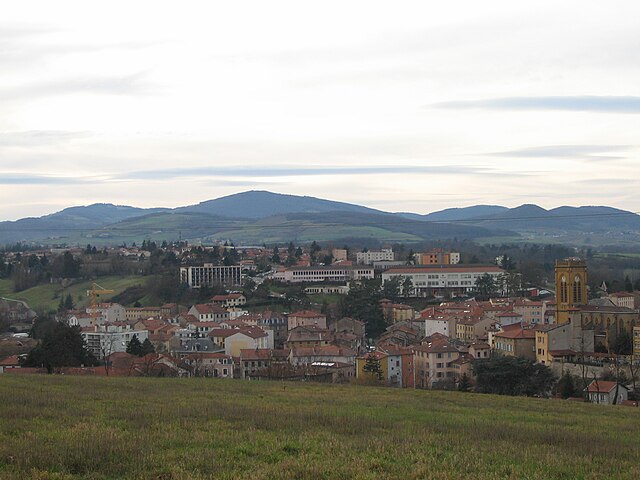
arrondissement of Lyon (arrondissement de Lyon)
- arrondissement of France
 Hiking in arrondissement of Lyon
The Arrondissement of Lyon, located in the Auvergne-Rhône-Alpes region of France, is not only famous for its rich culture and gastronomy but also offers a variety of hiking opportunities both within the city and in the nearby natural surroundings.
Hiking Options Nearby:
-
Parc de la Tête d'Or:
- Located within Lyon itself, this large urban park is perfect for leisurely hikes. It features beautiful gardens, a lake, and many pathways. While it’s not a true wilderness experience, it's great for a gentle stroll or jog.
-
Monts d'Or:
- Just north of Lyon, the Monts d'Or is a small mountain range that offers several hiking trails with stunning views of the city and the surrounding countryside. Trails range from easy walks to more challenging hikes. Check routes like the "Mont Pelerin" for panoramic views.
-
Pilat Regional Natural Park:
- Situated about an hour from Lyon, this park offers a myriad of hiking trails through beautiful landscapes, including forests, ridgelines, and picturesque villages. Trails vary in difficulty and length, accommodating both casual hikers and experienced trekkers.
-
The Rhône River Banks:
- For those looking for an easier, scenic walk, the banks of the Rhône River offer a lovely pathway for walking or cycling. You can enjoy the river's scenery while having easy access to cafes and other amenities.
-
Beaujolais Region:
- A little further afield, the vineyards of Beaujolais provide a chance to combine hiking with wine tasting. There are many marked trails through the rolling hills and vineyards, which can be enjoyed year-round.
Tips for Hiking in the Area:
-
Seasonal Considerations: The best seasons for hiking near Lyon are spring (April to June) and fall (September to November) when the weather is mild and the scenery vibrant. Summers can be quite hot, and winters may bring snow to higher elevations.
-
Footwear and Gear: Always wear comfortable, sturdy footwear suitable for the terrain. Even on well-marked paths, it’s smart to bring water, snacks, and a map or GPS device.
-
Local Regulations and Safety: Some trails may have specific regulations or require permits, especially in protected areas like the Pilat Natural Park. Always check local guidelines before heading out.
-
Group Hiking: If you’re not familiar with the area, consider joining local hiking groups or organized hikes. This can enhance your experience and provide insights into the region’s flora and fauna.
Whether you're looking for a light stroll or a more vigorous hike, the Arrondissement of Lyon and its surroundings offer a variety of options for all types of outdoor enthusiasts. Enjoy your adventures!
- Country:

- Capital: Lyon
- Coordinates: 45° 45' 0" N, 4° 35' 0" E


- GPS tracks (wikiloc): [Link]
- Area: 1746 sq km
- Population: 1370678
- Wikipedia en: wiki(en)
- Wikipedia: wiki(fr)
- Wikidata storage: Wikidata: Q535140
- Wikipedia Commons Category: [Link]
- Freebase ID: [/m/04fksb]
- GeoNames ID: Alt: [2996943]
- INSEE arrondissement code: [691]
- GNS Unique Feature ID: -1448469
Includes regions:


canton of Vaugneray
- canton of France
- Country:

- Capital: Vaugneray
- Coordinates: 45° 44' 22" N, 4° 40' 15" E


- GPS tracks (wikiloc): [Link]
- Population: 31723


canton of Brignais
- canton of France
- Country:

- Capital: Brignais
- Coordinates: 45° 41' 24" N, 4° 45' 0" E


- GPS tracks (wikiloc): [Link]
- Population: 37973


canton of L'Arbresle
- canton of France
- Country:

- Capital: L'Arbresle
- Coordinates: 45° 49' 15" N, 4° 36' 39" E


- GPS tracks (wikiloc): [Link]
- Population: 37833


canton of Saint-Symphorien-d'Ozon
- canton of France
 Hiking in canton of Saint-Symphorien-d'Ozon
Canton of Saint-Symphorien-d'Ozon, located near Lyon in the Auvergne-Rhône-Alpes region of France, offers a range of hiking opportunities suitable for various skill levels. While it may not be as mountainous as some other regions, its beautiful landscapes, forests, and proximity to the Rhône River provide excellent spots for hiking....
- Country:

- Capital: Saint-Symphorien-d'Ozon
- Coordinates: 45° 37' 50" N, 4° 54' 1" E


- GPS tracks (wikiloc): [Link]
- Population: 38680


canton of Genas
- canton of France
- Country:

- Capital: Genas
- Coordinates: 45° 43' 56" N, 5° 0' 10" E


- GPS tracks (wikiloc): [Link]
- Population: 40387


canton of Mornant
- canton of France
- Country:

- Capital: Mornant
- Coordinates: 45° 37' 40" N, 4° 38' 49" E


- GPS tracks (wikiloc): [Link]
- Population: 39853
