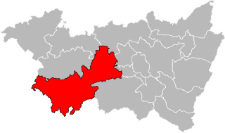
arrondissement of Neufchâteau, Vosges (arrondissement de Neufchâteau)

- arrondissement of France
- Country:

- Capital: Neufchâteau
- Coordinates: 48° 21' 0" N, 5° 41' 0" E


- GPS tracks (wikiloc): [Link]
- Area: 1610.72 sq km
- Population: 65039
- Wikipedia en: wiki(en)
- Wikipedia: wiki(fr)
- Wikidata storage: Wikidata: Q701915
- Freebase ID: [/m/0956q8]
- GeoNames ID: Alt: [2990681]
- VIAF ID: Alt: [124546650]
- Library of Congress authority ID: Alt: [n2005089885]
- INSEE arrondissement code: [882]
Includes regions:

canton of Darney
- canton of France
- Country:
- Capital: Darney
- Coordinates: 48° 7' 45" N, 6° 4' 52" E
- GPS tracks (wikiloc): [Link]
- Population: 18041

canton of Monthureux-sur-Saône
- canton of France (until March 2015)
- Country:
- Capital: Monthureux-sur-Saône
- Coordinates: 48° 1' 52" N, 5° 58' 26" E
- GPS tracks (wikiloc): [Link]


canton of Mirecourt
- canton of France
- Country:
- Capital: Mirecourt
- Coordinates: 48° 18' 0" N, 6° 8' 3" E
- GPS tracks (wikiloc): [Link]
- Population: 17661


canton of Neufchâteau
- canton of France
- Country:
- Capital: Neufchâteau
- Coordinates: 48° 19' 39" N, 5° 40' 26" E
- GPS tracks (wikiloc): [Link]
- Population: 17629


canton of Vittel
- canton of France
- Country:
- Capital: Vittel
- Coordinates: 48° 12' 5" N, 5° 55' 13" E
- GPS tracks (wikiloc): [Link]
- Population: 18189

canton of Bulgnéville
- canton of France (until March 2015)
- Country:
- Capital: Bulgnéville
- Coordinates: 48° 12' 48" N, 5° 48' 50" E
- GPS tracks (wikiloc): [Link]