canton of Darney (canton de Darney)

- canton of France
- Country:

- Capital: Darney
- Coordinates: 48° 7' 45" N, 6° 4' 52" E


- GPS tracks (wikiloc): [Link]
- Population: 18041
- Wikipedia en: wiki(en)
- Wikipedia: wiki(fr)
- Wikidata storage: Wikidata: Q125252
- Freebase ID: [/m/05q7_cw]
- INSEE canton code: [8804]
Includes regions:


Belrupt
- commune in Vosges, France
- Country:
- Postal Code: 88260
- Coordinates: 48° 5' 16" N, 6° 5' 37" E
- GPS tracks (wikiloc): [Link]
- Area: 9.14 sq km
- Population: 100


Dommartin-lès-Vallois
- commune in Vosges, France
- Country:
- Postal Code: 88260
- Coordinates: 48° 9' 20" N, 6° 5' 11" E
- GPS tracks (wikiloc): [Link]
- Area: 4.93 sq km
- Population: 59


Dombasle-devant-Darney
- commune in Vosges, France
- Country:
- Postal Code: 88260
- Coordinates: 48° 7' 37" N, 6° 4' 36" E
- GPS tracks (wikiloc): [Link]
- Area: 8.73 sq km
- Population: 82


Pont-lès-Bonfays
- commune in Vosges, France
- Country:
- Postal Code: 88260
- Coordinates: 48° 10' 8" N, 6° 7' 58" E
- GPS tracks (wikiloc): [Link]
- Area: 4.47 sq km
- Population: 99

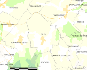
Esley
- commune in Vosges, France
- Country:
- Postal Code: 88260
- Coordinates: 48° 10' 10" N, 6° 3' 28" E
- GPS tracks (wikiloc): [Link]
- Area: 11 sq km
- Population: 182


Frénois
- commune in Vosges, France
- Country:
- Postal Code: 88270
- Coordinates: 48° 11' 19" N, 6° 7' 20" E
- GPS tracks (wikiloc): [Link]
- Area: 4.94 sq km
- Population: 48


Les Vallois
- commune in Vosges, France
- Country:
- Postal Code: 88260
- Coordinates: 48° 9' 29" N, 6° 7' 2" E
- GPS tracks (wikiloc): [Link]
- Area: 5.25 sq km
- Population: 122


Sans-Vallois
- commune in Vosges, France
- Country:
- Postal Code: 88260
- Coordinates: 48° 9' 37" N, 6° 6' 23" E
- GPS tracks (wikiloc): [Link]
- Area: 4.43 sq km
- Population: 133


Saint-Baslemont
- commune in Vosges, France
- Country:
- Postal Code: 88260
- Coordinates: 48° 9' 7" N, 5° 59' 35" E
- GPS tracks (wikiloc): [Link]
- Area: 12.71 sq km
- Population: 81


Senonges
- commune in Vosges, France
- Country:
- Postal Code: 88260
- Coordinates: 48° 8' 48" N, 6° 3' 43" E
- GPS tracks (wikiloc): [Link]
- Area: 5.84 sq km
- Population: 122


Bonvillet
- commune in Vosges, France
- Country:
- Postal Code: 88260
- Coordinates: 48° 5' 58" N, 6° 3' 24" E
- GPS tracks (wikiloc): [Link]
- AboveSeaLevel: 290 м m
- Area: 10.09 sq km
- Population: 323
- Web site: [Link]


Escles
- commune in Vosges, France
- Country:
- Postal Code: 88260
- Coordinates: 48° 7' 44" N, 6° 10' 40" E
- GPS tracks (wikiloc): [Link]
- Area: 22.54 sq km
- Population: 430

Pierrefitte
- commune in Vosges, France
- Country:
- Postal Code: 88270
- Coordinates: 48° 10' 7" N, 6° 10' 34" E
- GPS tracks (wikiloc): [Link]
- Area: 8.78 sq km
- Population: 137

Jésonville
- commune in Vosges, France
- Country:
- Postal Code: 88260
- Coordinates: 48° 7' 46" N, 6° 6' 34" E
- GPS tracks (wikiloc): [Link]
- Area: 6.96 sq km
- Population: 131


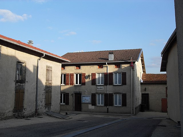
Darney
- commune in Vosges, France
- Country:
- Postal Code: 88260
- Coordinates: 48° 5' 6" N, 6° 2' 45" E
- GPS tracks (wikiloc): [Link]
- Area: 7.92 sq km
- Population: 1124
- Web site: [Link]


Provenchères-lès-Darney
- commune in Vosges, France
- Country:
- Postal Code: 88260
- Coordinates: 48° 7' 43" N, 5° 57' 24" E
- GPS tracks (wikiloc): [Link]
- Area: 9.07 sq km
- Population: 162