Arthun (Arthun)

- commune in Loire, France
- Country:

- Postal Code: 42130
- Coordinates: 45° 46' 23" N, 4° 2' 2" E


- GPS tracks (wikiloc): [Link]
- Area: 13.88 sq km
- Population: 563
- Web site: http://www.arthun.fr/
- Wikipedia en: wiki(en)
- Wikipedia: wiki(fr)
- Wikidata storage: Wikidata: Q384308
- Wikipedia Commons Category: [Link]
- Freebase ID: [/m/03nw3cm]
- Freebase ID: [/m/03nw3cm]
- GeoNames ID: Alt: [6613336]
- GeoNames ID: Alt: [6613336]
- SIREN number: [214200099]
- SIREN number: [214200099]
- BnF ID: [152595808]
- BnF ID: [152595808]
- INSEE municipality code: 42009
- INSEE municipality code: 42009
Shares border with regions:


Bussy-Albieux
- commune in Loire, France
- Country:
- Postal Code: 42260
- Coordinates: 45° 47' 35" N, 4° 2' 1" E
- GPS tracks (wikiloc): [Link]
- Area: 19.65 sq km
- Population: 535
- Web site: [Link]


Saint-Sixte
- commune in Loire, France
- Country:
- Postal Code: 42130
- Coordinates: 45° 46' 33" N, 3° 58' 56" E
- GPS tracks (wikiloc): [Link]
- Area: 15.35 sq km
- Population: 722
- Web site: [Link]


Sainte-Agathe-la-Bouteresse
- commune in Loire, France
- Country:
- Postal Code: 42130
- Coordinates: 45° 44' 3" N, 4° 3' 18" E
- GPS tracks (wikiloc): [Link]
- AboveSeaLevel: 387 м m
- Area: 11.75 sq km
- Population: 1023
- Web site: [Link]

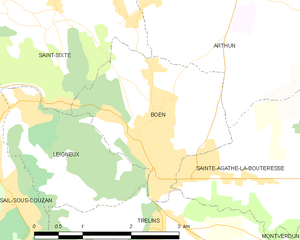
Boën-sur-Lignon
- commune in Loire, France
- Country:
- Postal Code: 42130
- Coordinates: 45° 44' 45" N, 4° 0' 16" E
- GPS tracks (wikiloc): [Link]
- Area: 6 sq km
- Population: 3308
- Web site: [Link]


Sainte-Foy-Saint-Sulpice
- commune in Loire, France
- Country:
- Postal Code: 42110
- Coordinates: 45° 46' 8" N, 4° 7' 45" E
- GPS tracks (wikiloc): [Link]
- Area: 29.12 sq km
- Population: 520
- Web site: [Link]