Asswiller (Asswiller)

- commune in Bas-Rhin, France
- Country:

- Postal Code: 67320
- Coordinates: 48° 52' 52" N, 7° 13' 12" E


- GPS tracks (wikiloc): [Link]
- Area: 6.02 sq km
- Population: 287
- Wikipedia en: wiki(en)
- Wikipedia: wiki(fr)
- Wikidata storage: Wikidata: Q21219
- Wikipedia Commons Category: [Link]
- Freebase ID: [/m/03cgbd2]
- Freebase ID: [/m/03cgbd2]
- GeoNames ID: Alt: [6450567]
- GeoNames ID: Alt: [6450567]
- SIREN number: [216700138]
- SIREN number: [216700138]
- BnF ID: [15271156s]
- BnF ID: [15271156s]
- VIAF ID: Alt: [242775068]
- VIAF ID: Alt: [242775068]
- INSEE municipality code: 67013
- INSEE municipality code: 67013
Shares border with regions:

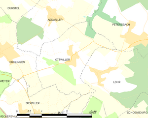
Ottwiller
- commune in Bas-Rhin, France
- Country:
- Postal Code: 67320
- Coordinates: 48° 51' 52" N, 7° 13' 46" E
- GPS tracks (wikiloc): [Link]
- AboveSeaLevel: 305 м m
- Area: 5.09 sq km
- Population: 257

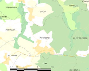
Petersbach
- commune in Bas-Rhin, France
- Country:
- Postal Code: 67290
- Coordinates: 48° 52' 15" N, 7° 16' 3" E
- GPS tracks (wikiloc): [Link]
- Area: 8.88 sq km
- Population: 642
- Web site: [Link]


Struth
- commune in Bas-Rhin, France
- Country:
- Postal Code: 67290
- Coordinates: 48° 53' 38" N, 7° 15' 21" E
- GPS tracks (wikiloc): [Link]
- Area: 4.12 sq km
- Population: 249
Tieffenbach
- commune in Bas-Rhin, France
- Country:
- Postal Code: 67290
- Coordinates: 48° 54' 17" N, 7° 15' 0" E
- GPS tracks (wikiloc): [Link]
- Area: 5.03 sq km
- Population: 274
- Web site: [Link]
Durstel
- commune in Bas-Rhin, France
- Country:
- Postal Code: 67320
- Coordinates: 48° 53' 30" N, 7° 11' 50" E
- GPS tracks (wikiloc): [Link]
- Area: 4.76 sq km
- Population: 400


Drulingen
- commune in Bas-Rhin, France
- Country:
- Postal Code: 67320
- Coordinates: 48° 52' 4" N, 7° 11' 28" E
- GPS tracks (wikiloc): [Link]
- Area: 4.49 sq km
- Population: 1491
- Web site: [Link]