canton of Drulingen (canton de Drulingen)
- canton of France (until March 2015)
- Country:

- Capital: Drulingen
- Coordinates: 48° 52' 0" N, 7° 11' 0" E


- GPS tracks (wikiloc): [Link]
- Wikidata storage: Wikidata: Q1397655
- Library of Congress authority ID: Alt: [n2017073792]
- INSEE canton code: [6706]
Includes regions:

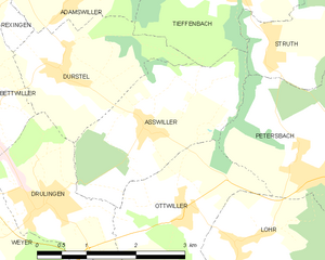
Asswiller
- commune in Bas-Rhin, France
- Country:
- Postal Code: 67320
- Coordinates: 48° 52' 52" N, 7° 13' 12" E
- GPS tracks (wikiloc): [Link]
- Area: 6.02 sq km
- Population: 287
Burbach
- commune in Bas-Rhin, France
- Country:
- Postal Code: 67260
- Coordinates: 48° 54' 4" N, 7° 6' 43" E
- GPS tracks (wikiloc): [Link]
- Area: 6.34 sq km
- Population: 269
Bettwiller
- commune in Bas-Rhin, France
- Country:
- Postal Code: 67320
- Coordinates: 48° 53' 11" N, 7° 10' 45" E
- GPS tracks (wikiloc): [Link]
- Area: 4.06 sq km
- Population: 309
Eywiller
- commune in Bas-Rhin, France
- Country:
- Postal Code: 67320
- Coordinates: 48° 52' 14" N, 7° 7' 52" E
- GPS tracks (wikiloc): [Link]
- Area: 4.69 sq km
- Population: 274


Kirrberg
- commune in Bas-Rhin, France
- Country:
- Postal Code: 67320
- Coordinates: 48° 49' 20" N, 7° 3' 51" E
- GPS tracks (wikiloc): [Link]
- Area: 6.35 sq km
- Population: 179

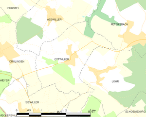
Ottwiller
- commune in Bas-Rhin, France
- Country:
- Postal Code: 67320
- Coordinates: 48° 51' 52" N, 7° 13' 46" E
- GPS tracks (wikiloc): [Link]
- AboveSeaLevel: 305 м m
- Area: 5.09 sq km
- Population: 257
Rexingen
- commune in Bas-Rhin, France
- Country:
- Postal Code: 67320
- Coordinates: 48° 54' 8" N, 7° 10' 53" E
- GPS tracks (wikiloc): [Link]
- Area: 2.32 sq km
- Population: 205

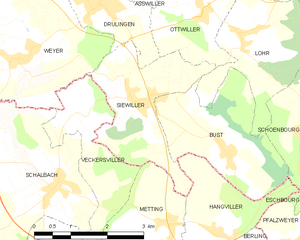
Siewiller
- commune in Bas-Rhin, France
- Country:
- Postal Code: 67320
- Coordinates: 48° 50' 39" N, 7° 12' 6" E
- GPS tracks (wikiloc): [Link]
- Area: 6.2 sq km
- Population: 390

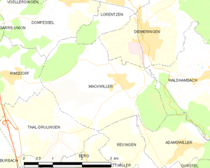
Mackwiller
- commune in Bas-Rhin, France
- Country:
- Postal Code: 67430
- Coordinates: 48° 55' 34" N, 7° 10' 31" E
- GPS tracks (wikiloc): [Link]
- Area: 9.02 sq km
- Population: 573
- Web site: [Link]
Thal-Drulingen
- commune in Bas-Rhin, France
- Country:
- Postal Code: 67320
- Coordinates: 48° 54' 36" N, 7° 8' 44" E
- GPS tracks (wikiloc): [Link]
- Area: 5.25 sq km
- Population: 181


Rauwiller
- commune in Bas-Rhin, France
- Country:
- Postal Code: 67320
- Coordinates: 48° 48' 41" N, 7° 6' 28" E
- GPS tracks (wikiloc): [Link]
- Area: 4.89 sq km
- Population: 207


Gungwiller
- commune in Bas-Rhin, France
- Country:
- Postal Code: 67320
- Coordinates: 48° 52' 52" N, 7° 9' 28" E
- GPS tracks (wikiloc): [Link]
- Area: 1.65 sq km
- Population: 281
- Web site: [Link]


Eschwiller
- commune in Bas-Rhin, France
- Country:
- Postal Code: 67320
- Coordinates: 48° 51' 34" N, 7° 6' 54" E
- GPS tracks (wikiloc): [Link]
- Area: 3.49 sq km
- Population: 187


Hirschland
- commune in Bas-Rhin, France
- Country:
- Postal Code: 67320
- Coordinates: 48° 50' 13" N, 7° 6' 43" E
- GPS tracks (wikiloc): [Link]
- Area: 10.73 sq km
- Population: 333
Gœrlingen
- commune in Bas-Rhin, France
- Country:
- Postal Code: 67320
- Coordinates: 48° 47' 46" N, 7° 4' 57" E
- GPS tracks (wikiloc): [Link]
- Area: 3.77 sq km
- Population: 250
Volksberg
- commune in Bas-Rhin, France
- Country:
- Postal Code: 67290
- Coordinates: 48° 56' 49" N, 7° 17' 55" E
- GPS tracks (wikiloc): [Link]
- Area: 9.45 sq km
- Population: 350
- Web site: [Link]


Berg
- commune in Bas-Rhin, France
- Country:
- Postal Code: 67320
- Coordinates: 48° 53' 50" N, 7° 9' 22" E
- GPS tracks (wikiloc): [Link]
- Area: 7.72 sq km
- Population: 374
- Web site: [Link]


Waldhambach
- commune in Bas-Rhin, France
- Country:
- Postal Code: 67430
- Coordinates: 48° 55' 37" N, 7° 13' 1" E
- GPS tracks (wikiloc): [Link]
- Area: 12.59 sq km
- Population: 613
- Web site: [Link]
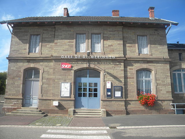

Diemeringen
- commune in Bas-Rhin, France
- Country:
- Postal Code: 67430
- Coordinates: 48° 56' 30" N, 7° 11' 12" E
- GPS tracks (wikiloc): [Link]
- Area: 8.81 sq km
- Population: 1625
- Web site: [Link]

Adamswiller
- commune in Bas-Rhin, France
- Country:
- Postal Code: 67320
- Coordinates: 48° 54' 17" N, 7° 12' 10" E
- GPS tracks (wikiloc): [Link]
- Area: 3.4 sq km
- Population: 378
Durstel
- commune in Bas-Rhin, France
- Country:
- Postal Code: 67320
- Coordinates: 48° 53' 30" N, 7° 11' 50" E
- GPS tracks (wikiloc): [Link]
- Area: 4.76 sq km
- Population: 400


Baerendorf
- commune in Bas-Rhin, France
- Country:
- Postal Code: 67320
- Coordinates: 48° 50' 18" N, 7° 5' 6" E
- GPS tracks (wikiloc): [Link]
- Area: 7.53 sq km
- Population: 314


Drulingen
- commune in Bas-Rhin, France
- Country:
- Postal Code: 67320
- Coordinates: 48° 52' 4" N, 7° 11' 28" E
- GPS tracks (wikiloc): [Link]
- Area: 4.49 sq km
- Population: 1491
- Web site: [Link]
Bust
- commune in Bas-Rhin, France
- Country:
- Postal Code: 67320
- Coordinates: 48° 49' 49" N, 7° 14' 7" E
- GPS tracks (wikiloc): [Link]
- Area: 6.76 sq km
- Population: 455
- Web site: [Link]


Weyer
- commune in Bas-Rhin, France
- Country:
- Postal Code: 67320
- Coordinates: 48° 51' 15" N, 7° 9' 30" E
- GPS tracks (wikiloc): [Link]
- Area: 11.58 sq km
- Population: 591
- Web site: [Link]


Weislingen
- commune in Bas-Rhin, France
- Country:
- Postal Code: 67290
- Coordinates: 48° 55' 9" N, 7° 15' 7" E
- GPS tracks (wikiloc): [Link]
- Area: 7.01 sq km
- Population: 537