Augicourt (Augicourt)

- commune in Haute-Saône, France
- Country:

- Postal Code: 70500
- Coordinates: 47° 46' 26" N, 5° 53' 52" E


- GPS tracks (wikiloc): [Link]
- Area: 9.06 sq km
- Population: 169
- Wikipedia en: wiki(en)
- Wikipedia: wiki(fr)
- Wikidata storage: Wikidata: Q760419
- Wikipedia Commons Category: [Link]
- Freebase ID: [/m/03nt12_]
- GeoNames ID: Alt: [6450792]
- SIREN number: [217000355]
- BnF ID: [15272429z]
- INSEE municipality code: 70035
Shares border with regions:
Arbecey
- commune in Haute-Saône, France
- Country:
- Postal Code: 70120
- Coordinates: 47° 44' 23" N, 5° 55' 43" E
- GPS tracks (wikiloc): [Link]
- Area: 16.71 sq km
- Population: 261


Oigney
- commune in Haute-Saône, France
- Country:
- Postal Code: 70120
- Coordinates: 47° 45' 41" N, 5° 51' 16" E
- GPS tracks (wikiloc): [Link]
- Area: 7.97 sq km
- Population: 55


Bougey
- commune in Haute-Saône, France
- Country:
- Postal Code: 70500
- Coordinates: 47° 46' 54" N, 5° 51' 39" E
- GPS tracks (wikiloc): [Link]
- Area: 8.56 sq km
- Population: 94
Gevigney-et-Mercey
- commune in Haute-Saône, France
- Country:
- Postal Code: 70500
- Coordinates: 47° 47' 58" N, 5° 55' 51" E
- GPS tracks (wikiloc): [Link]
- Area: 19.45 sq km
- Population: 470

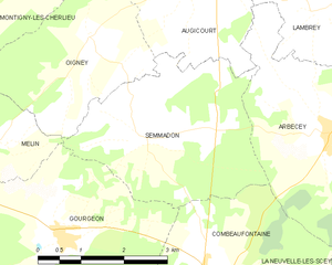
Semmadon
- commune in Haute-Saône, France
- Country:
- Postal Code: 70120
- Coordinates: 47° 44' 21" N, 5° 52' 16" E
- GPS tracks (wikiloc): [Link]
- Area: 10.82 sq km
- Population: 125
Lambrey
- commune in Haute-Saône, France
- Country:
- Postal Code: 70500
- Coordinates: 47° 45' 50" N, 5° 55' 40" E
- GPS tracks (wikiloc): [Link]
- Area: 6.08 sq km
- Population: 87